- Kovačica
-
Kovačica
Ковачица
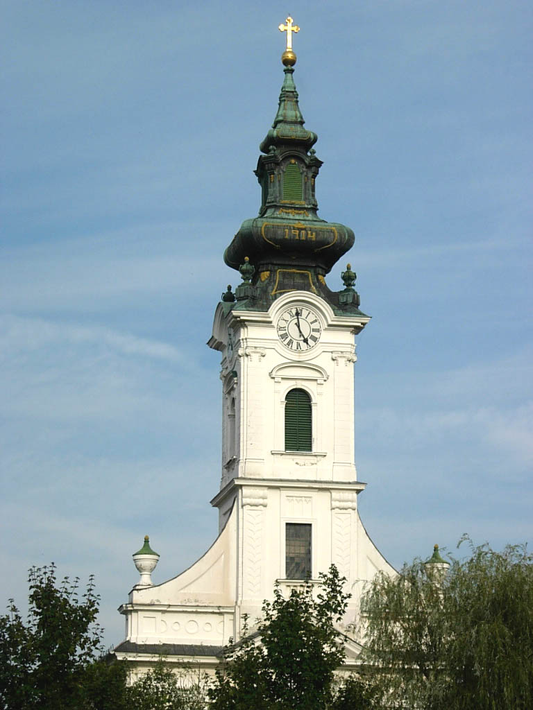
Kovačica— Municipality and Town — The Evangelical (Slovak) church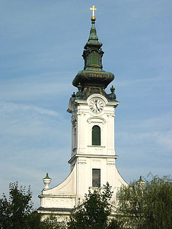

Coat of armsLocation of the municipality of Kovačica within Serbia
Coordinates: 45°07′N 20°37′E / 45.117°N 20.617°E Country Serbia District South Banat Settlements 8 Government – Mayor Miroslav Krišan Area[1] – Municipality 419 km2 (161.8 sq mi) Population (2011 census)[2] – Town 6,764 – Municipality 27,890 Time zone CET (UTC+1) – Summer (DST) CEST (UTC+2) Postal code 26210 Area code +381 13 Car plates PA Website www.kovacica.org Kovačica (Serbian: Ковачица or Kovačica, pronounced [kɔ̝v̞ǎt͡ʃit͡sa] Slovak: Kovačica, Hungarian: Antalfalva, Romanian: Covăciţa, German: Kowatschitza) is a town and municipality located in the South Banat District of Vojvodina, Serbia. According to 2002 census, the town has a population of 6,764, while Kovačica municipality has 27,890 inhabitants. It is widely known by its naïve art.
Contents
Inhabited places
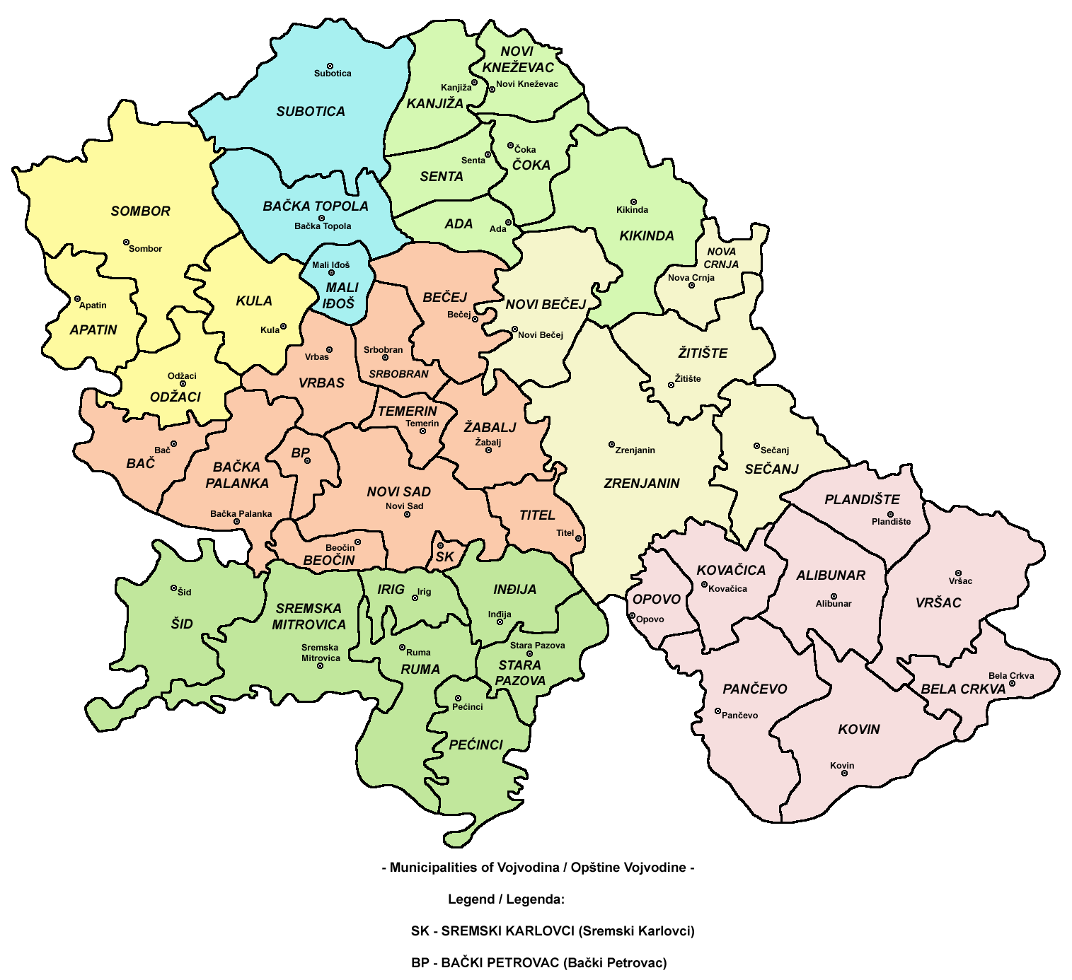
Kovačica municipality includes the town of Kovačica and the following villages:
The municipality is divided into 8 local communities.
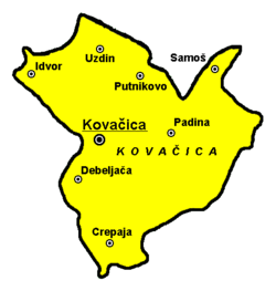 Map of Kovačica municipality
Ethnic groups (2002 census)
The ethnic groups in the Kovačica municipality are:
- Slovaks = 11,455 (41.07%)
- Serbs = 9,459 (33.91%)
- Hungarians = 2,935 (10.52%)
- Romanians = 1,950 (6.99%)
- Roma = 815 (2.92%)
- Yugoslavs = 349 (1.25%)
- Others.
Communities with Slovak majorities are: Kovačica (Slovak: Kovačica) and Padina (Slovak: Padina). Communities with Serb majorities are: Crepaja, Idvor, Putnikovo and Samoš. There is one community with a Hungarian majority: Debeljača (Hungarian: Torontálvásárhely), and one community with a Romanian majority: Uzdin (Romanian: Uzdin).
Geography
The town of Kovačica is located 27 km from Pančevo and 47 km from Belgrade. Kovačica lies in the wide Pannonian plain.
History
The town was founded in the 18th century, but there are records of small settlements dating from 1458. In the middle of the 18th century, this area was recorded as wasteland. Settlement was founded in 1750 and was settled (in 1751-1752) by Serb soldiers from Potisje and Pomorišje, after military frontier in these regions was abolished. In 1767, Kovačica was included into German regiment of Banatian Military Frontier. First Slovaks came here from Ečka and Aradac (in 1783) and after them, Slovaks from Arvas, Trenčin and Bekeš county came here as well (in 1801). From the middle of the 19th century, Kovačica is a center of municipality and cultural and social center of Slovaks in Banat.
Source: Stevan Kovačević, Gradovi Srbije u slici i reči, Beograd, 2010.
Demographics
Territory Municipality of Kovačica % Banat Area, km², 1999 419 4.26 9830 Number of settlement, 1999 8 4.02 199 Population by 1971 census 33489 4.44 754403 Population by 1981 census 32798 4.33 758321 Population by 1991 census 30469 4.18 729564 Total population age of 60 or more – by 1991 census 6342 4.51 140723 Total productive population by 1991 census 18700 4.12 453859 Total male productive population (age 15 to 64 ) by 1991 census 10016 4.19 238937 Total female productive population (age 15 to 59 ) by 1991 census 8684 4.04 214922 Share of agricultural population in total country population (%) by 1991 census 28.7 56.83 50.5 Share of agricultural population in active population in the country (%) by 1991 census 32 49.92 64.1 Number of households by 1991 census 10235 4.15 246839 Share of agricultural households in total number of households(%) by 1991 census 62.1 48.21 128.8 Increase in the population by year 2000 -184 3.67 -5009 Total number of employed 4232 2.52 168033 Females in total number of employed (%) by year 2000 - annual average 36.5 28.65 127.4 Income per capita (din) by year 1999 15660 28.05 55837 Income per capita (din) by year 2000 34548 27.95 123593 Agricultural area (km²) by year 2001 - Individual agricultural households and other 366.32 4.38 8360.14 Forest area (km²) by year 2000 0.39 0.15 268.60 Number of built apartments per 1000 citizens by year 2000 1.5 45.45 3.3 Total road length (km), by year 2000 74 2.99 2477 Phone subscribers, by year 2000 5779 3.27 176522 Net salaries per employee – average January /December 2000 2412 30.29 7963 Elementary schools 1999/2000 – end of a school year 8 3.69 217 High schools 1999/2000 – end of a school year 1 2.17 46 College 2000/2001 school year 0 0 3 Universities 2000/2001 school year 0 0 3 Graduated university students, 2000/2001 school year 0 0 146 International relations
See also: List of twin towns and sister cities in SerbiaTwin towns — Sister cities
Kovačica is twinned with:
References
- ^ "Municipalities of Serbia, 2006". Statistical Office of Serbia. http://webrzs.stat.gov.rs/axd/en/Zip/OG2006webE.zip. Retrieved 2010-11-28.
- ^ "2011 Census of Population, Households and Dwellings in the Republic of Serbia – FIRST RESULTS". Bulletin (Statistical Office of the Republic of Serbia) 540. 2011. ISSN 0354-3641. http://media.popis2011.stat.rs/2011/prvi_rezultati.pdf. Retrieved 2011-11-21.
External links
- Official web site
- vytvarne umenie vojvodinskych Slovakov (Slovak and English)
- politika vojvodinskych Slovakov (Serbian)
- Official Forum of Municipality Kovacica (Serbian)
- Art and Cultural Events In The Municipality of Kovačica (English)
Municipalities and cities of Serbia Central Serbia Belgrade (Barajevo • Čukarica • Grocka • Lazarevac • Mladenovac • Novi Beograd • Obrenovac • Palilula • Rakovica • Savski Venac • Sopot • Stari Grad • Surčin • Voždovac • Vračar • Zemun • Zvezdara) • Čačak • Jagodina • Kragujevac (Aerodrom • Pivara • Stanovo • Stari Grad • Stragari) • Kraljevo • Kruševac • Leskovac • Loznica • Niš (Crveni Krst • Medijana • Niška Banja • Palilula • Pantelej) • Novi Pazar • Požarevac • Smederevo • Šabac • Užice • Valjevo • Vranje • Zaječar Aleksandrovac • Aleksinac • Aranđelovac • Arilje • Babušnica • Bajina Bašta • Batočina • Bela Palanka • Blace • Bogatić • Bojnik • Boljevac • Bor • Bosilegrad • Brus • Bujanovac • Crna Trava • Čajetina • Ćićevac • Ćuprija • Despotovac • Dimitrovgrad • Doljevac • Gadžin Han • Golubac • Gornji Milanovac • Ivanjica • Kladovo • Knić • Knjaževac • Koceljeva • Kosjerić • Krupanj • Kučevo • Kuršumlija • Lajkovac • Lapovo • Lebane • Lučani • Ljig • Ljubovija • Majdanpek • Mali Zvornik • Malo Crniće • Medveđa • Merošina • Mionica • Negotin • Nova Varoš • Osečina • Paraćin • Petrovac • Pirot • Požega • Preševo • Priboj • Prijepolje • Prokuplje • Rača • Raška • Ražanj • Rekovac • Sjenica • Smederevska Palanka • Sokobanja • Surdulica • Svilajnac • Svrljig • Topola • Trgovište • Trstenik • Tutin • Ub • Varvarin • Velika Plana • Veliko Gradište • Vladičin Han • Vladimirci • Vlasotince • Vrnjačka Banja • Žabari • Žagubica • Žitorađa
Vojvodina 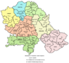 Ada • Alibunar • Apatin • Bač • Bačka Palanka • Bačka Topola • Bački Petrovac • Bečej • Bela Crkva • Beočin • Čoka • Inđija • Irig • Kanjiža • Kikinda • Kovačica • Kovin • Kula • Mali Iđoš • Nova Crnja • Novi Bečej • Novi Kneževac • Odžaci • Opovo • Pećinci • Plandište • Ruma • Sečanj • Senta • Šid • Srbobran • Sremski Karlovci • Stara Pazova • Temerin • Titel • Vrbas • Vršac • Žabalj • Žitište
Kosovo Dečani • Đakovica • Dragaš • Glogovac • Gnjilane • Istok • Kačanik • Klina • Kosovo Polje • Kosovska Kamenica • Kosovska Mitrovica • Leposavić • Lipljan • Mališevo • Novo Brdo • Obilić • Orahovac • Peć • Podujevo • Priština • Prizren • Štimlje • Srbica • Štrpce • Suva Reka • Uroševac • Vitina • Vučitrn • Zubin Potok • Zvečan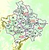 New Municipalities: Đeneral Janković • Gračanica • Junik • Klokot-Vrbovac • Mamuša • Parteš • RanilugPlanned Municipality: North Kosovska MitrovicaCategories:
- Places in Serbian Banat
- Populated places in Vojvodina
- Municipalities of Vojvodina
- Slovaks of Vojvodina
- Slovak communities in Serbia


Wikimedia Foundation. 2010.