- Dragaš
-
"Dragas" redirects here. For other uses, see Dragas (disambiguation).
Dragaš — Municipality and city — Dragaš (Драгаш)
Dragash
SharriLocation in Kosovo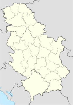
 Dragaš
Coordinates: 42°03′N 20°39′E / 42.05°N 20.65°E Country Kosovo[a] District District of Prizren Area – Total 435 km2 (168 sq mi) Population (2011) – Total 33,584 (municipality) – Density 77.4/km2 (200.5/sq mi) Time zone CET (UTC+1) – Summer (DST) CEST (UTC+2) Postal code 22000 Area code(s) +381 Car plates 04 Website Municipality of Dragaš Dragaš (Albanian: Dragash or Sharri; Serbian: Драгаш, Dragaš) is a town and municipality in the Prizren district of southern Kosovo[a]. The population of the town is approximately 33,584, that of the whole municipality is estimated at 33,584 (2011).[1] It was named after medieval Serbian lord Constantine Dragaš.[2]
Contents
History
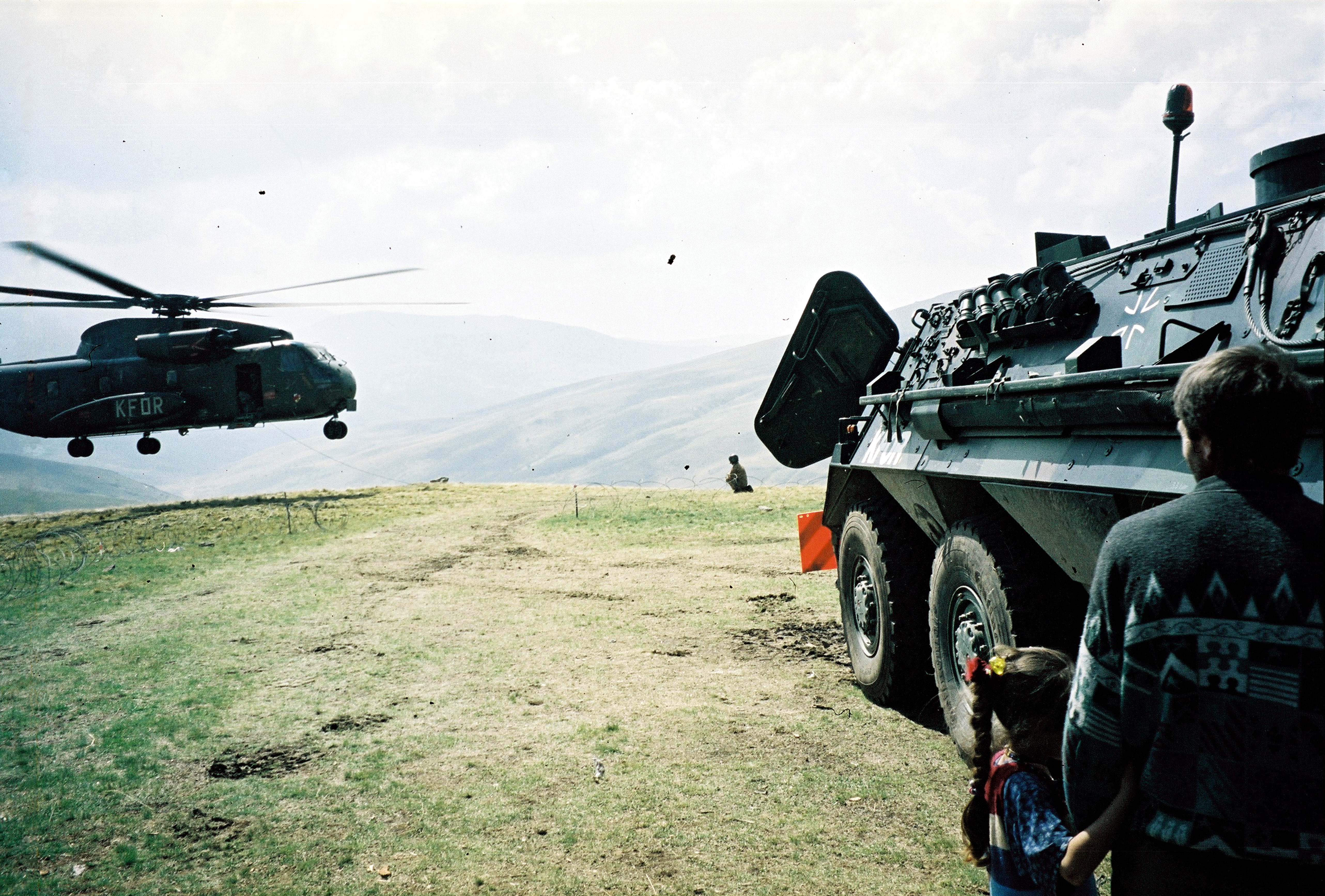
 KFOR post in the Dragaš area, 2001
The municipality of Dragash was created by the United Nations Interim Administration Mission in Kosovo (UNMIK) by merging the two former municipalities of Gora and Opolje; the government of Serbia does not recognise this act.
The Ottoman defter from 1591 registers Gora as inhabited exclusively by Serbs, Opolje to the north is Albanian populated.[3]
Geography
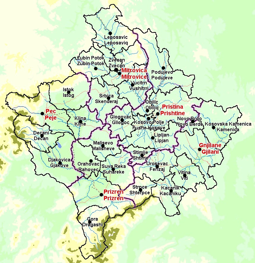
The territory of the Dragaš municipality lies in the northern latitude of 41 52' 30" to 42 09' 03" and longitude of 20 35' 39" to 20 48' 26". The whole territory is surrounded by the Šar Mountains, then Koritnik Mountain, mountain Gjalic and Cylen in the direction of Prizren. Only one part of the territory in Prizren direction is hilly with a relatively slight slope by which this territory is connected with Prizren basin and through Prizren with the world.
Demographics
The municipality is split into the regions Opoja and Gora, with the Albanian population living in Opoja and the Gorani population living in Gora.
1971 - 13,867 Albanians, 11,076 Gorani - total 26,850
1981 - 18,623 Albanians, 15,942 Gorani — total 35,054
1991 - 22,785 Albanians, 16,129 Gorani — total 39,435OSCE estimates say the following...[1]
January 1999 - 27,633 Albanians, 17,470 Gorani — total 45,103
March 2000 - 24,856 Albanians, 9,706 Gorani — total 34,562
January 2006 - 22,800 Albanians (57.22%) , 17,975 Gorani (43.30%) - total 40,775Economy
Its poor agricultural resources and relative geographical isolation have meant that Dragaš is one of the most underdeveloped regions of Kosovo. The economic situation in Dragaš is very poor and is dominated by a high rate of unemployment. The main employers in the area are the Municipality, UNMIK police, and private companies as “KUK Commerc”, “Meka” and former state-owned enterprises.[1]
All major local companies were formerly state-run and, as elsewhere in Kosovo, are currently under the responsibility of KTA. The original UNMIK strategy towards these public enterprises consisted of carrying out a process of ‘commercialisation’. This process was believed to be the best way to revive the enterprises, although no foreign investors decided to invest.[1]
Infrastructure
The municipality is mountainous and therefore has related infrastructural problems, e.g. problematic access to some villages during winter season. Whilst this part of Kosovo did not suffer much damage during the war, its infrastructure was in a state of serious disrepair beforehand, due to a combination of harsh winters and state neglect. Roads, in particular, (Zhur–Dragaš; Dragaš-Brod; Dragaš- Restelica) require urgent improvement for the social-economic development of the area. Bus connections between Dragaš town and the Opoja area continue to improve and the services to Gora are organized by the two OSCE-SIMF buses donated to the municipality. There is a free school bus service provided by the municipality along Gora routes. Taxi services do exist but are largely unaffordable for the population. OSCE through SIMF/ ECSF funds supported also the rehabilitation of the Heath House. Most Dragaš villages have no phone connection, although the system in Dragaš town has improved since 2001. Mobile coverage is also improving. Water supply is ensured in all villages.[1]
Symbol
The emblem of Dragaš includes an image of the Šarplaninac dog.[4]
Notes and references
Notes:
a. ^ Kosovo is the subject of a territorial dispute between the Republic of Serbia and the self-proclaimed Republic of Kosovo. The latter declared independence on 17 February 2008, while Serbia claims it as part of its own sovereign territory. Its independence is recognised by 85 UN member states. References:
- ^ a b c d e OSCE municipal profile of DragašPDF, June 2006. Retrieved on 21 February 2008.
- ^ "MEDIEVAL lANDs". SERBIA. http://fmg.ac/Projects/MedLands/SERBIA.htm. Retrieved 20 December 2010.
- ^ TKGM, TD № 55 (412), (Defter sandžaka Prizren iz 1591. godine).
- ^ Municipal Assembly of Dragaš. – Retrieved on 20 November 2008.
- PTK - Post and Telecommunictions of Kosovo, J.S.C documents foundit in interet 2006:KodePostare.pdf
- ENKEO Electronic Network of Kosovar Environmental Organization documents foundit in interet 2006: dragashi.pdf
- IFLA - International Federation of Library Associations and Institutions documents foundit in interet 2006 kosorepo.htm#_Toc480784381
Kosovo Dečani • Đakovica • Dragaš • Glogovac • Gnjilane • Istok • Kačanik • Klina • Kosovo Polje • Kosovska Kamenica • Kosovska Mitrovica • Leposavić • Lipljan • Mališevo • Novo Brdo • Obilić • Orahovac • Peć • Podujevo • Priština • Prizren • Štimlje • Srbica • Štrpce • Suva Reka • Uroševac • Vitina • Vučitrn • Zubin Potok • Zvečan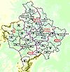 New Municipalities: Đeneral Janković • Gračanica • Junik • Klokot-Vrbovac • Mamuša • Parteš • RanilugPlanned Municipality: North Kosovska Mitrovica
Coordinates: 42°04′N 20°39′E / 42.067°N 20.65°E
Categories:- Populated places in Kosovo
- Municipalities of Kosovo

Wikimedia Foundation. 2010.