- Crna Trava
-
Coordinates: 42°48′36.53″N 22°17′56.43″E / 42.8101472°N 22.2990083°E
Crna Trava
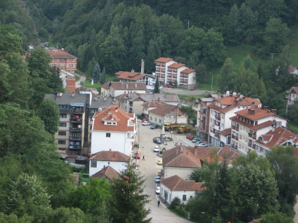
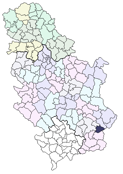
Црна Трава— Municipality and Town — View on Crna Trava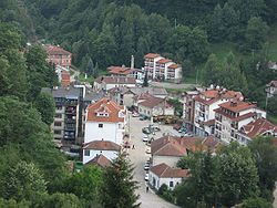 Location of the municipality of Crna Trava within Serbia
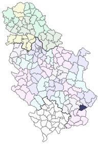
Country Serbia District Jablanica Settlements 25 Government - Mayor Slavoljub Blagojević (PSS) Area[1] - Municipality 312 km2 (120.5 sq mi) Population (2011 census)[2] - Town 452 - Municipality 1,661 Time zone CET (UTC+1) - Summer (DST) CEST (UTC+2) Postal code 16215 Area code +381 16 Car plates LE Crna Trava (Serbian Cyrillic: Црна Трава) is a village and municipality located in the Jablanica District of Serbia. According to 2011 census, the population of the village is 452 inhabitants, while population of the municipality is 1,661. This is the poorest municipality in the country.[3]
Contents
Name
The name of the village in Serbian translates to Black Grass. The origin of the name dates back to 1389, when Battle of Kosovo took place. A Serbian army unit, composed of Serbian archers and cavaliers, decided to take a rest on a grass field while travelling to the battlefield. Since the flowers and other herbs covering the field were highly poisonious, the soldiers became intoxicated, thereby they did not wake up on time for the battle. Realizing that fact, they cursed the grass that poisoned them, branding it "black" grass.
Demographics
- Natural Population Growth Rate: -2.82% per year
Crna Trava, along with the rest of Vlasina region, suffers from heavy depopulation, chiefly for economic reasons. It can be seen from the census data from 1953 to 2002:
- 1953 - 13,748
- 1961 - 12,513
- 1971 - 9,672
- 1981 - 6,366
- 1991 - 3,778
- 2002 - 2,563
- 2011 - 1,661
Ethnic groups in the municipality (2002 census):
- Serbs = 2,529
- Bulgarians = 8
- Yugoslavs = 3
- Russians = 2
- Albanians = 1
- Croats = 1
- undeclared = 5
- regional affiliation = 1
- unknown = 13
References
- ^ "Municipalities of Serbia, 2006". Statistical Office of Serbia. http://webrzs.stat.gov.rs/axd/en/Zip/OG2006webE.zip. Retrieved 2010-11-28.
- ^ (in Serbian) Popis stanovništva, domaćinstava i Stanova 2002. Knjiga 1: Nacionalna ili etnička pripadnost po naseljima. Statistical Office of Serbia. 2003. ISBN 86-84443-00-09. May be downloaded from: [1]
- ^ http://www.b92.net/eng/news/society-article.php?yyyy=2010&mm=10&dd=18&nav_id=70355
See also
Categories:- Populated places in Jablanica District
- Municipalities of Central Serbia
- Jablanica District geography stubs

Wikimedia Foundation. 2010.