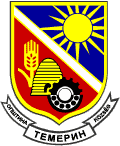
- Temerin
-
Temerin
Темерин
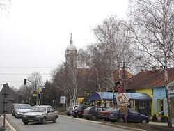
Temerin— Municipality and Town — Town center of Temerin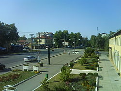

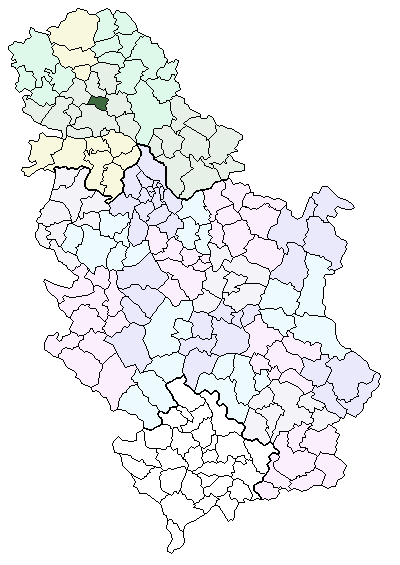
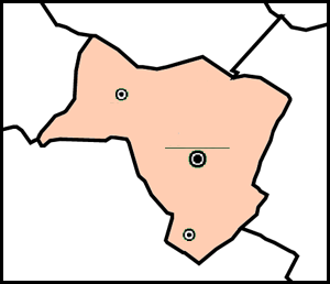
Coat of armsLocation of the municipality of Temerin within Serbia
Coordinates: 45°25′N 19°53′E / 45.417°N 19.883°E Country Serbia District South Bačka Settlements 3 Government – Mayor András Guszton Area[1] – Municipality 170 km2 (65.6 sq mi) Population (2011 census)[2] – Town 19,216 – Municipality 28,275 Time zone CET (UTC+1) – Summer (DST) CEST (UTC+2) Postal code 21235 Area code +381 21 Car plates NS Website www.temerin.rs Temerin (Serbian Cyrillic: Темерин, Hungarian and Serbian Latin: Temerin) is a town and municipality in South Bačka District of Vojvodina, Serbia. Temerin town has a population of 19,143, and Temerin municipality 28,201.
Temerin municipality encompasses of towns of Temerin and Bački Jarak (Hungarian: historically Tiszaistvánfalva, in modern usage Járek), and Sirig (Hungarian: Szőreg) village.
Contents
Name
In Serbian, the town is known as Temerin (Темерин), in Hungarian as Temerin, in German as Temeri, and in Croatian as Temerin.
The Serbian and Hungarian languages are officially used by municipal authorities.
Location, borders and size
Territory of Municipality of Temerin is in the southeast part of Bačka plain. On its east side it borders on Municipality of Žabalj, on the north side on Municipality of Srbobran, Municipality of Vrbas is on the west and Novi Sad borders on its south side.
The most influential factor in the development of Temerin is the vicinity of the most developed business center in Vojvodina – Novi Sad. The territory of the Municipality of Temerin covers the area of around 170 km² (66 mi²), and has a shape of irregular trapezoid, spreading in the northwest – southeast direction. The longer axis, covering the direction Sirig–Temerin, is 14 km long and the shorter axis in Bački Jarak–Temerin direction is 11 km long.
The boundaries of municipality are artificial lines, mostly in rectilinear directions. The only natural boundary of the municipality is on its northeast side where it follows the water current of river Jegrička. On the southeast side the boundary is made with the embankment called Rimski Šanac II.
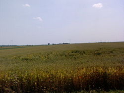 Wheat field near Temerin
In regard to relief shapes of Vojvodina, whole territory of Municipality of Temerin is placed on a south loessial ridge of Bačka. It leaves the impression of an almost flat surface. The river Jegrička flows through the north side of the municipality with few smaller channeled tributaries. It is established that thermo-mineral waters are present. Soil composition is quite equalized and fertility is naturally high. Different types of chernozem dominate in the area of the municipality. Along the riverbank swampy dark types of soil and solonchak can be found; these are partly or fully salted soil types.
The Municipality of Temerin has three settlements: Temerin, Bački Jarak and Sirig and the territory is divided into four cadastres: Temerin, Bački Jarak, Sirig and Kamendin. Geographical location of the Municipality of Temerin is very favorable. In the meridian direction the municipality is cut by three important roads. The most important is international road E-75 which drives from Novi Sad towards Subotica and then further to Hungary.
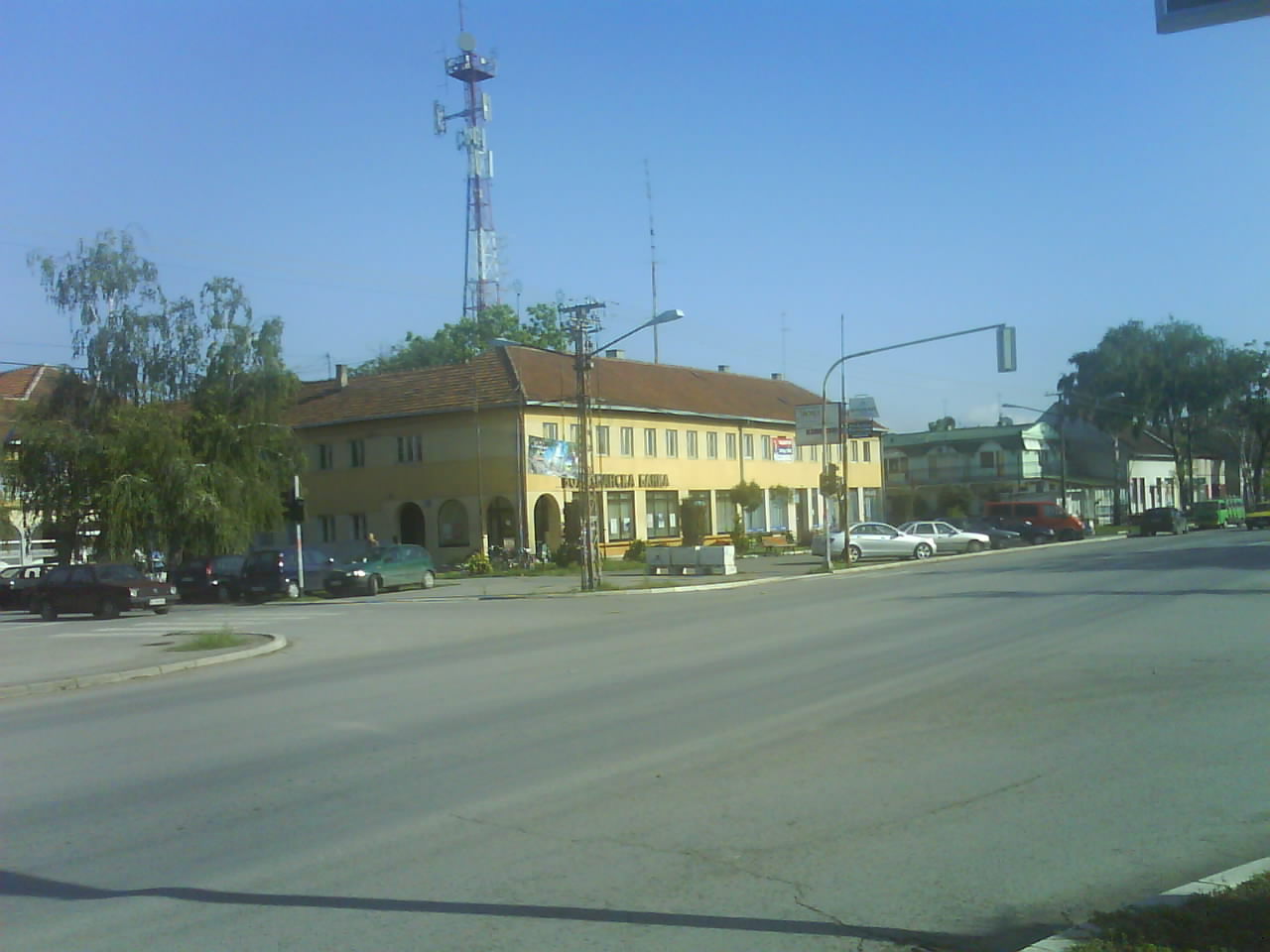
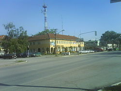 Town center
Road section Novi Sad–Srbobran, cutting the west part of the Municipality of Temerin, was put into use in 1984. The second road by its importance is highway M-22 (since recently international way E-5) which has the nearly the same direction. M-22 leads bit more eastern than E-75 and goes through village named Sirig.
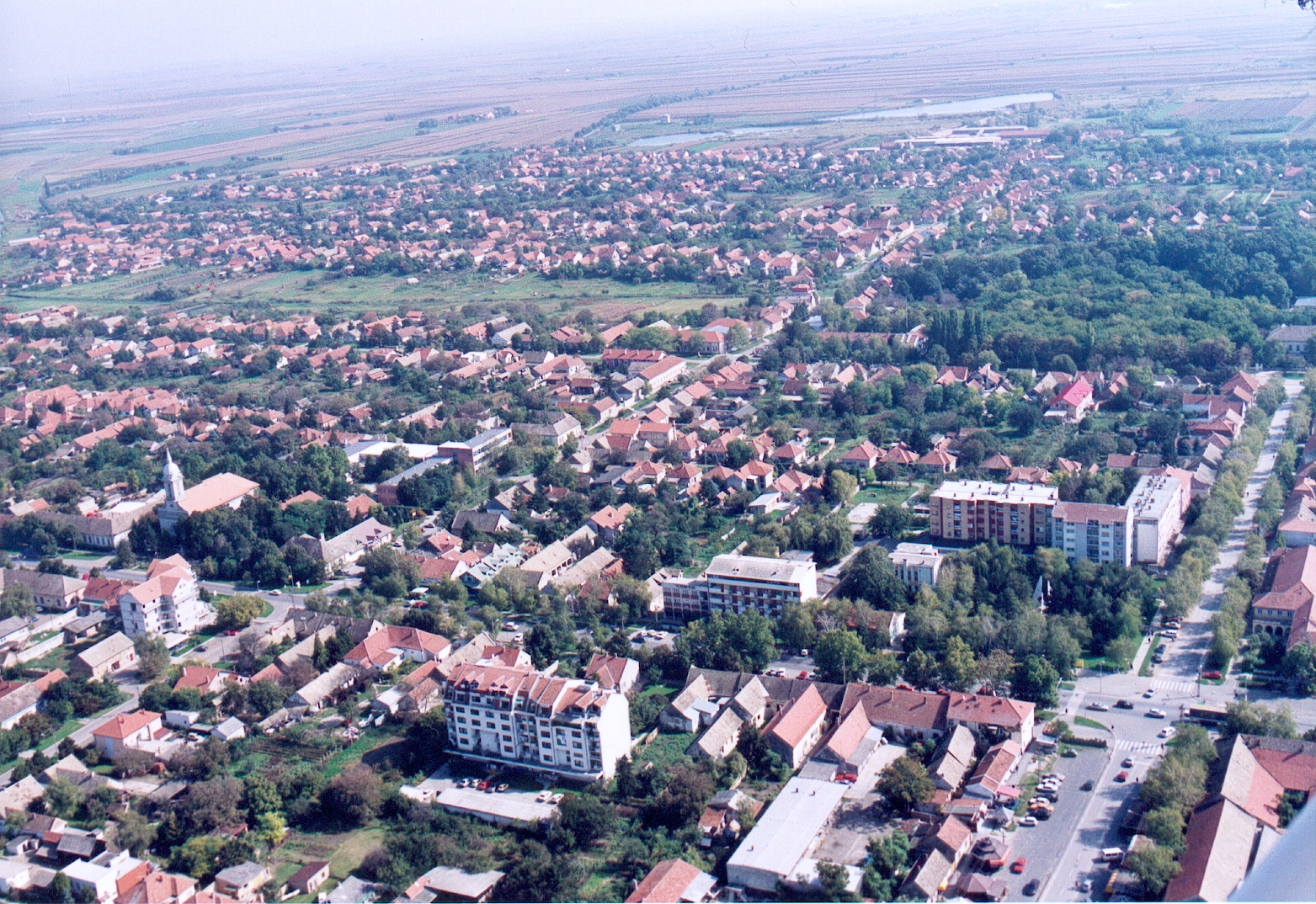
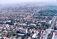 Town centre of Temerin seen from air
The third road is one with regional importance (R-120), going through Novi Sad, Bački Jarak and Temerin and leading to Bečej, Senta and Kanjiža. At Sirig and Temerin all these roads are crossed by regional road (R-104) which has Odžaci–Zmajevo–Sirig–Temerin–Žabalj direction. From here a main road leads over Tisa to Zrenjanin and other towns in Banat. Through the southeast part of the municipality and its two settlements—Bački Jarak and Temerin, leads a railway from Novi Sad to Žabalj, Bečej and Senta.
History
 Main street and the Catholic Church
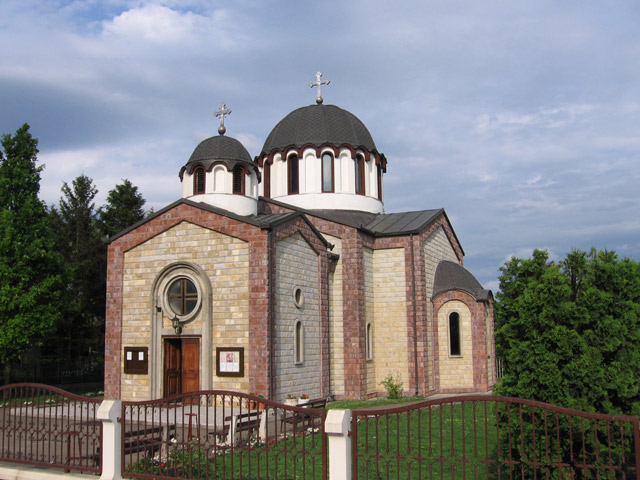
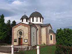 Serbian Orthodox church
In written documents, Temerin is mentioned for the first time in 1332 in the receipt by the pope, issued to Laurentius de Temeri, parish priest, for the payment of pope’s tax. Temerin was part of Hungarian Kingdom until battle of Mohács in 1526. After that year it was part of the Ottoman Empire.
In view of the fact that Temerin used to be a rich village, between 1746 and 1749 locals built an orthodox church and dedicated it to Christ’s ascension into Heaven. It was located at the beginning of today’s Bosanska street, on its right side, where are now houses with numerations from 2 to 10.[citation needed]
Military map and religious books from that same church are proving the existence of the church. Some of them are still kept in the church of Christ’s ascension into Heaven in the village Đurđevo. The church was made of bricks – solid material (which is important because in the most of the villages churches were made of wood – as log cabins). Church dimensions were: length 17 m, width 6.5 m, walls were nearly 6 m high. The church had church steeple, built just besides main building, 11 special windows with iron bars on them. Johan Milner built the church with assistance and coordination of Visarion Pavlović, the bishop of Bačko-Segedinska eparchy.
Among church school students was also one of the most important people from Temerin, writer, theology professor and bishop, polyglot Lukijan Mušicki, born in Temerin in 1777. He was a friend and associate of Vuk Stefanović Karadžić (he added a letter “đ” to the Vuk alphabet).
In 1796 Chamber sold Temerin and Bački Jarak to count Sándor Szécsen for a price of 80,000 forints. Organized colonization of Temerin by Hungarians started in 1782 and the migration of Germans started in 1787. In that year they founded and settled Bački Jarak, a place which used to be barren area of Bačka until then.
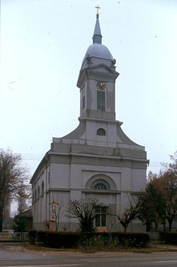 The Hungarian Catholic Church
Count Sándor Szécsen tried to turn Serbs into his peasants which resulted in their four years long attempt (from 1796 to 1800) to annex Temerin to the Military Border and its nearest unit battalion of Šajkaš. This attempt failed and on July 21, 1799 they decided to move out of Temerin. Delegation sent by parish commission stopped them in their attempt by postponing their migration. On the same day that commission made a document of a great importance. Document was called “a listing of all orthodox families from Temerin who came out for migration to the military battalion in the Paška barren area”. This important document contents the names of 178 heads of families that were leaving.
After a few months the number of immigrant families raised to 210 families and 1,610 living souls. In the spring of 1800 they tore down their houses and their church and carried all of its building material to Paška barren area where they founded new village named Đurđevo. Name was given because they moved on a St. George day (“Sveti Đorđe”). Only five years later they built a new, even bigger church out of the material they brought with themselves. They dedicated the new church to Christ’s ascension into Heaven, same as they did in Temerin.
For next 120 years Temerin was without Serbs, count Szécsen brought Hungarian colonizers, peasants from tribal states Pest, Fehér and Tolna. Same count ordered building of a very representative palace (castle), so called "Kastély", which is now under state jurisdiction. Nowadays it houses secondary school of techniques.
Szécsen family sold the Temerin property and "Кastély" to grain merchant Antal Fernbah from Apatin. Ana and Petar Fernbah were his heirs and they kept complete Temerin property until agrarian reform in the Kingdom of SHS (Serbs, Croats and Slovenes) in 1920.
In 1799 Temerin was declared a town and was given a right to hold 4 livestock fairs per year. Catholic Church was built in 1804, and the "old school" in 1835. Tumultuous times and 1848 did not spare Temerin. In clashes it burned ompletely and the settlers migrated to the north, in Bačka Topola, Mali Iđoš, Čantavir and other settlements. After 4-6 month most of them returned to their old homes.
On July 2, 1899 a railway direction Novi Sad–Temerin–Bečej was built and put in function as well as the railway station in Temerin. That started industrial development of Temerin, putting into operation one brick plant and first steam mills. Temerin soon became one of the important trading centers in the southeast part of Bačka.
Creation of the Kingdom SHS (Serbs, Croats and Slovenes) marked a new period in the history and the economy of the town. Fernbah's properties were one of the agrarian reform targets. Agrarian authorities from Belgrade and Novi Sad put a new law into effect, colonized farmers from Novi Sad and its vicinity and colonized volunteers. In 1920 started a creation of a new colony of volunteers south of Temerin, 18 km north of Novi Sad and next to road Novi Sad–Bečej–Senta. In the memory of an old Serbian village in Temerin, immigrants called their new settlement Staro Đurđevo in 1929. At the beginning it had 42 families, now it has grown into a place with over 1,100 households and about 4,000 settlers.
In 1927, between two wars, Temerin got electricity. During the Hungarian military occupation (1941–1944) settlers of Staro Đurđevo and Sirig were expelled from their homes and Hungarian families from Bukovina were settled on this land. During the occupation, in 1942 raid, 48 inhabitants of the town were murdered, of whom 14 were men, 15 women, 7 children, and 12 old people. By nationality, victims included 42 Jews, and 6 Serbs.[citation needed] In 1944, Hungarians from Bukovina resettled in Hungary. The Germans from Bački Jarak were resettled and murdered. Founders of Đurđevo and Sirig returned to their old settlements. Bački Jarak became almost completely colonized with immigrants from Bosnia and Herzegovina.
October 1944 the Soviet Red Army entered Temerin who were followed by the yugoslav communist partizans.
Ethnic groups
Ethnic groups in the municipality
Ethnical population structure of the Municipality of Temerin according to census in 2002:
All of the three settlements in the municipality have an ethnic Serb majority.
Ethnic groups in the town
Ethnical population structure of the town of Temerin according to census in 2002:
- Serbs = 9,660 (50.27%)
- Hungarians = 8,187 (42.61%)
- Others.
Population Demographic trends
Nowadays, the municipality of Temerin is a multinational community with 16 nationalities and 28,275 inhabitants. Trend of population growth in Temerin area is very specific. During the last few centuries’ number of inhabitants increased for 72%.
Migrations largely influenced population structure of Temerin. In 1800 Serbs with 1,610 inhabitants from 210 families left the village and established new one about 20 km east of Temerin. Today it is called Đurđevo and is located near Žabalj. That left Temerin without Serbs until 1920. That year volunteers established new settlement, Staro Đurđevo, which is now local community of the Municipality of Temerin. In 1991 it had 3,718 inhabitants and today more than 4,000 people live there.
Bački Jarak, until 1944 was settled with mostly German settlers, and was during 1946-1947 settled with Serb colonists, mostly from Bosnia and Herzegovina, in order to increase the number of inhabitants in Novi Sad, 2,276 settlers came in Bački Jarak, the nearest settlement to Novi Sad. In 1991 Bački Jarak had 6,000 inhabitants.
Sirig is colonized as well, in this town 63% of inhabitants are colonizers. During the 1960s and 1970s several hundred families from village Vrbljani (the Municipality of Ključ, Bosnia and Herzegovina) migrated to the local community Staro Đurđevo. Economical situation was reason for that.
Temerin itself is one of the settlements where natives were absolute majority. In 1961, 9,447 inhabitants were in this category, only one third of settlers (3 258) were immigrants. According to census in 1991 Temerin has 8,174 households; 3,059 of that number are farm households placed in 8,595 apartments. One of the local communities named Staro Đurđevo (3,718 inhabitants), even overgrown a village Sirig (2,546 inhabitants).
Finally, the civil war on the territory of former Yugoslavia brought to significant changes in the population structure of this municipality. Temerin was a stop point for 9,650 refugees, 4,950 of them still live here at their relatives and friends homes as well as in 4 organized refugee shelters that still exist. These changes brought population number to 30,000 in 1999.
Historical population of the town
- 1900: 9581 inhabitants, 8711 Hungarians, 787 Germans, 13 Serbs
- 1961: 12,705
- 1971: 13,584
- 1981: 14,875
- 1991: 16,971
- 2011: 19,613
Politics
Seats in the municipal parliament won in the 2004 local elections: [1]
- Serbian Radical Party (12)
- Democratic Party (6)
- Democratic Party of Vojvodina Hungarians (5)
- Alliance of Vojvodina Hungarians (3)
- Serbian Strength Movement (2)
- Socialist Party of Serbia (2)
- Group of citizens "List for prosperity" (2)
- Democratic Party of Serbia (1)
Nature
Relief
Territory of the Municipality of Temerin is a plain terrain with almost imperceptible distinctions in height. If we study relief the southern part of Bačka (in Vojvodina) and we can single out few geomorphological shapes based on soil composition and its genesis. These are Titelski breg – loessial ridge, alluvial ridge of river Danube and inundational planes of river Danube and river Tisa.
Total area of the Municipality of Temerin is placed in the eastern part of south loessial ridge of Bačka. Heights above sea level vary from 81 m to 83 m. Monotony of Bačka plain is disturbed only by lonely hillocks and valleys of smaller water currents.
Climate
Being a part of Pannonia plain the Municipality of Temerin has its climate characteristics. Pannonian plain is quite far away from Adriatic or Mediterranean see on the south and Atlantic Ocean on the west. These distances are even bigger because of Dinarics and Alps mountain ranges which keep the humid airstreams coming from seas and oceans away. Airstreams, influencing weather changes through the year, are conditioned by unequal warming of Earth surface and different atmospheric pressures above Adriatic and Mediterranean, Atlantic Ocean and wide Euro-Asian land. Water surfaces cause breach of humid airflows into Pannonia plain and land surfaces on the north and east influence dry, very cold airstreams in winter and very hot airstreams in summer. Influenced by all of these causes, Pannonia plain has the most continental climate in Serbia.
Rivers
There are no natural water currents on the territory of the Municipality of Temerin any more, all of them were transformed into canals and included in the DTD hydro system so they can now be used for irrigation of agricultural areas.
Jegrička is the biggest stream on the south loessial Bačka ridge and area of the Municipality of Temerin. Jegrička is a 64.5 km long tributary of Tisa that empties into the Tisa on its right side. The river course was formed during the Holocene, the youngest period of Earth history. At that period ground in the south part of Bačka lowered in a line that was later inherited by this water current.
Jegrička is formed from water of few swamps from areas of Despotovo, Silbaš, Parage, Ratkovo and Pivnice. River enters into the Temerin territory on its west side, from the Municipality of Vrbas. The part of Jegrička that flows through the Municipality of Temerin has the length of 18 km which is 28% of its total length. River flows about 1 km north of Sirig and about 2 km north of Temerin. From a place where the river crosses the Temerin–Bečej road it becomes the municipality borderline.
Soil
Analyzing the soil map of Vojvodina we can separate eight different types of soil in the territory of the Municipality of Temerin. The most represented are subtypes of chernozem: carbonated chernozem, carbonated chernozem with signs of earlier contact with swamp, carbonated chernozem with signs of gleying in loess, solonchak chernozem, carbonated and sporadically salted swampy dark soil, meadow carbonated dark soil, swampy noncarbonated dark soil and solonchak.
Flora
Area of loessial ridge that covers the biggest part of the Municipality of Temerin resembles steppe grassy vegetation. Development of agriculture during the 18th and 19th centuries brought disappearance of pastures with growing wild vegetation. Cultivation plants were planted; nowadays dominating plants are cereals, industrial plants and vegetables. Fruits and grapevine are not so often.
Narrow areas along rivers and lines of communication are full of wild growing vegetation: wild poppy, corn cockle, spurge, horse basil, meadow buttercup, red clover, yarrow, foxglove, burdock, nettle, chamomile, mustard, etc. Around and in riverbeds you can find plenty of cane, cattail, water lily and alga. There are no bigger forest areas, but around farms (“salaš”) smaller forests of black locust and poplar with few mulberry trees can be seen. Around motels near Sirig and Temerin pine trees have been planted.
Fauna
Animal world used to be more numerous and various. Changes in agriculture development caused reduction of total number and number of wild animal species.
Field mice and rats live on large areas planted with corn as well as polecats, weasels, ground squirrels, hamsters, hedgehogs and moles. If we look for big game, important for hunting, we can find roe deer, foxes and hares. Of game birds we can find pheasants, partridges, mallards and wild geese as well as rock doves. There are also a lot of other bird species: sparrows, swallows, woodpeckers, starlings, cuckoos, blackbirds, wrens, storks, hooded crows, etc.
There are a lot of insects: mosquitoes, flees, wasps, bees, gypsy moths, green crickets, hornets, different louses, crickets, ladybugs, moths, butterflies, etc. Among agricultural pests the widest spreads are: potato beetle, turnip beetle, grain weevil and bean weevil.
In and around water currents live various fishes: carp, bream, robin, pike, perch, as well as other animals: snails, leeches, various frogs, marsh shells, snakes, etc. A large number of domestic animals are raised.
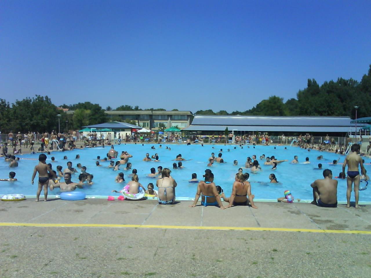
Thermo-mineral waters
 Spa and pool in Temerin
Thermo-mineral waters in Temerin were first discovered in 1914 and that is also when their exploitation started. At that time a 417 m well hole was drilled. Grisa Andraš was name of the owner. This well cuts through Quaternary and paludina deposits and gives water of 27 °C (81 °F). The quantity of water pouring out used to be 397 l/min but has lately been slightly reduced. Since these waters are also present in a depth of 200 to 1000 m, “Naftagas” from Novi Sad drilled a research drill in the center of Temerin in 1968. The drill is 2,004.5 m deep.
Chemical analysis was made in 1979 by the Institute of Physics from the University of Novi Sad. The results showed slightly base reaction (rN – 7.8), total mineralization of 2.669 g/l; characteristic ions are sodium (0.708), hydro-carbonate (1.512) and chlorine (0.337). Among other healing ingredients presence of iodine, bromine, fluorine, lithium and strontium is proven. Analysis showed presence of carbon dioxide in water. Methane which was also present was used for heating of water and rooms after separation.
Nowadays this thermo-mineral spring is used in contemporary spa bath tubes. A well next to Olympic pool has similar composition and mineralization. Its water is coming from the depth of 690 m and is used for open hot thermo-mineral pool (water temperature is 37 °C). These pools are also used by people from Novi Sad, Žabalj, Kisač, Petrovac and from all other surrounding settlements. This natural wealth is planned to be a basis for future development of a health, sport and tourist complex.
See also
- List of places in Serbia
- List of cities, towns and villages in Vojvodina
References
- ^ "Municipalities of Serbia, 2006". Statistical Office of Serbia. http://webrzs.stat.gov.rs/axd/en/Zip/OG2006webE.zip. Retrieved 2010-11-28.
- ^ "2011 Census of Population, Households and Dwellings in the Republic of Serbia – FIRST RESULTS". Bulletin (Statistical Office of the Republic of Serbia) 540. 2011. ISSN 0354-3641. http://media.popis2011.stat.rs/2011/prvi_rezultati.pdf. Retrieved 2011-11-21.
- Slobodan Ćurčić, Broj stanovnika Vojvodine, Novi Sad, 1996.
- Zvonimir Golubović, Racija u južnoj Bačkoj 1942. godine, Novi Sad, 1991.
External links
- Zvanični sajt opštine Temerin
- History of Temerin (Hungarian)
- Nase novine
- Teledom / Teleház Temerin
- Crveni krst Temerin
- Portal opštine Temerin
- Centar za socijalni rad opštine Temerin
- Dom zdravlja Temerin
- Portal Temerin.EU (English) (German) (Serbian) (Hungarian)
Municipalities and cities of Serbia Central Serbia Belgrade (Barajevo • Čukarica • Grocka • Lazarevac • Mladenovac • Novi Beograd • Obrenovac • Palilula • Rakovica • Savski Venac • Sopot • Stari Grad • Surčin • Voždovac • Vračar • Zemun • Zvezdara) • Čačak • Jagodina • Kragujevac (Aerodrom • Pivara • Stanovo • Stari Grad • Stragari) • Kraljevo • Kruševac • Leskovac • Loznica • Niš (Crveni Krst • Medijana • Niška Banja • Palilula • Pantelej) • Novi Pazar • Požarevac • Smederevo • Šabac • Užice • Valjevo • Vranje • Zaječar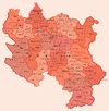 Aleksandrovac • Aleksinac • Aranđelovac • Arilje • Babušnica • Bajina Bašta • Batočina • Bela Palanka • Blace • Bogatić • Bojnik • Boljevac • Bor • Bosilegrad • Brus • Bujanovac • Crna Trava • Čajetina • Ćićevac • Ćuprija • Despotovac • Dimitrovgrad • Doljevac • Gadžin Han • Golubac • Gornji Milanovac • Ivanjica • Kladovo • Knić • Knjaževac • Koceljeva • Kosjerić • Krupanj • Kučevo • Kuršumlija • Lajkovac • Lapovo • Lebane • Lučani • Ljig • Ljubovija • Majdanpek • Mali Zvornik • Malo Crniće • Medveđa • Merošina • Mionica • Negotin • Nova Varoš • Osečina • Paraćin • Petrovac • Pirot • Požega • Preševo • Priboj • Prijepolje • Prokuplje • Rača • Raška • Ražanj • Rekovac • Sjenica • Smederevska Palanka • Sokobanja • Surdulica • Svilajnac • Svrljig • Topola • Trgovište • Trstenik • Tutin • Ub • Varvarin • Velika Plana • Veliko Gradište • Vladičin Han • Vladimirci • Vlasotince • Vrnjačka Banja • Žabari • Žagubica • Žitorađa
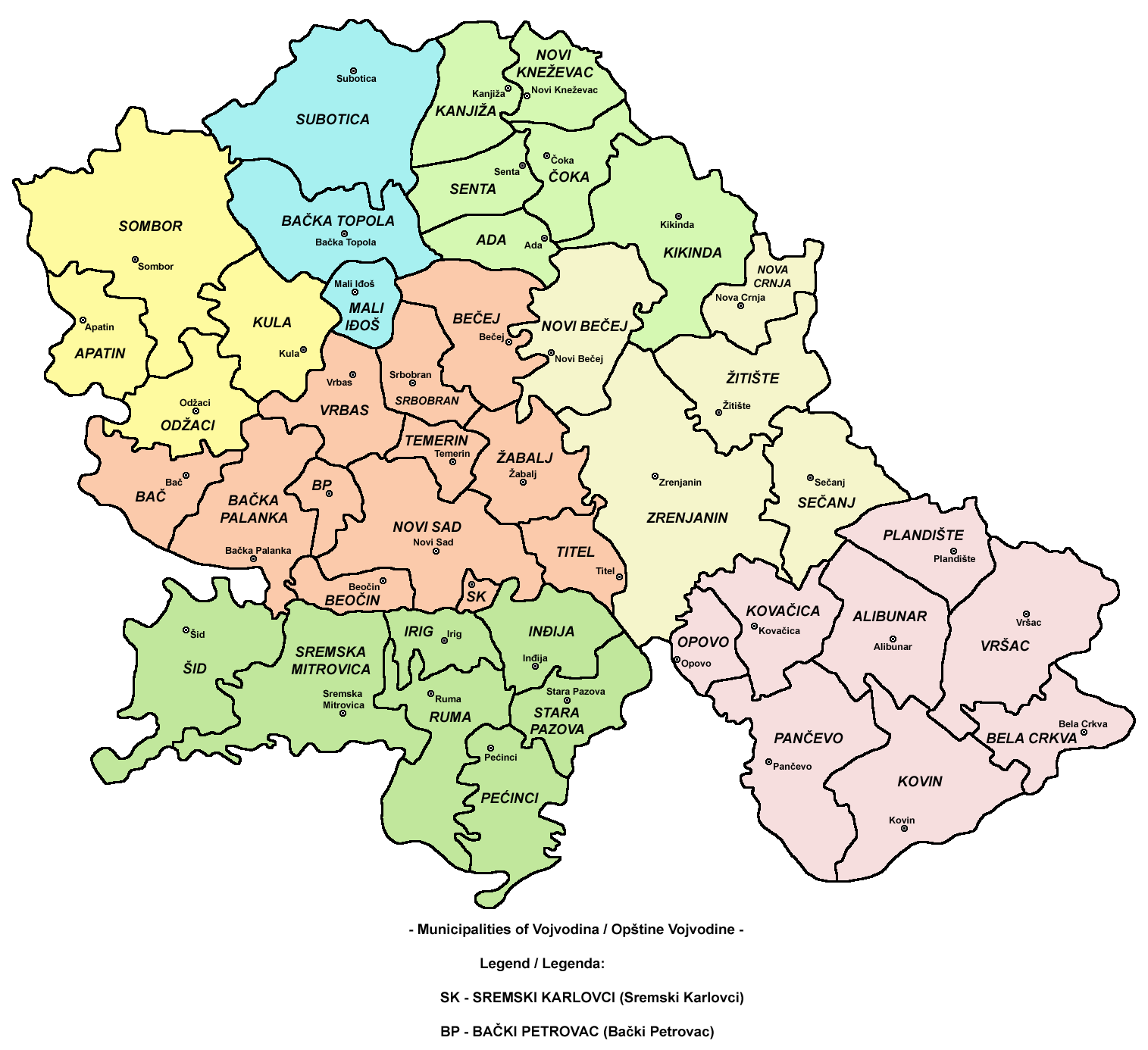
Vojvodina 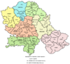 Ada • Alibunar • Apatin • Bač • Bačka Palanka • Bačka Topola • Bački Petrovac • Bečej • Bela Crkva • Beočin • Čoka • Inđija • Irig • Kanjiža • Kikinda • Kovačica • Kovin • Kula • Mali Iđoš • Nova Crnja • Novi Bečej • Novi Kneževac • Odžaci • Opovo • Pećinci • Plandište • Ruma • Sečanj • Senta • Šid • Srbobran • Sremski Karlovci • Stara Pazova • Temerin • Titel • Vrbas • Vršac • Žabalj • Žitište
Kosovo Dečani • Đakovica • Dragaš • Glogovac • Gnjilane • Istok • Kačanik • Klina • Kosovo Polje • Kosovska Kamenica • Kosovska Mitrovica • Leposavić • Lipljan • Mališevo • Novo Brdo • Obilić • Orahovac • Peć • Podujevo • Priština • Prizren • Štimlje • Srbica • Štrpce • Suva Reka • Uroševac • Vitina • Vučitrn • Zubin Potok • Zvečan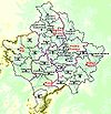 New Municipalities: Đeneral Janković • Gračanica • Junik • Klokot-Vrbovac • Mamuša • Parteš • RanilugPlanned Municipality: North Kosovska MitrovicaCategories:
- Temerin
- Places in Bačka
- Populated places in Vojvodina
- Municipalities of Vojvodina
- South Bačka District


Wikimedia Foundation. 2010.