- Čantavir
-
VišnjevacČantavir
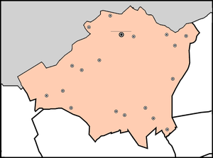
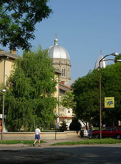
Čantavir (Serbian: Čantavir or Чантавир, Hungarian: Csantavér, Croatian: Čantavir) is the largest village with Hungarian ethnic majority in the autonomous province of Vojvodina, Serbia. It is situated in the municipality of Subotica, North Bačka District. The population of the village is 7,178 (2002 census). The main occupation of the villagers is agriculture and stock breeding.
Contents
Historical population
- 1921: 8,969
- 1931: 11,287
- 1948: 9,397
- 1953: 9,262
- 1961: 9,341
- 1971: 9,085
- 1981: 8,596
- 1991: 7,940
School and culture
There is an elementary school in Čantavir. This school have had a very famous children choir conducted by Éva Gubena music teacher (she got the prize "Sparkle of Culture" at year 2001 st). At year 1995th, previous members of famous children's choir, (Bodor/ Huszár/ Melinda, Barkóci/ Juhász/ Szilvia, Pósa/ Faragó/ Gabriella, Sándor/ Pósa/ Csilla, Poljaković/ Zabos/ Marianna) have had start a ladies choir "Primavera" under conductor of Éva Gubena. From 1996 "Primavera" became a mixed voice chamber choir "Musica Viva". They've tried to bring a live music to the hearts of their audience on concerts, festivals and other events. On their programme there are numerous compositions from all area of a musical history.
People
- Szilveszter Matuska
See also
- List of places in Serbia
- List of cities, towns and villages in Vojvodina
References
- Slobodan Ćurčić, Broj stanovnika Vojvodine, Novi Sad, 1996.
External links
- Ordinary school website
- History of Čantavir (Hungarian)
Cities, towns and villages in the North Bačka District Subotica: Bajmok • Bački Vinogradi • Bačko Dušanovo • Bikovo • Višnjevac • Gornji Tavankut • Donji Tavankut • Đurđin • Kelebija • Ljutovo • Mala Bosna • Mišićevo • Novi Žednik • Palić • Stari Žednik • Hajdukovo • Čantavir • Šupljak
Bačka Topola: Bagremovo • Bajša • Bački Sokolac • Bogaraš • Gornja Rogatica • Gunaroš • Zobnatica • Kavilo • Karađorđevo • Krivaja • Mali Beograd • Mićunovo • Novo Orahovo • Njegoševo • Obornjača • Tomislavci • Panonija • Pačir • Pobeda • Svetićevo • Srednji Salaš • Stara Moravica
(*) bold are municipalities
Coordinates: 45°55′N 19°46′E / 45.917°N 19.767°E
Categories:- Vojvodina geography stubs
- Subotica
- Places in Bačka
- Populated places in Vojvodina
Wikimedia Foundation. 2010.


