- Stari Grad, Belgrade
Infobox Settlement
official_name = Stari Grad
other_name =
native_name = Стари Град
nickname =
settlement_type = Municipality
motto =.jpg)
imagesize =
image_caption = Belgrade Old City (Stari Grad)
flag_size =
image_
seal_size =
image_shield = Stari Grad, Belgrade.gif
shield_size =
city_logo =
citylogo_size =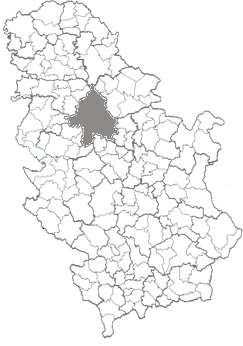
mapsize = 125px
map_caption = Belgrade's location within Serbia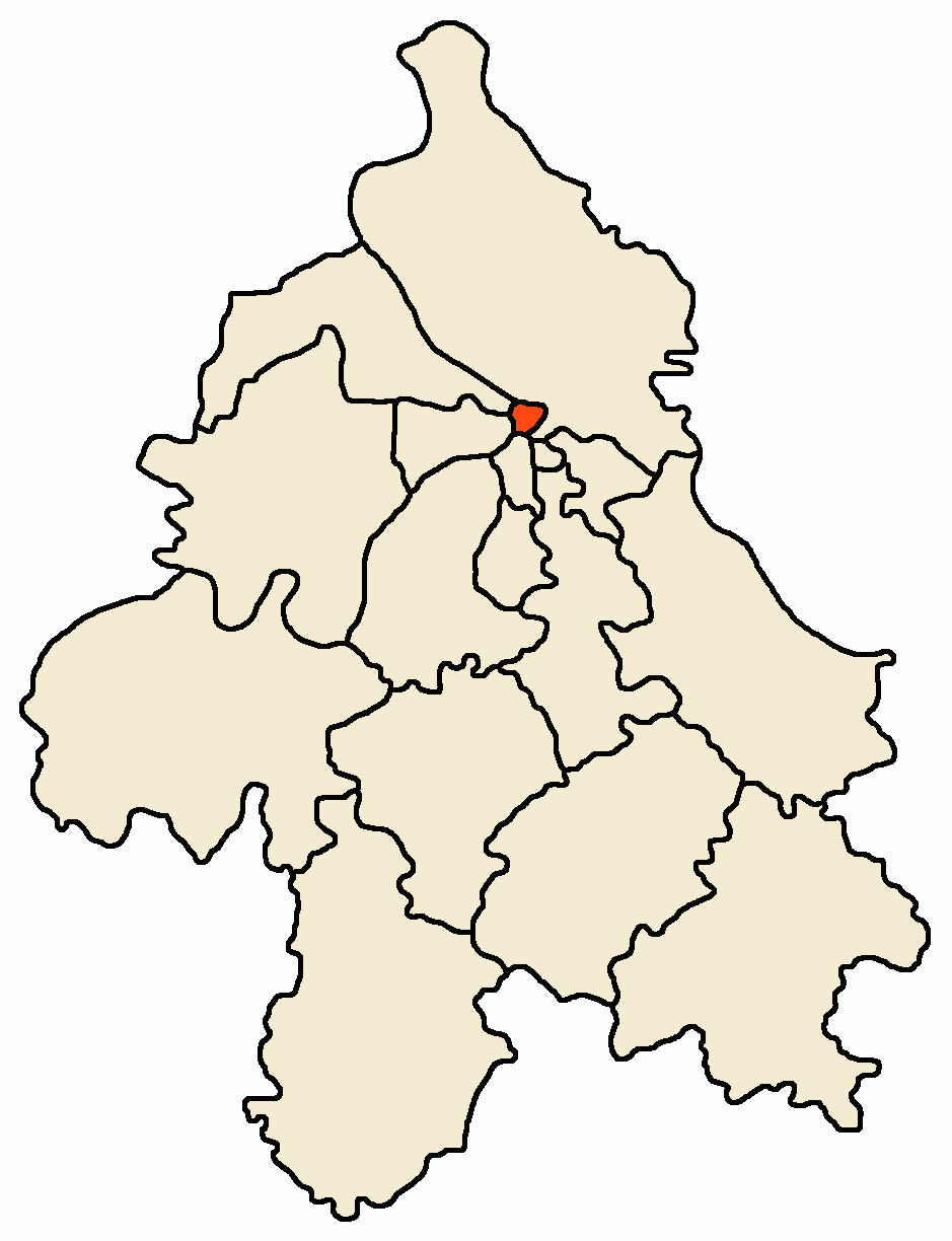
mapsize1 = 125px
map_caption1 = Location of Stari Grad within Belgrade
image_dot_
dot_mapsize =
dot_map_caption =
dot_x = |dot_y =
pushpin_
pushpin_label_position =
pushpin_map_caption =
pushpin_mapsize =
subdivision_type = Country
subdivision_name =Serbia
subdivision_type1 = District
subdivision_name1 = City of Belgrade
subdivision_type2 = Status
subdivision_name2 = Urban
subdivision_type3 = Settlements
subdivision_name3 = 1
subdivision_type4 =
subdivision_name4 =
government_footnotes =
government_type =
leader_title =nowrap|Municipality president
leader_name =Mirjana Božidarević (DS)
leader_title1 =
leader_name1 =
leader_title2 =
leader_name2 =
leader_title3 =
leader_name3 =
leader_title4 =
leader_name4 =
established_title =
established_date =
established_title2 =
established_date2 =
established_title3 =
established_date3 =
area_magnitude =
unit_pref =
area_footnotes =
area_total_km2 = 7.0
area_land_km2 =
area_water_km2 =
area_total_sq_mi =
area_land_sq_mi =
area_water_sq_mi =
area_water_percent =
area_urban_km2 =
area_urban_sq_mi =
area_metro_km2 =
area_metro_sq_mi =
area_blank1_title =
area_blank1_km2 =
area_blank1_sq_mi =
population_as_of =2002
population_footnotes =
population_note =
population_total =55543
population_density_km2 =
population_density_sq_mi =
population_metro =
population_density_metro_km2 =
population_density_metro_sq_mi =
population_urban =
population_density_urban_km2 =
population_density_urban_sq_mi =
population_blank1_title =
population_blank1 =
population_density_blank1_km2 =
population_density_blank1_sq_mi =
timezone = CET
utc_offset = +1
timezone_DST =CEST
utc_offset_DST = +2
latd= |latm= |lats= |latNS=
longd= |longm= |longs= |longEW=
elevation_footnotes =
elevation_m =
elevation_ft =
postal_code_type = Postal code
postal_code =11000
area_code =+381 11
blank_name =license plates
blank_info =BG
blank1_name =
blank1_info =
website = [http://www.starigrad.org.yu/ http://www.starigrad.org.yu/]
footnotes =Stari Grad (Serbian
Cyrillic : Стари Град) is an urban neighborhood and one of 17 municipalities which constitute the City of Belgrade, the capital ofSerbia . It is one of 10 urban municipalities which constitute the Belgrade City proper and encompasses some of the oldest sections of urban Belgrade, thus the name (‘’stari grad’’, Serbian for “old town”).Neighborhood
The neighborhood of Stari Grad is not generally considered by the Belgraders as one single definitive neighborhood. Area which Stari Grad covers is either simply styled "downtown" or by the names of the more established neighborhood which it overlaps: northern ("Upper") and eastern parts of
Dorćol (which it borders on the north) orStudentski Trg . Roughly, it spawns northern and western from theSquare of the Republic , bordering also the neighborhoods ofKalemegdan (west),Kosančićev Venac (south-west),Jevremovac and Palilula (south-west) andViline Vode (north-west), with a population of 9,646 in 2002.Municipality
Geography
Stari Grad, occupies the ending ridge of
Šumadija geological bar. The cliff-like ridge, where the fortress of Kalemegdan is located, overlooks theGreat War Island and the confluence of theSava river into theDanube , and makes one of the most beautiful natural lookouts in Belgrade. WithNovi Beograd , it is one of 2 municipalities of Belgrade (out of 17) which occupy the banks of both major rivers in Belgrade, the Sava and the Danube (Zemun was the third, but when the municipality ofSurčin split, Zemun was left with the Danube, and Surčin with the Sava bank).The municipality of Stari Grad covers an area of just km2 to sq mi|7 (second smallest in Belgrade, after Vračar) and borders the municipalities of Paliula on the east, Vračar on the south-east and
Savski Venac on the south. The Sava makes a border to the municipality of Novi Beograd (west) and the Danube to the municipalities ofZemun (north-west) and theBanat 's section of Palilula.The riverside of the Danube has two distinct artificial bays, the small marina (
Marina Dorćol ) and the port "Beograd".Population
Like the other two "old" municipalities of the central Belgrade (Savski Venac and Vračar), Stari Grad for decades is a highly depopulating municipality, but being a central municipality and small in area, it remains one of the most densely populated municipalities in Serbia. There were 55,543 inhabitants according to the 2002 census or PD km2 to sq mi|7935, compared to a population of 96,517 with a density of PD km2 to sq mi|13788 back in 1971. Population of Stari Grad:
* 1961 - 96,517
* 1971 - 83,742
* 1981 - 73,767
* 1991 - 68,552
* 2002 - 55,543 (57.5% of the 1961 population)Ethnic composition:
*
Serbs - 48,027 or 86.47%
*Yugoslavs - 1,404 or 2.53%
*Montenegrins - 1,031 or 1.86%
*Croats - 409 or 0.74%
* Macedonians - 308 or 0.55%
* Roma - 305 or 0.55%Even though residential areas are much densely compact compared to Vračar, the latter is densely populated because almost one third of Stari Grad, even though it is "heart" of Belgrade is not inhabited (mostly the large park of Kalemegdan and the highly industrialized riverside of the Danube, with dozens of factories and spacious hangars and depots).However, a number of people working on the territory of the municipality doubles its own population and makes possible for the municipality of Stari Grad to achieve
GDP per capita 6 to 8 times higher than the average of Serbia.History
Despite some of the oldest sections of Belgrade belong to Stari Grad, the municipality itself is among the latest urban ones formed administratively. It was formed by the merger of the municipality of
Skadarlija and part of the municipality ofTerazije onJanuary 1 ,1957 . Recent presidents of the municipality:* 1992 – 2000; Jovan Kažić (b. 1937)
* 2000 – present: Mirjana Božidarević (b. 1954)Twin towns
"Stari Grad is twinned with:"
*
Germasogeia (Yermasoyia) ,Cyprus
*Kotor ,Montenegro
*Staré Mesto ,Bratislava "',Slovakia
* Centar,Skopje "',Macedonia
*Erzsébetváros ,Budapest "',Hungary Neighborhoods
Features
Administration
* Presidency of the Republic
*National Assembly of Serbia (both buildings)
* former Federal Assembly
* Assembly of the City of Belgrade (City hall)Economy and tourism
* large industrial zone on the riverside of the Danube (including the
Port of Belgrade )
* BEKO clothing factory
* park and fortress ofKalemegdan
*botanical garden ofJevremovac
*Belgrade Zoo
* pedestrian zone ofKnez Mihailova
* bohemian quarter ofSkadarlija
* [http://www.aleksandarpalas.com/ Aleksandar Palas] *****
* Hotel Majestic ****
* Hotel Palace ****
* [http://www.petitpiaf.com Le Petit Piaf] ***
* [http://www.hotelroyal.co.yu Hotel Royal] ***Culture
*
Serbian Academy of Sciences and Arts
* [http://www.mpu.org.yu Museum of Applied Arts] (Vuka Karadžica 18)
* [http://www.narodnimuzej.org.yu National Museum] (Trg republike 1a)
* [http://www.mgb.org.yu Konak Kneginje Ljubice] (Kneza Sime Markovića 3)
* [http://www.spc.yu/Muzej/english.html Serbian Orthodox Church Museum] (Kralja Petra I 5)
* Military Museum (Kalemegdan)
* Museum of Belgrade Fortress (Kalemegdan)
* [http://www.etnomuzej.co.yu Museum of Ethnography] (Studentski trg 13)
* [http://www.beograd.org.yu/cms/view.php?id=202316 Museum of Pedagogy] (Uzun Mirkova 14)
* [http://www.mgb.org.yu Museum of the City of Belgrade] (Zmaj Jovina 1)
* [http://www.theatremuseum.org.yu Museum of Theatrical Art] (Gospodar Jevremova 19)
* [http://www.jim-bg.org Jewish Historical Museum] (Kralja Petra I 71/1)
* Museum of Vuk and Dositej (Gospodar Jevremova 21)
* [http://www.beograd.org.yu/cms/view.php?id=202312 Museum of Automobiles] (Majke Jevrosime 30)As a curiosity, Stari Grad is location of two shortest streets of Belgrade, "Marka Leka" and "Laze Pačua", which are 45 and 48 meters long, respectively. [
Politika ,April 26 ,2008 , p.30 ] . Despite being in the sole downtown and densely populated urban section, they have no numbers as all the buildings located in them are numbered from the neighboring streets.ee also
*
Subdivisions of Belgrade
*List of Belgrade neighborhoods and suburbs References
External links
* [http://www.starigrad.org.yu/ Stari Grad municipality]
* [http://www.beograd.org.yu/cms/view.php?id=2098 Stari Grad presentation at the official Belgrade site]
Wikimedia Foundation. 2010.