- Grocka
-
Grocka
Гроцка— Municipality and Town — 
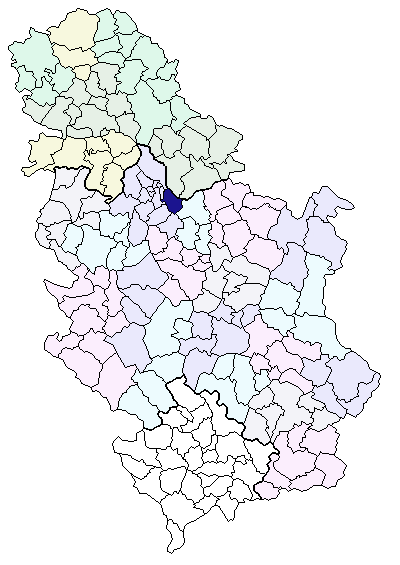
Coat of armsLocation of the municipality of Grocka within Serbia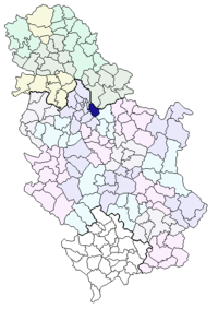
Country Serbia District Belgrade Settlements 15 Government – Mayor Zoran Jovanović (DSS) Area[1] – Municipality 289 km2 (111.6 sq mi) Population (2011 census)[2] – Town 8,338 – Municipality 75,466 Time zone CET (UTC+1) – Summer (DST) CEST (UTC+2) Postal code 11306 Area code +381 011 Car plates BG Website www.grocka.rs Grocka (Serbian Cyrillic: Гроцка, pronounced [grɔ̌t͡skaː]) is a suburban neighborhood and one of 17 municipalities which constitute the City of Belgrade, the capital of Serbia.
Contents
Municipality
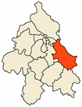 Location of Grocka within Belgrade
Location
The municipality is located east of Belgrade, in the northern part of Šumadija region, with the northern section being part of the Podunavlje macro-region in the valley of the Danube, while the southern section is located around the valley of the Ralja river, which is a tributary to the Velika Morava's arm of Jezava. With an altitude of 71 meters above sea level, the town of Grocka is one of the lowest parts of Belgrade.[3] Other rivers in the municipality are Bolečica and Gročica.
Settlements
The municipality of Grocka covers an area of 289 km² and includes 15 settlements, all of which are statistically classified as rural, except for the municipal seat of Grocka, which is classified as urban.
- Grocka
- Kaluđerica
- Vrčin
- Zaklopača
- Avramovići
- Bajića Kraj
- Carino Naselje
- Cerje
- Donja Mala
- Gornja Mala
- Jankovići
- Malo Polje
- Pobrđani
- Ramnice
- Tranšped
- Karagača
- Kasapovac
Population
The municipality has a population of 75,466 (census 2002), with an estimated 78,825 inhabitants on 31 December 2005 (273 per km²). Thanks to the immigration and the natural increase of all of the city's municipalities, Grocka has been for decades one of the fast growing areas of Belgrade, with an average annual growth of 1.2% in the 2000s. The population boomed in the last 30 years, increasing the number of inhabitants (1971-2005 by 2.23 times; in 1971-81 the population grew by 4.5% annually). As in other similar areas surrounding Belgrade, the rapid population growth has not followed by the equal development of infrastructure (roads, waterworks, sewage system, and waste disposal).
Population of the municipality:
- 1961: 32,836
- 1971: 35,275
- 1981: 54,599
- 1991: 65,735
- 2002: 75,466
- 2005: 78,825
With refugees from Bosnia, Croatia and Kosovo and Metohija, it is estimated that the population has already crossed 100,000. Th ethnic structure is, as of the 2002 census: Serbs 94,7%, Montenegrins 0,8%, Roma 0,6%, Ethnic Macedonians 0,5%.
Economy
In both demographic and economic terms, the municipality is sharply divided into two opposing parts. The western part extends into one urban area with Belgrade, experiencing a boost of both population and economy, as hundreds of small companies are located there (Kaluđerica, Boleč, Leštane, Vinča, Ritopek are some), while the eastern part is agricultural, in particular a fruit growing area, and, apart from the town of Grocka itself, experiencing a net decline in population.
The Microclimate is perfect for the fruit growing and grapevines, so the area east of Boleč is one of the best known fruit growing area in Serbia. Conditions are especially good for growing peaches, apricots, plums, cherries and grapes. Of the other agricultural products, wheat is the most important. The experimental farm of Radmilovac is located near Vinča, as a section of the Agricultural Faculty of the Belgrade University. At the moment, Radmilovac is being expanded as a experimental ground for future agricultural production.
As a result of this, industrial processing of the fruit is developed in Grocka, Vinča and Boleč, where the large plantations and refrigiration plants of the agricultural company PKB Beograd are located. Also, several mills are located in Grocka and Vinča.
Apart from that, the textile industry is also important (Grocka, Dunav factory,aka:Partizanka), while hundreds of small family-owned factories and work shops are located in the settlements in the western part of the municipality.
Some major traffic routes, like the Smederevski put (Smederevo road) and both the railway and highway Belgrade-Niš, pass through the municipal territory. Also, there are several docks in the settlements on the Danube (Vinča, Grocka) with the prospect of a future marina to be built in Grocka in the next few years.
Other important facilities in the municipality are the Geomagnetic observatory in Brestovik, Nuclear Institute (with now defunct nuclear reactor) and Belgrade City dump in Vinča.
Tourism is the most developed part the municipal economy. Almost every village has its own summer festival (like Zlatni kotlić (Golden Cauldron) in Grocka or Dani trešnje (Days of cherry) in Ritopek) and three weekend-settlements (mostly by the inhabitants of Belgrade) are located in Grocka, on the bank of the Danube. The women's monastery of Rajinovac in Begaljica, the possible marina and aqua park in Grocka and the archeological find of Vinča culture are potential opportunities to boost the tourist economy.
History
The municipality of Grocka became part of the wider Belgrade City area in 1955. In 1957 with the dissolution of the Mali Mokri Lug municipality, the eastern section (the villages of Kaluđerica, Leštane and Vinča) were attached to Grocka. In the early 1960s, the municipalities of Umčari and Vrčin were disbanded and incorporated into the municipality of Grocka as well. Since the elections in 2000,Grocka became the most politically turbulent of all Belgrade municipalities.[citation needed]
Recent presidents of the municipal assembly:
- 1992 - 1996 - Bogoljub Stevanić (1943)
- 1996 - November 24, 2000 - Milan Janković (1954)
- November 24, 2000 - June 28, 2002 - Vesna R. Ivić (1962)
- June 28, 2002 - December 8, 2002 - Milan Tanasković
- December 8, 2002 - April 15, 2003 - Sava Starčević (1955)
- April 15, 2003 - December 15, 2004 - Vladan Zarić (1972)
- December 15, 2004 - June 23, 2005 - Blažo Stojanović
- June 23, 2005 - November 4, 2005 - Dragoljub Simonović (1959)
- November 4, 2005 - July 2008 Blažo Stojanović (second term)
- July 2008 - Zoran Jovanović
As a result of the economic and demographic discrepancy between the western and eastern parts of the municipality, there is a movement for splitting the municipality in two, or perhaps three parts. Primarily, it is about the division in two, with western half becoming new municipality of Vinča, while eastern remaining the municipality of Grocka. Also, there is a possibility of Vrčin splitting from Grocka and forming new municipality of Avalski Venac with other sub-Avalan settlements in the municipality of Voždovac (Beli Potok, Zuce, Pinosava).
Town
Location and population
Grocka is a small town, located on the right bank of the Danube, where the small river of the Gročica (Cyrillic: Грочица) empties into the Danube, 30 km east of Belgrade. Despite being seat of the municipality, in term of population, it is only the fourth largest settlement in the municipality, after Kaluđerica, Vrčin and Leštane. The population of Grocka:
- 1921 - 2,808
- 1953 - 3,200
- 1971 - 4,955
- 1981 - 6,394
- 1991 - 7,420
- 2002 - 8,338
- 2005 - 8,719
Economy
Grocka is at the center of one of the best known fruit growing areas in Serbia. Conditions are especially favorable for growing peaches, apricots, plums, cherries and grapes. Industrial processing of the fruit has been developed. There are also several mills and a textile industry (Kluz factory).
Traffic is also important as Grocka is located on the road of Smederevski put. It also has a small harbor on the Danube, at the Gročica's mouth (which regularly floods Grocka).
Tourism is important for the town's economy, with several festivals during the year (most notably, the Zlatni kotlić). Large weekend-settlement (mostly by the inhabitants of Belgrade) is built on the eastern extension of the town.
Culture and history
Town has a historical main street with shops, green market and a small administrative center, which has been turned into a pedestrian zone.
The area on which modern town Grocka is located was once part of Limes, a border defense system of Ancient Rome. The remains of several watch-towers and small forts were found in near-by villages along the banks of the Danube river. The town was first time mentioned in 878[where?] under Slavic name Gradec, while present settlement of Grocka was esdtablished in 1550.
International cooperation
Grocka is twinned with following cities and municipalities[4]:
See also
- Subdivisions of Belgrade
- List of Belgrade neighborhoods and suburbs
- Battle of Grocka
References
- ^ "Municipalities of Serbia, 2006". Statistical Office of Serbia. http://webrzs.stat.gov.rs/axd/en/Zip/OG2006webE.zip. Retrieved 2010-11-28.
- ^ "2011 Census of Population, Households and Dwellings in the Republic of Serbia – FIRST RESULTS". Bulletin (Statistical Office of the Republic of Serbia) 540. 2011. ISSN 0354-3641. http://media.popis2011.stat.rs/2011/prvi_rezultati.pdf. Retrieved 2011-11-21.
- ^ Politika, April 20, 2008, front page
- ^ [1] Stalna konferencija gradova i opština. Retrieved on 2007-06-18.
- Mala Prosvetina Enciklopedija, Third edition (1985); Prosveta; ISBN 86-07-00001-2
- Jovan Đ. Marković (1990): Enciklopedijski geografski leksikon Jugoslavije; Svjetlost-Sarajevo; ISBN 86-01-02651-6
External links
Coordinates: 44°40′N 20°43′E / 44.667°N 20.717°E
Municipalities of Belgrade Municipalities Barajevo · Čukarica · Grocka · Lazarevac · Mladenovac · Novi Beograd · Obrenovac · Palilula · Rakovica · Savski Venac · Sopot · Stari Grad · Surčin · Voždovac · Vračar · Zemun · Zvezdara
Municipalities and cities of Serbia Central Serbia Belgrade (Barajevo • Čukarica • Grocka • Lazarevac • Mladenovac • Novi Beograd • Obrenovac • Palilula • Rakovica • Savski Venac • Sopot • Stari Grad • Surčin • Voždovac • Vračar • Zemun • Zvezdara) • Čačak • Jagodina • Kragujevac (Aerodrom • Pivara • Stanovo • Stari Grad • Stragari) • Kraljevo • Kruševac • Leskovac • Loznica • Niš (Crveni Krst • Medijana • Niška Banja • Palilula • Pantelej) • Novi Pazar • Požarevac • Smederevo • Šabac • Užice • Valjevo • Vranje • Zaječar Aleksandrovac • Aleksinac • Aranđelovac • Arilje • Babušnica • Bajina Bašta • Batočina • Bela Palanka • Blace • Bogatić • Bojnik • Boljevac • Bor • Bosilegrad • Brus • Bujanovac • Crna Trava • Čajetina • Ćićevac • Ćuprija • Despotovac • Dimitrovgrad • Doljevac • Gadžin Han • Golubac • Gornji Milanovac • Ivanjica • Kladovo • Knić • Knjaževac • Koceljeva • Kosjerić • Krupanj • Kučevo • Kuršumlija • Lajkovac • Lapovo • Lebane • Lučani • Ljig • Ljubovija • Majdanpek • Mali Zvornik • Malo Crniće • Medveđa • Merošina • Mionica • Negotin • Nova Varoš • Osečina • Paraćin • Petrovac • Pirot • Požega • Preševo • Priboj • Prijepolje • Prokuplje • Rača • Raška • Ražanj • Rekovac • Sjenica • Smederevska Palanka • Sokobanja • Surdulica • Svilajnac • Svrljig • Topola • Trgovište • Trstenik • Tutin • Ub • Varvarin • Velika Plana • Veliko Gradište • Vladičin Han • Vladimirci • Vlasotince • Vrnjačka Banja • Žabari • Žagubica • Žitorađa
Vojvodina  Ada • Alibunar • Apatin • Bač • Bačka Palanka • Bačka Topola • Bački Petrovac • Bečej • Bela Crkva • Beočin • Čoka • Inđija • Irig • Kanjiža • Kikinda • Kovačica • Kovin • Kula • Mali Iđoš • Nova Crnja • Novi Bečej • Novi Kneževac • Odžaci • Opovo • Pećinci • Plandište • Ruma • Sečanj • Senta • Šid • Srbobran • Sremski Karlovci • Stara Pazova • Temerin • Titel • Vrbas • Vršac • Žabalj • Žitište
Kosovo Dečani • Đakovica • Dragaš • Glogovac • Gnjilane • Istok • Kačanik • Klina • Kosovo Polje • Kosovska Kamenica • Kosovska Mitrovica • Leposavić • Lipljan • Mališevo • Novo Brdo • Obilić • Orahovac • Peć • Podujevo • Priština • Prizren • Štimlje • Srbica • Štrpce • Suva Reka • Uroševac • Vitina • Vučitrn • Zubin Potok • Zvečan New Municipalities: Đeneral Janković • Gračanica • Junik • Klokot-Vrbovac • Mamuša • Parteš • RanilugCategories:
- Municipalities of Belgrade
- Populated places in Central Serbia
- Suburbs of Belgrade
- Šumadija


Wikimedia Foundation. 2010.