- Agia Paraskevi
-
Agia Paraskevi
Αγία ΠαρασκευήLocation 
 Agia Paraskevi
Coordinates 38°0′N 23°49′E / 38°N 23.817°ECoordinates: 38°0′N 23°49′E / 38°N 23.817°E Location within the region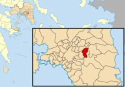
Government Country: Greece Region: Attica Regional unit: North Athens Mayor: Vasilis Zorbas (ND) Population statistics (as of 2001) Municipality - Population: 59,500 - Area: 7.935 km2 (3 sq mi) - Density: 7,498 /km2 (19,421 /sq mi) Other Time zone: EET/EEST (UTC+2/3) Elevation (center): 206 m (676 ft) Postal: 153 xx, 154 xx Telephone: 210 Auto: I Website www.agiaparaskevi.gr Agia Paraskevi (Greek: Αγία Παρασκευή, named after Saint Paraskevi of Rome), is a suburb of Athens, Greece, in the northeast of Athens, about nine kilometers away from the city centre. It is linked to Athens by Mesogeion Avenue, a major road in the greater Athens area. It is a municipality within Attica region.
Contents
History
Until the 1950s, the suburb was sparsely inhabited, with most of its inhabitants practising agriculture. In the 1960s, the rapid economic development that the country was experiencing drove an influx of immigrants to the big cities, and a burst of construction activity. Thus the population of suburban Athens (and Agia Paraskevi) dramatically increased; a process that went on into the 1980s and 1990s (see table below). Today, Agia Paraskevi, like the majority of Athens' suburbs, is densely populated.
Agia Paraskevi consists of 7 districts: Kontopefko (Greek Κοντόπευκο for short pine tree, Ancient/Katharevousa Kontopefkon), Nea Zoi (Νέα Ζωή Greek for new life), Tsakos (Τσακός), Stavros, Agios Ioannis (Άγιος Ιωάννης the Greek equivalent of Saint John), Pefkakia and Paradisos (Heaven). In the downtown area lies the central Agia Paraskevi Square with a cathedral dedicated to the Orthodox Saint Agia Paraskevi, after whom the suburb is named.
Agia Paraskevi operates the nuclear research center Demokritos, which hosts the sole nuclear reactor in Greece. It is also home of the Greek Ministry of Agriculture.
The football team of the city is Agia Paraskevi F.C., but is known as "Santa", attracting devoted fans. During the Olympic games in 2004, a part of the historical Marathon passed through Agia Paraskevi in Mesogeion avenue, and this was deemed a great moment for the municipality.
1993 riot
In 1993, there was considerable opposition from inhabitants of the suburb to the construction of the Hymettus ring road. The ring road was to form a major highway on the mountainside linked directly to the Attiki Odos, and the construction of both the ring and Attiki Odos were to commence immediately. The realization that this plan would demand the felling of a considerable numbers of trees, as well as spurring an increase in noise pollution, predictably aroused the opposition of the local population, who requested a different solution: a covered road. However, the government would not reverse the decision and, in fact, sent bulldozers to the mountainside. This led to a riot in April, 1993. Thousands of people travelled up the mountainside and faced the bulldozers, forcing the drivers to leave. At length police arrived and managed to force the demonstrators off the site; eventually the construction of the two highways began, and was completed in 2001. The road was covered only at a small section, that running over the Deree College.
Geography
 Agiou Ioannou street.
 Block of apartments at the Kontopefko area.
Built at the foot of mount Hymettus, Agia Paraskevi is one of the few suburbs of Athens to retain plenty of trees, and offers good opportunities for leisure activities, such as trekking, jogging and picnics. A beautiful route on the mountainside leads through the pine trees, to the small monastery of Saint John, known as "the hunter" in the area. There are spectacular views at the summit, to all Athens as far as Piraeus.
Climate
The climatic conditions in Agia Paraskevi are typically Mediterranean: summers are hot and dry, and winters are mild. Snowfalls are not uncommon, but they don't occur every winter, while heatwaves also occur every summer, with temperatures reaching 40 or even 42 Celsius degrees. Due to these conditions, people suffering from serious illnesses were once brought here as part of their recovery process, before the great wave of urban development.
Transportation
Although there is a very satisfactory highway connection, Agia Paraskevi is still poorly linked to other areas of Attica via public transport; a major reason for this is the town's geographical position. There are few bus lines leading to the center of Athens and one going to Agioi Anargyroi. Also there are two Metro stations that are serving the city, called Nomismatokopio and Agia Paraskevi.
Historical population
Year Population 1981 32,904 1991 47,463 2001 56,836 2011 59,500 References
External links

Chalandri Chalandri Cholargos and Neo Psychiko 
Glyka Nera  Agia Paraskevi

Cholargos Administrative division of the Attica Region Regional unit of Central AthensAthens • Dafni–Ymittos • Filadelfeia–Chalkidona • Galatsi • Ilioupoli • Kaisariani • Vyronas • Zografou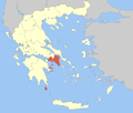 Regional unit of West AthensRegional unit of South AthensAgios Dimitrios • Alimos • Elliniko–Argyroupoli • Glyfada • Kallithea • Moschato–Tavros • Nea Smyrni • Palaio FaliroRegional unit of PiraeusAcharnes • Dionysos • Kropia • Lavreotiki • Marathon • Markopoulo • Oropos • Paiania • Pallini • Rafina–Pikermi • Saronikos • Spata–Artemida • Vari–Voula–VouliagmeniRegional unit of IslandsCategories:
- Municipalities of Attica
- Populated places in North Athens


Wikimedia Foundation. 2010.