- Nea Ionia
-
Nea Ionia
Νέα Ιωνία
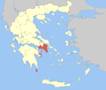
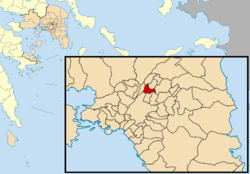
Location Coordinates 38°2′N 23°45′E / 38.033°N 23.75°ECoordinates: 38°2′N 23°45′E / 38.033°N 23.75°E Government Country: Greece Region: Attica Regional unit: North Athens Mayor: Iraklis Gotsis Population statistics (as of 2001) Municipality - Population: 66,017 - Area: 4.421 km2 (2 sq mi) - Density: 14,933 /km2 (38,675 /sq mi) Other Time zone: EET/EEST (UTC+2/3) Elevation (center): 130 m (427 ft) Postal: 142 xx Telephone: 210 Auto: Z Website www.neaionia.gr Nea Ionia (Greek: Νέα Ιωνία, meaning New Ionia) is a northern suburb of Athens, Greece, and a municipality of the Attica region. It has a surface train station (ISAP). The suburb was named after Ionia, the region in Anatolia from which many Greeks migrated in the 1920s following the Population exchange between Greece and Turkey. It is located northeast of the neighborhood of Patissia. It is located S of Attiki Odos which opened in 2001 and wasn't fully connected until February 2004, WSW of Kifissia and W of Kifissias Avenue, W of Marathonos Avenue, ENE of Athens and E of Kifissou Avenue. Its main street is one connecting Patissia and Kifissia.
The area was made up of farmlands and trees dominated the area. The trees are in the squares today. Urban development replaced much of the farmlands. Today, much of the municipality is urbanized while the businesses are along its main roads. Many of the trees are aligned with the streets and in squares. A few tracts of hilly grasslands lie to the east.
Nea Ionia has schools, lyceums, gymnasia, banks, a post office and squares (plateies).
Contents
Historical population
Year Population 1981 59,202 1991 60,635 2001 66,017 Notable people
- Maria Farantouri (1947-), Greek singer
- Stelios Kazantzidis (1931–2001), Greek singer
- Nikos Xanthopoulos (1934-), Greek actor
References
External links
See also
- List of municipalities of Attica
North: Metamorfosi Northeast: Heraklio West: Nea Filadelfeia Nea Ionia East: Filothei Southwest: Athens South: Galatsi Administrative division of the Attica Region Area: 3,808km² • Population: 3,761,810 (2001) • Capital: Athens Regional unit of Central AthensAthens • Dafni–Ymittos • Filadelfeia–Chalkidona • Galatsi • Ilioupoli • Kaisariani • Vyronas • Zografou Agia Paraskevi • Amarousio • Chalandri • Filothei–Psychiko • Irakleio • Kifisia • Lykovrysi–Pefki • Metamorfosi • Nea Ionia • Papagou–Cholargos • Penteli • VrilissiaRegional unit of West AthensRegional unit of South AthensAgios Dimitrios • Alimos • Elliniko–Argyroupoli • Glyfada • Kallithea • Moschato–Tavros • Nea Smyrni • Palaio FaliroRegional unit of PiraeusAcharnes • Dionysos • Kropia • Lavreotiki • Marathon • Markopoulo • Oropos • Paiania • Pallini • Rafina–Pikermi • Saronikos • Spata–Artemida • Vari–Voula–VouliagmeniRegional unit of Islands
Regional governor: Ioannis Sgouros (el) • Website: www.patt.gov.gr Categories:- Municipalities of Attica
- Populated places in North Athens
Wikimedia Foundation. 2010.


