- Oropos
-
Oropos
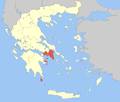
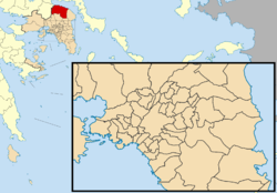
ΩρωπόςLocation Coordinates 38°18′N 23°45′E / 38.3°N 23.75°ECoordinates: 38°18′N 23°45′E / 38.3°N 23.75°E Government Country: Greece Region: Attica Regional unit: East Attica Population statistics (as of 2001) Municipality - Population: 33,448 - Area: 317.5 km2 (123 sq mi) - Density: 105 /km2 (273 /sq mi) Community - Population: 1,252 - Area: 12.0 km2 (5 sq mi) - Density: 104 /km2 (270 /sq mi) Other Time zone: EET/EEST (UTC+2/3) Elevation: 45 m (148 ft) Postal: 190 15 Telephone: 22950 Auto: Z Oropos (Greek: Ωρωπός) is a small town and a municipality in East Attica, Greece.
Contents
Geography
It is situated on the southern Euboean Gulf, opposite Eretria. Oropos is located N of Avlona and Athens, E of Thebes and SE of Chalcis. Oropos is linked with the road linking Nea Palatia and Sikamino. Oropos is also linked with the service road which links with the GR-1/E75 at its nearest interchanges. The area around Oropos supports farmlands with olive groves to the south and with some mountains to the south. South of the superhighway is the Parnitha mountain. Various businesses form the industry of Oropos, and agriculture dominates the farmlands.
Municipality
The present municipality Oropos was formed at the 2011 local government reform by the merger of the following 9 former municipalities, that became municipal units (constituent communities in brackets):[1]
- Afidnes
- Avlonas
- Kalamos
- Kapandriti
- Malakasa
- Markopoulo Oropou
- Oropioi (Nea Palatia, Skala Oropou and Oropos)
- Polydendri
- Sykamino
Nearest places
- Chalkoutsi, north
- Skala Oropou, northeast
- Milessi, east
- Avlona, south
- Oinofyta, west
History
Oropos was founded by colonists from Eretria; it was either located in or identical with Graea.[2] In ancient times, it was a border city between Boeotia and Attica, and its possession was a continual cause of dispute between the two states; but ultimately it came into possession of Athens, and was always an Attic town, even during the Roman Empire. The actual harbour, which was called Delphinium, was at the mouth of the Asopus, about a mile (1.6 km) north of the city.
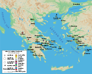
The famous oracle of Amphiaraus was situated in the territory of Oropus, 12 stadia from the city. The site has been excavated by the Greek Archaeological Society;[3] it contained a temple, a sacred spring, into which coins were thrown by worshippers, altars and porticoes, and a small theatre, of which the proskenion is well preserved. Worshippers used to consult the oracle of Amphiaraus by sleeping on the skin of a slaughtered ram within the sacred building.
Historical population
Year Town population Community population 1981 672 - 1991 784 924 2001 860 1,252 Other
The town (pop. 860 in 2001) is the seat of government of the community, which also includes the villages of Kámpos Oropoú (pop. 237), and Platánia Oropoú (155). Oropos has a school and a lyceum or a middle school, a gymnasia or a high school, churches, a post office and a few squares (plateies).
See also
- List of municipalities of Attica, Including communities
References
- ^ Kallikratis law Greece Ministry of Interior (Greek)
- ^ Robin Lane Fox, Travelling Heroes: In the Epic Age of Homer (Random House, 2008: ISBN 0679444319), p. 161.
- ^ A. Mazzarakis Ainian, "Oropos in the Early Iron Age", in M. Bats and d'Agostino, eds. Euboica: l'Eubea e la presenza euboica in Calcidia e in occidente 1998:197-215.
External links

Skala Oropou 
Sykamino 
Skala Oropou  Oropos

Avlonas Malakasa Administrative division of the Attica Region Area: 3,808km² • Population: 3,761,810 (2001) • Capital: AthensRegional unit of Central AthensAthens • Dafni–Ymittos • Filadelfeia–Chalkidona • Galatsi • Ilioupoli • Kaisariani • Vyronas • Zografou Regional unit of North AthensAgia Paraskevi • Amarousio • Chalandri • Filothei–Psychiko • Irakleio • Kifisia • Lykovrysi–Pefki • Metamorfosi • Nea Ionia • Papagou–Cholargos • Penteli • VrilissiaRegional unit of West AthensRegional unit of South AthensAgios Dimitrios • Alimos • Elliniko–Argyroupoli • Glyfada • Kallithea • Moschato–Tavros • Nea Smyrni • Palaio FaliroRegional unit of PiraeusRegional unit of East AtticaAcharnes • Dionysos • Kropia • Lavreotiki • Marathon • Markopoulo • Oropos • Paiania • Pallini • Rafina–Pikermi • Saronikos • Spata–Artemida • Vari–Voula–VouliagmeniRegional unit of West AtticaRegional unit of IslandsRegional governor: Ioannis Sgouros (el) • Website: www.patt.gov.gr
Municipal unit of Avlonas AvlonasMunicipal unit of Kalamos Municipal unit of Kapandriti Municipal unit of Malakasa Municipal unit of Markopoulo Oropou Municipal unit of Oropioi Municipal unit of Polydendri Municipal unit of Sykamino Categories:- Populated places in East Attica
- Municipalities of Attica
- Ancient Greek cities
- Geography of ancient Attica
- Geography of ancient Boeotia
Wikimedia Foundation. 2010.


