- Parnitha
-
Parnitha Πάρνηθα 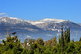
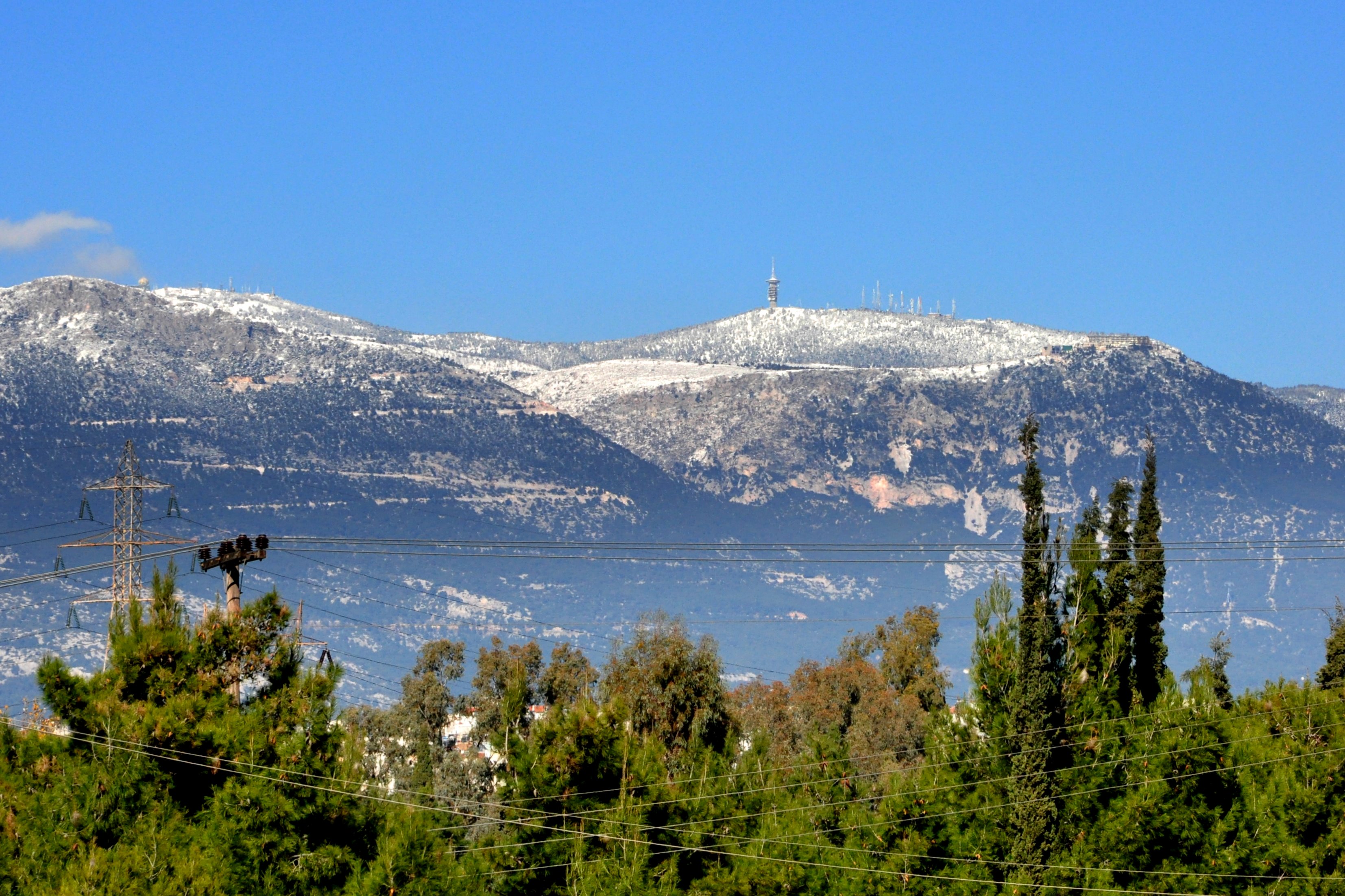
Parnitha as seen from Nea Filadelfia, AthensElevation 1,413 m (4,636 ft) Prominence 10 to 15 km, north to south
approx. 10 km from east to westListing National park Location Location north of Athens, Greece Range Parnitha Coordinates 38°10′24″N 23°43′03″E / 38.1734°N 23.7174°ECoordinates: 38°10′24″N 23°43′03″E / 38.1734°N 23.7174°E Climbing Easiest route climb Mount Parnitha (Greek, modern: Πάρνηθα, ancient/Katharevousa: Πάρνης Parnis/Parnes; sometimes Parnetha) is a densely forested mountain range north of Athens, the highest on the peninsula of Attica, with an elevation of 1,413 m and a summit known as Karavola (Καραβόλα). Much of the mountain is designated a national park, and is a protected habitat for wildfowl, first created in 1961. The summit is located 18 km N of Acharnae and about 30 km N of Athens, while the mountain covers approximately 250 km² of land. Other peaks include Mavrovouni (Μαυροβούνι), Ornio (1,350 m), Area (1,160 m), Avgo or Avgho (1,150 m), and Xerovouni (Ξεροβούνι, meaning dry mountain - 1,120 m).It also has two shelters Mpafi and Flampouri.
Contents
Geography
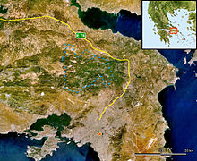 A satellite view of Parnitha along with most of Attica, the boundary is marked in light blue
Towns surrounding the mountain include Aspropyrgos (Thria), Fyli, Acharnae/Menidi, Varymbombi, Thrakomakedones, Decelea, Avlona and Aghios Stefanos as well as the settlement of Agios Merkourios. The highway GR-1 aka E75 surrounds the northern and eastern part of the mountain along with the Cephissus river, while the Attiki Odos motorway (GR-6) runs to its south. The mountain offers panoramic views of the mountains northeast of Parnitha, Penteli to the east, the Ymittos to the southeast, the Aigaleo to the south and another to the west; from its summit, one can also see the Thriasian Plain, the Saronic Gulf including the islands of Salamina, Aigina and the North, the South Euboean Gulfs and island of Euboea, and most of central and northern Greater Athens. The view during clear days can extend to northern Viotia and the Peloponnese.
Forests of Greek Fir and Aleppo Pine cover all slopes beneath 1,000 m altitude, and are often threatened by forest fires, such as occurred in 2005 and 2007. Above 1,000 m it is covered principally in grasses and shrubbery, and beneath 300 m mainly farmlands and suburban housing to the east. About 1,000 species of plants can be found on the mountain, including crocus and tulips, and the mountain also provides a native habitat to its red deer, which were known in ancient times. After the traumatic event listed below in 2007, they are even more scarce. Several large mines lie to the northwest, and the ore from them was shipped to a nearby factory in industrial areas.
A casino, the Mount Parnes Casino, is located near the top of the mountain and is served by a suspended cable car. Two shelters are also located on Parnitha, the most known of which is Mpafi. A series of trails are found around the mountain as well as forest roads, and also on the mountain is Athens' second transmitter, broadcasting radio and television since the mid-1950s, across the range of television channels from ERT, ANT1, Mega, Alter and more, to satellite, including Super Sport, Seven X and Filmnet, and a multitude of radio including ERA Radio, Klik FM, ANT1 Radio, Ciao FM, Rhythmos, Super Sport FM, Top FM and others. The supporting road connection was paved in the mid-20th century.
The mountain was also affected by several major blizzards, including two in 2005 and 2006, stranding cars and closing roads, as well as the cable car.
The name of the mountain dates back to ancient times, when it was under the ancient demes of Acharnae and Decelea.
2007 wildfire
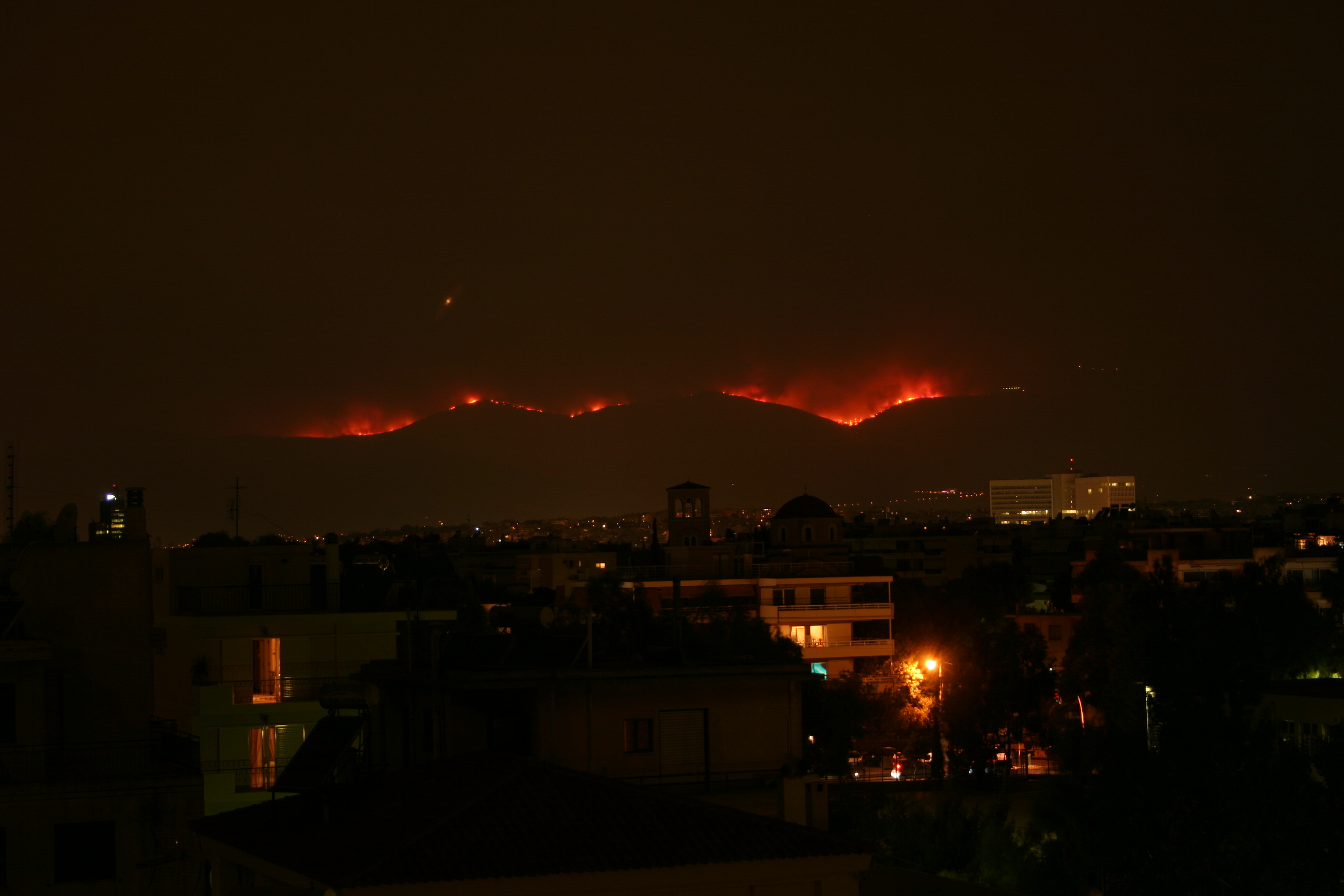
See also: 2007 Greek forest fires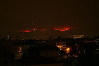 View of the fire from the East
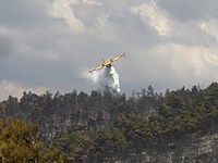 Parnitha during 2007 wildfire
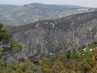 A very small part of the burned area
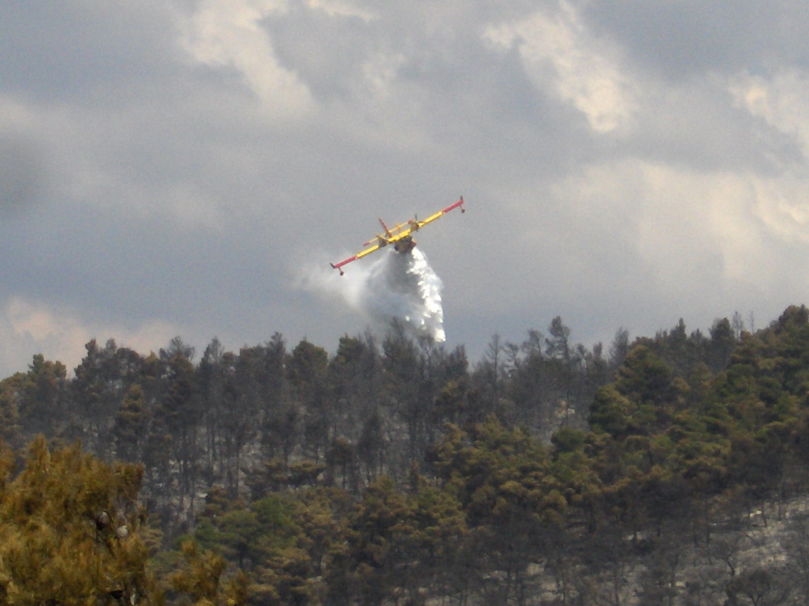
Parnitha suffered extensive damage from a wildfire on Thursday, June 28, 2007 around the morning and noon hours, continuing for several days and burning approximately 56 km² of land; one of the worst recorded wildfires in the prefecture after that of Penteli. The magnitude of the devastation was unforeseen. A smaller fire had, however, taken place in the 1960s.[1]The fire consumed forests in two prefectures. Firefighters, helicopters, and planes were brought into action across the mountain area and its edges fighting the enormous blaze,which took days to contain. It spread rapidly with the help of intense winds, and intensified into the northwestern edges of Greater Athens, including both Ano Liosia and towns and villages such as Fyli, near Thrakomakedones, Pyli and both Skoura and Schimatari north of the mountain. From Athens, inhabitants could see the mountainside burning throughout the night. In Schimatari in Viotia, it ruined several acres of forest and businesses. The fire claimed an 80% proportion of the rare Greek Fir and Aleppo Pine forest, 150 animals of the red deer population (an endangered species), birds, and other rare animals. The remains of the green firs and pines are sporadically located around its edges; the scene now resembles that of a devastated forest or an ugly winter. With the loss of its pine needles, one can see the horrifying bareness of the mountain slopes, summit, and valleys. Smoke was seen from most of the Athens area, even the west central and west suburbs, the downtown area, the northern suburbs and almost every part of Viotia, except for most of the western and northernmost portions. The smoke from the massive destruction formed a line that traveled east over Attica, southern Euboea, Chios, to the edge of Turkey, at a distance of approximately 350 km.
On June 30, the fire was mostly contained and warnings of new ones were reduced, as only a few fires were slowly burning sporadically in separate parts of the mountain. The main blaze was completely put out on July 1. At the edges of the burnt parts, several fires slowly continued to burn in sections after June 30, with a slow expansion.
Scientists estimate[citation needed] the area's recovery time may be as long as a century. They predict the effect of the loss will only begin to be felt in the coming years; the air may become a little stale and the already known problems of air pollution and smog in Athens may reappear and intensify. Temperatures could also rise and flooding may become a problem for several years. The Ministry of Environment is currently considering a conclusive reforestation program, while many citizens plan to march on the streets of Athens to express their disapproval of the handling of the situation. More recently, forestation has been underway, and the government will be receiving tens of thousands of trees to be planted around the mountains, most of them from outside the country.
Investigations are still underway as to the fire's cause. One scenario suggests a transformer belonging to a major power line exploded due to overuse and overheating by the 47C heatwave, some days prior to the fire. Another holds that this was one of the many arson attacks that have claimed forested land in Greece over recent decades.
Bibliography
- Ernst Meyer: Parnes. In: Der Kleine (Parnitha) Pauly 1972
See also
- List of mountains in Greece
- National parks in Greece
References
- ^ "Greek forest fire close to Athens". BBC. June 29, 2007. http://news.bbc.co.uk/2/hi/europe/6252676.stm. Retrieved 2007-06-29.
External links
- Official website of the Parnitha National Park
- Accurate Forecasts in Parnitha
- Birds in Parnitha (Greek)
- Official website of the shelter Mpafi
National parks of Greece Mainland 
Marine Parks Alonnisos • ZakynthosCategories:- Attica
- Mountains of Greece
- National parks of Greece
- Tourism in Greece

Wikimedia Foundation. 2010.