- Megara
-
Megara
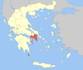
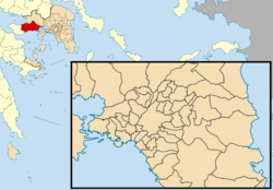
ΜέγαραLocation Coordinates 38°0′N 23°20′E / 38°N 23.333°ECoordinates: 38°0′N 23°20′E / 38°N 23.333°E Government Country: Greece Region: Attica Regional unit: West Attica Mayor: Dimitrios G. Stratiotis Population statistics (as of 2001) Municipality - Population: 35,675 - Area: 330.3 km2 (128 sq mi) - Density: 108 /km2 (280 /sq mi) Municipal unit - Population: 28,195 - Area: 322.2 km2 (124 sq mi) - Density: 88 /km2 (227 /sq mi) Other Time zone: EET/EEST (UTC+2/3) Elevation (center): 4 m (13 ft) Postal: 191 00 Telephone: 22960 Website www.megara.gr Megara (Greek: Μέγαρα, /ˈmɛɡərə/, Greek pronunciation: [ˈmeɣara]) is an ancient city (pop. 23,032 in 2001) in Attica, Greece. It lies in the northern section of the Isthmus of Corinth opposite the island of Salamis, which belonged to Megara in archaic times, before being taken by Athens. Megara was one of the four districts of Attica, embodied in the four mythic sons of King Pandion II, of whom Nisos was the ruler of Megara. Megara was also a trade port, its people using their ships and wealth as a way to gain leverage on armies of neighboring poleis. Megara specialized in the exportation of wool and other animal products including livestock such as horses. It possessed two harbors, Pegae, to the west on the Corinthian Gulf and Nisaea, to the east on the Saronic Gulf of the Aegean Sea.
Contents
Early history
In historical times, Megara was an early dependency of Corinth, in which capacity colonists from Megara founded Megara Hyblaea, a small polis north of Syracuse in Sicily. Megara then fought a war of independence with Corinth, and afterwards founded (c. 667 BC) Byzantium, as well as Chalcedon (685 BC). Megara was known for its money in historical times.
In the late seventh century BC Theagenes established himself as tyrant of Megara reportedly by slaughtering the cattle of the rich to win over the poor.[1] During the second Persian invasion of Greece (480-479 BC) Megara fought alongside the Spartans and Athenians at crucial battles such as Salamis and Plataea.
Megara's defection from the Spartan dominated Peloponnesian League (c.460 BC) was one of the causes of the First Peloponnesian War. By the terms of the Thirty Years' Peace of 446-445 BC Megara was returned to the Peloponnesian League.
In the Peloponnesian War (c. 431 BC-404 BC), Megara was an ally of Sparta. The Megarian decree is considered to be one of several contributing "causes" of the Peloponnesian War.[2] The Megarian decree was issued by Athens with the purpose of choking out the Megarian economy. The decree stated that Megarian merchants were not allowed in territory controlled by Athens.
The most famous citizen of Megara in antiquity was Byzas, the legendary founder of Byzantium in the 7th century BC. The 6th century BC poet Theognis also came from Megara. In the early 4th century BC, Euclid of Megara founded the Megarian school of philosophy which flourished for about a century, and became famous for the use of logic and dialectic.
The Megarans were proverbial for their generosity in building and endowing temples. Jerome reports "There is a common saying about the Megarians […:] 'They build as if they are to live forever; they live as if they are to die tomorrow.'"[3]
Geography
A population of 28,195 live within the municipality. It is located 42 km (WNW) of Athens in the southwestern part of West Attica Prefecture, and is linked by a highway connecting the Peloponnese, Western Greece, and Athens. It is now linked by a high-speed rail line suburban railway. Megara lies in the Megaris plain. It has the largest land area of any municipality in the Attica region, and the largest population in West Attica. Agriculture used to dominate before housing began to expand in Megara in the 1960s and the 1970s.
3 km south of Megara is a small community called Pachi, which is famous for its fish tavernas and is visited by people from all over ancient Greece. Nea Peramos is the neighboring city to the east of Megara and Kakia Skala to the west of Megara. There is a military airport to the south. South of Megara is the Gulf of Megara. The largest other towns in the municipality are Kinéta (pop. 1,972), Spárta (712), Vlycháda (694), and Aigeiroúses (479). The municipality is unusual for one its geographical size, in that it has only one municipal district, the third-largest in Greece (after the Sílis district in Paranesti and the Mikró Déreio district in Orfeas) if Mount Athos is not counted. There are, however, 14 towns or villages in the municipality.
Municipality
The municipality Megara was formed at the 2011 local government reform by the merger of the following 2 former municipalities, that became municipal units (constituent communities in brackets):[4]
- Megara
- Nea Peramos
Towns and villages
- Agía Triás
- Aigeiroúses
- Alepochori
- Kineta
- Koumíntri
- Lákka Kalogírou
- Meli
- Mégara
- Moní Agíou Ierothéou
- Moní Agíou Ioánnou Prodrómou
- Moní Panachrántou
- Pacháki Puto
- Páchi
- Stíkas
- Vlycháda
- Lîchymaniõ
Historical population
Year Town population Municipality population 1971 17,584 - 1981 20,814 21,245 1991 20,403 25,061 2001 23,032 28,195 Notable people
See also: Category:Ancient Megarians- Orsippus (8th century BC), runner
- Byzas (7th century BC), founder of Byzantium
- Theognis (6th century BC), elegiac poet
- Eupalinos (6th century BC), engineer who built the Tunnel of Eupalinos on Samos
- Theagenes (c. 600 BC), Tyrant of Megara
- Euclid (c. 400 BC), founder of the Megarian school of philosophy
- Stilpo (c. 325 BC), philosopher of the Megarian school
- Teles (3rd century BC), cynic philosopher
See also
- Communities of Attica
- List of traditional Greek place names
Notes
- ^ Aristotle, Politics V 4,5
- ^ Sarah B, Pomeroy, Stanley M.Beloniqua, Walter Donlan and Jennifer Tolbert Roberts, Ancient Greece: A Political, Social, and Cultural History (Oxford: Oxford University Press, 1999).
- ^ Jerome, To Ageruchia, Letter cxxiii.15
- ^ Kallikratis law Greece Ministry of Interior (Greek)
References
- Legon, Ronald P. Megara: the political history of a Greek city-state to 336 B.C.. Ithaca, NY: Cornell University Press, 1981.
- Smith, Philip J. The archaeology and epigraphy of Hellenistic and Roman Megaris, Greece. Oxford: John and Erica Hedges Ltd, 2008.
External links
 "Megara". Catholic Encyclopedia. New York: Robert Appleton Company. 1913.
Administrative division of the Attica Region Regional unit of Central AthensAthens • Dafni–Ymittos • Filadelfeia–Chalkidona • Galatsi • Ilioupoli • Kaisariani • Vyronas • Zografou Agia Paraskevi • Amarousio • Chalandri • Filothei–Psychiko • Irakleio • Kifisia • Lykovrysi–Pefki • Metamorfosi • Nea Ionia • Papagou–Cholargos • Penteli • VrilissiaRegional unit of West AthensRegional unit of South AthensAgios Dimitrios • Alimos • Elliniko–Argyroupoli • Glyfada • Kallithea • Moschato–Tavros • Nea Smyrni • Palaio FaliroRegional unit of PiraeusAcharnes • Dionysos • Kropia • Lavreotiki • Marathon • Markopoulo • Oropos • Paiania • Pallini • Rafina–Pikermi • Saronikos • Spata–Artemida • Vari–Voula–VouliagmeniRegional unit of IslandsCategories:
- Populated places in West Attica
- Ancient Greek cities
- Municipalities of Attica
- Greek mythology
- Ancient Megara
Wikimedia Foundation. 2010.


