- Nea Peramos
-
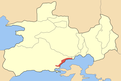
Nea Peramos
Νέα ΠέραμοςLocation 
 Nea Peramos
Coordinates 38°0′N 23°25′E / 38°N 23.417°ECoordinates: 38°0′N 23°25′E / 38°N 23.417°E Location within the regional unit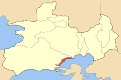
Government Country: Greece Region: Attica Regional unit: West Attica Municipality: Megara Population statistics (as of 2001) Municipal unit - Population: 7,480 - Area: 7.900 km2 (3 sq mi) - Density: 947 /km2 (2,452 /sq mi) Other Time zone: EET/EEST (UTC+2/3) Elevation (center): 2 m (7 ft) Postal: 190 06 Telephone: 22960 Auto: Z Website www.nea-peramos.gr Nea Peramos (Greek: Νέα Πέραμος, before the 1990s Megalo Pefko(Greek: Μεγάλο Πεύκο) is a suburb and a former municipality in West Attica, Greece. Since the 2011 local government reform, it is part of the municipality Megara, of which it is a municipal unit.[1]
Contents
Geography
Nea Peramos is situated in the eastern portion of the Megaris plain, in the northwestern part of the agglomeration of Athens. Mountains are situated to the north, and the Saronic Gulf to the south. Nea Peramos offers a panorama of the island of Salamis. Greek National Road 8A/E94 (Athens - Corinth - Patras) and the commuter rail Proastiakos pass through Nea Peramos. The beaches of Nea Peramos are popular with tourists. It is located about 8 km E of Megara, about 35 km W of Athens, about 50 km east of Corinth and S of Thiva.
The area around Nea Peramos is made up of residential and urban areas. There are farmlands to the west. Bushes, grasslands, deforested areas cover the north and east. Suburban housing arrived in the 1970s and continued in the 1990s. Its main suburbs are Neraki and Loutropyrgos to the east and Aghios Panteleimon and Vlyhada to the north-northeast (taking the fishing harbour as the central point).
Landmark buildings include the two tall (12-storied and 10-storied) blocks of flats, the Church of St. George, the N. Petkas Traditional Olive Press[2] (currently (Oct. '11)under reconstruction), which has been donated to the Association of Peramians Kyzikians and the former Town Hall, all of them on 28 October st. (the Old National Highway) which traverses the town parallel to the coast.
Nea Peramos has a few schools (a lyceum - high school,[3] a gymnasium - junior high school[4] and four primary schools[5]), banks, two KAPI (day care centres for elderly people), a post office and a train station (line Athens - Corinth - Patras). Three military camps are located in town, among them the Artillery School[6] and the Army Special Forces base. From its fishing harbour, a ferryboat line connects it to the island of Salamis, close to the Monastery of Panagia Faneromeni.[7] The nearest hospital is in Megara.
Culture
There is a municipal library whose mostly-Greek-language collection is as yet (Oct '11) uncatalogued. The cultural life of the town is enriched by the Fair of St. George in April,[8] the Klidonas festival[9] on St. John's Day (after the summer solstice) and the Sardine Night in late August. Several cultural associations operate, such as the Association of Peramians Kyzikians,[10] the Nea Peramos Women's Association and the Cultural Association "Aghios Panteleimon".
There are two amateur sports teams: The Athletic Sports Association of Nea Peramos (est. 1939)[11] and Attalos Neas Peramou (est. 2001).[12]
There are 15 teams in town (about 900 in the whole of Attica) of skilled flying (high flying, diving, spiralling etc) pigeons, most of them belonging to the Aspropyrgos Association of Pigeon-Owners.[13] The next upcoming event is on January 9, 2012 (location as yet undecided).
History
In 1922, after the debacle of the Greek Army, the residents of Peramos (modern Karsiyaka, Turkey)[14] in Asia Minor were kicked out of their town before the advancing Turkish Army and the rebels. They ended up in Kavala and in the area of Megara. In this second area, they were joined by refugees from Kyzikos (also from Asia Minor, modern Aydıncıḳ, Turkey).[15] This location near Megara was given over by the Government of Eleftherios Venizelos so that they could start their new life. Their first school was a wooden shack which also functioned on Sundays as a church until the current Church of Saint George was built to accommodate his Icon which the refugees brought with them from their ancestral land.[16]
Year Population 1981 4,129 1991 6,869 2001 7,480 See also
- List of municipalities of Attica
References
- ^ Kallikratis law Greece Ministry of Interior (Greek)
- ^ http://www.aixminews.gr/jpdaixminews/index.php?option=com_content&task=view&id=557&Itemid=34
- ^ http://lyk-n-peram.att.sch.gr/
- ^ http://gym-n-peram.att.sch.gr/portal/doku.php?id=%CE%B1%CF%81%CF%87%CE%B9%CE%BA%CE%AE_%CF%83%CE%B5%CE%BB%CE%AF%CE%B4%CE%B1
- ^ http://www.vrisko.gr/details/2543b176706d43a57i4dab61d43ka25j?what=%CE%94%CE%B7%CE%BC%CF%8C%CF%83%CE%B9%CE%B1%20%CE%A3%CF%87%CE%BF%CE%BB%CE%B5%CE%AF%CE%B1&where=%CE%9D%CE%AD%CE%B1%20%CE%A0%CE%AD%CF%81%CE%B1%CE%BC%CE%BF%CF%82%20%CE%91%CF%84%CF%84%CE%B9%CE%BA%CE%AE%CF%82
- ^ http://www.army.gr/files/File/ODIGOS.pdf
- ^ http://www.salamina.gr/Default.aspx?tabid=243&language=el-GR
- ^ http://www.megaratv.gr/index.php?page=8&vcat=11&video=58
- ^ http://mikrasiatis.gr/?tag=%CE%BA%CE%BB%CE%AE%CE%B4%CF%89%CE%BD%CE%B1%CF%82
- ^ http://sypeky.blogspot.com/
- ^ http://el.wikipedia.org/wiki/%CE%9A%CE%B1%CF%84%CE%AC%CE%BB%CE%BF%CE%B3%CE%BF%CF%82_%CF%80%CE%BF%CE%B4%CE%BF%CF%83%CF%86%CE%B1%CE%B9%CF%81%CE%B9%CE%BA%CF%8E%CE%BD_%CE%BF%CE%BC%CE%AC%CE%B4%CF%89%CE%BD_%CE%91%CF%84%CF%84%CE%B9%CE%BA%CE%AE%CF%82
- ^ http://www.erasitexniko-podosfairo.gr/component/joomsport/team/%CE%86%CF%84%CF%84%CE%B1%CE%BB%CE%BF%CF%82-%CE%9D%CE%AD%CE%B1%CF%82-%CE%A0%CE%B5%CF%81%CE%AC%CE%BC%CE%BF%CF%85/38/293
- ^ http://www.psarema.gr/index.php?option=com_content&view=article&id=1167:2009-11-23-18-51-45&catid=112:variusnews&Itemid=205
- ^ http://www.translatum.gr/forum/index.php?topic=2849.15
- ^ http://en.wikipedia.org/wiki/Kyzikos
- ^ http://el.wikipedia.org/wiki/%CE%9D%CE%AD%CE%B1_%CE%A0%CE%AD%CF%81%CE%B1%CE%BC%CE%BF%CF%82_%CE%91%CF%84%CF%84%CE%B9%CE%BA%CE%AE%CF%82
External links
- Official website (Greek)
North: Megara West: Megara Nea Peramos East: Eleusis South: Saronic Gulf - Gulf of Eleusis Municipal units Categories:- Populated places in West Attica

Wikimedia Foundation. 2010.