- Narrandera
-
Narrandera
New South Wales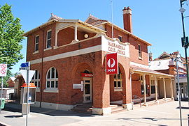
Narrandera Post Office
 Narrandera
Population: 3,961(2006 Census)[1] Postcode: 2700 Coordinates: 34°45′S 146°33′E / 34.75°S 146.55°ECoordinates: 34°45′S 146°33′E / 34.75°S 146.55°E Elevation: 173.0 m (568 ft) Location: - 549 km (341 mi) from Sydney
- 428 km (266 mi) from Melbourne
- 99 km (62 mi) from Wagga Wagga
- 97 km (60 mi) from Griffith
LGA: Narrandera Shire County: Cooper State District: Murrumbidgee Federal Division: Riverina Mean max temp Mean min temp Annual rainfall 23.3 °C
74 °F9.9 °C
50 °F471.5 mm
18.6 inNarrandera (
 /nəˈrændərə/ nə-ran-dər-ə)[2] is a town in southern New South Wales, Australia. It is an important destination for travellers as it lies on the junction of the Newell and Sturt Highways and it is the gateway to the productive Murrumbidgee Irrigation Area. At the 2006 census, Narrandera had a population of 3,961 people.[1]
Contents
History
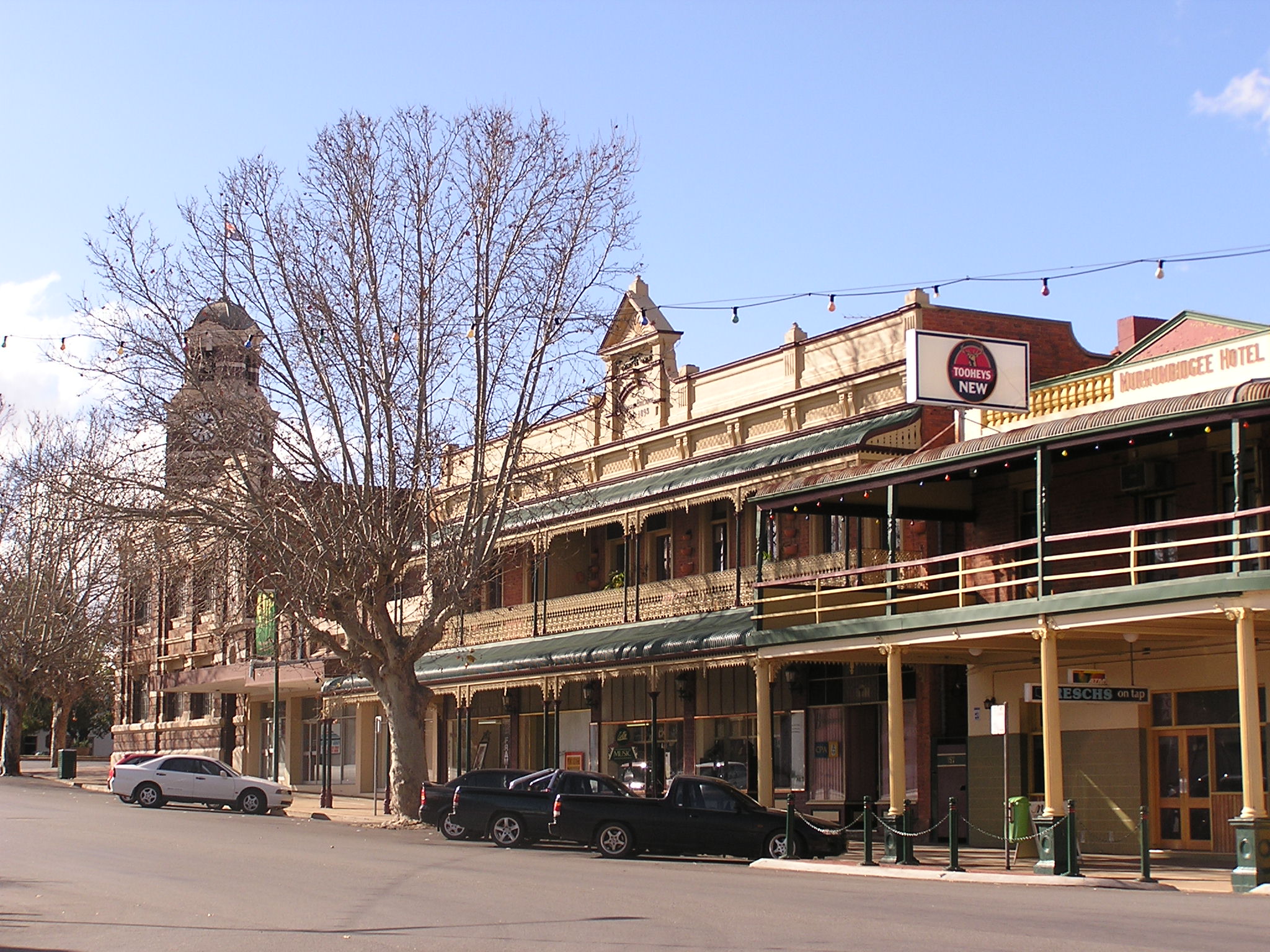
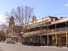 Main street

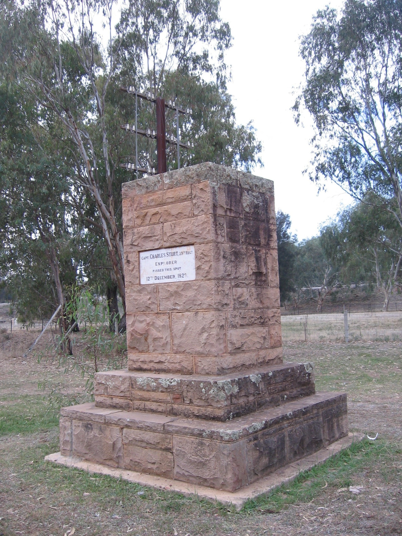
Narrandera is a river town with a rich heritage. Captain Charles Sturt, the famous explorer, is credited with being the first white man to observe the area that later was to become known as Narrandera. However Sturt, who passed through the district on 12 December 1829, was not the first explorer to cast eyes on the Murrumbidgee River. The upper Murrumbidgee, the "Big Water", was first discovered in April 1821, by Charles Throsby. The name Narrandera is probably derived from Wiradjuri nharrang, meaning "frill-necked lizard".[3]
The Narrungderra were the local indigenous people. They were all but destroyed by settlement, disease brought by European settlers, and clashes with the settlers. The last major battle between the indigenous people and European settlers took place near Massacre Island, and is said to have left only one survivor.[4]
Narrandera had its first recorded mention as a pastoral station or "run" (Narrandera Run) in 1848, at which time the property held by Mr Edward Flood comprised approximately 76,800 acres (31,080 ha).
The township developed in the early 1860s. Gillinbah Post Office opened nearby on 1 March 1859 and was replaced by the Narrandera office in 1861. A Gillenbah office was open from 1881 to 1892 and from 1906 to 1941.[5]
The Borough of Narrandera was constituted by proclamation dated 17 March 1885, and gazetted the following day. The centenary of Local Government in Narrandera was celebrated in 1985.
Narrandera today
The town of Narrandera is located on the Murrumbidgee River, at the intersection of the Newell Highway and the Sturt Highway at the centre of a diversely productive agricultural region. Its attractive tree-lined streets contrast with the open plains that surround it.
The Narrandera Memorial Gardens include the unusual Hankinson Fountain.[6] Manufactured by the Royal Doulton Company of England, the ceramic fountain is one of only two known to be in existence, the other located in India. It was given to the people of Narrandera by Alderman and Mrs Hankinson in 1922 in honour of locals who served in World War I. The Hankinson Fountain was smashed by an act of vandalism in 1971 and was restored by Charles Pearce.
Narrandera now marks the transition between an extensive dry-land area devoted to cereal crops and sheep and wool production to the east, and, to the west, the Murrumbidgee Irrigation Area (MIA) fed by water from the Burrinjuck Dam. The MIA is a region where irrigation has opened the way to a diversity of enterprise, from the growing of rice and other cereals under irrigation to the production of citrus, wine grapes and potatoes.
The town also has number of historic attractions, such as the Royal Doulton Fountain, located in the Memorial Gardens; a fig tree on the corner of King and Cadell Streets, which is thought to be 150 years old; and the Mon Repos, a residence built in a Queen Anne-style, which was built in the 1890s.[7]
Narrandera's immediate surrounds feature a number of waterways, the major waterway being the Murrumbidgee River.
The Irrigation Canal, which carries water to the Murrumbidgee Irrigation Area to Narrandera's west, flows through the town. It originates 34 kilometres (21 mi) west at Berembed Weir where water is diverted from the Murrumbidgee River. The canal follows the natural bed of Bundidgerry Creek and in places spreads wide and has no levee banks. Lake Talbot was formed in 1924 when the bank of the Irrigation Canal gave way, flooding the river flat between the canal and Bundidgerry Hill. The shallow body of water was allowed to remain and became an important recreational feature of the town. The eastern end of the lake is commonly used by water skiiers while the western end forms a wetland habitat for native fauna. A wetland has been created off Lizard Drive, only 300 metres (980 ft) from the Murrumbidgee River. The Narrandera Wetland is a collection point for storm water run-off from the town.
Climate
Climate data for Narrandera Golf Club Month Jan Feb Mar Apr May Jun Jul Aug Sep Oct Nov Dec Year Record high °C (°F) 47.0
(116.6)44.9
(112.8)41.6
(106.9)37.0
(98.6)29.2
(84.6)23.7
(74.7)25.3
(77.5)28.6
(83.5)34.7
(94.5)36.5
(97.7)44.0
(111.2)43.0
(109.4)45.2
(113.4)Average high °C (°F) 32.5
(90.5)32.0
(89.6)28.4
(83.1)23.5
(74.3)18.8
(65.8)15.0
(59.0)14.1
(57.4)15.9
(60.6)19.1
(66.4)23.1
(73.6)27.3
(81.1)30.5
(86.9)23.4 Average low °C (°F) 17.1
(62.8)17.4
(63.3)14.1
(57.4)10.0
(50.0)6.8
(44.2)4.3
(39.7)3.2
(37.8)4.1
(39.4)6.1
(43.0)9.0
(48.2)12.4
(54.3)15.1
(59.2)10.0 Record low °C (°F) 6.3
(43.3)6.0
(42.8)3.0
(37.4)−0.2
(31.6)−2.6
(27.3)−4.4
(24.1)−6.1
(21.0)−4
(24.8)−3
(26.6)0.0
(32.0)2.3
(36.1)4.4
(39.9)−6.1
(21.0)Precipitation mm (inches) 36.0
(1.417)37.0
(1.457)29.2
(1.15)39.4
(1.551)40.7
(1.602)40.4
(1.591)41.1
(1.618)43.3
(1.705)41.9
(1.65)48.1
(1.894)36.9
(1.453)37.1
(1.461)471.1
(18.547)Avg. precipitation days 4.7 4.0 4.0 5.5 6.9 8.8 9.7 9.7 8.7 7.5 6.0 5.0 80.5 Source: [8] Transport
Narrandera is well served for transport. The Sturt Highway and the Newell Highways cross, just south of Narrandera. Greyhound buses pass daily - note that the destination can be listed as Jillenbah. The Narranderra-Leeton airport is 5km west of town, and Regional Express (REX) operate several turboprop return services daily to Sydney, an hour and 10 minutes (approx) flying time away. Narrandera's railway station is serviced by the weekly Countrylink Sydney to Griffith XPlorer. It stops on the way to Griffith at 2:33pm on Saturdays and stops on the way back to Sydney at 8:45am on Sundays. CountryLink buses carry passengers daily to and from Wagga, to meet Sydney and Melbourne bound train services.
In popular culture
The book Jessica by Bryce Courtenay has several mentions of Narrandera as the main town near the place where the book is set.
Notable citizens
Notable citizens originating from Narrandera include the Governor of New South Wales Marie Bashir;[9] Australian Rules footballer, Tim Ruffles, who plays for the Fremantle Football Club;[10] Daniel Christian (Australian Cricketer);[11] Prima ballerina Kathleen Gorham;[12] and Patrick Hartigan (poet and author who used the pen name, "John O'Brien"): the bush ethos celebrated by Hartigan in his writings is commemorated in the annual John O'Brien Bush Festival held in the town.[13]
Gallery
-
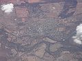
Aerial view of Narrandera
-
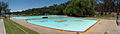
Lake Talbot Swimming Complex
See also
References
- ^ a b Australian Bureau of Statistics (25 October 2007). "Narrandera (Urban Centre/Locality)". 2006 Census QuickStats. http://www.censusdata.abs.gov.au/ABSNavigation/prenav/LocationSearch?collection=Census&period=2006&areacode=UCL159400&producttype=QuickStats&breadcrumb=PL&action=401. Retrieved 7 November 2009.
- ^ Macquarie Dictionary, Fourth Edition (2005). Melbourne, The Macquarie Library Pty Ltd. ISBN 1-876429-14-3
- ^ McNicol, Sally; Hosking, Dianne (1994). "Wiradjuri". Macquarie Aboriginal Words. Sydney: Macquarie Library. pp. 98.
- ^ "History of Narrandera". Narrandera Shire Council. 2005. Archived from the original on 2006-08-21. http://web.archive.org/web/20060821142049/http://www.narrandera.nsw.gov.au/about/1012/1033.html. Retrieved 2007-01-30.
- ^ Premier Postal History, Post Office List, https://www.premierpostal.com/cgi-bin/wsProd.sh/Viewpocdwrapper.p?SortBy=NSW&country=, retrieved 2009-06-11
- ^ "Monument Australia website". http://monumentaustralia.org.au/monument_display.php?id=22467&image=0. Retrieved 21 September 2011.
- ^ "History of Narrandera". Narrandera Shire Council. Archived from the original on 2007-09-27. http://web.archive.org/web/20070927200634/http://www.narrandera.nsw.gov.au/about/1012/1033.html. Retrieved 2008-03-24.
- ^ "Monthly climate statistics". Bureau of Meteorology. http://www.bom.gov.au/climate/averages/tables/cw_074221_All.shtml. Retrieved 24 November 2010.
- ^ "The Governor of NSW". Parliament of New South Wales. 13 April 2010. http://www.parliament.nsw.gov.au/prod/web/common.nsf/key/resourcesSystemTheGovernorofNewSouthWales. Retrieved 24 November 2010.
- ^ "News Fremantle's 2008 NAB AFL Draft Summary". Hawthorn Football Club. 29 November 2008. http://www.hawthornfc.com.au/news/newsarticle/tabid/4742/default.aspx?newsid=70422. Retrieved 24 November 2010.
- ^ English, Peter. "The man from Narrandera". Cricinfo Magazine (ESPN): pp. 30 April 2008. http://www.espncricinfo.com/magazine/content/story/457821.html. Retrieved 24 November 2010.
- ^ Grove, Robin. "Gorham, Kathleen Ann (Kathy) (1928 - 1983)". Australian Dictionary of Biography, Online Edition. http://adbonline.anu.edu.au/biogs/A170450b.htm. Retrieved 24 November 2010.
- ^ Walsh, G. P.. "Hartigan, Patrick Joseph [John O'Brien (1878 - 1952)"]. Australian Dictionary of Biography, Online Edition. http://adbonline.anu.edu.au/biogs/A090224b.htm. Retrieved 24 November 2010.
External links
Preceding station NSW Branch lines Following station Yancotowards HayHay Line towards JuneePreceding station NSW Closed lines Following station towards TocumwalTocumwal Line Terminus Preceding station CountryLink Following station towards GriffithCountryLink Southern Griffith Xplorertowards SydneyBarellan · Binya · Colinroobie · Corobimilla · Grong Grong · Kamarah · Kywong · Moombooldool · Narrandera
Main Article: Local Government Areas of New South WalesCategories:- Towns in New South Wales
- Towns in the Riverina
- Australian Aboriginal placenames
- Populated places on the Murrumbidgee River


Wikimedia Foundation. 2010.