- Coleambally
-
Coleambally
New South Wales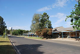
Main street of Coleambally looking toward the distinctive water tower
 Coleambally
Population: 658(2006 census)[1] Established: 1968 Postcode: 2707 Coordinates: 34°48′S 145°53′E / 34.8°S 145.883°ECoordinates: 34°48′S 145°53′E / 34.8°S 145.883°E Location: LGA: Murrumbidgee Shire County: Boyd State District: Murrumbidgee Federal Division: Riverina Coleambally (
 /kɒliːˈæmbəli/)[3] is a small town in the Riverina of New South Wales, Australia, in Murrumbidgee Shire.
Coleambally is one of the newest towns in the state of New South Wales, officially opened in June 1968,[4] with the Post Office opening on 1 April 1970. [5]
Designed to act as the centre for the surrounding Coleambally Irrigation Area, at the 2006 census, Coleambally had a population of 658 people.[1]
Its name is Aboriginal, probably meaning a swift in flight. The spine-tailed swift is one of the most powerful fliers known, wheeling and sweeping at high speed in search of flying insects.[4]
Coleambally can be accessed by road from Sydney and Canberra via the Hume Highway and Burley Griffin Way and from Melbourne via the Hume Highway, Newell Highway and the Kidman Way.
Contents
History
The Coleambally Irrigation Area scheme was started in the 1950s, with potential farmland being made available through a ballot system. Those who entered the ballot had to prove they had enough money to set up a farm in order to enter, as the land they acquired started off with no fencing or infrastructure whatsoever. The successful ballot winners were also required to give up any other primary interests they may have held. They were to give all or nothing to Coleambally.
In 2008, following the Federal Government's proposals to buy large amounts of water from irrigators — ostensibly to "save" the Murray-Darling Basin — the Coleambally Irrigation Area offered the entire area, including the farms, water rights and the entire town, for sale at a price of $3.5 billion.[6]
Commerce
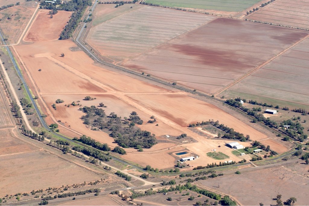
 Coleambally Airfield overview
Its main industry has been rice growing, with a major rice mill located one kilometre north of the town. Other crops are also grown, such as wheat, maize, sorghum and soya beans. Grazing of sheep and cattle is also common.
The quality of soil in the Coleambally Irrigation Area, combined with growing a water-intensive crop such as rice, has led to soil salination and high water table problems throughout the area. Efforts to alleviate the soil salination problem since 1995 have minimised the problem.
The lack of water during the latest drought has put the rice industry at risk, with severe water restrictions being imposed. Competition from highly subsidised US farmers also poses a large threat to this industry and the families involved in it.[citation needed]
Rice production in 2006 will be much higher than recent years due to greater water allocations being available.
Total rice production in 2006 in the Murray Valley and the Murrumbidgee Irrigation Area (MIA) and Coleambally Irrigation Area are expected to total 1,000,000 tonnes (1,100,000 short tons), up from 330,000 tonnes (360,000 short tons) in 2005.
Education
There are two schools in Coleambally: Coleambally Central School, a comprehensive government school catering for students from Kindergarten to Year 12, and St Peter's Primary School, a Roman Catholic school administered by the Diocese of Wagga Wagga.
Churches
Coleambally is situated in the Anglican Diocese of Riverina. The Anglican Church is dedicated to St Mark.
The Roman Catholic Church is dedicated to St Peter.
The church of the Uniting Church of Australia was formerly a shearer's quarters before being moved to its present location.
Attractions
Coleambally's distinctive wine glass shaped water tower is located in the centre of town. A Bucyrus Class Dragline is located in the Lions Park at the entrance of the town. It is one of four machines imported from the United States in 1935 to excavate the main irrigation channels in the Murray Valley and the Coleambally Irrigation Area in the early 1960s.
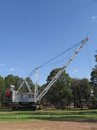 The Bucyrus Class Dragline at Coleambally. This is one of four used to excavate the main irrigation channels in the area.
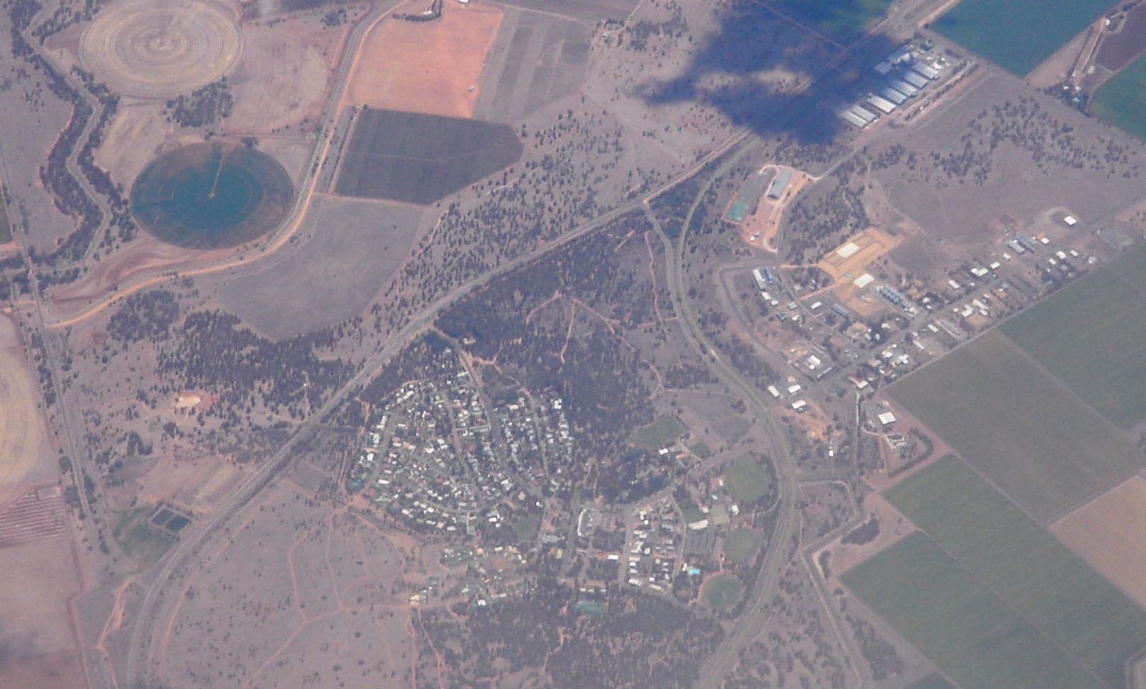
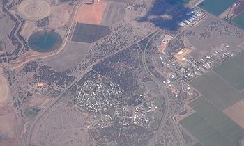 Aerial view of Coleambally.
Popular culture
Coleambally was mentioned in the television miniseries Underbelly: A Tale of Two Cities.
References
- ^ a b Australian Bureau of Statistics (25 October 2007). "Coleambally (L) (Urban Centre/Locality)". 2006 Census QuickStats. http://www.censusdata.abs.gov.au/ABSNavigation/prenav/LocationSearch?collection=Census&period=2006&areacode=UCL120000&producttype=QuickStats&breadcrumb=PL&action=401. Retrieved 12 July 2009.
- ^ Travelmate
- ^ Macquarie Dictionary, Fourth Edition (2005). Melbourne, The Macquarie Library Pty Ltd. ISBN 1-876429-14-3
- ^ a b Geographical Names Board of NSW
- ^ Premier Postal History. "Post Office List". https://www.premierpeostal.com/cgi-bin/wsProd.sh/Viewpocdwrapper.p?SortBy=NSW&country=. Retrieved 2009-06-11.
- ^ Wahlquist, Asa (2008-09-01). "Town says take it all ... for $3.5bn". The Australian. http://www.theaustralian.news.com.au/story/0,25197,24272699-601,00.html. Retrieved 2008-09-19.
Categories:- Towns in New South Wales
- Towns in the Riverina
- Australian Aboriginal placenames


Wikimedia Foundation. 2010.