- Coolamon, New South Wales
-
Coolamon
New South Wales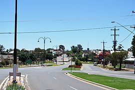
Coolamon seen as entering from the Wagga Wagga road
 Coolamon
Population: 1,339(2006 census)[1] Established: 3 October 1881[2] Postcode: 2701 Coordinates: 34°49′55″S 147°12′04″E / 34.832°S 147.201°ECoordinates: 34°49′55″S 147°12′04″E / 34.832°S 147.201°E Elevation: 290 m (951 ft) Location: LGA: Coolamon Shire Council County: Bourke State District: Murrumbidgee Federal Division: Riverina Coolamon is a town in the Riverina region of south-west New South Wales, Australia. Coolamon is 40 kilometres (25 mi) north-west of Wagga Wagga and 506 kilometres (314 mi) south-west of Sydney via the Hume and Sturt Highways. The town is situated on the railway line between Junee and Narrandera. Coolamon had a population of 1,339 at the 2006 census[1] and is 290 metres (950 ft) above sea level. It is the administrative and service centre for the local government area which bears its name—Coolamon Shire.
Contents
History
The original land where Coolamon now stands, prior to European settlement, was occupied by the Kamilaroi and/or Wiradjuri Aborigines.
A property "Coleman" was first settled there by a Mr J. Atkinson in 1848. The town was surveyed prior to the coming of the railway and the railway station opened in 1881.
Cowabbie Post Office opened on 1 May 1881 and was renamed Ganmain on 1 July and Coolamon on 1 November of that year.[3]
Firstly called Cowabbie Road, the station name was very shortly after changed to Coleman and finally the name Coolamon was settled on in 1895. The coming of the railway allowed greater ease in transporting the area's products to distant markets.
Modern Coolamon
The name of Coolamon comes from the Aboriginal word for a basin-shaped wooden dish made and used by Australian Aborigines.[4][5] In the area around the town are thousands of naturally occurring indentations in the ground called Coolamon Holes which fill with water.
Coolamon is in the wheat belt of New South Wales and is a leading state producer of wheat and chaff. Wheat was first grown in the area in the 1850s. In addition, turkeys and wool are produced and the area is noted for the quality and plumpness of its lambs. A notable sight around about are the traditional sheaf haystacks which dot the local flat, clay countryside.
The town's railway station is served by the weekly Sydney to Griffith Countrylink Xplorer service. The train stops heading to Griffith at 1:50pm on Saturdays and heading back to Sydney at 9:25am on Sundays
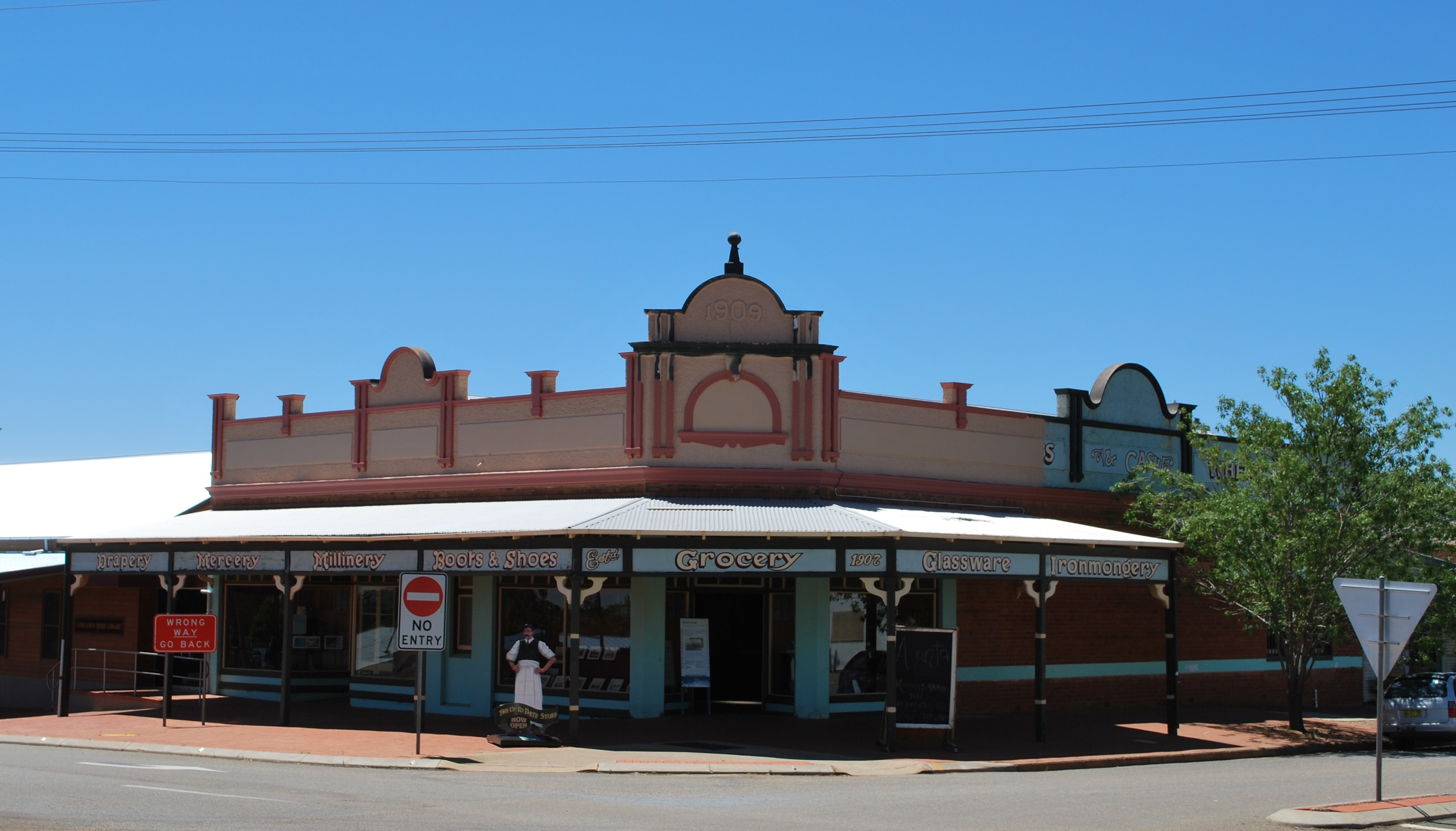
The town's broad main street, which has been restored, retains much of its old world charm with its wrought-iron verandahs and awnings. Various bric-a-brac and antique shops and a modern bakery decorated in a country style invite passing tourists to explore the town. The Up-to-Date store, designed by architect William Monks, [6] has what is probably the only cash ball cash railway still in situ[7].
Gallery
-

Coolamon Hotel
-

Up-To-Date Store
References
- ^ a b Australian Bureau of Statistics (25 October 2007). "Coolamon (Urban Centre/Locality)". 2006 Census QuickStats. http://www.censusdata.abs.gov.au/ABSNavigation/prenav/LocationSearch?collection=Census&period=2006&areacode=UCL121000&producttype=QuickStats&breadcrumb=PL&action=401. Retrieved 2008-07-01.
- ^ "Up-To-Date Store and Garth Jones Collection of farm machinery". New South Wales Department of Planning. Heritage Branch. http://www.heritage.nsw.gov.au/07_subnav_02_2.cfm?itemid=5053418. Retrieved 2008-07-01.
- ^ Hardinge, Marcia (September 2006). Coolamon 1881–2006. Back to Coolamon Committee, Coolamon Heritage and Advancement Society. pp. 14.
- ^ The Macquarie Dictionary 1985 Edition - Macquarie Library Pty Ltd
- ^ "Coolamon". Geographical Names Board of New South Wales. http://www.gnb.nsw.gov.au/name_search/extract?id=JPIOjzUlan. Retrieved 12 July 2009.
- ^ Up-to-Date Store, Coolamon "Cash Railway Website". http://www.ids.u-net.com/cash/coolamon.htm.
- ^ Liz Lawton in Bush Telegraph, 11 Nov. 2003 "ABC Local". http://www.abc.net.au/rural/telegraph/viewpoint/stories/s986475.htm.
External links
- Riverina Redevelopment Board Website
- Coolamon Shire Council
- Coolamon Sport and Recreation Club
- Coolamon Lions Club
Preceding station NSW Branch lines Following station towards HayHay Line towards JuneePreceding station CountryLink Following station towards GriffithCountryLink Southern Griffith XplorerJuneetowards SydneyMain Article: Local Government Areas of New South WalesCategories:- Towns in New South Wales
- Towns in the Riverina
- Australian Aboriginal placenames
-


Wikimedia Foundation. 2010.