- Mayrung, New South Wales
-
Mayrung
New South Wales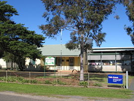
Mayrung Public SchoolPostcode: 2710 Location: - 17 km (11 mi) from Pretty Pine
- 35 km (22 mi) from Deniliquin
LGA: Conargo Shire Council County: Townsend State District: Murray-Darling Federal Division: Farrer Mayrung is a community in the central part of the Riverina and situated about 55 kilometres east from Pretty Pine and 40 kilometres north east from Deniliquin.
The Wiradjuri Aborigines, who inhabited the district prior to white settlement, called it 'Carawatha', which is thought to mean 'place of pines'. Mayrung is situated within the Berriquin Irrigation Area which supplies wool, wheat, fat lambs, rice, dairy products, vegetables, cereals, cattle and pigs. [1]
References
Coordinates: 35°27′55″S 145°17′05″E / 35.46528°S 145.28472°E
Categories:- Towns in New South Wales
- Towns in the Riverina

Wikimedia Foundation. 2010.