- Coolamon Shire Council
Infobox Australian Place | type = lga
name = Coolamon Shire
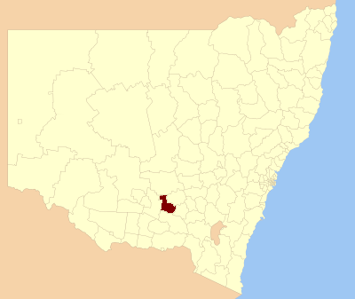
caption = Location in NSW
state=New South Wales
region=Riverina
area=2433
seat=Coolamon (55 Cowabbie Street)cite web
title=Coolamon Shire Council
publisher = Department of Local Government
url = http://www.dlg.nsw.gov.au/dlg/dlghome/dlg_CouncilContactDetails.asp?slacode=2000
accessdate = 2006-11-08 ]
est =
pop=4,127 cite web
publisher =Australian Bureau of Statistics
title=Regional Population Growth, Australia, 2004-05
url = http://abs.gov.au/Ausstats/abs@.nsf/Latestproducts/3218.0Main%20Features22004-05?opendocument&tabname=Summary&prodno=3218.0&issue=2004-05&num=&view=
accessdate = 2006-12-01 ]
url=http://www.coolamon.nsw.gov.au
mayor=Robert Menzies
fedgov =Riverina
stategov =Murrumbidgee
near-nw= Bland
near-w= Narrandera
near-sw= Narrandera
near-s= Wagga Wagga
near-se= Wagga Wagga
near-e= Junee
near-ne= Temora
near-n= BlandCoolamon Shire Council is a local government area in
New South Wales ,Australia in theRiverina region. TheNewell Highway and theBurley Griffin Way pass through the north-western part of the Shire.It includes the town of Coolamon and the small towns of Marrar, Ganmain, Matong, Ardlethan, Beckom and Mirrool.
References
Wikimedia Foundation. 2010.