Cooper County, New South Wales

Cooper County, New South Wales
Cooper
New South Wales
Cooper NSW.PNG
Location in New South Wales
Lands administrative divisions around Cooper
Dowling Dowling Gipps
Sturt Cooper Bourke
Boyd Mitchell Mitchell

Cooper County is one of the 141 Cadastral divisions of New South Wales. It contains the town of Barellan. The Murrumbidgee River is the southern boundary.

Cooper County was named in honour of the merchant and philanthropist Sir Daniel Cooper (1821-1902).[1]

Parishes within this county

A full list of parishes found within this county; their current LGA and mapping coordinates to the approximate centre of each location is as follows:

Parish LGA Coordinates
Ariah Bland Shire Council 34°0354S 146°4204E / 34.065°S 146.70111°E / -34.065; 146.70111 (Ariah)
Barellan Narrandera Shire Council 34°1354S 146°2904E / 34.23167°S 146.48444°E / -34.23167; 146.48444 (Barellan)
Barralong Narrandera Shire Council 34°2054S 146°3304E / 34.34833°S 146.55111°E / -34.34833; 146.55111 (Barralong)
Beremabere Narrandera Shire Council 34°3254S 146°3404E / 34.54833°S 146.56778°E / -34.54833; 146.56778 (Beremabere)
Bingar Carrathool Shire Council 34°0754S 146°1204E / 34.13167°S 146.20111°E / -34.13167; 146.20111 (Bingar)
Binya Carrathool Shire Council 34°1254S 146°1804E / 34.215°S 146.30111°E / -34.215; 146.30111 (Binya)
Bogolong Narrandera Shire Council 34°3954S 146°4304E / 34.665°S 146.71778°E / -34.665; 146.71778 (Bogolong)
Bolaro Narrandera Shire Council 34°2754S 146°4404E / 34.465°S 146.73444°E / -34.465; 146.73444 (Bolaro)
Bondi Leeton Shire Council 34°2154S 146°1604E / 34.365°S 146.26778°E / -34.365; 146.26778 (Bondi)
Bourke Bland Shire Council 33°5654S 146°2404E / 33.94833°S 146.40111°E / -33.94833; 146.40111 (Bourke)
Bourke Carrathool Shire Council 33°5654S 146°2504E / 33.94833°S 146.41778°E / -33.94833; 146.41778 (Bourke)
Bringan Carrathool Shire Council 34°2754S 146°0904E / 34.465°S 146.15111°E / -34.465; 146.15111 (Bringan)
Brobenah Narrandera Shire Council 34°2654S 146°2804E / 34.44833°S 146.46778°E / -34.44833; 146.46778 (Brobenah)
Bundidgerry Narrandera Shire Council 34°4354S 146°3804E / 34.73167°S 146.63444°E / -34.73167; 146.63444 (Bundidgerry)
Bunganbil Narrandera Shire Council 34°2654S 146°3704E / 34.44833°S 146.61778°E / -34.44833; 146.61778 (Bunganbil)
Bygoo Bland Shire Council 34°0754S 146°4804E / 34.13167°S 146.80111°E / -34.13167; 146.80111 (Bygoo)
Camarooka Carrathool Shire Council 34°2354S 146°0204E / 34.39833°S 146.03444°E / -34.39833; 146.03444 (Camarooka)
Cocoparra Carrathool Shire Council 33°4654S 146°0904E / 33.78167°S 146.15111°E / -33.78167; 146.15111 (Cocoparra)
Colaragang Carrathool Shire Council 34°3154S 146°0004E / 34.53167°S 146.00111°E / -34.53167; 146.00111 (Colaragang)
Colchester Carrathool Shire Council 34°2354S 146°0904E / 34.39833°S 146.15111°E / -34.39833; 146.15111 (Colchester)
Conapaira Carrathool Shire Council 33°5054S 146°1604E / 33.84833°S 146.26778°E / -33.84833; 146.26778 (Conapaira)
Conapaira East Bland Shire Council 33°4954S 146°2304E / 33.83167°S 146.38444°E / -33.83167; 146.38444 (Conapaira East)
Conapaira South Carrathool Shire Council 33°5554S 146°1704E / 33.93167°S 146.28444°E / -33.93167; 146.28444 (Conapaira South)
Cuba Carrathool Shire Council 34°3254S 146°0504E / 34.54833°S 146.08444°E / -34.54833; 146.08444 (Cuba)
Cudgel Leeton Shire Council 34°3754S 146°2904E / 34.63167°S 146.48444°E / -34.63167; 146.48444 (Cudgel)
Cudjello Narrandera Shire Council 34°3754S 146°3404E / 34.63167°S 146.56778°E / -34.63167; 146.56778 (Cudjello)
Dallas Carrathool Shire Council 34°3554S 146°1404E / 34.59833°S 146.23444°E / -34.59833; 146.23444 (Dallas)
Dowling Bland Shire Council 34°0554S 146°3604E / 34.09833°S 146.60111°E / -34.09833; 146.60111 (Dowling)
Edon Leeton Shire Council 34°2654S 146°2204E / 34.44833°S 146.36778°E / -34.44833; 146.36778 (Edon)
Euratha Bland Shire Council 33°4654S 146°3204E / 33.78167°S 146.53444°E / -33.78167; 146.53444 (Euratha)
Euratha South Bland Shire Council 33°5254S 146°3104E / 33.88167°S 146.51778°E / -33.88167; 146.51778 (Euratha South)
Garoolgan Narrandera Shire Council 34°1054S 146°3304E / 34.18167°S 146.55111°E / -34.18167; 146.55111 (Garoolgan)
Gibbs Narrandera Shire Council 34°2154S 146°2204E / 34.365°S 146.36778°E / -34.365; 146.36778 (Gibbs)
Gogeldrie Leeton Shire Council 34°3654S 146°2004E / 34.615°S 146.33444°E / -34.615; 146.33444 (Gogeldrie)
Gorton Carrathool Shire Council 34°2054S 146°1004E / 34.34833°S 146.16778°E / -34.34833; 146.16778 (Gorton)
Grong Grong Narrandera Shire Council 34°4554S 146°4204E / 34.765°S 146.70111°E / -34.765; 146.70111 (Grong Grong)
Gurragong Bland Shire Council 33°5454S 146°3804E / 33.915°S 146.63444°E / -33.915; 146.63444 (Gurragong)
Hebden Leeton Shire Council 34°2554S 146°1504E / 34.43167°S 146.25111°E / -34.43167; 146.25111 (Hebden)
Hulong Carrathool Shire Council 34°3454S 146°0804E / 34.58167°S 146.13444°E / -34.58167; 146.13444 (Hulong)
Jondaryan City of Griffith 34°1854S 146°0404E / 34.315°S 146.06778°E / -34.315; 146.06778 (Jondaryan)
Kolkilbertoo Bland Shire Council 33°5854S 146°3204E / 33.98167°S 146.53444°E / -33.98167; 146.53444 (Kolkilbertoo)
Kolkilbertoo East Bland Shire Council 33°5954S 146°3604E / 33.99833°S 146.60111°E / -33.99833; 146.60111 (Kolkilbertoo East)
Kolkilbertoo South Bland Shire Council 34°0554S 146°3004E / 34.09833°S 146.50111°E / -34.09833; 146.50111 (Kolkilbertoo South)
Lewes Bland Shire Council 33°5854S 146°4304E / 33.98167°S 146.71778°E / -33.98167; 146.71778 (Lewes)
Mejum Narrandera Shire Council 34°3854S 146°3904E / 34.64833°S 146.65111°E / -34.64833; 146.65111 (Mejum)
Moombooldool Narrandera Shire Council 34°2154S 146°4004E / 34.365°S 146.66778°E / -34.365; 146.66778 (Moombooldool)
Moombooldool North Narrandera Shire Council 34°1654S 146°4004E / 34.28167°S 146.66778°E / -34.28167; 146.66778 (Moombooldool North)
Moura Narrandera Shire Council 34°1754S 146°2304E / 34.29833°S 146.38444°E / -34.29833; 146.38444 (Moura)
Munduburra Bland Shire Council 33°4954S 146°3804E / 33.83167°S 146.63444°E / -33.83167; 146.63444 (Munduburra)
Munduburra Bland Shire Council 33°5054S 146°3804E / 33.84833°S 146.63444°E / -33.84833; 146.63444 (Munduburra)
Narrandera Narrandera Shire Council 34°4254S 146°3304E / 34.715°S 146.55111°E / -34.715; 146.55111 (Narrandera)
Narriah Bland Shire Council 33°5154S 146°4404E / 33.865°S 146.73444°E / -33.865; 146.73444 (Narriah)
Narriah Bland Shire Council 33°5054S 146°4404E / 33.84833°S 146.73444°E / -33.84833; 146.73444 (Narriah)
Naunton Carrathool Shire Council 34°2754S 146°0604E / 34.465°S 146.10111°E / -34.465; 146.10111 (Naunton)
North Bolaro Narrandera Shire Council 34°2154S 146°4504E / 34.365°S 146.75111°E / -34.365; 146.75111 (North Bolaro)
Oxley Narrandera Shire Council 34°0754S 146°2404E / 34.13167°S 146.40111°E / -34.13167; 146.40111 (Oxley)
Patterson Narrandera Shire Council 34°1254S 146°2404E / 34.215°S 146.40111°E / -34.215; 146.40111 (Patterson)
Pulletop Carrathool Shire Council 33°5654S 146°0804E / 33.94833°S 146.13444°E / -33.94833; 146.13444 (Pulletop)
Sandy Creek Bland Shire Council 34°0954S 146°4104E / 34.165°S 146.68444°E / -34.165; 146.68444 (Sandy Creek)
Sims Gap Carrathool Shire Council 33°5154S 146°0804E / 33.865°S 146.13444°E / -33.865; 146.13444 (Sims Gap)
Stanbridge City of Griffith 34°1554S 146°1104E / 34.265°S 146.18444°E / -34.265; 146.18444 (Stanbridge)
Stanley Carrathool Shire Council 34°0654S 146°1804E / 34.115°S 146.30111°E / -34.115; 146.30111 (Stanley)
Tabbita Carrathool Shire Council 34°0654S 146°0604E / 34.115°S 146.10111°E / -34.115; 146.10111 (Tabbita)
Tabbita North Carrathool Shire Council 34°0154S 146°0804E / 34.03167°S 146.13444°E / -34.03167; 146.13444 (Tabbita North)
Tenningerie Leeton Shire Council 34°2954S 146°1504E / 34.49833°S 146.25111°E / -34.49833; 146.25111 (Tenningerie)
The Bluff Carrathool Shire Council 34°0154S 146°1604E / 34.03167°S 146.26778°E / -34.03167; 146.26778 (The Bluff)
The Peak Carrathool Shire Council 34°0254S 146°2504E / 34.04833°S 146.41778°E / -34.04833; 146.41778 (The Peak)
Tuckerbil Leeton Shire Council 34°3054S 146°2004E / 34.515°S 146.33444°E / -34.515; 146.33444 (Tuckerbil)
Wallandry Bland Shire Council 34°0054S 146°4804E / 34.015°S 146.80111°E / -34.015; 146.80111 (Wallandry)
Wallandry North Bland Shire Council 33°5454S 146°5004E / 33.915°S 146.83444°E / -33.915; 146.83444 (Wallandry North)
Wammera Narrandera Shire Council 34°3354S 146°4004E / 34.565°S 146.66778°E / -34.565; 146.66778 (Wammera)
Watti Narrandera Shire Council 34°3454S 146°4404E / 34.58167°S 146.73444°E / -34.58167; 146.73444 (Watti)
Waugh Narrandera Shire Council 34°2054S 146°2904E / 34.34833°S 146.48444°E / -34.34833; 146.48444 (Waugh)
Willbriggie Carrathool Shire Council 34°2754S 146°0104E / 34.465°S 146.01778°E / -34.465; 146.01778 (Willbriggie)
Willimbong Leeton Shire Council 34°3254S 146°2804E / 34.54833°S 146.46778°E / -34.54833; 146.46778 (Willimbong)
Wyangan City of Griffith 34°1254S 146°0504E / 34.215°S 146.08444°E / -34.215; 146.08444 (Wyangan)
Yalgogoring Bland Shire Council 34°1454S 146°4704E / 34.24833°S 146.78444°E / -34.24833; 146.78444 (Yalgogoring)
Yarangery Leeton Shire Council 34°3654S 146°2504E / 34.615°S 146.41778°E / -34.615; 146.41778 (Yarangery)
Yenda City of Griffith 34°1754S 146°1704E / 34.29833°S 146.28444°E / -34.29833; 146.28444 (Yenda)

References


Wikimedia Foundation. 2010.

Игры ⚽ Нужно решить контрольную?

Look at other dictionaries:

  • Sturt County, New South Wales — Infobox Australian cadastral name = Sturt state = New South Wales caption = Location in New South Wales near nw = Nicholson near n = Nicholson near ne = Cooper near e = Cooper near se = Boyd near s = Boyd near sw = Waradgery near w =… …   Wikipedia

  • Dowling County, New South Wales — Infobox Australian cadastral name = Dowling state = New South Wales caption = Location in New South Wales near nw = Blaxland near n = Blaxland near ne = Cunningham near e = Gipps near se = Cooper near s = Cooper near sw = Nicholson near w =… …   Wikipedia

  • Gipps County, New South Wales — Infobox Australian cadastral name = Gipps state = New South Wales caption = Location in New South Wales near nw = Blaxland near n = Cunningham near ne = Ashburnham near e = Forbes near se = Bland near s = Bourke near sw = Cooper near w =… …   Wikipedia

  • Bourke County, New South Wales — Infobox Australian cadastral name = Bourke state = New South Wales caption = Location in New South Wales near nw = Dowling near n = Gipps near ne = Bland near e = Clarendon near se = Wynyard near s = Mitchell near sw = Mitchell near w =… …   Wikipedia

  • Boyd County, New South Wales — Infobox Australian cadastral name = Boyd state = New South Wales caption = Location in New South Wales near nw = Waradgery near n = Sturt near ne = Cooper near e = Mitchel near se = Urana near s = Urana near sw = Townsend near w = WaradgeryBoyd… …   Wikipedia

  • Nicholson County, New South Wales — Infobox Australian cadastral name = Nicholson state = New South Wales caption = Location in New South Wales near nw = Franklin near n = Franklin near ne = Blaxland near e = Dowling near se = Cooper near s = Sturt near sw = Waradgery near w =… …   Wikipedia

  • Mitchell County, New South Wales — Map of all coordinates from Google Map of all coordinates from Bing Export all coordinates as KML …   Wikipedia

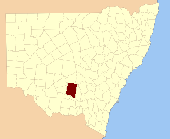
  • Cooper County — may refer to: Cooper County, Missouri Cooper County, New South Wales This disambiguation page lists articles about distinct geographical locations with the same name. If an internal link led you here, yo …   Wikipedia

  • Darlington Point, New South Wales — Darlington Point New South Wales The Punt Hotel …   Wikipedia

  • Merungle Hill, New South Wales — Merungle Hill New South Wales Irrigation pumping station …   Wikipedia

Share the article and excerpts

Direct link
https://en-academic.com/dic.nsf/enwiki/5342569 Do a right-click on the link above
and select “Copy Link”