- Kawartha Lakes
-
This article is about the city of Kawartha Lakes. For the geographical lakes of the same name, see Kawartha lakes (Ontario).
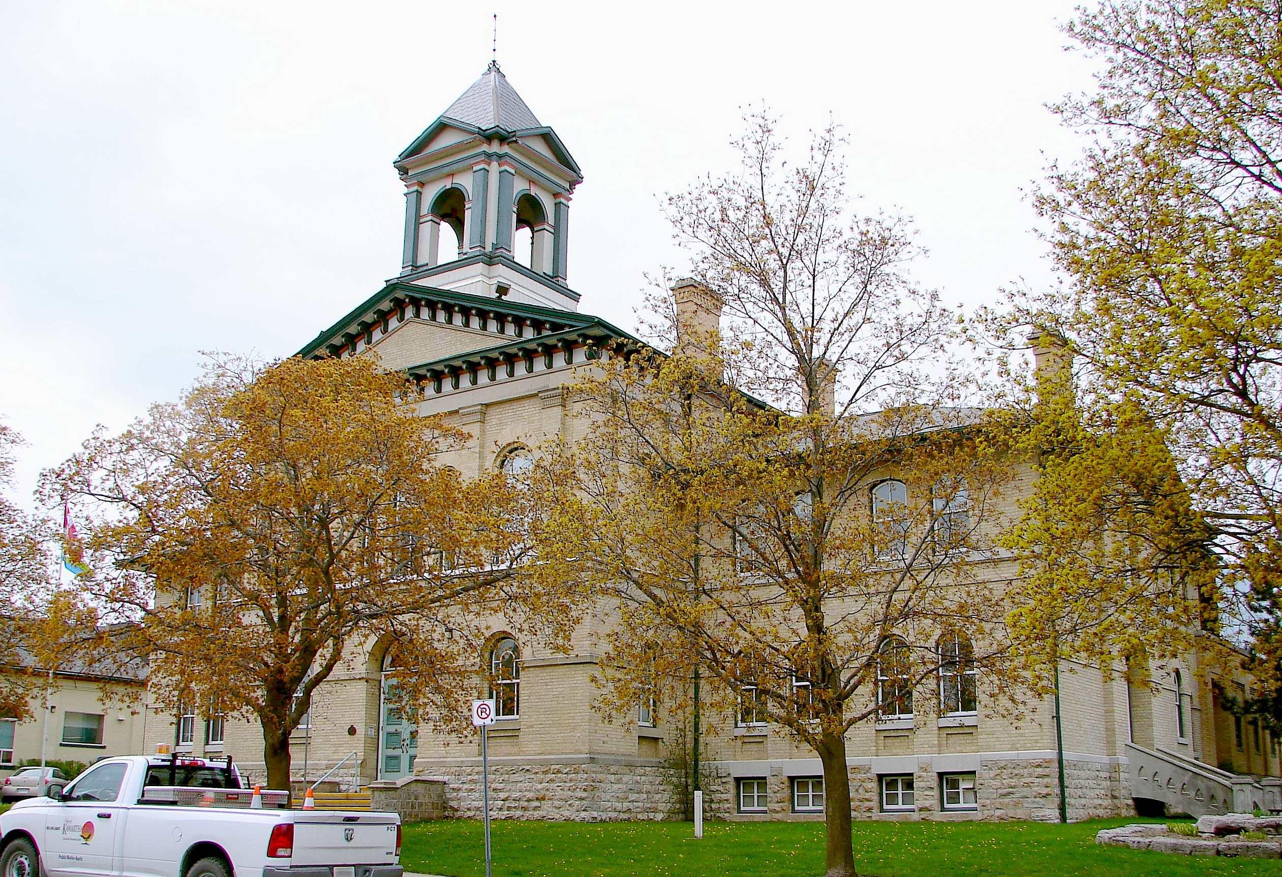
City of Kawartha Lakes — Unitary authority & city — Kawartha Lakes city hall in Lindsay

Flag
LogoMotto: Catch the Kawartha Spirit. Kawartha Lake's location within Ontario.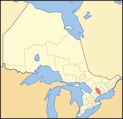
Coordinates: 44°21′N 78°45′W / 44.35°N 78.75°WCoordinates: 44°21′N 78°45′W / 44.35°N 78.75°W Country  Canada
Province  Ontario
County (historical) Victoria Formed by political merger January 1, 2001 Seat Lindsay Government – Mayor Ric McGee – Council City of Kawartha Lakes Council – MP Barry Devolin (CPC) – MPP Rick Johnson (OLP) Area[1] – Total 3,059.47 km2 (1,181.3 sq mi) Population (2006)[1] – Total 74,561 – Density 24.4/km2 (63.1/sq mi) Time zone EST (UTC-5) – Summer (DST) EDT (UTC-4) Postal Code beginning with K and L Area code(s) 705 Website www.city.kawarthalakes.on.ca The city of Kawartha Lakes (2006 population 74,561[1]) is a unitary municipality in Central Ontario, Canada. Although called a city, Kawartha Lakes is the size of a typical Ontarian county and is mostly rural.
The main population centres are Bobcaygeon, Fenelon Falls, Lindsay, Omemee and Woodville.
Contents
History
The city's names comes from the name of the Kawartha lakes. The term Kawartha is an anglicization of the word Ka-wa-tha (from Ka-wa-tae-gum-maug or Gaa-waategamaag, meaning), a word coined in 1895 by aboriginal Martha Whetung of the Curve Lake First Nations. The word meant "land of reflections" in the Anishinaabe language, according to Whetung. The word was subsequently changed by tourism promoters to Kawartha, meaning "bright waters and happy lands."[2]
Prior to its restructuring as a city, the area was known as Victoria County. The city was created in 2001, during the ruling provincial Progressive Conservative party's "Common Sense Revolution". Through provincial legislation, the former Victoria County and its constituent municipalities were amalgamated into one entity named the City of Kawartha Lakes.
This act was made by Ontario commissioner Kitchen, responding to a 2 - 3 vote by the Township of Emily to call the commissioner in to assist with the mismanagement of their landfill site. Despite a general opposition from residents of the area, the provincial government pushed forward with the amalgamation,[3][4] which officially came into effect on January 1, 2001.[5]
By a narrow margin (51% for, 49% against), the citizens of Kawartha Lakes voted to de-amalgamate in a November 2003 local plebiscite, but the provincial and municipal governments have not taken any steps since the vote to initiate de-amalgamation.[4]
Demographics
Census Population Lindsay 1841 200 1871 4,049 1881 5,080 1891 6,081 1901 7,003 1911 6,964 1921 7,620 1931 7,505 1941 8,345 1951 9,603 1961 11,399 1971 12,746 1981 13,596 1991 16,696 Kawartha Lakes 2001 69,179 2006 74,561 Canada census – Kawartha Lakes Community Profile 2006 Population:
Land area:
Population density:
Median age:
Total private dwellings:
Mean household income:74,561 (7.8% from 2001)
3,059.47 km2 (1,181.27 sq mi)
24.4 /km2 (63 /sq mi)
N/A (males: N/A, females: N/A)
37,986
$N/A
References: 2006[6]-
-
- N/A = Data Not Available
-
In 2006, the population of the Lindsay urban area was 19,361.
Census Division rankings
National rank in terms of population (2006): 69
Provincial rank in terms of population (2001): 36Communities
The following is a list of all the former incorporated villages, unincorporated hamlets and communities, and existing or abandoned rural post offices left desolate by the start of rural mail delivery.
- Ancona Point
- Argyle
- Aros
- Avery Point
- Baddow
- Baker Trail
- Ballyduff
- Barclay
- Bellevue
- Bethany
- Bethel
- Birch Point
- Bobcaygeon
- Bolsover
- Brunswick
- Burnt River
- Burton
- Bury's Green
- Cambray
- Cameron
- Camp Kagawong
- Campbells Beach
- Coboconk
- Corson's Siding
- Cowan's Bay
- Crawfords Beach
- Cresswell
- Crosshill
- Cunningham's Corners
- Dalrymple
- Dartmoor (ghost town)
- Daytonia Beach
- Dongola
- Downeyville
- Dunsford
- East Emily
- Eldon
- Fairburn Corner
- Fee's Landing
- Feir Mill
- Fell Station
- Fenelon Falls
- Fingerboard
- Fleetwood (ghost town)
- Fleetwood Station
- Fowlers Corners
- Fox's Corners
- Frank Hill
- Franklin
- Gilsons Point
- Glamorgan
- Glandine
- Glenarm
- Glenway Village
- Grasshill
- Greenhurst-Thurstonia
- Hartley
- Head Lake
- Hickory Beach
- Hillhead Corners
- Horncastle (ghost town)
- Hukish
- Isaacs Glen
- Islay
- Janetville
- Joyvista Estates
- Kenedon Park
- Kenrei Park
- Kenstone Beach
- Keystone Beach
- King's Wharf
- Kinmount
- Kirkfield
- Lake Dalrymple
- Lancaster Bay
- Lifford
- Linden Valley
- Lindsay
- Little Britain, Ontario
- Long Beach
- Long Point
- Lorneville
- Lotus
- MacKenzie Point
- Mallards Bay
- Manilla
- Manvers
- Mariposa Station
- Mariposa
- McCrackin's Beach
- McGuire Beach
- Mount Horeb (ghost town)
- Newmans Beach
- Norland
- Oak Hill
- Oakdene Point
- Oakwood
- O'Donnell Landing
- Omemee
- Orange Corners
- Palestine
- Pickerel Point
- Pleasant Point
- Pontypool
- Port Hoover
- Powles Corners
- Ragged Rapids (ghost town)
- Reaboro
- Red Cap Beach
- Rohallion
- Rokeby
- Rosedale
- Sadowa
- Sandy Point
- Sebright
- Silver Lake
- Snug Harbour
- Southview Estates
- St. Mary's
- Sturgeon Point
- Sullivan's Bay
- Sylvan Glen Beach
- Taylor's Corners
- Tracey's Hill
- Union Creek
- Uphill
- Valentia
- Verulam Park
- Victoria Place
- View Lake
- Washburn Island
- Watson's Siding
- Woodville
- Yelverton
- Zion
Victoria County
Prior to 2001, Victoria County consisted of 13 separate townships and 6 incorporated villages with their own local governments:[7]
Townships
Population centres:
- Bexley (Victoria Road, Coboconk)
- Carden (Dalrymple)
- Dalton (Sebright, Uphill, Sadowa)
- Eldon (Glenarm)
- Emily (Downeyville, Fowlers Corners)
- Fenelon (Isaacs Glen, Powles Corners)
- Laxton, Digby and Longford (Uphill, Norland)
- Longford (uninhabited)
- Manvers (Janetville, Bethany)
- Mariposa (Oakwood, Little Britain)
- Ops (Reaboro)
- Somerville (Coboconk, Kinmount)
- Verulam (Dunsford, Bobcaygeon)
The township of Laxton, Digby and Longford is an amalgamation of the once individual townships of Digby and Laxton, and half of the original Longford Township. The separate township of Longford is uninhabited, though dotted with abandoned logging towns. In 2000, just prior to amalgamation into the city of Kawartha Lakes, the township of Verulam and the village of Bobcaygeon were amalgamated into the Municipality of Bobcaygeon/Verulam.[8]
Incorporated communities
- Town of Lindsay
- Village of Bobcaygeon
- Village of Fenelon Falls
- Village of Omemee
- Village of Sturgeon Point
- Village of Woodville
Transportation
Further information: List of numbered roads in Kawartha Lakes, OntarioThe following King's Highways pass through the city:
- Highway 7, part of the Trans-Canada Highway
- Highway 7A
- Highway 35
- Highway 115
Highway 7B also exists entirely within the city, following the length of Kent Street through Lindsay, and cosigning with Highway 35 for 800 m.
Attractions
- Devil's Elbow Ski Area, Bethany
- Ganaraska Hiking Trail
- Lindsay Airport, Lindsay
- Olde Gaol Museum
- Victoria Recreation Corridor
- Fenelon Falls Museum, Fenelon Falls
- Highland Cinema and Museum, Kinmount
- Trent-Severn Waterway
- Lock 32: Bobcaygeon
- Lock 33: Lindsay
- Lock 34: Fenelon Falls
- Lock 35: Rosedale
- Lock 36: Kirkfield lift lock
Media
- The Lindsay Post (established in Beaverton as The Canadian Post in 1857, moved to Lindsay in 1861)
- Kawartha Lakes This Week (established as Lindsay This Week in 1977)
- 91.9 BOB FM (CKLY-FM) transmits from Lindsay
- CHEX-TV transmits on Channel 12 from Peterborough
Protected areas
- Queen Elizabeth II Wildlands Provincial Park
- Balsam Lake Provincial Park
- Indian Point Provincial Park
- Emily Provincial Park
- Pigeon River Headwaters Conservation Area
- Fleetwood Creek Conservation Area
- Windy Ridge Conservation Area
- Ken Reid Conservation Area
- Gamiing Nature Centre
Surrounding counties
- Muskoka District Municipality
- Haliburton County
- Northumberland County
- Peterborough County
- Regional Municipality of Durham
- Simcoe County
References
- ^ a b c d "Kawartha Lakes (city) community profile". 2006 Census data. Statistics Canada. http://www12.statcan.ca/census-recensement/2006/dp-pd/prof/92-591/details/page.cfm?Lang=E&Geo1=CSD&Code1=3516010&Geo2=PR&Code2=35&Data=Count&SearchText=kawartha&SearchType=Begins&SearchPR=01&B1=All&Custom=. Retrieved 2011-06-10.
- ^ Rayburn, Alan. Place Names in Ontario. University of Toronto Press. p. 176.
- ^ a b "Yes Victoria - Citizens for the de-amalgamation of the city of Kawartha Lakes". http://www.yesvictoria.com. Retrieved 2009-07-12.
- ^ a b c "Voices of Central Ontario - Historical summary". http://www.voconews.com/summary.htm. Retrieved 2009-08-05.
- ^ a b Municipal Government for Victoria County - A New Beginning (Final Report), 2000-04-19, https://ospace.scholarsportal.info/bitstream/1873/6527/1/10286971.pdf, retrieved 2009-07-22
- ^ "2006 Community Profiles". Statistics Canada. Government of Canada. 2009-02-24. http://www12.statcan.ca/census-recensement/2006/dp-pd/prof/92-591/index.cfm?Lang=E. Retrieved 2009-02-24.
- ^ Algonquin Park and Kawarthas map. MapArt Corporation. 1998.
- ^ (PDF) Order of the Commission, (on Victoria County), April 19, 2000, http://www.voconews.com/kitchen.pdf, retrieved 2009-08-05
External links

Gravenhurst Bracebridge Minden Hills Ramara
Brock
Galway-Cavendish and Harvey
Smith-Ennismore-Lakefield Kawartha Lakes

Scugog Clarington Cavan-Monaghan City of Kawartha Lakes Towns 
Villages and
unincorporated
communitiesAncona Point · Argyle · Avery Point · Baddow · Baker Trail · Ballyduff · Barclay · Bellevue · Bethany · Bethel · Bobcaygeon1 · Bolsover · Burnt River · Burton · Cambray · Cameron · Coboconk · Dalrymple · Dartmoor · Daytonia Beach · Dongola · Downeyville · Dunsford · Emily · Eldon Station · Feir Mill · Fenelon Falls · Fowlers Corners · Fleetwood · Glenarm · Greenhurst-Thurstonia · Hartley · Head Lake · Janetville · Kinmount1 · Kirkfield · Little Britain · Long Beach · Long Point · Lorneville · Manilla1 · Manvers · Mariposa Station · Mariposa · Norland · Oakwood · Omemee · Pontypool · Ragged Rapids · Rokeby · Rosedale · Sadowa · St. Mary's · Sebright · Sturgeon Point · Uphill · Valentia · Verulam Park · Victoria Road · View Lake · Woodville
Former townships Major lakes Trent River Shadow Lake · Silver Lake · Four Mile Lake · Balsam Lake · Cameron Lake · Sturgeon Lake · Lake Scugog · Pigeon LakeTalbot River Severn River Topics List of roads · Victoria County1) This area lies on the border of an adjacent region, but is part of the Kawartha Lakes census.Categories: -


Wikimedia Foundation. 2010.