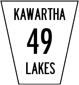
- Kawartha Lakes Road 49
-
Kawartha Lakes Municipal Road 49
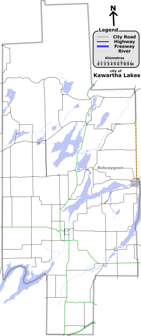
Route information Maintained by city of Kawartha Lakes Length: 18.0 km[1] (11.18 mi) Major junctions North end:  City Road 36 (Main Street) – Bobcaygeon
 City Road 37
South end:  City Road 121
Location Counties: Kawartha Lakes, Peterboroough (road lies on boundary between counties) Villages: Bobcaygeon Highway system ←  K.L. Road 48
Road 49 K.L. Road 57  →
→Kawartha Lakes Road 49 (also known locally as East Street North in Bobcaygeon) is a municipally-maintained class-3 roadway (with the exception of a 0.4 km (0.25 mi) class-4 section at the southern end)[2] located in the city of Kawartha Lakes, in the Canadian province of Ontario. The road runs in a predominantly north–south direction and covers a distance of 18.0 kilometres (11.2 mi).[1][3] The road crosses primarily rural geography[1] between its southern terminus, City Road 36 (Main Street), and northern terminus, City Road 121, with the exception of the village of Bobcaygeon at its southern terminus.[3] The road crosses the boundary between the Ordovician limestone to the south and the granite Canadian Shield to the north, resulting in a hilly landscape with many large rock outcroppings.
The road that is now
 City Road 49 started in 1853, when an act of parliament set forth the building of colonization roads into what was then the frontier of Upper Canada. One of the first of these roads was named the Bobcaygeon Road, after the village at its southern end. In 1956, the southern portion of the Bobcaygeon Road through Minden was transferred to the responsibility of the provincial government. Highway 121 was opened along the road from south of Kinmount to Minden, and the portion south of Highway 121 was designated as Secondary Highway 649. The road held this designation until April 1, 1997, when the entirety of Highway 649 was designated as Victoria County 49. In 2001, Victoria County was restructured as the city of Kawartha Lakes, and the road was renamed City Road 49. The road is still up to provincial highway standards for the most part, though it has not been maintained for over a decade.
Major intersections
 A map of Kawartha Lakes, with route 49 highlighted in orange.
(Click to enlarge)Location Kilometres[1] Road(s) intersected Notes Bobcaygeon 0.0 City Road 36 (Main Street)Southern terminus of City Road 49; the road continues south as City Road 369.7 City Road 37 (Burys Green Road)18.0 City Road 121Northern terminus of City Road 49See also
List of numbered roads in Kawartha Lakes, Ontario
References
- ^ a b c d Google Maps - Kawartha Lakes Road 49 (length and route), http://maps.google.ca/maps?f=d&source=s_d&saddr=44.547181,-78.542359&daddr=County+Rd-49%2FHWY+649&geocode=%3BFcoQqgIdaGVQ-w&hl=en&mra=dme&mrcr=0&mrsp=0&sz=19&sll=44.54752,-78.54314&sspn=0.001193,0.002669&ie=UTF8&ll=44.632994,-78.573532&spn=0.304906,0.683212&t=h&z=11, retrieved 2009-11-22
- ^ city of Kawartha Lakes, Kawartha Lakes winter maintenance priorities schedule, http://www.city.kawarthalakes.on.ca/residents/roads/general-operations/winter-road-maintenance/123-EPW-009-Schedule-A-Roadway-Priority.pdf, retrieved 2009-10-11
- ^ a b Ontario Back Road Atlas, MapArt, 2010, ISBN 978-1-55198-226-7
Roads in Kawartha Lakes City roads Provincial Highways Decommissioned Categories:- Kawartha Lakes City Roads

Wikimedia Foundation. 2010.