- Kawartha Lakes Road 8
-
Kawartha Lakes Municipal Road 8
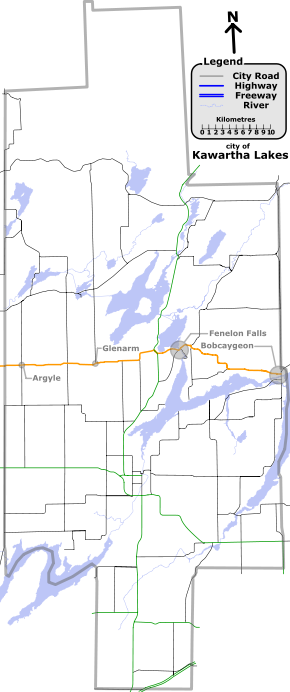
A map of Kawartha Lakes, with route 8 highlighted in orange.
(Click to enlarge)Route information Maintained by city of Kawartha Lakes Length: 78.80 km[1] (48.96 mi) Major junctions West end: Simcoe Street  Highway 35 (near Fenelon Falls)
East end:  City Road 36 (East Street)
Location Towns: Argyle
Glenarm
Fenelon Falls
BobcaygeonHighway system ←  K.L. Road 7
K.L. Road 9  →
→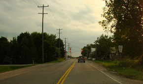 Glenarm Road passes through the small community of Argyle at its junction with Kawartha Lakes Road 46
Kawartha Lakes Road 8 (known locally by various names, including Glenarm Road, Colborne Street and Duke Street) is a municipally-maintained class-3 roadway[2] located in the city of Kawartha Lakes, in the Canadian province of Ontario. The road crosses the entire city from west to east, passing through two towns along the way, Fenelon Falls, and Bobcaygeon. The road runs in a predominantly east–west direction and covers a distance of 45.9 kilometres (28.5 mi).[1][3] The road crosses primarily rural geography,[1] with the exception of the two towns and two unincorporated communities, Argyle and Glenarm, between its western terminus, Simcoe Street and eastern terminus, East Street (Kawartha Lakes Road 36).[3]
Prior to 1 January 1998, the portion of Kawartha Lakes Road 8 between Highway 35 and Fenelon Falls was designated as Highway 35A.
Major intersections
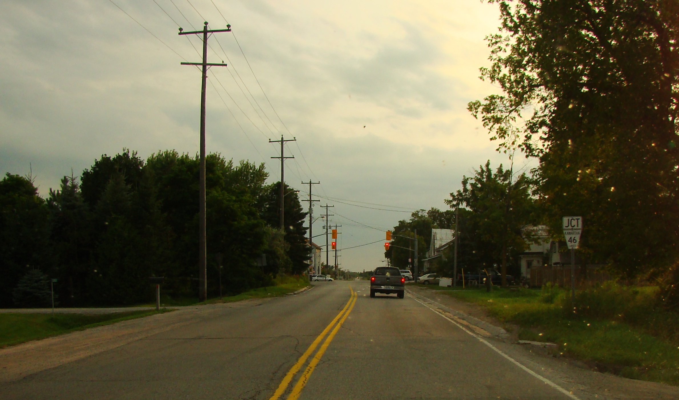
Location Kilometre[1][4] Road(s) intersected Notes 0.0 Simcoe Street Western terminus of Kawartha Lakes Road 8; continues west as Regional Road 15; Simcoe Street becomes Kawartha Lakes/Durham Regional Road 2 6.1 kilometres south of this junction Argyle 2.7  City Road 46 (former Highway 46)
9.6  City Road 6 (Kirkfield Road)
Glenarm 14.0  City Road 35 (Fennel Road)
18.1  City Road 21 (Killarney Bay Road)
20.8  City Road 34 (Cameron Road)
Grove 24.0–24.6 Highway 35Concurrent with Highway 35 for 0.6 kilometres.[5] End of designation of Glenarm Road. Beginning of former Highway 35A. Fenelon Falls 28.3  City Road 121 (Lindsay Street)
End of former Highway 35A. Kawartha Lakes Roads 8 and 121 run concurrent for the next 1.9 kilometres.[6] 28.6  City Road 22 (Francis Street)
Kawartha Lakes Road 8 is known as Helen Street south-west of this junction, and as Colborne Street north-east of it. 29.1 Princess Street Kawartha Lakes Road 8 is known as Short Street east of this junction. 30.1 City Road 121 (Northline Road)End of designation of Short Street. End of concurrency with Kawartha Lakes Road 121. 30.5  City Road 25 (Sturgeon Point Road)
37.8  City Road 30
Bobcaygeon 44.7 West Street Kawartha Lakes Road 8 is known as North Street east of this junction. 45.3 Joseph Street Kawartha Lakes Road 8 is known as Joseph Street for 100 metres north-west of this junction, and as Duke Street east of it. 45.9 City Road 36 (East Street)Eastern terminus of Kawartha Lakes Road 8. Formerly Highway 36. See also
List of numbered roads in Kawartha Lakes, Ontario
References
- ^ a b c d Google Maps - Kawartha Lakes Road 8 (length and route), http://maps.google.com/maps?f=d&source=s_d&saddr=Simcoe+St&daddr=44.54519,-78.541561&hl=en&geocode=FXQfpgIddM5J-w%3B&mra=mi&mrsp=1,0&sz=19&sll=44.54517,-78.541021&sspn=0.001214,0.003227&ie=UTF8&ll=44.492587,-78.765793&spn=0.31103,0.826035&t=h&z=11, retrieved 2009-10-25
- ^ city of Kawartha Lakes, Kawartha Lakes winter maintenance priorities schedule, http://www.city.kawarthalakes.on.ca/residents/roads/general-operations/winter-road-maintenance/123-EPW-009-Schedule-A-Roadway-Priority.pdf, retrieved 2009-10-11
- ^ a b Muskoka and the Kawartha's, 1999 edition road map, MapArt, 1999
- ^ MapArt (2010). Ontario Back Road Atlas (Map). ISBN 978-1-55198-226-7.
- ^ Google Maps - Kawartha Lakes Road 8 and Highway 35 (length and route of concurrency), http://maps.google.ca/maps?f=d&source=s_d&saddr=44.524141,-78.784415&daddr=King%27s+Hwy+35&hl=en&geocode=%3BFaBWpwId_PFN-w&mra=dme&mrcr=0&mrsp=0&sz=19&sll=44.523942,-78.784214&sspn=0.001042,0.002047&ie=UTF8&ll=44.523682,-78.780041&spn=0.008338,0.016372&t=h&z=16, retrieved 2009-10-29
- ^ Google Maps - Kawartha Lakes Road 8 and Road 121 (length and route of concurrency), http://maps.google.ca/maps?f=d&source=s_d&saddr=44.533717,-78.738327&daddr=Route+121%2FCounty+Rd-121%2FCounty+Rd-8&hl=en&geocode=%3BFZqspwIdwtBO-w&mra=dme&mrcr=0&mrsp=0&sz=12&sll=44.546197,-78.737297&sspn=0.133351,0.261955&ie=UTF8&ll=44.539835,-78.729615&spn=0.016671,0.032744&t=h&z=15, retrieved 2009-10-29
Roads in Kawartha Lakes City roads Provincial Highways Decommissioned Categories:- Kawartha Lakes City Roads


Wikimedia Foundation. 2010.