Laxton, Digby and Longford Township

Laxton, Digby and Longford Township
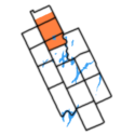
Laxton, Digby and Longford Township within former Victoria County

The united Townships of Laxton, Digby and Longford were a municipality in the north of the former Victoria County, now the city of Kawartha Lakes in the Canadian province of Ontario. In 1993, Canada's centre of population fell in the area[citation needed], despite the lack of any population centers with over 1000 residents.

The more current and geographically separate Longford Township is a unique situation in that the township is wholly owned by Longford Reserve Limited, and contains no permanent inhabitants.

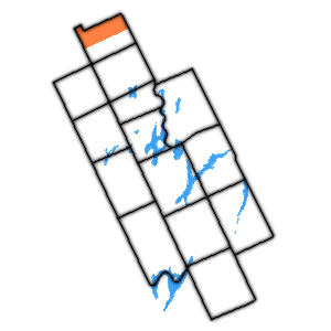
New Longford Township within former Victoria County

The former Township of Longford, was surveyed in 1861 by Brookes Wright Gossage, as one of ten townships sold to the Canadian Land and Emigration Company. Longford was the only one of the townships within Victoria County. In 1867 John Thomson purchased by auction the right to cut timber in the township, from the Canadian Land and Emigration Company, to supply timber for his mill at Longford Mills, named for the township. Thomson later purchased the township outright from the Company.

The old Digby fire tower was situated on rocky outcropping straight north of the village of Uphill , where the old fire trail used to exist, along the former aligment of the Victoria Rd. The tower was de-commissioned in the late 1960s. The area now is mostly swamp, but can be accessed on a newer private road to the west.

The township is also home to a few ghost settlements from the bygone logging/ farming era of the 19th century. These include: Ragged Rapids and the eastern part of Uphill.

Communities

Coordinates: 44°42′42″N 78°49′32″W / 44.71161°N 78.82553°W / 44.71161; -78.82553


Wikimedia Foundation. 2010.

Игры ⚽ Поможем сделать НИР

Look at other dictionaries:

  • Laxton, Digby and Longford Township, Ontario — The United Townships of Laxton, Digby and Longford is a former municipality in the north end of the former County of Victoria, now the City of Kawartha Lakes.Longford Geographic Township is a unique geographic situation in that the entire… …   Wikipedia

  • Mariposa Township, Ontario — Mariposa Township within former Victoria County The Township of Mariposa was a municipality located in the southwest corner of the former Victoria County, now the city of Kawartha Lakes, in the Canadian province of Ontario. The other municipal… …   Wikipedia

  • Verulam Township — within former Victoria County The Township of Verulam was a rural municipality within the former Victoria County, now the city of Kawartha Lakes. It was bounded on the north by the geographic township of Somerville, the south by the geographic… …   Wikipedia

  • Dalton Township, Ontario — Dalton Township within former Victoria County The Township of Dalton was a municipality located in the northwest corner of the former Victoria County, now the city of Kawartha Lakes, in the Canadian province of Ontario. It was named after Dr.… …   Wikipedia

  • Manvers Township — within former Victoria County The Township of Manvers (area 69,923 acres (283 km2)) was a municipality in the former Victoria County, now the city of Kawartha Lakes, in the Canadian province of Ontario. From 1792 to 1974 Manvers Township was …   Wikipedia

  • Ops Township — within former Victoria County The Township of Ops was a municipality located in the centre of the former Victoria County, now the city of Kawartha Lakes. The township contained the communities of Reaboro and Fleetwood, and also surrounded the… …   Wikipedia

  • Kawartha Lakes — This article is about the city of Kawartha Lakes. For the geographical lakes of the same name, see Kawartha lakes (Ontario). City of Kawartha Lakes   Unitary authority city   …   Wikipedia

  • List of townships in Ontario — This is a list of townships in the Canadian province of Ontario. Townships are listed by census division.Algoma District*Abbott *Aberdeen Additional (see Macdonald, Meredith and Aberdeen Additional) *Abigo *Abotossaway *Abraham *Acton *Aguonie… …   Wikipedia

  • Center of population — with a mean distance of convert|5000|km|sigfig=1|sp=us. Its antipodal point is correspondingly the farthest point from everyone on earth, and is located in the South Pacific near 15000|km|sp=us.In demographics, the center of population of a… …   Wikipedia

  • Norland, Ontario — Norland is a small rural community located within the city of Kawartha Lakes, in the Canadian province of Ontario. It is located in a scenic spot on the Gull River at the north end of Shadow Lake, the northernmost Kawartha lake. Here a series of… …   Wikipedia

Share the article and excerpts

Direct link
Do a right-click on the link above
and select “Copy Link”