- Normandy Park, Washington
-
Normandy Park, Washington — City — 
SealLocation of Normandy Park, Washington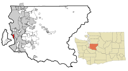
Coordinates: 47°26′14″N 122°20′36″W / 47.43722°N 122.34333°WCoordinates: 47°26′14″N 122°20′36″W / 47.43722°N 122.34333°W Country United States State Washington County King Area – Total 6.6 sq mi (17.1 km2) – Land 2.5 sq mi (6.4 km2) – Water 4.2 sq mi (10.8 km2) Elevation 328 ft (100 m) Population (2010) – Total 6,335 – Density 2,597.3/sq mi (1,002.8/km2) Time zone Pacific (PST) (UTC-8) – Summer (DST) PDT (UTC-7) ZIP codes 98148, 98166, 98198 Area code(s) 206 FIPS code 53-49415[1] GNIS feature ID 1512509[2] Normandy Park is a city in King County, Washington, United States. The population was 6,335 at the 2010 census.
Based on per capita income, Normandy Park ranks 26th of 522 areas in the state of Washington.
Contents
History
Normandy Park was officially incorporated on June 8, 1953. The city is located in King County, WA and is bordered on the north by the City of Burien and by the City of Des Moines to the south.
The Seattle-Tacoma Land Company was organized in the mid-1920s for the purpose of developing 1,200 acres (4.9 km2) of land on the shores of Puget Sound between Seattle and Tacoma. The development was to be known as Normandy Park, a planned residential community with strict building codes and numerous restrictions. It was to be a community of distinctive architecture in the French Normandy style, and there was to be a yacht club, two community beaches and a golf course.
By 1929, the entire area had been platted. Good gravel roads were built and a water system installed that was fed from deep wells in the area. An elegant clubhouse was built on what is now known as "Lot A," and promotional efforts such as free refreshments and band concerts were offered there to promote Normandy Park. Building started with a distinctive brick house on Lot 1, Block 20, built by C. S. Hughett. This house was considered to be the first built according to the plans of the developers. The house is located at 17999 Normandy Terrace SW. A few other houses in the French Normandy style were built soon after, as well as two Prudence Penny Budget houses.
The depression brought a halt to all development activities of Normandy Park and the Seattle-Tacoma Land Company "abandoned" the project. The clubhouse was sold to the late Ben Tipp in 1934, and much of the property passed into private hands.
In the late 1940s and early 1950s, Normandy Park was "discovered" and, within a few years, many fine homes were built. In a short time it became a vigorous community, so much so that the residents decided to incorporate the area into the City of Normandy Park in order to control their own destinies. As a result, the City of Normandy Park was incorporated on June 8, 1953. A city government was organized consisting of seven elected Councilmembers, one of whom is selected as Mayor by the Council themselves and serves as chair of the Council. They serve unsalaried by choice. The City is classified in the Revised Code of Washington as a "second class city" with a "council/manager form of government".
Geography
Normandy Park is located at 47°26′14″N 122°20′36″W / 47.43722°N 122.34333°W (47.437341, -122.343310).[3]
According to the United States Census Bureau, the city has a total area of 6.6 square miles (17.1 km²), of which, 2.5 square miles (6.4 km²) of it is land and 4.2 square miles (10.8 km²) of it (62.84%) is water.
Demographics
Historical populations Census Pop. %± 1960 3,224 — 1970 4,202 30.3% 1980 4,268 1.6% 1990 6,709 57.2% 2000 6,392 −4.7% 2010 6,335 −0.9% As of the census[1] of 2000, there were 6,392 people, 2,609 households, and 1,933 families residing in the city. The population density was 2,597.3 people per square mile (1,003.2/km²). There were 2,670 housing units at an average density of 1,084.9 per square mile (419.1/km²). The racial makeup of the city was 90.21% White, 1.14% African American, 0.39% Native American, 4.60% Asian, 0.23% Pacific Islander, 0.80% from other races, and 2.63% from two or more races. Hispanic or Latino of any race were 2.44% of the population.
There were 2,609 households out of which 30.1% had children under the age of 18 living with them, 65.5% were married couples living together, 6.3% had a female householder with no husband present, and 25.9% were non-families. 22.0% of all households were made up of individuals and 11.7% had someone living alone who was 65 years of age or older. The average household size was 2.45 and the average family size was 2.86.
In the city the population was spread out with 22.2% under the age of 18, 5.0% from 18 to 24, 21.9% from 25 to 44, 30.6% from 45 to 64, and 20.3% who were 65 years of age or older. The median age was 46 years. For every 100 females there were 92.9 males. For every 100 females age 18 and over, there were 92.2 males.
The median income for a household in the city was $70,367, and the median income for a family was $78,102. Males had a median income of $54,500 versus $40,018 for females. The per capita income for the city was $33,845. About 2.0% of families and 4.0% of the population were below the poverty line, including 4.1% of those under age 18 and 6.1% of those age 65 or over.
References
- ^ a b "American FactFinder". United States Census Bureau. http://factfinder.census.gov. Retrieved 2008-01-31.
- ^ "US Board on Geographic Names". United States Geological Survey. 2007-10-25. http://geonames.usgs.gov. Retrieved 2008-01-31.
- ^ "US Gazetteer files: 2010, 2000, and 1990". United States Census Bureau. 2011-02-12. http://www.census.gov/geo/www/gazetteer/gazette.html. Retrieved 2011-04-23.
External links
 State of Washington
Topics State government | Cities | Towns | Congressional delegation | City governments | Governors | History | Geography | People | Legislative initiatives | Popular initiatives | Legislature | Music | Parks | Highways | Symbols | Visitor attractions
Society Demographics · Economy · Education · Politics
Regions Larger cities and
metropolitan areasSeattle | Seattle metropolitan area | Spokane | Tacoma | Tri-Cities | Vancouver | Bellevue | Everett | Yakima
Smaller cities Aberdeen | Anacortes | Arlington | Auburn | Bainbridge Island | Battle Ground | Bellingham | Bonney Lake | Bothell | Bremerton | Burien | Camas | Centralia | Cheney | Cle Elum | Coupeville | Covington | Des Moines | East Wenatchee | Edmonds | Ellensburg | Enumclaw | Federal Way | Fort Lewis | Grandview | Hoquiam | Issaquah | Kelso | Kenmore | Kennewick | Kent | Kirkland | Lacey | Lake Forest Park | Lake Stevens | Lakewood | Langley | Longview | Lynden | Lynnwood | Mabton | Maple Valley | Marysville | Mercer Island | Mill Creek | Monroe | Moses Lake | Mountlake Terrace | Mount Vernon | Mukilteo | Naches | Oak Harbor | Olympia | Pasco | Port Angeles | Port Orchard | Port Townsend | Prosser | Pullman | Puyallup | Redmond | Renton | Richland | Sammamish | SeaTac | Sedro-Woolley | Selah | Shelton | Shoreline | Silverdale | Spokane Valley | Sunnyside | Toppenish | Tukwila | Tumwater | University Place | Walla Walla | Wapato | Washougal | Wenatchee | West Richland | Woodinville | Zillah
Counties Adams | Asotin | Benton | Chelan | Clallam | Clark | Columbia | Cowlitz | Douglas | Ferry | Franklin | Garfield | Grant | Grays Harbor | Island | Jefferson | King | Kitsap | Kittitas | Klickitat | Lewis | Lincoln | Mason | Okanogan | Pacific | Pend Oreille | Pierce | San Juan | Skagit | Skamania | Snohomish | Spokane | Stevens | Thurston | Wahkiakum | Walla Walla | Whatcom | Whitman | Yakima
Categories:- Cities in King County, Washington
- Cities in the Seattle metropolitan area


Wikimedia Foundation. 2010.