- Cumberland, Washington
-
Cumberland — Unincorporated community — Location within the state of Washington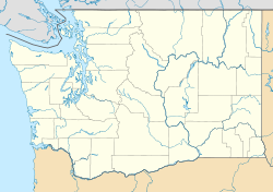
 Cumberland
Coordinates: 47°16′59″N 121°55′32″W / 47.28306°N 121.92556°WCoordinates: 47°16′59″N 121°55′32″W / 47.28306°N 121.92556°W Country United States State Washington County King Time zone Pacific (PST) (UTC-8) – Summer (DST) PDT (UTC-7) ZIP codes FIPS code GNIS feature ID Cumberland is an unincorporated community in King County, Washington. Originally a mining camp, Cumberland was named by F.X. Schreiner in 1893 after the Cumberland coal region of the Appalachian Mountains.[1] Cumberland gained a post office on October 13, 1894. Today, the Enumclaw post office serves this area. Although many other mining camps in the area have disappeared, Cumberland can still be found in the Cascade foothills between Nolte State Park and Kanaskat-Palmer State Park. It is accessible via Southeast King County backroads. Cumberland has an all volunteer fire department and is a King County registered voting precinct.
In 1989 the county-wide transit and sewage waste municipality known as "Metro" (short for Metropolitan King County), planned a 25-year sewage sludge waste spraying on the 400 acres (1.6 km2) of pristine woods northwest of the town. Following grassroots community protest and objections from the Muckleshoot tribe (who are downriver on the nearby Green River), the county agreed to create an Environmental impact statement (EIS). The EIS showed a number of toxins present in the sludge, and the project was officially cancelled in 1992.
References
- ^ Majors, Harry M. (1975). Exploring Washington. Van Winkle Publishing Co. p. 91. ISBN 9780918664006. http://books.google.com/books?id=CoWrPQAACAAJ.
 State of Washington
Topics State government | Cities | Towns | Congressional delegation | City governments | Governors | History | Geography | People | Legislative initiatives | Popular initiatives | Legislature | Music | Parks | Highways | Symbols | Visitor attractions
Society Demographics · Economy · Education · Politics
Regions Larger cities and
metropolitan areasSeattle | Seattle metropolitan area | Spokane | Tacoma | Tri-Cities | Vancouver | Bellevue | Everett | Yakima
Smaller cities Aberdeen | Anacortes | Arlington | Auburn | Bainbridge Island | Battle Ground | Bellingham | Bonney Lake | Bothell | Bremerton | Burien | Camas | Centralia | Cheney | Cle Elum | Coupeville | Covington | Des Moines | East Wenatchee | Edmonds | Ellensburg | Enumclaw | Federal Way | Fort Lewis | Grandview | Hoquiam | Issaquah | Kelso | Kenmore | Kennewick | Kent | Kirkland | Lacey | Lake Forest Park | Lake Stevens | Lakewood | Langley | Longview | Lynden | Lynnwood | Mabton | Maple Valley | Marysville | Mercer Island | Mill Creek | Monroe | Moses Lake | Mountlake Terrace | Mount Vernon | Mukilteo | Naches | Oak Harbor | Olympia | Pasco | Port Angeles | Port Orchard | Port Townsend | Prosser | Pullman | Puyallup | Redmond | Renton | Richland | Sammamish | SeaTac | Sedro-Woolley | Selah | Shelton | Shoreline | Silverdale | Spokane Valley | Sunnyside | Toppenish | Tukwila | Tumwater | University Place | Walla Walla | Wapato | Washougal | Wenatchee | West Richland | Woodinville | Zillah
Counties Adams | Asotin | Benton | Chelan | Clallam | Clark | Columbia | Cowlitz | Douglas | Ferry | Franklin | Garfield | Grant | Grays Harbor | Island | Jefferson | King | Kitsap | Kittitas | Klickitat | Lewis | Lincoln | Mason | Okanogan | Pacific | Pend Oreille | Pierce | San Juan | Skagit | Skamania | Snohomish | Spokane | Stevens | Thurston | Wahkiakum | Walla Walla | Whatcom | Whitman | Yakima
Categories:- Unincorporated communities in King County, Washington
- King County, Washington geography stubs


Wikimedia Foundation. 2010.