- Hunts Point, Washington
Infobox Settlement
official_name = Hunts Point, Washington
settlement_type =Town
nickname =
motto =
imagesize =
image_caption =
image_
imagesize =
image_caption =
image_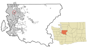
mapsize = 250x200px
map_caption = Location of Hunts Point, Washington
mapsize1 =
map_caption1 =subdivision_type = Country
subdivision_name =United States
subdivision_type1 = State
subdivision_name1 =Washington
subdivision_type2 = County
subdivision_name2 = Kinggovernment_footnotes =
government_type =
leader_title =
leader_name =
leader_title1 =
leader_name1 =
established_title =
established_date =unit_pref = Imperial
area_footnotes =area_magnitude =
area_total_km2 = 0.8
area_land_km2 = 0.8
area_water_km2 = 0.0
area_total_sq_mi = 0.3
area_land_sq_mi = 0.3
area_water_sq_mi = 0.0population_as_of = 2000
population_footnotes =
population_total = 443
population_density_km2 = 585.6
population_density_sq_mi = 1516.6timezone = Pacific (PST)
utc_offset = -8
timezone_DST = PDT
utc_offset_DST = -7
elevation_footnotes =
elevation_m = 20
elevation_ft = 66
latd = 47 |latm = 38 |lats = 12 |latNS = N
longd = 122 |longm = 13 |longs = 50 |longEW = Wpostal_code_type =
ZIP code
postal_code = 98004
area_code = 425
blank_name = FIPS code
blank_info = 53-32755GR|2
blank1_name = GNIS feature ID
blank1_info = 1512315GR|3
website =
footnotes =Hunts Point is a town located in the Eastside, a region of
King County, Washington and part of theSeattle metropolitan area . The town is located on a smallpeninsula surrounded byLake Washington , and is near thesuburbs of Medina (to the southwest), Clyde Hill (to the south), Yarrow Point (on another peninsula to the east), and Kirkland (to the northeast), as well as thecity of Bellevue (to the east). As of the 2000 census, the town had a totalpopulation of 443.History
Leigh S. J. Hunt , a resident of nearbyYarrow Point , acquired theproperty of Hunts Point some time after 1870. He wanted it so that he could cut down the tall evergreen trees which grew out at the end, obstructing his view ofSeattle .Around 1900, the property was taken over by
Puget Sound National Bank and sold to a group of Seattle men who used it as a family retreat for Sundaypicnic s and summercamping .Before the creation of the two
Lake Washington bridges, residents commuted to Seattle via the Gazelle, a smallferry which chugged intoCozy Cove each morning at 7:15.A clubhouse was built in 1913 at what is now 3655 Hunts Point Road. The clubhouse became the center of social activity on Hunts Point through the 1920s. That same year, the women of Hunts Point formed the charitable organization -
The Eastside Circle of the Seattle Fruit and Flower Mission (later calledThe Overlake Service League ) which continues to this day.In the 1950s,
Stan Sayer , owner of the famous Slo Mo unlimitedhydroplane , housed the boat at the end of Hunts Point Road.Hunts Point was officially incorporated on
August 22 ,1955 .
* 1957Fairweather Basin developed, turningmarshland into prime residential property.
* 1960 - firstsewer s installed.
* 1963 -Evergreen Point Bridge completed, putting Hunts Point only minutes from Seattle.
* 1988 -Wetherill Nature Preserve dedicatedGeography
Hunts Point is located at coor dms|47|38|12|N|122|13|50|W|city (47.636754, -122.230598)GR|1.
According to the
United States Census Bureau , the town has a total area of 0.3square mile s (0.8km² ), of which, 0.3 square miles (0.8 km²) of it is land and 3.33% is water.Politics
Hunts Point is part of the 48th Legislative District of Washington State. The current legislators for the district are:
* Senator [http://www1.leg.wa.gov/senate/tom/ Rodney Tom] , Democrat
* Representative [http://www1.leg.wa.gov/house/hunter/ Ross Hunter] , Democrat
* Representative [http://www1.leg.wa.gov/house/eddy/ Deborah Eddy] , DemocratHunts Point is part of Washington State Congressional District 8, represented by Congressman [http://www.house.gov/reichert/ Dave Reichert] , Republican.
George W. Bush has made a fund raising stop to the small town in each of his last two presidential campaigns. TheAugust 22 ,2003 visit ended up costing the town $23,000 for police security for the visit. [http://seattletimes.nwsource.com/html/localnews/2001797398_bushbill21e.html] [http://seattletimes.nwsource.com/html/localnews/2001846273_brodeur29m.html]Demographics
As of the
census GR|2 of 2000, there were 443 people, 165 households, and 131 families residing in the town. Thepopulation density was 1,516.6 people per square mile (589.8/km²). There were 186 housing units at an average density of 636.8/sq mi (247.6/km²). The racial makeup of the town was 94.81% White, 0.45% African American, 2.71% Asian, 0.23% from other races, and 1.81% from two or more races. Hispanic or Latino of any race were 2.26% of the population. 21.4% were of English, 11.5% German, 10.9%Europe an, 5.9% Swedish and 5.0% Dutch ancestry according toCensus 2000 .There were 165 households out of which 32.1% had children under the age of 18 living with them, 73.3% were married couples living together, 3.6% had a female householder with no husband present, and 20.6% were non-families. 15.2% of all households were made up of individuals and 7.9% had someone living alone who was 65 years of age or older. The average household size was 2.68 and the average family size was 2.98.
In the town the population was spread out with 26.0% under the age of 18, 3.8% from 18 to 24, 20.3% from 25 to 44, 34.1% from 45 to 64, and 15.8% who were 65 years of age or older. The median age was 45 years. For every 100 females there were 102.3 males. For every 100 females age 18 and over, there were 98.8 males.
The median income for a household in the town was $179,898, and the median income for a family was $200,000. Males had a median income of $100,000 versus $40,417 for females. The
per capita income for the town was $113,816. None of the families and 1.1% of the population were living below thepoverty line , including no under eighteens and 2.6% of those over 64.References
External links
* [http://www.huntspoint-wa.gov/ Town of Hunts Point]
Wikimedia Foundation. 2010.