- Fall City, Washington
Infobox Settlement
official_name = Fall City, Washington
settlement_type = CDP
nickname =
motto =
imagesize =
image_caption =
image_
imagesize =
image_caption =
image_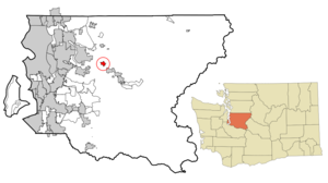
mapsize = 250x200px
map_caption = Location of Fall City, Washington
mapsize1 =
map_caption1 =subdivision_type = Country
subdivision_name =United States
subdivision_type1 = State
subdivision_name1 =Washington
subdivision_type2 = County
subdivision_name2 = Kinggovernment_footnotes =
government_type =
leader_title =
leader_name =
leader_title1 =
leader_name1 =
established_title =
established_date =unit_pref = Imperial
area_footnotes =
area_magnitude =
area_total_km2 = 3.4
area_land_km2 = 3.4
area_water_km2 = 0.0
area_total_sq_mi = 1.3
area_land_sq_mi = 1.3
area_water_sq_mi = 0.0population_as_of = 2000
population_footnotes =
population_total = 1638
population_density_km2 = 484.0
population_density_sq_mi = 1253.5timezone = Pacific (PST)
utc_offset = -8
timezone_DST = PDT
utc_offset_DST = -7
elevation_footnotes =
elevation_m = 32
elevation_ft = 105
latd = 47 |latm = 33 |lats = 59 |latNS = N
longd = 121 |longm = 53 |longs = 42 |longEW = Wpostal_code_type =
ZIP code
postal_code = 98024
area_code = 425
blank_name = FIPS code
blank_info = 53-23200GR|2
blank1_name = GNIS feature ID
blank1_info = 1531451GR|3
website =
footnotes =Fall City is an unincorporated town located 26 miles east of Seattle in
King County, Washington along theSnoqualmie River . The population was 1,638 at the 2000 census. TheFall City Airport is a small privateairport community located roughly 1 mile east of the town.Based on per capita income, one of the more reliable measures of affluence, Fall City ranks 88th of 522 areas in the state of Washington to be ranked.
The city's
ZIP code is 98024 and the city's phone prefix is 425-222.History
The Snoqualmie Indian village of "Yelhw" occupied the waterfront from time out of memory.
The first white settlements in the area were two forts built in 1856 during the
Puget Sound War to protect future settlers against possible uprisings by the native population. Fort Patterson, a few miles downstream, and Fort Tilton, a few miles upstream, were built with the help of Indians led by ChiefPatkanim , and both abandoned within 2 years after interactions with the local tribes remained peaceful. A historical marker can be found north of Fall City on the Fish Hatchery Road where Fort Tilton once stood.A trading post was established near the present day location of the Last Chance Saloon in 1869 and became a hub of the local economy. Fall City was known at the time as "The Landing", as shallow water and rapids upstream on the Snoqualmie were impassable to the large dugout canoes used for transporting goods. In the early 1870s the first local mill in the
Snoqualmie Valley was opened at the mouth of Tokul Creek, just downstream fromSnoqualmie Falls and just upstream from where Fall City would be. The Fall City Post Office first openedJune 10 ,1872 .The first small steamboats started ferrying supplies up the river in 1875. In the late 1880s, a group of Puget Sound businessmen founded and started building the
Seattle, Lake Shore & Eastern railroad including a line up into the upperSnoqualmie Valley , in an attempt to build a line over theCascade range . The land claim holder at the time, Jeremiah "Jerry" Borst, had Fall City surveyed and platted in anticipation of the people the railroad would bring, but was disappointed in 1889 when the railroad line was built a mile away from the town.However even a mile away the railroad combined with the first bridge over the Snoqualmie River greatly improved the business of the local lumber mills and farmers, and made the area and its scenic features (such as
Snoqualmie Falls ) accessible to tourists. Hundreds moved to the area over the next two decades.When the Sunset Highway, connecting Seattle with eastern
Washington through Fall City was improved in the early 1910s, it further accelerated the economic and residential development of the area. Fall City was easier than ever to reach with the availability of inexpensive cars like theFord Model T . By the late 1920s most of the population either worked in the bourgeoning tourist trade or commuted to work west toward Issaquah and Seattle.The
Great Depression followed by gasoline rationing duringWorld War II hurt the tourist trade in Fall City. And tourism was further hampered just after the war asU.S. Highway 10 (nowInterstate 90 ) was rerouted south directly from Preston to North Bend, bypassing Fall City and Snoqualmie. The local economy suffered further impacts as the local logging mills started closing.Today, Fall City is a
bedroom community to the high tech industry of theSeattle metropolitan area with large suburban estates just outside of the town juxtaposed with the historical homes and farmsteads built in the town's heyday.Geography
Fall City is located at coor dms|47|33|59|N|121|53|42|W|city (47.566419, -121.894972)GR|1.
According to the
United States Census Bureau , the CDP has a total area of 1.3 square miles (3.4 km²), all of it land.The town sits at the confluence of the
Snoqualmie River and theRaging River and is sometimes, albeit rarely, subject toflood ing during the autumn and winter months. More typical is a strong east wind aspressure gradient s carry higher pressure air acrossSnoqualmie Pass and down the Snoqualmie Valley.Demographics
At 2000
census GR|2, there were 1,638 people, 644 households and 473 families residing in the CDP. Thepopulation density was 1,253.5 per square mile (482.8/km²). There were 649 housing units at an average density of 496.6/sq mi (191.3/km²). The racial makeup of the CDP was 94.44% White, 0.24% African American, 0.92% Native American, 0.73% Asian, 1.40% from other races, and 2.26% from two or more races. Hispanic or Latino of any race were 2.63% of the population.There were 644 households of which 33.9% had children under the age of 18 living with them, 58.9% were married couples living together, 8.5% had a female householder with no husband present and 26.4% were non-families. 19.7% of all households were made up of individuals and 7.8% had someone living alone who was 65 years of age or older. The average household size was 2.54 and the average family size was 2.91.
In the CDP, the age distribution was 25.1% under the age of 18, 5.7% from 18 to 24, 32.0% from 25 to 44, 25.1% from 45 to 64, and 12.1% who were 65 years of age or older. The median age was 40 years. For every 100 females there were 104.0 males. For every 100 females age 18 and over, there were 99.2 males.
The median household income in the CDP was $61,848, and the median family income was $68,529. Males had a median income of $42,325 versus $32,143 for females. The
per capita income for the CDP was $25,189. About 2.4% of families and 4.1% of the population were below thepoverty line , including 2.7% of those under age 18 and 3.9% of those age 65 or over.References
External links
Wikimedia Foundation. 2010.