- Snoqualmie, Washington
:"This article refers to the city of Snoqualmie, Washington. For the Native American tribe, see
Snoqualmie (tribe) . For the river, seeSnoqualmie River ."Infobox Settlement
official_name = City of Snoqualmie, Washington
settlement_type =City 
imagesize =
image_caption = Snoqualmie Depot
image_
mapsize = 250x200px
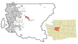
map_caption = Location of Snoqualmie within King County.
mapsize1 =
map_caption1 =
subdivision_type = Country
subdivision_type1 = State
subdivision_type2 = County
subdivision_name =United States
subdivision_name1 =Washington
subdivision_name2 = King
government_type =
leader_title =Mayor
leader_name = Matt Larson
established_date =
area_magnitude = 1 E8
area_total_km2 = 13.4
area_land_km2 = 13.2
area_water_km2 = 0.1
area_total_sq_mi = 5.2
area_land_sq_mi = 5.1
area_water_sq_mi = 0.0
elevation_m = 130
elevation_ft = 427
latd = 47 |latm = 31 |lats = 59 |latNS = N
longd = 121 |longm = 50 |longs = 40 |longEW = W
population_as_of = 2000
population_total = 1,631
population_density_km2 = 122.5
timezone = PST
utc_offset = -8
timezone_DST = PDT
utc_offset_DST = -7
latitude = 47°31'59" N
longitude = 121°50'40" W
website = http://www.ci.snoqualmie.wa.us/
postal_code_type =ZIP code s
postal_code = 98065, 98068
area_code = 425
blank_name = FIPS code
blank_info = 53-65205GR|2
blank1_name = GNIS feature ID
blank1_info = 1526014GR|3
footnotes =Snoqualmie (pronEng|snoʊˈkwɑːlmi) is a city next to
Snoqualmie Falls inKing County, Washington . The city is home to theNorthwest Railway Museum . As of theUnited States 2000 Census , the city population was 1,631. Movie actressElla Raines was born in Snoqualmie Falls, a mill town across the Snoqualmie River that is now part of Snoqualmie, on 6 August 1920.Many of the exterior shots for
David Lynch 's "Twin Peaks " television series and movie ("") were filmed in Snoqualmie and in the neighboring towns of North Bend and Fall City.According to Washington State population estimates [http://www.ofm.wa.gov/pop/april1/] , Snoqualmie grew to 6,345 or 289.03% between 2000 and 2005, ranking it 1st of 281 in population growth in Washington State. The 2006 estimate was 7,815 and for 2007 the estimate was 9,360.
History
The first written record of the exploration of the Snoqualmie Valley comes from the notes of Samuel Hancock, who ventured up-river with the Snoqualmie tribe in 1851 in search of coal. Near the current location of Meadowbrook Bridge, Hancock was told by his guides that the land was known as “Hyas Kloshe Illahee”, or “good/productive land”. Hancock took this useful information back with him to the area now known as Tacoma.
During the 1850s, tensions were very high between the native populations and the new settlers claiming the land as their own. In 1856, in response to these tensions, Fort Alden was built in the area that would become Snoqualmie. Fortunately, no alliances were made between the tribes in the east and the tribes in the west, and Fort Alden was abandoned (along with other forts built around this time).
The most successful early pioneer in the Valley was Jeremiah Borst, who arrived in the spring of 1858 on his way over the Cedar River trail from the eastern side of the mountains. He settled in the area that formerly held Fort Alden, and used his sales of pigs and apples in Seattle to buy out many of the surrounding land from other settlers.
As successful as farming was, other settlers had different methods of working the land. The very first mill in Snoqualmie was established at the mouth of Tokul Creek around 1872 by Watson Allen. Within 5 years, there were 12 logging operations on the Snoqualmie River, providing lumber to the entire Seattle region. Within 15 years, logging and mill work was employing 140 men and sending millions of board feet of logs down the river.
In 1882, the Hop Growers Association was founded by three Puget Sound partners, who used land purchased from Jeremiah Borst to create a farm that would eventually cover 1500 acres, 900 of which was devoted solely to hops. This extremely successful venture (billed as “The Largest Hop Ranch in the World”) would fall prey to a combination of market and pest factors, and fell into relative obscurity by the end of the 1890s.
By the late 1800s, the Puget Sound region was growing, but bypassed by the major railways. In response, a group of Seattle entrepreneurs funded and built their own railway in an attempt to cross the Cascade mountains. The Seattle, Lake Shore & Eastern opened up the vast natural resources Snoqualmie valley to the markets of the world, and brought in tourists from around the world to enjoy the natural beauty of the area, and to marvel at the Falls.
Of course, a by-product of this sudden massive increase in interest in the area was a marked increase in speculation. Originally, the area that would become North Bend was platted as “Snoqualmie” in February of 1889 by Will Taylor. The area that is currently Snoqualmie was platted in August of that same year as “Snoqualmie Falls” by investors from Seattle. The oral history of the area places the first residents of Snoqualmie as Edmund and Louisa Kinsey, who established the first hotel, livery, general store, dance hall, post office, and meat market – in addition to helping build the very first church in the town. Two of their sons (out of six children) are most famous for their photography documenting the early timber works in the region.
The first power plant at the Falls was built in the late 1890s by Charles Baker, one of the investors from Seattle who had assisted in the platting of the city. This development provided both power and jobs to the region, and a small company town grew up near the Falls to house the workers. More than 100 years later, Baker’s original generators are still in use by the BPA.
The official vote for incorporation of “Snoqualmie Falls” as the City of Snoqualmie occurred in 1903. At the time, land prices had not decreased since initially set in 1889 - prices that did not reflect the financial reality of the region. In response to these high prices, people had created a large “squatting” community, building where they wanted regardless of land ownership or interests. The first challenge that the city council faced was lowering lot prices and migrating these buildings off of the public right-of way, establishing the basic layout of the town that exists to this day.
In 1917, a new all-electric lumber mill (only the second ever in the U.S.) opened across the river from Snoqualmie, along with the company town associated with it, Snoqualmie Falls. For the first half of the century, the timber industry provided the city and Valley with a stable source of income and employment, even as World War I drew away workers and the Great Depression took its toll across the nation.
This prosperity was moderated during the Depression, and with the changes in culture and mobility that took effect in the latter half of the century, Snoqualmie and the majority of the Valley fell into somewhat of a stagnant existence. The city was bypassed when US-10 was built across the Cascades (now Interstate-90), and this led to a shift in commerce to the east (into North Bend) and west (into the Bellevue/Issaquah areas).
By the 1960s, the homes that had made up the company town of Snoqualmie Falls had been moved to other locations within the Valley, and the city’s population had stabilized to a growth rate of roughly 11 people per year over the next 30 years (from 1,216 in 1960 to 1,546 in 1990).
This slow growth cycle continued until the mid-1990s, when the City annexed 1300 acres of undeveloped land that became the site of the current “master-planned” community of
Snoqualmie Ridge . The plan for this new community includes homes for more than 8,000 new residents, two retail centers, a business park, and the Snoqualmie Ridge Tournament Players Course (TPC) - a private, PGA-sanctioned golf course. The resulting influx of new residents and businesses is an ongoing challenge for the city council, as they attempt to balance the desire to retain the rural and historical feel of “historic” Snoqualmie with the needs of a significantly larger population than has existed in the Valley in the past.Geography
Snoqualmie is located at coor dms|47|31|59|N|121|50|40|W (47.532934, -121.844341)GR|1.
The city is at an elevation of 124 m (410 ft) above MSL.
According to the
United States Census Bureau , the city has a total area of 5.2 square miles (13.4 km²), of which, 5.1 square miles (13.3 km²) of it is land and 0.04 square miles (0.1 km²) of it (0.58%) is water.Economy
Until recently, logging and
Weyerhaeuser 's milling operations were the mainstays of the local economy. Since 1989, the company has run a much smaller mill operation. While dairies were a significant local industry into the early 1950s, agriculture is no longer a major economic force in the community. With the completion ofInterstate 90 in the 1970s, Snoqualmie became more accessible to Seattle and the Eastside, resulting in more residents working in the communities to the West. In addition, the Snoqualmie Ridge Business Park now employs close to a thousand people, and continues to expand.Currently, the City's scenic and recreational attractions are fostering the growth of a significant local tourism economy. Along with the Falls, the city is home to the
Northwest Railway Museum . The Museum owns a historic depot and operates a historic tourist railway in the city.Demographics
As of the
United States 2000 Census GR|2, there were 1,631 people, 632 households, and 432 families residing in the city. Thepopulation density was 317.2 people per square mile (122.5/km²). There were 656 housing units at an average density of 127.6/sq mi (49.3/km²). The racial makeup of the city was 89.88% White, 0.86% African American, 2.58% Native American, 1.90% Asian, 0.06% Pacific Islander, 1.78% from other races, and 2.94% from two or more races. Hispanic or Latino of any race were 5.21% of the population.There were 632 households out of which 38.8% had children under the age of 18 living with them, 48.4% were married couples living together, 14.1% had a female householder with no husband present, and 31.6% were non-families. 25.2% of all households were made up of individuals and 4.7% had someone living alone who was 65 years of age or older. The average household size was 2.58 and the average family size was 3.06.
In the city the population was spread out with 28.9% under the age of 18, 7.9% from 18 to 24, 39.3% from 25 to 44, 17.7% from 45 to 64, and 6.2% who were 65 years of age or older. The median age was 32 years. For every 100 females there were 101.1 males. For every 100 females age 18 and over, there were 99.8 males.
The median income for a household in the city was US$52,697, and the median income for a family was US$58,889. Males had a median income of US$40,645 versus US$30,917 for females. The
per capita income for the city was US$22,239. About 6.1% of families and 9.4% of the population were below thepoverty line , including 16.9% of those under age 18 and 1.7% of those age 65 or over.References
External links
* [http://www.ci.snoqualmie.wa.us/ Official web site]
* [http://www.snoqualmieridge.org Snoqualmie Ridge Neighborhood Site]
* [http://www.zwire.com/site/news.cfm?newsid=13187372 Snoqualmie Valley Record, The name Snoqualmie]
* [http://www.city-data.com/city/Snoqualmie-Washington.html Factual Information from www.city-data.com]
* [http://hikingsnoqualmie.blogspot.com Hiking in the Snoqualmie area]
* [http://www.intwinpeaks.com/ InTwinPeaks.com –Photos of the"Twin Peaks" filming locations in Snoqualmie, then and now]
Wikimedia Foundation. 2010.