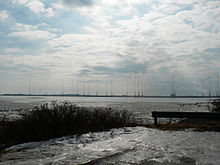
- VLF Transmitter Cutler
-
The VLF Transmitter Cutler is the United States Navy's very low frequency (VLF) station at Cutler, Maine. The station provides one-way communication to the United States strategic submarine forces.
Contents
History
The station began operations in 1913 as a radio telegraphy station in Arlington, Virginia, at a facility next to Fort Myer. Although its broadcasts occasionally included band concerts and speeches, it was most famous for its nightly time signals.[1] The current Cutler Naval Station was built in 1960 and became operational on January 4, 1961.
Transmitter
Cutler Naval Station has a transmission power of 1800 kW, making it the most powerful VLF-transmitter in the world. The transmission consists of a continuous encrypted FSK (F1B) signal at 200 baud.[2] The transmitter operates on 24.0 kHz. In the past it operated on 17.8 kHz. The callsign of the station is NAA.
Antenna
The extensive antenna system consists of two completely separate arrays, designated the “north array” and the “south array”.
Each array consists of six diamond shaped panels supported by 13 towers. The system was designed to allow transmission by one array (single) or both arrays (dual). The central tower of each antenna system is 304 m (997.5 ft) tall. It is surrounded by six 266.7 m (875 ft) tall masts, placed on a ring with a radius of 556 m around the central tower. The remaining six towers of the array are 243.5 m (799 ft) tall and placed on a circle of 935.7 m (3070 ft) around the central tower. [3]
Each radiating element (“panel”) of the antenna is spun between the central tower, two towers of the inner ring and one tower of the outer ring.
The masts are surrounded by free-standing lattice towers. At least one of them is partially guyed.
Antenna maintenance
Antenna maintenance is performed during the summer months. During maintenance periods the station transmits on one array while people work on the other array, which is grounded. This allows continuous transmission, crucial since the Navy closed Annapolis (NSS), the only other East Coast VLF station.
The region where the two arrays come close together, near the transmitter house, is called the "bow-tie area". There are two panels and three towers from each array in this area. The fields on the grounded array are highest in the bow-tie area due to proximity to the active array. The present station operating procedure, based on a past RADHAZ survey, does not allow work on the bow-tie area towers or panels while transmitting on the other array. There is an ongoing tower painting project at Cutler scheduled for completion over the next few years. Under the present station policy, completion of this project would require several months of total downtime, which is unacceptable.
Test transmissions have been arranged, during which only four panels of one array shall be connected to the transmitter. The objective of the four-panel tests was to allow painting and normal maintenance on the bow-tie area towers of an inactive array. A secondary objective of the tests is to determine the antenna operating parameters which had not been measured since changing to 24.0 kHz.
References
- ^ White, Thomas H. (January 1, 2006). "Washington, D.C. AM Station History". http://earlyradiohistory.us/hist-dc.htm. Retrieved 2006-10-11.
- ^ Marten, M. (2007) (in german). Spezial-Frequenzliste 2007-2008, Band 2 (17th ed.). Meckenheim, Germany: Siebel Verlag. pp. 36. ISBN 978-3-88180-665-7.
- ^ Klawitter, G.; Herold, K. & Oexner, M. (2000) (in german). Langwellen- und Laengstwellenfunk. Meckenheim, Germany: Siebel Verlag. pp. 82–83. ISBN 3-89632-043-2.
See also
- Jim Creek Naval Radio Station
- Naval Communication Station Harold E. Holt
- Lualualei VLF transmitter
- List of masts
Further reading
- "NCTCS, Cutler Maine; NCTAMS LANT DET, Cutler East Machias, Maine". GlobalSecurity.org. http://www.globalsecurity.org/military/facility/cutler.htm. Retrieved 2008-02-06.
- A Lockportian Goes "Down East" In Maine (includes photos of NAA towers)
- Hansen, P. (September 1994). "VLF Cutler Hollow Core Cable Repair/Replacement (Technical Report 1681)" (PDF). http://www.spawar.navy.mil/sti/publications/pubs/tr/1681/tr1681.pdf. Retrieved 2008-02-07.
Coordinates: 44°38′47.02″N 67°16′51.85″W / 44.6463944°N 67.2810694°W
Categories:- Military facilities in Maine
- Military radio systems
- Buildings and structures in Washington County, Maine
- United States Navy bases
- Radio stations in Maine
Wikimedia Foundation. 2010.


