- List of districts of Karnataka
-
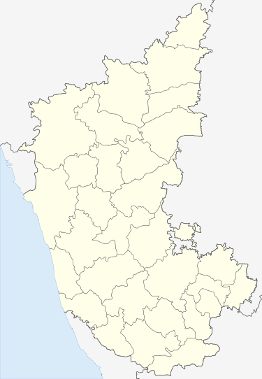
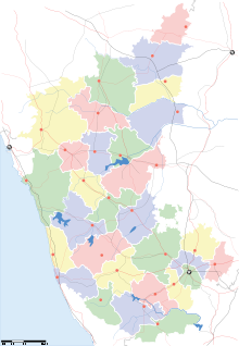 A map showing the 30 districts of Karnataka.
The Indian State of Karnataka is located within 11°30' North and 18°30' North latitudes and 74° East and 78°30' East longitude. It is situated on a tableland where the Western and Eastern Ghat ranges converge into the Nilgiri hill complex, in the western part of the Deccan Peninsular region of India. The State is bounded by Maharastra and Goa States in the north and northwest; the Arabian Sea in the west; Kerala and Tamil Nadu States in the south and the State of Andhra Pradesh in the east. The state covers an area of 191,976 square kilometres (74,122 sq mi), or 5.83% of the total geographical area of India. Geographically, the state is divided into 3 principal regions:the coastal region of Karavali, the hilly Malenadu region comprising the Western Ghats and the Bayaluseeme region comprising the plains of the Deccan plateau.
After Indian independence, Maharaja Jayachamarajendra Wodeyar acceded the princely state of Mysore to India. In 1950, Mysore became an Indian state. Following the long-standing demand of the Ekikarana Movement, Kodagu- and Kannada-speaking regions from the adjoining states of Madras, Hyderabad and Bombay were incorporated into the Mysore state, under the States Reorganization Act of 1956. The thus expanded state was renamed Karnataka, seventeen years later, in 1973.
Karnataka is now divided into 30 districts and 4 administrative divisions. Districts are administered by a District collector, and divisions are administered by a Divisional Commissioner. Bangalore is the capital of the state.
Contents
History
 Mysore State that was created during States Reorganisation of 1956.Main articles: History of Karnataka and Unification of Karnataka
Karnataka took its present shape in 1956, when the states of Mysore and Coorg (Kodagu) were merged with the Kannada-speaking districts of the former states of Bombay, Hyderabad, and Madras. Mysore state was made up of ten districts, Bangalore, Kolar, Tumkur, Mandya, Mysore, Hassan, Chikmagalur (Kadur), Shimoga and Chitradurga; Bellary had been transferred from Madras state to Mysore in 1953, when the new state of Andhra Pradesh was created out of Madras' northern districts.[1] Coorg state became a district,[2] Dakshina Kannada (South Kanara) district was transferred from Madras State, North Kanara, Dharwad District, Belgaum District, and Bijapur District from Bombay State, and Bidar, Gulbarga District, and Raichur district from Hyderabad State.
In 1989, the Bangalore Rural district was split from Bangalore. In 1997 Bagalkot district was split from Bijapur, Chamrajnagar district was split from Mysore, Gadag district was split from Dharwad, Haveri district was split from Dharwad, Koppal district was split from Raichur, Udupi district was split from Dakshina Kannada, and Davanagere district was created from parts of Chitradurga, Shimoga and Bellary.
On June 21, 2007 the Government announced the cabinet approval for the creation of two more districts: Ramanagara District and Chikballapur district. Ramanagara District and Chikballapura District are being formed by the bifurcation of Bangalore Rural District and Kolar Districts respectively. [3]
On December 30, 2009, Yadgir district was carved out of Gulbarga district and officially declared the 30th district of Karnataka. [4]
Administrative Structure
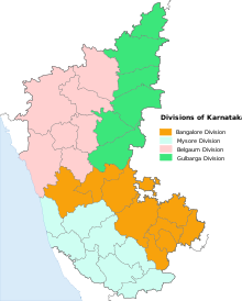 Administrative divisions of Karnataka
A district of an Indian state is an administrative geographical unit, headed by a Deputy Commissioner or District Magistrate, an officer belonging to the Indian Administrative Service. The district magistrate or the deputy commissioner is assisted by a number of officers belonging to the Karnataka Civil Service and other Karnataka state services.
A Superintendent of Police (India), usually an officer belonging to the Indian Police Service is entrusted with the responsibility of maintaining law and order and related issues of the district. He is assisted by the officers of the Karnataka Police Service and other Karnataka Police officials. Cities like Bangalore, Mysore and Hubli-Dharwad are headed by a Commissioner of Police holding the rank of Additional Director General of Police(ADGP) or Inspector General of Police (IGP).
A Deputy Conservator of Forests, an officer belonging to the Indian Forest Service is responsible for managing the forests, the environment and wild-life of the district. He is assisted by the officers of the Karnataka Forest Service and other Karnataka Forest officials and Karnataka wildlife officials.
Sectoral development is looked after by the district head of each development department such as PWD, Health, Education, Agriculture, Animal husbandry, etc. These officers belong to the various state services.
Bangalore Division Belgaum Division Gulbarga Division Mysore Division - Bangalore Urban
- Bangalore Rural
- Chikkaballapur
- Chitradurga
- Davanagere
- Kolar
- Ramanagara
- Shimoga
- Tumkur
Alphabetical listing
Code[5] District Headquarters[6] Established[7][8] Subdivisions Population[6](As of 2001[update]) Area[6] Population density Map BK Bagalkot Bagalkot 15 August 1997[9] 1,651,892 6,575 km2 (2,539 sq mi) 251 /km2 (650 /sq mi)[10] 
BN Bangalore Urban Bangalore 1 November 1956 - Anekal
- Bangalore North
- Bangalore East
- Bangalore South
6,537,124 2,208 km2 (853 sq mi) 2,985 /km2 (7,730 /sq mi)[11] 
BR Bangalore Rural Bangalore 15 August 1986[12] 850,968[13] 2,259 km2 (872 sq mi) 377 /km2 (980 /sq mi) 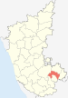
BG Belgaum Belgaum 1 November 1956 4,214,505 13,415 km2 (5,180 sq mi) 314 /km2 (810 /sq mi)[14] 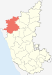
BL Bellary Bellary 1 November 1956 2,027,140 8,450 km2 (3,260 sq mi) 240 /km2 (620 /sq mi)[15] 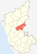
BD Bidar Bidar 1 November 1956 1,502,373 5,448 km2 (2,103 sq mi) 276 /km2 (710 /sq mi)[16] 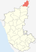
BJ Bijapur Bijapur 1 November 1956 1,806,918 10,494 km2 (4,052 sq mi) 171 /km2 (440 /sq mi)[14] 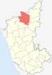
CJ Chamarajanagar Chamarajanagar 15 August 1997[9] 965,462 5,101 km2 (1,970 sq mi) 189 /km2 (490 /sq mi)[17] 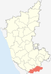
Chikballapur Chikballapur 10 September 2007[9] 1,149,007[18] 4,524 km2 (1,747 sq mi)[18] 308 /km2 (800 /sq mi)[18] 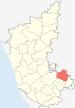
CK Chikmagalur Chikmagalur 1 November 1956 - Chikmagalur
- Kadur
- Koppa
- Mudigere
- Narasimharajapura
- Sringeri
- Tarikere
1,140,905 7,201 km2 (2,780 sq mi) 158 /km2 (410 /sq mi)[17] 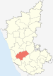
CT Chitradurga Chitradurga 1 November 1956 1,517,896 8,440 km2 (3,260 sq mi) 180 /km2 (470 /sq mi)[19] 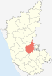
DK Dakshina Kannada Mangalore 1 November 1956 1,897,730 4,560 km2 (1,760 sq mi) 416 /km2 (1,080 /sq mi)[17] 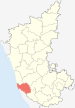
DA Davanagere Davanagere 15 August 1997[9] 1,790,952 5,924 km2 (2,287 sq mi) 333 /km2 (860 /sq mi)[20] 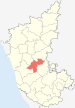
DH Dharwad Dharwad 1 November 1956 1,604,253 4,260 km2 (1,640 sq mi) 376 /km2 (970 /sq mi)[14] 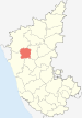
GA Gadag Gadag 24 August 1997[9] 971,835 4,656 km2 (1,798 sq mi) 209 /km2 (540 /sq mi)[14] 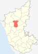
GU Gulbarga Gulbarga 1 November 1956 2,174,742[21] 10,951 km2 (4,228 sq mi) 198.5 /km2 (514 /sq mi) 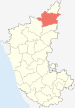
HS Hassan Hassan 1 November 1956 1,721,669 6,814 km2 (2,631 sq mi) 287 /km2 (740 /sq mi)[17] 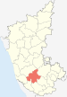
HV Haveri Haveri 24 August 1997[9] 1,439,116 4,823 km2 (1,862 sq mi) 298 /km2 (770 /sq mi)[14] 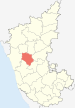
KD Kodagu Madikeri 1 November 1956 548,561 4,102 km2 (1,584 sq mi) 194 /km2 (500 /sq mi)[22] 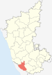
KL Kolar Kolar 1 November 1956 - Bangarapet
- Kolar
- Malur
- Mulbagal
- Srinivaspur
1,387,062[23] 3,969 km2 (1,532 sq mi)[23] 348 /km2 (900 /sq mi)[23] 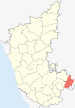
KP Koppal Koppal 24 August 1997[9] 1,196,089 7,189 km2 (2,776 sq mi) 166 /km2 (430 /sq mi)[24] 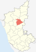
MA Mandya Mandya 1 November 1956
(29 August 1939)[25][26]- Krishnarajpet
- Maddur
- Malavalli
- Mandya
- Nagamangala
- Pandavapura
- Shrirangapattana
1,763,705 4,961 km2 (1,915 sq mi) 355 /km2 (920 /sq mi)[27] 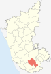
MY Mysore Mysore 1 November 1956 - Heggadadevana kote
- Hunsur
- Krishnarajanagara
- Mysore
- Nanjangud
- Piriyapatna
- T.Narsipur
2,641,027 6,854 km2 (2,646 sq mi) 419 /km2 (1,090 /sq mi)[28] 
RA Raichur Raichur 1 November 1956 1,669,762 6,827 km2 (2,636 sq mi) 244 /km2 (630 /sq mi) 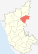
Ramanagara Ramanagara 10 September 2007[9] 1,030,546 3,556 km2 (1,373 sq mi) 290 /km2 (750 /sq mi) 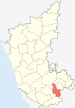
SH Shimoga Shimoga 1 November 1956 1,642,545 8,477 km2 (3,273 sq mi) 194 /km2 (500 /sq mi)[29] 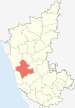
TU Tumkur Tumkur 1 November 1956 - Chiknayakanhalli
- Gubbi
- Koratagere
- Kunigal
- Madhugiri
- Pavagada
- Sira
- Tiptur
- Tumkur
- Turuvekere
2,584,711 10,597 km2 (4,092 sq mi) 244 /km2 (630 /sq mi)[30] 
UD Udupi Udupi 25 August 1997[9] 1,112,243 3,880 km2 (1,500 sq mi) 287 /km2 (740 /sq mi)[17] 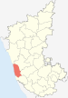
UK Uttara Kannada Karwar 1 November 1956 1,353,644 10,291 km2 (3,973 sq mi) 132 /km2 (340 /sq mi)[14] 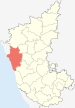
Yadgir Yadgir 30 December 2009[4] 956,180 5,273 km2 (2,036 sq mi) 181.4 /km2 (470 /sq mi) 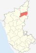
Clickable map
 BijapurChamrajnagarChikmagalurDakshina KannadaShimogaUttara KannadaYadgir
Tajuddin
References
- ^ "Petition against transfer of Bellary dismissed". Indian Express. 30 September 1953. http://news.google.com/newspapers?id=TgJFAAAAIBAJ&sjid=ZbcMAAAAIBAJ&dq=bellary%20district%20madras&pg=6922%2C6087026. Retrieved 17 December 2010.
- ^ Chinnappa, Jeevan (15 November 2005). "Did reorganisation panel ignore Kodava leaders' plea?". The Hindu. http://www.hindu.com/2005/11/15/stories/2005111510700300.htm. Retrieved 17 December 2010.
- ^ "2 new districts notified in Bangalore". Online Edition of The Times of India, dated 2007-08-06. 6 August 2007. http://timesofindia.indiatimes.com/2_new_districts_notified_in_Bangalore/articleshow/2258093.cms. Retrieved 2007-08-09.
- ^ a b "Creation of Yadgir district". Online Edition of The Hindu, dated 2009-12-30 (Chennai, India). 30 December 2009. http://www.hindu.com/2009/12/30/stories/2009123051050300.htm.
- ^ "NIC Policy on format of e-mail Address: Appendix (2): Districts Abbreviations as per ISO 3166–2" (PDF). Ministry Of Communications and Information Technology, Government of India. 2004-08-18. pp. 5–10. https://www.mail.nic.in/docs/MailService_e-mail_address_Policy_WithCodes.pdf. Retrieved 2008-11-24.
- ^ a b c "Know India - Districts of Karnataka". Government of India portal. http://india.gov.in/knowindia/districts/andhra1.php?stateid=KA. Retrieved 16 November 2010.
- ^ Here 'Established' means year of establishment as a district of Karnataka. If the district was formed earlier to the formation of district in the state of Karnataka, 1 Nov 1956 will be considered as the day of establishment of the district.
- ^ "STATES REORGANISATION ACT 1956 - Formation of a new Mysore State". http://www.commonlii.org/in/legis/num_act/sra1956250/. Retrieved 17 November 2010.
- ^ a b c d e f g h i "A Handbook of Karnataka - Administration" (pdf). Government of Karnataka. pp. 354,355. http://www.karunadu.gov.in/gazetteer/HandbookKarnataka2010/Chapter%20IX%20Administration.pdf. Retrieved 16 November 2010.
- ^ a b "Bagalkot district statistics- Area and Population" (PDF). http://bagalkot.nic.in/DISTRICT-STATISTICS/sheet5.pdf. Retrieved 17 November 2010.
- ^ "District at a glance". http://bangaloreurban.nic.in/DAG.pdf. Retrieved 18 November 2010.
- ^ "District Profile". http://bangalorerural.nic.in/District_profile.htm. Retrieved 18 November 2010.
- ^ "Bangalore Rural - District at a glance" (pdf). http://bangalorerural.nic.in/DistAtAGlanceBrur_2008_09PartI.pdf. Retrieved 18 November 2010.
- ^ a b c d e f "Geography & population information(Census-2001) Belgaum Division". http://www.regional-commissioner-belgaum.gov.in/geography.html. Retrieved 18 November 2010.
- ^ "Bellary profile". http://www.bellary.nic.in/BelProf.htm. Retrieved 18 November 2010.
- ^ "Bidar district - Statistics at a glance" (pdf). Bidar district administration. http://bidar.nic.in/Generalfeatures/DAG008-09.pdf. Retrieved 17 November 2010.
- ^ a b c d e "Census 2001". Regional commissioner office Mysore. http://rcmysore.gov.in/Census.htm. Retrieved 18 November 2010.
- ^ a b c "District Profile - Area and population". http://www.chikballapur.nic.in/district_areapopulation-1.html. Retrieved 18 November 2010.
- ^ "District at a glance". http://chitradurga.nic.in/stastics.html. Retrieved 18 November 2010.
- ^ "Davanagere district - A profile". http://davanagere.nic.in/Backup/profile.htm. Retrieved 18 November 2010.
- ^ "Gulbarga district profile". http://gulbarga.nic.in/district_profile.htm. Retrieved 18 November 2010.
- ^ "Kodagu district profile". DSERT. http://dsert.kar.nic.in/dietwebsite/kodagu/index.html. Retrieved 18 November 2010.
- ^ a b c "Kolar district at a glance" (pdf). http://kolar.nic.in/kolar_statistics.pdf. Retrieved 18 November 2010.
- ^ "Koppal District Statistics - Area & Population". http://koppal.nic.in/profile/fprofile.htm. Retrieved 18 November 2010.
- ^ Note: This date means the day when the district was initially formed , even before the formation of the state of Karnataka(Mysore). Hence 1 Nov 1956 will be considered as the day of formation of district in the state of Karnataka
- ^ "Formation of Mandya district". http://www.mandya.nic.in/scmallaiah.htm. Retrieved 18 November 2010.
- ^ "district statistics". http://www.mandya.nic.in/statistics.htm. Retrieved 18 November 2010.
- ^ "Mysore district profile". DSERT. http://dsert.kar.nic.in/dietwebsite/mysore/DistrictProfile.htm. Retrieved 18 November 2010.
- ^ "Shimoga district statistics booklet p5". http://shimoga.nic.in/diststats.pdf. Retrieved 18 November 2010.
- ^ "Ground water information booklet p5". Central ground water board. http://cgwb.gov.in/District_Profile/karnataka/Tumkur_Brochure.pdf. Retrieved 18 November 2010.
 Districts of Karnataka
Bangalore Division Bangalore Urban · Bangalore Rural · Chitradurga · Davanagere · Kolar · Shimoga · Tumkur . Ramanagara. ChikkaballapurBelgaum Division Gulbarga Division Mysore Division Districts of States of India States Andhra Pradesh · Arunachal Pradesh · Assam · Bihar · Chhattisgarh · Goa · Gujarat · Haryana · Himachal Pradesh · Jammu and Kashmir · Jharkhand · Karnataka · Kerala · Madhya Pradesh · Maharashtra · Manipur · Meghalaya · Mizoram · Nagaland · Orissa · Punjab · Rajasthan · Sikkim · Tamil Nadu · Tripura · Uttar Pradesh · Uttarakhand · West Bengal
Union Territories Andaman and Nicobar Islands · Chandigarh · Dadra and Nagar Haveli · National Capital Territory of Delhi · Daman and Diu · Lakshadweep · PuducherryRelated topics List of states and territories of India · District collector · Sub-Divisional Magistrate · Community Development Block · Block Development Officer · Gram panchayatCategories:- Districts of Karnataka
- Karnataka-related lists


Wikimedia Foundation. 2010.