- List of districts of Haryana
-
Haryana a state in the northern region of India and is the nation's seventeenth most populous.[1] The state borders with Punjab and Himachal Pradesh to the north and Rajasthan to the west and south. The river Yamuna defines its eastern border with Uttarakhand and Uttar Pradesh. Haryana also surrounds Delhi on three sides, forming the northern, western and southern borders of Delhi. Consequently, a large area of Haryana is included in the National Capital Region.[2]
On 1 November 1966 Haryana emerged as a separate state with seven districts, according to the partition plan of the then East Punjab. The partition was based on the linguistic demographics and was held after the recommendation of Sardar Hukam Singh—the then Speaker of the Lok Sabha—Parliamentary Committee.[3]
A district of Haryana state is an administrative geographical unit, headed by a Deputy Commissioner or District Magistrate, an officer belonging to the Indian Administrative Service. The district magistrate or the deputy commissioner is assisted by a number of officers belonging to Haryana Civil Service and other state services.
A Superintendent of Police, an officer belonging to the Indian Police Service is entrusted with the responsibility of maintaining law and order and related issues of the district. He is assisted by the officers of the Haryana Police Service and other Haryana Police officials.
A Deputy Conservator of Forests, an officer belonging to the Indian Forest Service is responsible for managing the Forests, environment and wild-life related issues of the district. He is assisted by the officers of the Haryana Forest Service and other Haryana Forest officials and Haryana Wild-Life officials.
Sectoral development is looked after by the district head of each development department such as PWD, Health, Education, Agriculture, Animal husbandry, etc. These officers belong to the various State Services.
Contents
History
At the time of its formation on 1 November, 1966 Haryana state comprised seven districts. 14 more districts were added later by re-organizing the erstwhile districts.
Districts
The details of the twenty-one districts of Haryana state are as follows:
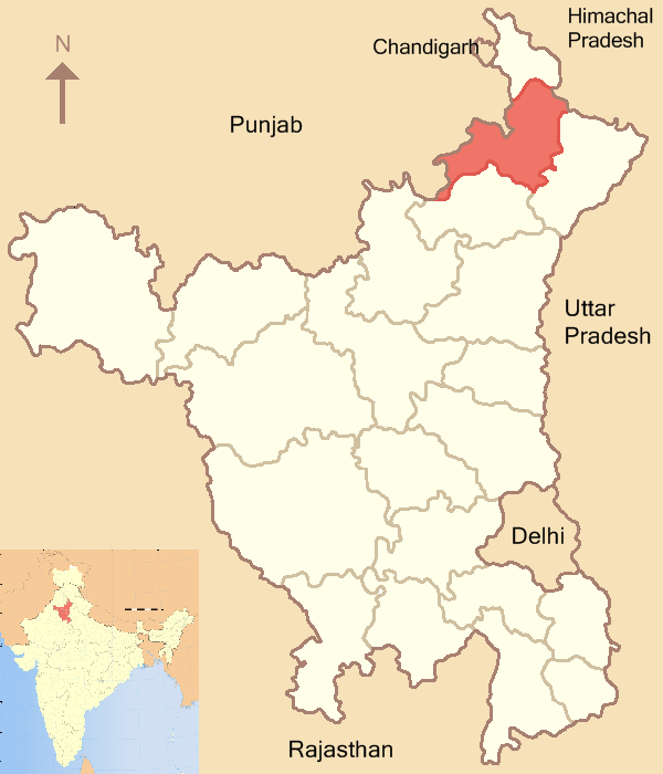
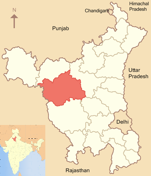
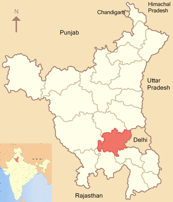
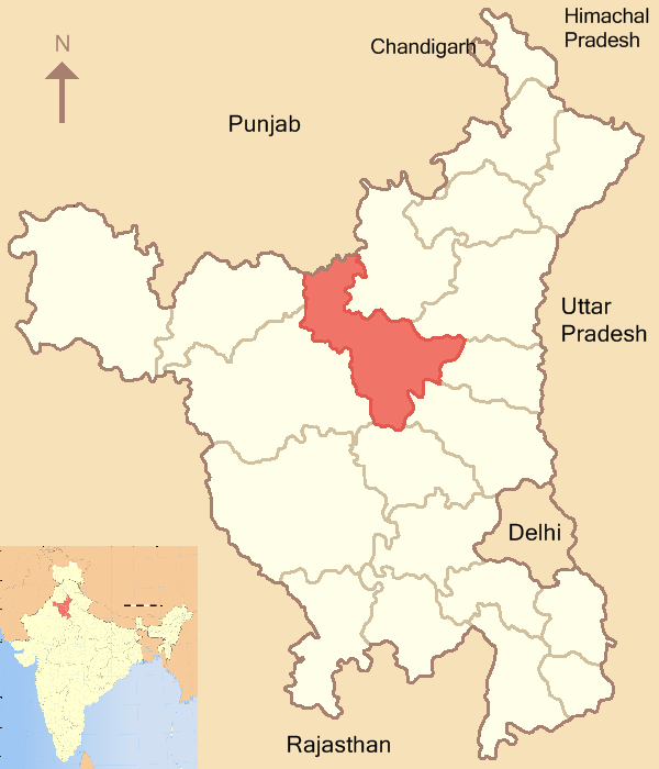
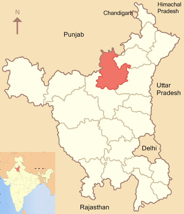
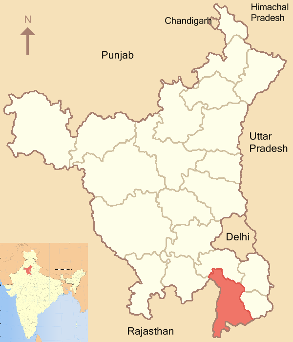
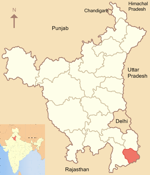
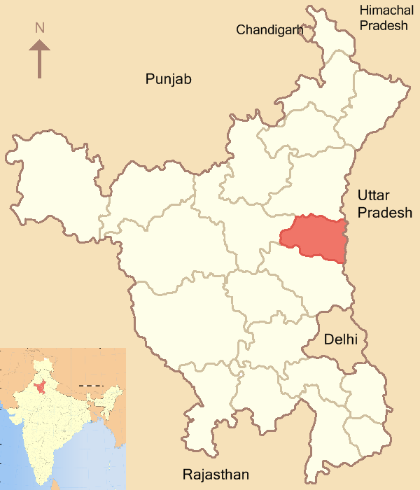
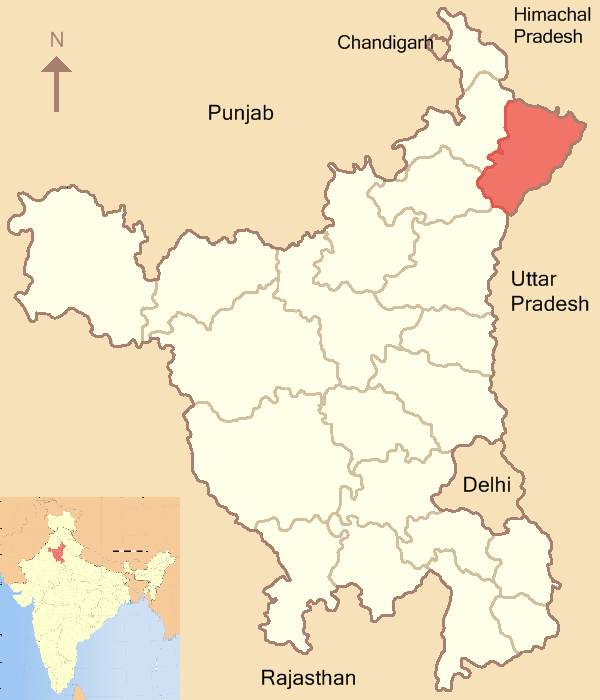
District Code[4][5] Headquarters Established Area (in km²) Population (As of 2011[update])[6] Map Ambala AM Ambala 1 November 1966 1,574 1,136,784 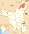
Bhiwani BH Bhiwani 22 December 1972 4,778 1,629,109 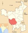
Faridabad FR Faridabad 2 August 1979 1,792 1,798,954 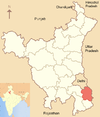
Fatehabad FT Fatehabad 15 July 1997 2,538 941,522 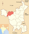
Gurgaon GU Gurgaon 1 November 1966 1,253 1,514,085 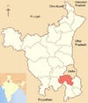
Hisar HI Hisar 1 November 1966 3,983 1,742,815 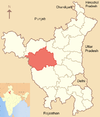
Jhajjar JH Jhajjar 15 July 1997 1,834 956,907 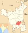
Jind JI Jind 1 November 1966 2,702 1,332,042 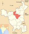
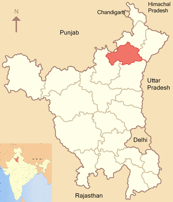
Kaithal KT Kaithal 1 November 1989 2,317 1,072,861 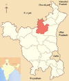
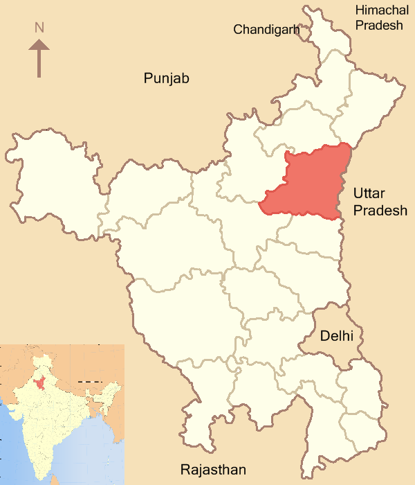
Karnal KR Karnal 1 November 1966 2,520 1,506,323 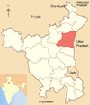
Kurukshetra KU Kurukshetra 23 January 1973 1,530 964,231 
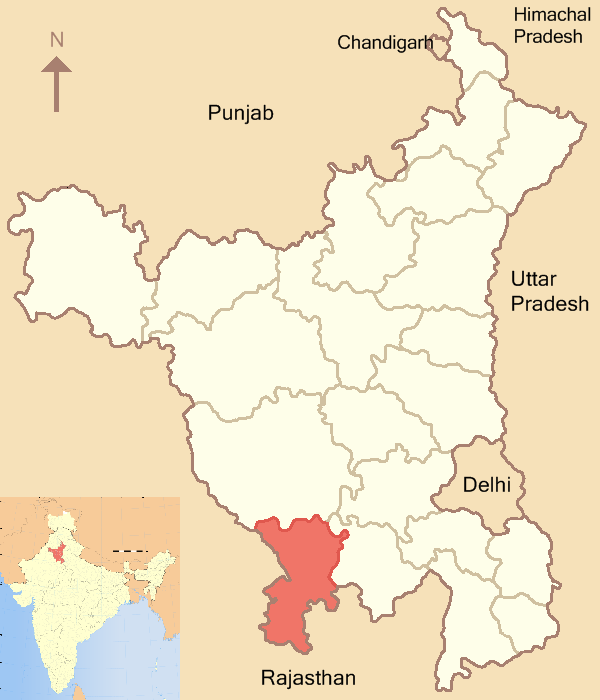
Mahendragarh MA Narnaul 1 November 1966 1,859 921,680 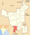
Mewat MW Nuh 4 April 2005 1,874 1,089,406 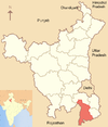
Palwal PL Palwal 13 August 2008 1,359 1,040,493 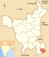
Panchkula PK Panchkula 15 August 1995 898 558,890 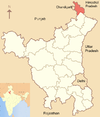
Panipat PP Panipat 1 November 1989 1,268 1,202,811 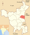
Rewari RE Rewari 1 November 1989 1,582 896,129 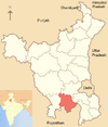
Rohtak RO Rohtak 1 November 1966 1,745 1,058,683 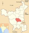
Sirsa SI Sirsa 26 August 1975 4,277 1,295,114 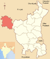
Sonipat SO Sonipat 22 December 1972 2,122 1,480,080 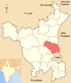
Yamuna Nagar YN Yamunanagar 1 November 1989 1,768 1,214,162 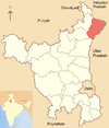
References
- General
- "Districts of India – Haryana". india.gov.in. Government of India. http://india.gov.in/knowindia/andhra1.php?stateid=HR. Retrieved 14 July 2011.
- Specific
- ^ "Size, Growth Rate and Distribution of Population – Ranking of States and Union Territories by population: 2001 and 2011" (PDF). censusindia.gov.in. Ministry of Home Affairs – Office of the Register General & Census Commissioner. p. 47. http://www.censusindia.gov.in/2011-prov-results/data_files/india/Final%20PPT%202011_chapter3.pdf. Retrieved 19 July 2011.
- ^ "Haryana". Encyclopædia Britannica. Encyclopædia Britannica Online. 2011. http://www.britannica.com/EBchecked/topic/256424/Haryana. Retrieved 19 July 2011.
- ^ Khanna, C. L. (2008). Haryana General Knowledge. Delhi: Upkar Prakashan. pp. 10–11. ISBN 8174823832.
- ^ "Districts of India". Statoids.com. http://www.statoids.com/yin.html. Retrieved 15 July 2011.
- ^ "NIC Policy on format of e-mail Address". mail.nic.in. National Informatics Center. https://www.mail.nic.in/docs/MailService_e-mail_address_Policy_WithCodes.pdf. Retrieved July 15, 2011.
- ^ "District-wise Population of Haryana" (DOC). censusindia.gov.in. Ministry of Home Affairs – Office of the Register General & Census Commissioner. http://www.censusindia.gov.in/2011-prov-results/prov_data_products_haryana.html. Retrieved 18 July 2011.
See also
- List of villages in Haryana
Districts of States of India States Andhra Pradesh · Arunachal Pradesh · Assam · Bihar · Chhattisgarh · Goa · Gujarat · Haryana · Himachal Pradesh · Jammu and Kashmir · Jharkhand · Karnataka · Kerala · Madhya Pradesh · Maharashtra · Manipur · Meghalaya · Mizoram · Nagaland · Orissa · Punjab · Rajasthan · Sikkim · Tamil Nadu · Tripura · Uttar Pradesh · Uttarakhand · West Bengal
Union Territories Andaman and Nicobar Islands · Chandigarh · Dadra and Nagar Haveli · National Capital Territory of Delhi · Daman and Diu · Lakshadweep · PuducherryRelated topics List of states and territories of India · District collector · Sub-Divisional Magistrate · Community Development Block · Block Development Officer · Gram panchayatCategories:- Haryana geography stubs
- Districts of Haryana
- Haryana-related lists


Wikimedia Foundation. 2010.