- National Capital Region (India)
-
- This article is about National Capital Region of India which includes Delhi and adjoining urban areas. You might be looking for National Capital Territory of Delhi, or New Delhi. For other uses see National Capital Region (disambiguation).
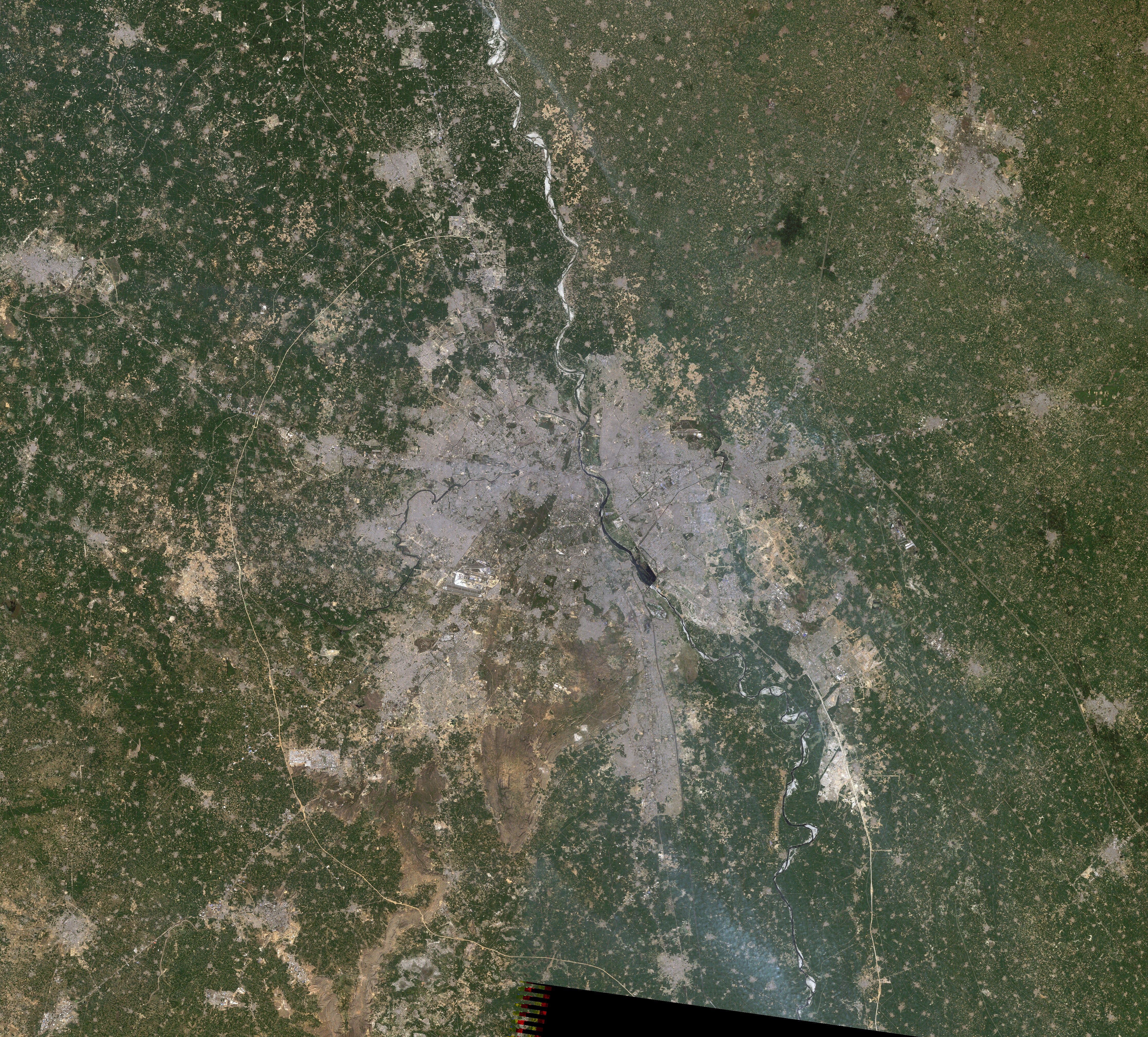
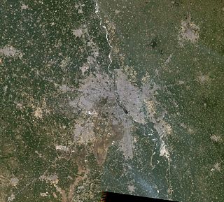 Delhi metropolitan region, satellite image, Landsat-5, 2011-03-12
The National Capital Region (NCR) in India is a name for the conurbation or metropolitan area which encompasses the entire National Capital Territory of Delhi as well as urban areas ringing it in neighbouring states of Haryana, Uttarakhand, Uttar Pradesh and Rajasthan. With a total area of about 33,578 km2 (12,965 sq mi), it is the world's second largest urban agglomeration.[1]
Contents
History
The concept of National Capital Region was mooted in first master plan of Delhi, notified in 1962. The aim of the concept was to develop a metropolitan area around Delhi, so as to divert increasing pressure of population from the region. The concept was essential in order to protect Delhi's infrastructure from excessive pressure and a planned development of the region.
Participating States
Four states are participant in National Capital Region (NCR) of India. These are -
Area-wise contribution of participating states in the NCR. State Area Contributed NCT Delhi 1,483 km2 (573 sq mi) Haryana 13,413 km2 (5,179 sq mi) Uttar Pradesh 10,853 km2 (4,190 sq mi) Rajasthan 7,829 km2 (3,023 sq mi) NCT Delhi
The National Capital Territory of Delhi lies central to the National Capital Region. It includes the city of Delhi and New Delhi, the seat of India's central government. This region has largest concentration of population in whole of the NCR. The population of Delhi as of 2001 census is 13,782,976 persons, population in 2007 was around 17 million.
Haryana
Bounding Delhi on west, north and south Haryana contributes largest area, 13,413 km2 (5,179 sq mi), to the National Capital Region and forms its western and northern territory. The districts of the state included in NCR are :-
Uttar Pradesh
Uttar Pradesh (UP) is a major contributor in the NCR. It bounds Delhi on the east and forms eastern territory of the NCR. The districts of the state included in NCR are :-
- Meerut[3]
- Baghpat[3]
- Bulandshahr[3]
- Ghaziabad 3.314 million (33.14 lakh)[4]
- Gautam Buddha Nagar District (Noida and Greater Noida) 1.202 million (12.02 lakh)[5]
Rajasthan
Rajasthan bounds Delhi on west and forms western territory of the NCR. The district of the state that is included is:
Aims and Objectives
The Plan aims to promote growth and balanced development of the whole region through providing economic base in the identified major settlements (Metro Centres/Regional Centres) for absorbing economic development impulse of Delhi, efficient transport network, development of physical infrastructure, rational land use pattern, improved environment and quality of life.
Zones of NCR
- NCT-Delhi covers an area of 1,483 km2
- Central Capital Region (CNCR) is about 2000 km2. It includes suburbs like Faridabad-Ballabhgarh complex, Gurgaon-Manesar complex, Bahadurgarh, Sonipat-Kundli complex, Ghaziabad-Loni Bulandshahar complex and Noida-Greater Noida complex.
- Highway Corridor Zone proposed with a minimum width of 500 metres on either side of ROW of National Highways. Approximate area is 300 km2 (excluding controlled areas).
Counter Magnets
Counter-magnet towns are identified as those that can be developed as alternative centres of growth and attract migrants to them rather than Delhi. Promoting growth of counter magnet towns are the principal components of the strategy to reduce both migration and population explosion in the Delhi metropolitan area.
These towns are located in six states- Uttarakhand, Madhya Pradesh and Punjab, in addition to Uttar Pradesh, Haryana and Rajasthan, which are already part of the national capital region.
The criterion for selecting counter magnet towns are that they should not be within approximately. 250 km. from Delhi, should have their own established roots and potential of growth and should not be centres of either religious, strategic or environmental importance.
These are:-
- Existing
- New ones
Real Estate Development
The development of the region has given strong impetus to the development of real estate in this entire region. Leading developers like Tata Housing has come up luxury properties such as Raisina Residency and Primanti in Gurgaon. In other areas as well many leading real estate brands have strong presence and are constructing properties in large scale.
References
- ^ http://en.wikipedia.org/wiki/List_of_urban_agglomerations_by_population_(United_Nations)
- ^ Dipak Kumar Dash, TNN, 17 May 2008, 03:33am IST (2008-05-17). "Gurgaon can now go up and up-Delhi-Cities-The Times of India". Timesofindia.indiatimes.com. http://timesofindia.indiatimes.com/Gurgaon_can_now_go_up_and_up/rssarticleshow/3047768.cms. Retrieved 2010-09-01.
- ^ a b c "ncr>>coverage". http://ncrup.up.nic.in/ncr/coverage.htm.
- ^ "indexprof". Ghaziabad.nic.in. http://ghaziabad.nic.in/indexprof.htm. Retrieved 2010-09-01.
- ^ "Welcome to the Gautam Budh Nagar Website". Gbnagar.nic.in. http://gbnagar.nic.in/. Retrieved 2010-09-01.
- ^ a b c d e f g h Bhushan, Ranjit. "Counter Magnets of NCR". Mydigitalfc.com. http://www.mydigitalfc.com/news/ambala-kanpur-taken-counter-magnet-towns-492. Retrieved 2010-09-01.
External links
Categories:- Delhi
- Regions of India
- Metropolitan areas of India
Wikimedia Foundation. 2010.