- List of districts of West Bengal
-
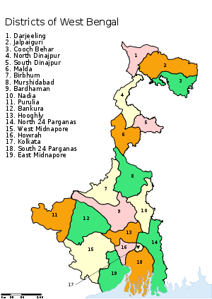 Districts of West Bengal
The Indian state of West Bengal borders with Nepal, Bhutan, Bangladesh and the Indian states of Bihar, Jharkhand, Orissa, Assam and Sikkim. The Himalayas lies in the north of the state and the Bay of Bengal is at the south. In between them, the river Ganges flows eastwards and its main distributary, the Hooghly River, flows south to reach the Bay of Bengal. The Siliguri Corridor, which connects North-East India with rest of the India, lies in the North Bengal region of the state. Geographically, West Bengal is divided into a variety of regions—Darjeeling Himalayan hill region, Terai and Doors region, North Bengal plains, Rarh region, Western plateau and high lands, coastal plains, Sunderbans and the Ganges Delta.[1]
In 1947, when India gained independence, the state of West Bengal was formed with 14 districts, as per partition plan of the then Bengal province of British India.[2][3] The former princely state Koch Bihar joined as a district in 1950,[4] and the former French enclave Chandannagore joined as part of the Hooghly district in 1954.[5] The States Reorganisation Act of 1956 led to addition of Purulia district to the state and to enlargement of West Dinajpur district.[6] Later, larger districts such as West Dinajpur, 24 Parganas and Midnapore were bifurcated.
West Bengal is now divided into nineteen districts under three divisions.[7] Districts are administered by District Magistrates,[8] and divisions are administered by Divisional Commissioners.[7] Kolkata, the capital of the state, constitutes the Kolkata district. Other districts are further divided into administrative units such as subdivisions and blocks, administered by SDO and BDO, respectively. The Panchayati Raj has a three-tier structure in the state. The atomic unit is called a Gram Panchayat, which is the Panchayat organization for a collection of villages.[9] The block-level organizations are called Panchayat Samiti,[10] and the district-level organizations are named Zilla Parishad.[11]
Contents
Geography
West Bengal is bordered by three countries: Nepal, Bhutan and Bangladesh; and five Indian states: Sikkim, Bihar, Jharkhand, Chhattishgarh, Orissa, and Assam. Sikkim and Bhutan are located at the north of the state, Nepal at the northwest, Bihar, Jharkhand and Chhattishgarh at the west, Orissa at the southwest, the Bay of Bengal at the south, and Bangladesh and Assam are at the east. West Bengal is the only state of India that has both the Himalayas in the north and the Bay of Bengal at the south. In between them, the river Ganges enters the state from west, before it branches off into its main distributaries: the Hooghly River, which flows southwards to reach the Bay of Bengal, and the Padma River, which flows eastwards into Bangladesh.
The districts that are located at the north of the Ganges—Darjeeling, Jalpaiguri, Cooch Behar, Malda, North Dinajpur and South Dinajpur—are often referred to collectively as North Bengal.[1] Geographically, this area is divided into the Darjeeling Himalayan hill region, the Terai and Doors region, and the North Bengal plains.[1] The Siliguri Corridor, also known as Chicken's Neck, which connects North-East India with rest of the India, lies in this region. The Indo-Bangladesh enclaves are either enclaves or exclaves of the Cooch Behar district or the Jalpaiguri district.[12]
The districts on the south of the Ganges—Bankura, Bardhaman, Birbhum, Purulia, Murshidabad, Nadia, West Midnapore, East Midnapore, Hooghly, Howrah, Kolkata, North 24 Parganas and South 24 Parganas—constitute a variety of geographical regions such as the Rarh region, the Western plateau and high lands, the coastal plains, the Sunderbans and the Ganges Delta.[1] Kolkata, the capital of the state, constitutes the Kolkata district.
The uninhabited South Talpatti Island, which surfaced in the Bay of Bengal in 1970s near the Indo-Bangladesh border, is claimed by both India and Bangladesh.[13]
History
After India gained independence in 1947, the province of Bengal was partitioned along religious lines. The western part went to India (and was named West Bengal) while the eastern part joined Pakistan as a province called East Bengal (later renamed East Pakistan, giving rise to Bangladesh in 1971).[2] At the time of its creation in 1947, the state of West Bengal was divided into 14 districts—Bankura, Birbhum, Burdwan, Calcutta, Darjeeling, Jalpaiguri, Hooghly, Howrah, Malda, Midnapore, Murshidabad, Nadia, West Dinajpur and 24 Parganas.[3] Cooch Behar district was a princely state named Koch Bihar till 20 August 1949, when the state formally agreed to join India. Transfer of administration was started on 12 September 1949 and was completed on 19 January 1950, when Cooch Behar became a district of West Bengal.[4] Chandernagore, which was earlier part of the French India, had voted to join India in a plebiscite in 1949. Formally, it joined India in 1952 and finally became a part of the Hooghly district of West Bengal on 2 October 1954.[5] The States Reorganisation Act of 1956 reorganized boundaries of the Indian states along linguistic lines. As this act was implemented, the then West Dinajpur district was enlarged with the addition of some areas from Bihar, and the Purulia district was formed on 1 November 1956 from parts of the Manbhum district of Bihar.[6]
Later, some large districts were divided into smaller districts. On 1 March 1986, the district of 24 Parganas was bifurcated into two districts—the North 24 Parganas district and the South 24 Parganas district.[14] On 1 April 1992, the West Dinajpur district was bifurcated into the North Dinajpur district and the South Dinajpur district.[15][16] On 1 January 2002, the erstwhile Midnapore district was bifurcated into the Purba Medinipur district and the Paschim Medinipur district.[17]
Since 2007, the demand for a separate Gorkhaland state has been revived by the Gorkha Janmukti Morcha and its supporters in the Darjeeling hills.[18] The Kamtapur People's Party and its supporters' movement for a separate Kamtapur state that covers the North Bengal has also gained momentum in 2000s.[19]
Administrative structure
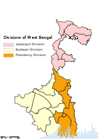 Divisions of West Bengal
A district is governed by a District Collector, who is better known as a District Magistrate (DM) in the state of West Bengal.[8] A DM is an officer from either Indian Administrative Service (IAS) or West Bengal Civil Service (WBCS), and is appointed by the State Government of West Bengal.[8] Each district is divided into subdivisions, except the Kolkata district, which contains urban area only, administered by Kolkata Municipal Corporation. A subdivision is governed by a sub-divisional magistrate (SDM), better known as a Sub-Divisional Officer (SDO).[20] Other than urban units such as town municipalities, a subdivision contains 'community development blocks' (also known as CD blocks or blocks). A block consists of urban units such as census towns and rural units called gram panchayats. A block is administered by a Block Development Officer (BDO), who is appointed by the Government of West Bengal.[8]
A gram panchayat, which consists of a group of villages, is administered by a village council headed by a Pradhan.[9] As per the West Bengal Panchayat Act, 1973, each Block has a Panchayat Samiti, whose members include the Pradhans of the constituent gram panchayats, and the MLAs from the block.[10] A Panchayat Samiti is headed by a Sabhadhipati.[21] The third tier of the Panchayati Raj is Zilla Parishad, a district level organization with the Sabhapatis of the constituent Panchayat Samitis and the MLAs from the district as its members.[11] A Zilla Parishad is headed by a Sabhadhipati.[22] For the Darjeeling district, the Zilla Parishad has ceased to exist, but a similar organization for the Siliguri subdivision exists, which is designated as a Mahakuma Parishad.[23]
The Gorkha Hill Council, formed in 1988, administers three (out of four) subdivisions of the Darjeeling district: Darjeeling Sadar, Kalimpong and Kurseong.[24] Gorkha Hill Council manages the departments of Public Health, Education, Public Works, Transport, Tourism, Market, Small scale industries, Agriculture, Agricultural waterways, Forest (except reserved forests), Water, Livestock, Vocational Training and Sports and Youth services.[25] District administration of Darjeeling, which is still responsible for election, panchayat, law and order, revenue etc., also acts as an interface between the Council and the State Government.[25]
A District Superintendent of Police, better known as a Superintendent of Police, heads the District Police organization of West Bengal Police. This is as per the Police Act of 1861, which is applicable to the whole of India.[26] The Superintendents of Police are officers of the Indian Police Service.[27] For every subdivision, there is a Subdivision Police, headed by a Police officer of the rank of Assistant Superintendent of Police or Deputy Superintendent of Police.[28] Under subdivisions, there are Police Circles, each headed by an Inspector of Police.[28] A Police Circle consists of Police Stations, each headed by an Inspector of Police, or in case of rural areas, by a Sub-Inspector of Police.[28]
The Calcutta High Court has the jurisdiction of the state of West Bengal. Though most of the districts have more courts other than a District Court, not every subdivision of the state has a Court.[29]
A group of districts forms a division, which is administered by a 'Divisional Commissioner'. West Bengal is now divided in nineteen districts, grouped under three divisions:[7]
Jalpaiguri division Burdwan division Presidency division - Cooch Behar
- Darjeeling
- Jalpaiguri
- Malda
- North Dinajpur (Uttar Dinajpur)
- South Dinajpur (Dakshin Dinajpur)
- Bankura
- Bardhaman
- Birbhum
- East Midnapore (Purba Medinipur)
- Hooghly
- Purulia
- West Midnapore (Paschim Medinipur)
- Howrah
- Kolkata
- Murshidabad
- Nadia
- North 24 Parganas (Uttar 24 Parganas)
- South 24 Parganas (Dakshin 24 Parganas)
Alphabetical listing
Code[30] District Headquarters[31] Established[32] Subdivisions[7] Area[31] Population As of 2001[update][31] Population Density Map BN Bankura Bankura 1947 - Bankura Sadar
- Khatra
- Bishnupur
6,882 km2 (2,657 sq mi) 3,192,695 464 /km2 (1,200 /sq mi) 
BR Bardhaman Bardhaman 1947 - Asansol
- Durgapur
- Kalna
- Katwa
- Bardhaman Sadar North
- Bardhaman Sadar South
7,024 km2 (2,712 sq mi) 6,895,514 982 /km2 (2,540 /sq mi) 
BI Birbhum Suri 1947 - Suri Sadar
- Bolpur
- Rampurhat
4,545 km2 (1,755 sq mi) 3,015,422 663 /km2 (1,720 /sq mi) 
KB Cooch Behar Cooch Behar 1950[4] - Cooch Behar Sadar
- Dinhata
- Mathabhanga
- Mekhliganj
- Tufanganj
3,387 km2 (1,308 sq mi) 2,479,155 732 /km2 (1,900 /sq mi) 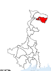
DA Darjeeling Darjeeling 1947 - Darjeeling Sadar
- Kalimpong
- Kurseong
- Siliguri
3,149 km2 (1,216 sq mi) 1,609,172 511 /km2 (1,320 /sq mi) 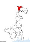
ME East Midnapore Tamluk 2002[17] - Tamluk
- Haldia
- Egra
- Contai
4,785 km2 (1,847 sq mi) 4,417,377 923 /km2 (2,390 /sq mi) 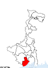
HG Hooghly Chinsura 1947 - Chinsurah
- Chandannagore
- Srirampore
- Arambagh Rajkumar
3,149 km2 (1,216 sq mi) 5,041,976 1,601 /km2 (4,150 /sq mi) 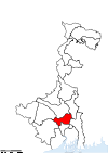
HR Howrah Howrah 1947 - Howrah Sadar
- Uluberia
1,467 km2 (566 sq mi) 4,273,099 2,913 /km2 (7,540 /sq mi) 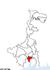
JA Jalpaiguri Jalpaiguri 1947 - Jalpaiguri Sadar
- Malbazar
- Alipurduar
6,227 km2 (2,404 sq mi) 3,401,173 546 /km2 (1,410 /sq mi) 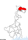
KO Kolkata Kolkata 1947 — 185 km2 (71 sq mi) 4,572,876 24,718 /km2 (64,020 /sq mi) 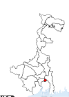
MA Malda English Bazar 1947 3,733 km2 (1,441 sq mi) 3,290,468 881 /km2 (2,280 /sq mi) 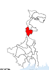
MU Murshidabad Baharampur 1947 - Barhampur
- Domkol
- Lalbag
- Kandi
- Jangipur
5,324 km2 (2,056 sq mi) 5,866,569 1,102 /km2 (2,850 /sq mi) 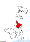
NA Nadia Krishnanagar 1947 - Krishnanagar Sadar
- Kalyani
- Ranaghat
- Tehatta
3,927 km2 (1,516 sq mi) 4,604,827 1,173 /km2 (3,040 /sq mi) 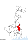
PN North 24 Parganas Barasat 1986[14] - Barrackpore
- Barasat Sadar
- Bangaon
- Basirhat
- Bidhannagar
4,094 km2 (1,581 sq mi) 8,934,286 2,182 /km2 (5,650 /sq mi) 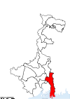
UD North Dinajpur Raiganj 1992[15] - Raiganj
- Islampur
3,140 km2 (1,210 sq mi) 2,441,794 778 /km2 (2,020 /sq mi) 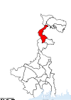
PU Purulia Purulia 1956[6] - Purulia Sadar East
- Purulia Sadar West
- Raghunathpur
6,259 km2 (2,417 sq mi) 2,536,516 405 /km2 (1,050 /sq mi) 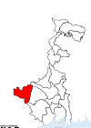
PS South 24 Parganas Alipore 1986[14] - Baruipur
- Canning
- Diamond Harbour
- Kakdwip
- Alipore Sadar
9,960 km2 (3,850 sq mi) 6,906,689 693 /km2 (1,790 /sq mi) 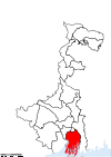
DD South Dinajpur Balurghat 1992[16] - Balurghat
- Gangarampur
2,219 km2 (857 sq mi) 1,503,178 677 /km2 (1,750 /sq mi) 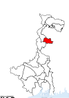
ME West Midnapore Medinipur 2002[17] - Kharagpur
- Medinipur Sadar
- Ghatal
- Jhargram
9,296 km2 (3,589 sq mi) 5,193,411 559 /km2 (1,450 /sq mi) 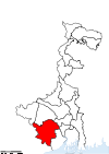
Total — — — 66 88,752 km2 (34,267 sq mi) 80,176,197 903 /km2 (2,340 /sq mi) — See also
References
- ^ a b c d David Christiana (2007-09-01). "Arsenic Mitigation in West Bengal, India: New Hope for Millions" (PDF). Southwest Hydrology. p. 32. http://www.swhydro.arizona.edu/07symposium/presentationpdf/ChristianaD_pro.pdf. Retrieved 2008-12-20.
- ^ a b Harun-or-Rashid. "Partition of Bengal, 1947". Banglapedia. Asiatic Society of Bangladesh. http://banglapedia.search.com.bd/HT/P_0101.htm. Retrieved 2006-10-26.
- ^ a b Chatterji, Joya (2007). The Spoils of Partition: Bengal and India, 1947–1967. Cambridge University Press. p. 58. ISBN 0521875366. http://books.google.co.in/books?id=FjQ0iWSq2R0C&pg=PR6&dq=bengal+1947+district&as_brr=3#PPA58,M1. Retrieved 2008-12-08.
- ^ a b c "Brief History of Cooch Behar". Official website of Cooch Behar District. http://coochbehar.gov.in/HTMfiles/brief_history.html. Retrieved 2008-09-10.
- ^ a b "States of India since 1947". World Statesmen website. Archived from the original on 2008-06-18. http://web.archive.org/web/20080618002451/http://www.worldstatesmen.org/India_states.html. Retrieved 2008-11-07.
- ^ a b c "District profile". Official website of Purulia District. http://purulia.gov.in/district_profile/dist_profile.html. Retrieved 2008-11-18.[dead link]
- ^ a b c d "Directory of District, Sub division, Panchayat Samiti/ Block and Gram Panchayats in West Bengal, March 2008". West Bengal. National Informatics Centre, India. 2008-03-19. http://wbdemo5.nic.in/writereaddata/Directoryof_District_Block_GPs(RevisedMarch-2008).doc. Retrieved 2008-11-19.
- ^ a b c d "Section 2 of West Bengal Panchayat Act, 1973". Department of Panchayat and Rural Department, West Bengal. http://wbdemo5.nic.in/html/asp/g2csw/sections/2.htm. Retrieved 2008-12-09.
- ^ a b "Section 9 of West Bengal Panchayat Act, 1973". Department of Panchayat and Rural Department, West Bengal. http://wbdemo5.nic.in/html/asp/g2csw/sections/9.htm. Retrieved 2008-12-09.
- ^ a b "Section 94 of West Bengal Panchayat Act, 1973". Department of Panchayat and Rural Department, West Bengal. http://wbdemo5.nic.in/html/asp/g2csw/sections/94.htm. Retrieved 2008-12-09.
- ^ a b "Section 140 of West Bengal Panchayat Act, 1973". Department of Panchayat and Rural Department, West Bengal. http://wbdemo5.nic.in/html/asp/g2csw/sections/140.htm. Retrieved 2008-12-09.
- ^ Evgeny Vinokurov (2005). "Theory of Enclaves, Chapter 6: Enclave stories and case studies" (PDF). Evgeny Vinokurov's website. p. 17. http://www.vinokurov.info/downloads/ch6enclavecasestudies.pdf. Retrieved 2008-12-20.[dead link]
- ^ A.G. Noorani (2001-08-31). "Of Indo-Bangladesh distrust". Frontline magazine. http://www.hinduonnet.com/fline/fl1817/18170730.htm. Retrieved 2008-12-29.
- ^ a b c Mandal, Asim Kumar (2003). The Sundarbans of India: A Development Analysis. Indus Publishing. pp. 168–169. ISBN 8173871434. http://books.google.com/books?id=jbKGojVTWGcC&pg=PA168&lpg=PA168&dq=24+parganas+history+divide+two+district&source=web&ots=PHyZZn5Uu2&sig=uy8P9MDvn3wbnTS7GPMi53I3cH0&hl=en&sa=X&oi=book_result&resnum=1&ct=result#PPA169,M1. Retrieved 2008-09-04.
- ^ a b "Home page". Official website of Uttar Dinajpur District. http://uttardinajpur.nic.in/. Retrieved 2008-09-01.
- ^ a b "Historical Perspective". Official website of South Dinajpur District. http://ddinajpur.nic.in/Historical_Perspective/historical_perspective.html. Retrieved 2008-09-01.
- ^ a b c Jana, Naresh (2001-12-31). "Tamluk readies for giant's partition". The Telegraph (Kolkata). http://www.telegraphindia.com/1011231/national.htm#head3. Retrieved 2008-09-01.
- ^ "Call for Gorkhaland renewed". Darjeeling Times. 2007-10-07. http://www.darjeelingtimes.com/news/Top-Story/Call-for-Gorkhaland-renewed.html. Retrieved 2008-12-11.
- ^ Indo Asian News Service (2008-06-25). "West Bengal faces another blockade, this time for Kamtapur state". AOL India News. http://www.aol.in/news-story/west-bengal-faces-another-blockade-this-time-for-kamtapur-state/2008062513039012000006/index.html. Retrieved 2008-12-11.
- ^ Ramesh Kumar Arora, Ramesh Kumar Arora Rajni Goyal. Indian Public Administration: Institutions and Issues. New Age Publishers. p. 298. ISBN 8173280681. http://books.google.co.in/books?id=nvzcy7o4sgAC&pg=PA298&dq=collector+SDO+BDO#PPA297,M1. Retrieved 2008-12-09.
- ^ "Section 98 of West Bengal Panchayat Act, 1973". Department of Panchayat and Rural Department, West Bengal. http://wbdemo5.nic.in/html/asp/g2csw/sections/98.htm. Retrieved 2008-12-09.
- ^ "Section 143 of West Bengal Panchayat Act, 1973". Department of Panchayat and Rural Department, West Bengal. http://wbdemo5.nic.in/html/asp/g2csw/sections/143.htm. Retrieved 2008-12-09.
- ^ "Section 185 of West Bengal Panchayat Act, 1973". Department of Panchayat and Rural Department, West Bengal. http://wbdemo5.nic.in/html/asp/g2csw/sections/185.htm. Retrieved 2008-12-09.
- ^ "Memoranda of Settlement - DGHC". Darjeeling Times. http://www.darjeelingtimes.com/news/Historic-Documents/Memorandum-of-Settlement.html. Retrieved 2008-12-11.
- ^ a b "History of Darjeeling: Darjeeling-Today". Official website of Darjeeling District. http://darjeeling.gov.in/darj-hist.html#drj-today. Retrieved 2008-12-29.
- ^ "The Police Act, 1861". India Code Legislative Department. http://indiacode.nic.in/fullact1.asp?tfnm=186105. Retrieved 2008-12-14.
- ^ "Indian Police Service (Uniform) Rules". Ministry of Personnel, Public Grievances and Pensions, Government of India. http://persmin.nic.in/ais/B11new.htm#s17. Retrieved 2008-12-14.[dead link]
- ^ a b c "Police Organization of India" (PDF). Commonwealth Human Rights Initiative. p. 9. http://www.humanrightsinitiative.org/publications/police/police_organisations.pdf. Retrieved 2008-12-14.
- ^ "Different Courts in West Bengal (Other than High Courts, Kolkata)". Judicial Department, Government of West Bengal. http://www.banglarmukh.com/e-gov/English/Departments/DeptDetails.asp?DPId=140&LinkId=6&Type=1. Retrieved 2008-12-14.
- ^ "NIC Policy on format of e-mail Address: Appendix (2): Districts Abbreviations as per ISO 3166–2" (PDF). Ministry Of Communications and Information Technology, Government of India. 2004-08-18. pp. 5–10. https://www.mail.nic.in/docs/MailService_e-mail_address_Policy_WithCodes.pdf. Retrieved 2008-11-24.
- ^ a b c "Districts : West Bengal". Government of India portal. http://india.gov.in/knowindia/districts/andhra1.php?stateid=WB. Retrieved 2008-11-24.
- ^ Here 'Established' means year of establishment as a district of West Bengal. The state of West Bengal was established in 1947 with 14 districts of erstwhile Bengal province of British India.
External links
Divisions & Districts of West Bengal Burdwan division Bankura · Bardhaman · Birbhum · Hooghly · Paschim Medinipur · Purba Medinipur · Purulia
Jalpaiguri division Presidency division Districts of States of India States Andhra Pradesh · Arunachal Pradesh · Assam · Bihar · Chhattisgarh · Goa · Gujarat · Haryana · Himachal Pradesh · Jammu and Kashmir · Jharkhand · Karnataka · Kerala · Madhya Pradesh · Maharashtra · Manipur · Meghalaya · Mizoram · Nagaland · Orissa · Punjab · Rajasthan · Sikkim · Tamil Nadu · Tripura · Uttar Pradesh · Uttarakhand · West Bengal
Union Territories Andaman and Nicobar Islands · Chandigarh · Dadra and Nagar Haveli · National Capital Territory of Delhi · Daman and Diu · Lakshadweep · PuducherryRelated topics List of states and territories of India · District collector · Sub-Divisional Magistrate · Community Development Block · Block Development Officer · Gram panchayatCategories:- Districts of West Bengal
- West Bengal-related lists


Wikimedia Foundation. 2010.