- Murshidabad
-
Murshidabad — city — Coordinates 24°11′N 88°16′E / 24.18°N 88.27°ECoordinates: 24°11′N 88°16′E / 24.18°N 88.27°E Country India State West Bengal District(s) Murshidabad Parliamentary constituency Murshidabad Assembly constituency Murshidabad Population 36,894 (2001[update]) Time zone IST (UTC+05:30) Area
• 10 metres (33 ft)
Murshidabad (Bengali: মুর্শিদাবাদ) is a city in Murshidabad district of West Bengal state in India. The city of Murshidabad is located on the southern bank of the Bhagirathi, a distributary of the Ganges River. It was the capital of undivided Bengal during the Mughal rule. Nawabs of Bengal used to rule Bengal from this city. It is still inhabited, but has none of the glory it used to have- except for the royal buildings. Earlier European spellings include Muxadavad, Murshedabud, Murshedabad, Murshedebad, Murshidabud, Murshidabad, Murshidebad, Mursedabad, Mursidabud, Mursidabad, Moorshedabud, Moorshedabad, Moorshedebad, Moorshidabad, Moorsedabad, Moorsidabad, Mourshedabad, Mourshedebad, and Mourshidabad, Murschidabad, Murschedabad, Moorschedabad, and Moorschidabad, and among others.
Contents
History
Mushidabad or Moorsheedabad, a town and district of British India, in the Presidency division of Bengal. The administrative headquarters of the district are at Berhampur. The town of Murshidabad is on the left bank of the Bhagirathi or old sacred channel of the Ganges. Pop. (1901), 15,168. The city of Murshidabad was the latest capital of Bengal before British era. In 1704 the nawab Murshid Quli Khan changed the seat of government from Dhaka to Maksudabad, which he called after his own name. The family of Jagat Seth maintained their position as state bankers at Murshidabad from generation to generation. Even after the conquest of Bengal by the British, Murshidabad remained for some time the seat of administration. Warren Hastings removed the supreme civil and criminal courts to Calcutta in 1772, but in 1 775 the latter court was brought back to Murshidabad again. In 1790, under Lord Cornwallis, the entire revenue and judicial staffs were fixed at Calcutta. The town is still the residence of the nawab, who ranks as the first nobleman of the province with the style of Nawab Bbahadur of Murshidabad, instead of Nawab Nazim of Bengal. The Murshidabad palace, dating from 1837, is a magnificent building in Italian style. The city still bears memories of Nawabs with other palaces, mosques, tombs, and gardens, and retains such industries as carving in ivory, gold and silver embroidery, and silk-weaving. An educational institution is named after Nawab family.
The District Of Murshidabad has an area of 2143 sq. m. It is divided into two nearly equal portions by the Bhagirathi, the ancient channel of the Ganges. The tract to the west, known as the Rarh, consists of hard clay and nodular limestone. The general level is high, but interspersed with marshes and seamed by hill torrents. The Bagri or eastern half belongs to alluvial plains of eastern Bengal. There are few permanent swamps; but the whole country is low-lying, and liable to annual inundation. In the north-west are a few small detached hillocks, said to be of basaltic formation. Pop. (1901), 1,333,184, showing an increase of 6.6% in the decade. The major industry is that of silk, formerly of much importance, and now revived with government assistance. The city is also famous for producing exotic mango and litchi. A narrow-gauge railway crosses the district, from the East Indian line at Nalhati to Azimganj on the Bhagirathi, the home of many rich Jain merchants; and a branch of the Eastern Bengal railway has been opened.Berhampore is the capital of Murshidabad. The town now become a very well known town and also populated, the area are of this town increasing gradually.
Demographics
As of 2001[update] India census,[1] Murshidabad had a population of 36,894. Males constitute 51% of the population and females 49%. Majority of the people are Muslim. Murshidabad has an average literacy rate of 66%, higher than the national average of 59.5%: male literacy is 71%, and female literacy is 61%. In Murshidabad, 12% of the population is under 6 years of age.
Some Bhumihar Brahmins had settled in Chandipur, Murshidabad during late nineteenth and early twentieth century where they were the local landlords and are at the top of the social hierarchy.[2]
Murshidabad City
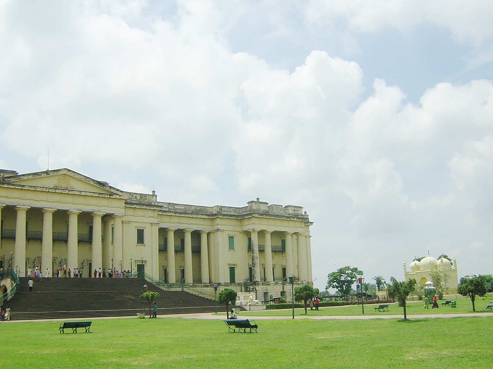
 Murshidabad Palace
The origins of Murshidabad are not entirely clear. According to Ghulam Hussain, author of the Riyaz-us-Salatin, a merchant named Makhsus Khan first improved the present site of Murshidabad. Makhsus Khan had been mentioned in Akbar's biography, the Ain-i-Akbari, as a nobleman who served in Bengal and Bihar during the last decades of the sixteenth century. In Valentyn's map (1658–64) Moxudabath is shown on an island formed by the two branches of the Ganges.
In 1704, Murshid Quli Khan, the Diwan of Bengal under Aurangzeb transferred the capital from Dacca (now Dhaka in Bangladesh), and renamed the city Murshidabad. In 1716, he attained the title of Nawab (ruler) of the Subah (province) of Bengal, and Murshidabad became his capital. It continued to be the capital under a succession of Nawabs, and also under the British until 1790. It was constituted as a municipality in 1869, which remains to the present day.
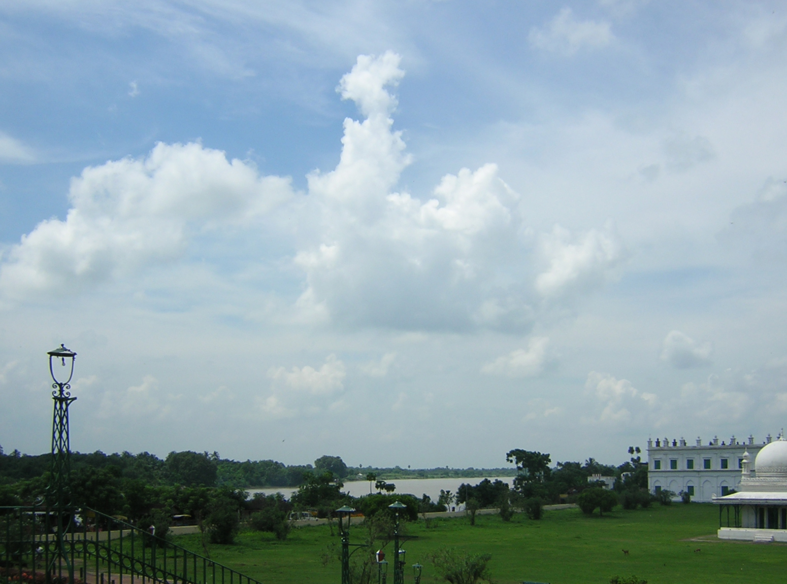
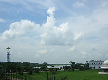 palace ground and Hoogly river
While it features extensively in history books, the large potential for heritage tourism has been somewhat neglected. Of historic interest are Nizamat Kila (the Fortress of the Nawabs), also known as the Hazaarduari Palace (Palace of a Thousand Doors), built by Duncan McLeod of the Bengal Engineers in 1837, in the Italianate style, the Moti Jhil (Pearl Lake) just to the south of the palace, the Muradbagh Palace and the Khushbagh Cemetery, where the remains of Ali Vardi Khan and Siraj Ud Daulah are interred.
The city today is a center for agriculture, handicrafts and sericulture. The famous Murshidabad Silk, much in demand for making saris and scarves, is produced in the like-named city in Uttar Pradesh.
Murshidabad District
The district of Murshidabad - 2,062 sq mi (5,341 km²), population 5.863m (2001 census) - has its district headquarters at Baharampur. The district comprises two distinct regions separated by the Bhagirathi River. To the west lies the Rarh region, a high, undulating continuation of the Chota Nagpur plateau. The eastern portion, the Bagri, is a fertile, low-lying alluvial tract, part of the Ganges Delta. The district is drained by the Bhagirathi and Jalangi rivers and their tributaries. Rice, jute, legumes, oilseeds, wheat, barley, and mangoes are the chief crops in the east; extensive mulberry cultivation is carried out in the west. The district became part of the Gaur kingdom in 1197 and passed to the British East India Company in the 18th century.
 Hazarduari Palace
Current MLA from Murshidabad assembly constituency is Bivas Chakraborty of AIFB, who won the seat in State elections of 2006. Chhaya Ghosh of FBL had won this seat in 2001, 1991, 1982 and in 1977. Independent candidate Mozammel Haque was MLA from this seat in 1996. Mannan Hossain of INC had won this seat in 1987.[3]
Murshidabad assembly constituency is part of Murshidabad (Lok Sabha constituency).[4]
References
 This article incorporates text from a publication now in the public domain: Chisholm, Hugh, ed (1911). Encyclopædia Britannica (11th ed.). Cambridge University Press.
- ^ "Census of India 2001: Data from the 2001 Census, including cities, villages and towns (Provisional)". Census Commission of India. Archived from the original on 2004-06-16. http://web.archive.org/web/20040616075334/http://www.censusindia.net/results/town.php?stad=A&state5=999. Retrieved 2008-11-01.
- ^ Nicholas, Ralph W. (2003). Fruits of worship: practical religion in Bengal. Orient Blackswan. pp. 248 (at p 35). ISBN 978-8180280061.
- ^ "State Elections 2006 - Partywise Comparison for 58 - Murshidabad Constituency of West Bengal". Election Commission of India. http://eci.gov.in/electionanalysis/AE/S25/partycomp58.htm. Retrieved 2008-10-27.
- ^ "Assembly Constituencies - Corresponding Districts and Parliamentary Constituencies". West Bengal. Election Commission of India. http://archive.eci.gov.in/se2001/background/S25/WB_Dist_PC_AC.pdf. Retrieved 2008-10-02.
External links
Cities and towns in Murshidabad District Barhampur subdivision Domkol subdivision Lalbag subdivision Kandi subdivision Jangipur subdivision Anup Nagar · Aurangabad · Chachanda · Charka · Dafahat · Dhulian · Dhusaripara · Farrakka Barrage Township · Fatellapur · Ghorsala · Jagtaj · Jahangirpur · Jot Kamal · Kankuria · Khodarampur · Paschim Punropara · Sahajadpur · Serpur · Srikantabati · Uttar MahammadpurRelated topics Murshidabad topics · People from Murshidabad district · Villages in Murshidabad districtCities and towns
in other districtsBankura · Bardhaman · Birbhum · Cooch Behar · Dakshin Dinajpur · Darjeeling · Hooghly · Howrah · Jalpaiguri · Malda · Nadia · North 24 Parganas · Paschim Medinipur · Purba Medinipur · Purulia · South 24 Parganas · Uttar DinajpurMurshidabad district topics General Alkap • Farakka Barrage • Farakka Super Thermal Power Station • Gauda • Kankagrambhukti • KarnasubarnaHistory Alivardi Khan • Battle of Plassey • Jagat Seth • Mir Jafar • Murshid Quli Khan • Nawab of Bengal • Shashanka • Siraj ud-DaulahSubdivisions Locations
other than cities and townsMunicipalities Community development blocks Barhampur subdivision Berhampore • Beldanga I • Beldanga II • Hariharpara • Naoda Domkol subdivision Domkal • Raninagar I • Raninagar II • Jalangi Jangipur subdivision Raghunathganj I • Raghunathganj II • Suti I • Suti II • Samserganj • Sagardighi • Farakka Kandi subdivision Kandi • Khargram • Burwan • Bharatpur I • Bharatpur II Lalbag subdivision Murshidabad-Jiaganj • Bhagawangola I • Bhagawangola II • Lalgola • NabagramRivers Transport Lok Sabha constituencies Baharampur • Jangipur • MurshidabadVidhan Sabha constituencies Farakka • Samserganj • Suti • Jangipur • Raghunathganj • Sagardighi • Lalgola • Bhagabangola • Raninagar • Murshidabad • Nabagram • Khargram • Burwan • Kandi • Bharatpur • Rejinagar • Beldanga • Baharampur • Hariharpara • Naoda • Domkal • JalangiFormer Vidhan Sabha constituencies AurangabadSee also Cities and towns in Murshidabad district • People from Murshidabad district • Villages in Murshidabad districtOther districts in West Bengal Bankura • Bardhaman • Birbhum • Cooch Behar • Dakshin Dinajpur • Darjeeling • Hooghly • Howrah • Jalpaiguri • Kolkata • Malda • Nadia • North 24 Parganas • Paschim Medinipur • Purba Medinipur • Purulia • South 24 Parganas • Uttar DinajpurSurrounding areas outside West Bengal Jharkhand Cities and towns in Santhal Parganas • Santhal Pargana division topics Bangladesh Rajshahi Division • Khulna DivisionMunicipalities & CD blocks of West Bengal Municipal
CorporationsMunicipalities Alipurduar · Arambagh · Ashoknagar Kalyangarh · Baduria · Baidyabati · Bally · Balurghat · Bangaon · Bankura · Bansberia · Baranagar · Barasat · Bardhaman · Barrackpore · Baruipur · Basirhat · Beldanga · Berhampore · Bhadreswar · Bhatpara · Bidhannagar · Birnagar · Bishnupur · Bolpur · Budge Budge · Chakdaha · Champdani · Chandrakona · Contai · Cooch Behar · Dainhat · Dalkhola · Darjeeling · Dhulian · Dhupguri · Diamond Harbour · Dinhata · Dubrajpur · Dum Dum · Egra · English Bazar · Gangarampur · Garulia · Gayespur · Ghatal · Gobardanga · Guskara · Habra · Haldia · Haldibari · Halisahar · Hugli-Chuchura · Islampur · Jalpaiguri · Jamuria · Jangipur · Jhalda · Jhargram · Jiaganj Azimganj · Jaynagar Mazilpur · Kaliaganj · Kalimpong · Kalna · Kalyani · Kamarhati · Kanchrapara · Kandi · Katwa · Kharagpur · Kharar · Khardaha · Kshirpai · Konnagar · Krishnanagar · Kulti · Kurseong · Madhyamgram · Maheshtala · Mal · Mathabhanga · Mekhliganj · Memari · Midnapore · Murshidabad · Nabadwip · Naihati · Nalhati · New Barrackpur · North Barrackpur · North Dumdum · Old Maldah · Panihati · Panskura · Pujali · Purulia · Raghunathpur · Raiganj · Rajarhat · Rajpur Sonarpur · Ramjibanpur · Rampurhat · Ranaghat · Raniganj · Rishra · Sainthia · Shantipur · Serampore · Sonamukhi · South Dumdum · Suri · Taki · Tamluk · Tarakeswar · Titagarh · Tufanganj · Uluberia · Uttarpara Kotrung
Community
development
blocks*A Alipuduar I · Alipurduar II · Amdanga · Amta I · Amta II · Andal · Arambagh · Arsha · Ausgram I · Ausgram II B Baduria · Bagdah · Baghmundi · Bagnan I · Bagnan II · Balagarh · Balarampur · Balurghat · Bally Jagachha · Bamangola · Bandwan · Bangaon · Bankura I · Bankura II · Barjora · Bansihari · Barabani · Barabazar · Barrackpore I · Barrackpore II · Barasat I · Barasat II · Baruipur · Basanti · Basirhat I · Basirhat II · Beldanga I · Beldanga II · Berhampore · Bhagawangola I · Bhagawangola II · Bhagabanpur I · Bhagabanpur II · Bhangore I · Bhangore II · Bharatpur I · Bharatpur II · Bhatar · Binpur I · Binpur II · Bishnupur, Bankura · Bishnupur I, South 24 Parganas · Bishnupur II, South 24 Parganas · Bolpur Sriniketan · Budge Budge I · Budge Budge II · Burdwan I · Burdwan II · Burwan C Canning I · Canning II · Chakdaha · Chanchal I · Chanchal II · Chandipur · Chanditala I · Chanditala II · Chapra · Chandrakona I · Chandrakona II · Chhatna · Chinsurah-Mogra · Chopra · Contai I · Contai II · Contai III · Cooch Behar I · Cooch Behar II D Darjeeling Pulbazar · Dantan I · Dantan II · Daspur I · Daspur II · Debra · Deganga · Diamond Harbour I · Diamond Harbour II · Deshapran · Dhaniakhali · Dhupguri · Dinhata I · Dinhata II · Domjur · Domkal · Dubrajpur E Egra I · Egra II · English Bazar F Falakata · Falta · Farakka · Faridpur-Durgapur G Gaighata · Galsi I · Galsi II · Gangajalghati · Gangarampur · Garhbeta I · Garhbeta II · Garhbeta III · Gazole · Ghatal · Goalpokhar I · Goalpokhar II · Goghat I · Goghat II · Gopiballavpur I · Gopiballavpur II · Gorubathan · Gosaba H Habibpur · Habra I · Habra II · Haldia · Haldibari · Hanskhali · Hariharpara · Haringhata · Haripal · Harirampur · Harishchandrapur I · Harishchandrapur II · Haroa · Hasnabad · Hemtabad · Hili · Hingalganj · Hirbandh · Hura I Ilambazar · Indas · Indpur · Islampur · Itahar J Jagatballavpur · Jalangi · Jalpaiguri · Jamalpur · Jamboni · Jamuria · Jangipara · Jaynagar I · Jaynagar II · Jhalda I · Jhalda II · Jhargram · Jorebunglow Sukhiapokhri · Joypur, Bankura · Joypur, Purulia · K Kakdwip · Kalchini · Kaliachak I · Kaliachak II · Kaliachak III · Kaliaganj · Kaliganj · Kalimpong I · Kalimpong II · Kalna I · Kalna II · Kandi · Kanksa · Karandighi · Karimpur I · Karimpur II · Kashipur · Katwa I · Katwa II · Keshiari · Keshpur · Ketugram I · Ketugram II · Khanakul I · Khanakul II · Khandaghosh · Kharagpur I · Kharagpur II · Khargram · Kharibari · Khatra · Khejuri I · Khejuri II · Khoyrasole · Kotulpur · Krishnaganj · Krishnanagar I · Krishnanagar II · Kulpi · Kultali · Kumarganj · Kumargram · Kurseong · Kushmandi L Labpur · Lalgola M Madarihat-Birpara · Magrahat I · Magrahat II · Mahisadal · Mal · Manbazar I · Manbazar II · Mandirbazar · Manikchak · Manteswar · Mathabhanga I · Mathabhanga II · Mathurapur I · Mathurapur II · Matiali · Matigara · Maynaguri · Mayureswar I · Mayureswar II · Mejia · Mekhliganj · Memari I · Memari II · Midnapore Sadar · Minakhan · Mirik · Mohammad Bazar · Mohanpur · Mongalkote · Moyna · Murarai I · Murarai II · Murshidabad-Jiaganj N Nabadwip · Nabagram · Nagrakata · Nakashipara · Nalhati I · Nalhati II · Namkhana · Nandakumar · Nandigram I · Nandigram II · Nanoor · Naoda · Narayangarh · Naxalbari · Nayagram · Neturia O Old Malda · Onda · P Panchla · Pandabeswar · Pandua · Panskura I · Panskura II · Para · Patashpur I · Patashpur II · Patharpratima · Patrasayer · Phansidewa · Pingla · Polba-Dadpur · Puncha · Purbasthali I · Purbasthali II · Pursurah · Purulia I · Purulia II R Raghunathganj I · Raghunathganj II · Raghunathpur I · Raghunathpur II · Raiganj · Raina I · Raina II · Raipur · Rajarhat · Rajganj · Rajnagar · Ramnagar I · Ramnagar II · Rampurhat I · Rampurhat II · Ranaghat I · Ranaghat II · Rangli Rangliot · Ranibandh · Raniganj · Raninagar I · Raninagar II · Ratua I · Ratua II S Sabang · Sagar · Sagardighi · Sahid Matangini · Sainthia · Salanpur · Salboni · Saltora · Samserganj · Sandeshkhali I · Sandeshkhali II · Sankrail, Howrah · Sankrail, Paschim Medinipur · Santipur · Santuri · Sarenga · Shyampur I · Shyampur II · Simlapal · Singur · Sitai · Sitalkuchi · Sonamukhi · Sonarpur · Sreerampur-Uttarpara · Suri I · Suri II · Sutahata · Suti I · Suti II · Swarupnagar T Taldangra · Tamluk · Tapan · Tarakeswar · Tehatta I · Tehatta II · Thakurpukur Mahestala · Tufanganj I · Tufanganj II U Udaynarayanpur · Uluberia I · Uluberia II
- Similar to Tehsils in many states of India
Categories:- Cities and towns in Murshidabad district
- Former Indian capital cities


Wikimedia Foundation. 2010.