- Dum Dum
-
For other uses, see Dum Dum (disambiguation).
Dum Dum — city — Coordinates 22°37′N 88°25′E / 22.62°N 88.42°ECoordinates: 22°37′N 88°25′E / 22.62°N 88.42°E Country India State West Bengal District(s) North 24 Parganas Parliamentary constituency Dum Dum Assembly constituency Dum Dum Population 392,150 (2001[update]) Time zone IST (UTC+05:30) Area
• 11 metres (36 ft)
Website north24parganas.nic.in  Railway Station, Dum Dum
 Dum Dum Metro
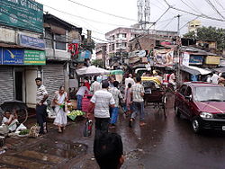 The busy bazaar area at Dum Dum road near railway station.
Dum Dum (Bengali দমদম Dômdôm, Hindi दमदम Damdam) is a city and a municipality in North 24 Parganas district in the state of West Bengal, India. It is a neighbourhood in North-west Kolkata and the location of Netaji Subhash Chandra Bose International Airport, formerly Dum Dum Airport. Dum Dum is a well known place in greater Kolkata. Dum Dum provides a number of transport facilities in the city. It has developed into a modern commercial centre in the outskirts of Kolkata. Dum Dum region is important as it constitutes main entry points of the city. With its domestic and international airport, it is the landing base for visitors to the city. The township falls in the northern region of Kolkata city. Dum Dum region is about 10 km from the city centre which is taken to be Esplanade, Kolkata. The nearby localities include Nager Bazar, Motijheel, Ghughu Danga, Jawpur, Rajbari and Lal Bagan.
Contents
Geography
Dum Dum is located at 22°37′N 88°25′E / 22.62°N 88.42°E.[1] It has an average elevation of 11 metres (36 feet).
History
During the 19th century the area was home to a British Royal Artillery armoury, where, in the early 1890s, Captain Bertie Clay developed a bullet with the jacket cut away at the tip to reveal its soft lead core (see hollow point bullet), known as a dum-dum,[2][3][4][5][6][7][8] or more correctly expanding bullet.
Demographics
As of 2001[update] India census,[9] Dum Dum had a population of 101,319. Males constitute 52% of the population and females 48%. Dum Dum has an average literacy rate of 82%, higher than the national average of 59.5%: male literacy is 85% and, female literacy is 78%. In Dum Dum, 8% of the population is under 6 years of age.
Accessibility
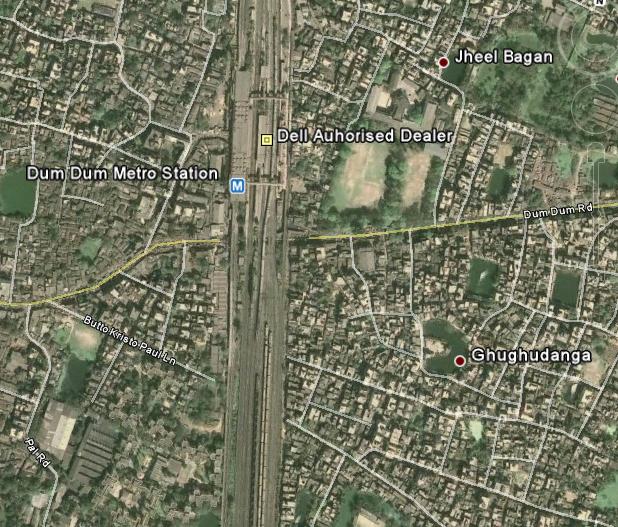
By Metro : The Kolkata Metro terminates at Dum Dum Station. This is right on the boundary of Dum Dum. From the station the Dum Dum Road leads to areas within Dum Dum and further.
By Air
The Netaji Subhash Chandra Bose International Airport or Kolkata Airport is located on the peripheries of Dum Dum and therefore, it is also called the Dum Dum Airport. There are flights to all major cities in India. There are also international flights to London, Frankfurt, Dubai, Singapore, Bangkok, Muscat, Doha, Kuala Lumpur, Kunming, Kathmandu, Dhaka and Paro.
By Rail
The Eastern Railway line has a station in Dum Dum. The Railway station and the Metro station is in the same complex. The Circular Railway also terminates at the same station. The other stations in Dum Dum are Dum Dum Cantonment and Patipukur (on the Circular Railway line) and Airport Gate No 1 and Airport (on the single Airport line). Travel to airport by rail is however inconvenient as there are only a few trains at odd hours.
By Road
Road is one the prime means of communications in Dum Dum. There are 2 arterial roads in Dum Dum - (a) The Jessore Road and the (b) Dum Dum Road. Buses ply on both the roads. On Dum Dum road the Bus Routes are 30B, L30B, 30B/1, 202, DN9, Airport-Babughat Mini, Howrah-Nagerbazar Mini,Dum dum Station-Ruby Hospital WBSTC Mini, Dankuni-Saltlake Sector 5 WBSTC Mini. On Jessore road there are more bus routes - namely 3C/1, 3C/2, 30, 30C, 30D, 30E, 45, 45A, 45B, 47, 47A, 47B, 79B, 91, 91A, 91B, 93, 211A, 215, 219, 221 , 223, 237, DN8, DN18, Central Jail-Heritage WBSTC Mini... The other minor roads on which buses ply are R.N Guha Road (30B/1), Birati-Nimta road (237), Laketown connector (221, 223, 30C, 211A, 47, 47A), Gorabazar-Cantonment Road (30D).
Road Distance
- From Central Kolkata (Esplanade) to Nagerbazar - approx 12 km through Central Avenue, Jessore Road
- From Central Kolkata (Esplanade) to Laketown Jessore Road crossing - approx 9 km
- From Central Kolkata to Airport through VIP Road - approx 22 km
- From Central Kolkata to Dum Dum Station through Central Avenue, BT Road, Chiriamore, approx : 10 km
- From Central Kolkata to Dum Dum Cantonment - approx 15 km
- From Airport to Nagerbazar - 5 km
- From Airport to Laketown - 8 km
- From Airport to Dum Dum Station - 7 km
- From Airport to Cantonment - 5 km
- From Airport to Central Jail - 4 km
- From subhasnagar to airport - 5 km
Travel within Dum Dum
- There are a plenty of buses available here - though most of them are the blue private one & mini bus. There are few CSTC or WBSTC or CTC buses.
 Dum Dum Metro
Autos are plenty - they can be used for short stretches.Auto can be used to travel from (i)Dum Dum st. to Nager Bazar ,(ii)Dum Dum st. to Chiria more. In addition, there are Taxis; Nagerbazar and Airport being the largest taxi stands. The other taxi stands are in Birati, Central Jail, Laketown, Bangur, Kalindi. Unfortunately the Dum Dum Station area doesn't have too many taxis as the area is extremely crowded. The other popular means of travel over short distances is the rickshaw. Many historically important places in the locality are worthy of mention, which include:
- 1. Dum Dum Central Jail
- 2. Dum Dum Cantonment, the birthplace of Mutiny of 1857
- 3. Dum Dum Air Port (Netaji Subhash International Airport)
- 4. Bungalow of Lord Clive
Neighbourhoods
Birati, Sarat Coloney, Bangur Avenue, Dum Dum Park, Nagar Bazaar, Satgachi, Amarpalli, Kshudiram colony, Gora Bazaar, Durganagar, Padmapukur, Motijheel, Ghosh Road, Devinibash, Lichubagan, Laxminagar, Subhas Nagar, Seth Bagan,Lal Bagan, Ghosh Para, Purba Sinthee, Madhugar and Nalta, Private Road, Chatakol, Hanuman Mandir, Fari. central jail opposite at padrihata
Education
There are 4 govt. general colleges in Dum Dum, they are
- Dum Dum Motijheel Science College (It is a renowned college in the locality)
- Dum Dum Rabindra Mahabidyalay (Formerly known as Motijheel Commerce College, located in Chatakal)
- Dum Dum Arts College
- Sarojini Naidu Girls College
There is also a Private Engineering College, Dr. Sudhir Chandra Sur Degree Engineering College in Surer Math.
 Dum Dum Krishna Kumar Hindu Academy at Motijheel.
There are many Govt. Sponsored School, including:
- 1. Dum Dum K K Hindu Academy
- 2. Dum Dum Motijheel Girls High School
- 3. Dum Dum Kishore Bharati High School
- 4. Dum Dum Sree Aravinda Vidyamandir
- 5. Siksha Niketan High School
- 6. Rameswar High School
- 7. Sahid Khudiram High School
- 8. Adarsha High School
- 9. Prachya High School
- 10. KV Dum Dum
- 11. KV Cossipore
and more. Many Private Schools are also found in the localities, including:
- 1. St. Mary's Orphanage & Day School (Nursery to Std. XII)
- 2. St. Stephens School (Nursery to Std. XII)
- 3. Seraphim's Public School (Std. I to XII)
- 4. Indira Gandhi Memorial School (Std. I to XII)
- 5. Tender Hearts (Nursery to Std. IV)
- 6. Howard Memorial English School (Nursery to X)
- 7. Christ Church Girls' High Secondary School ( Primary - XII)
See also
- Dum-dum bullets
- dum-dum fever
References
- ^ Falling Rain Genomics, Inc - Dum Dum
- ^ First world War
- ^ India 9
- ^ Encyclopedia
- ^ Specialist Ammunition Types
- ^ 303 British
- ^ BBC News
- ^ "Dum Dum". Encyclopædia Britannica. 2009. http://www.search.eb.com/eb/article-9031421. Retrieved 2009-05-18.
- ^ "Census of India 2001: Data from the 2001 Census, including cities, villages and towns (Provisional)". Census Commission of India. Archived from the original on 2004-06-16. http://web.archive.org/web/20040616075334/http://www.censusindia.net/results/town.php?stad=A&state5=999. Retrieved 2008-11-01.
External links
Neighbourhoods in Kolkata KMC - Alipore
- B.B.D. Bagh
- Bagbazar
- Baghajatin
- Ballygunge
- Barisha
- Behala
- Belgachia
- Bhowanipore
- Bowbazar
- Bow Barracks
- Brahmapur
- Burrabazar
- Chak Garia
- China Town
- Chitpur
- Chowringhee
- Cossipore
- Dhakuria
- Dharamtala
- Entally
- Esplanade
- Garia
- Golf Green
- Jadavpur
- Janbazar
- Jodhpur Park
- Jorabagan
- Jorasanko
- Kalighat
- Kasba
- Kidderpore
- Kudghat
- Kumortuli
- Lake Gardens
- Lalbazar
- Maniktala
- Metiabruz
- Naktala
- New Alipore
- New Garia
- Park Circus
- Parnasree Pally
- Pathuriaghata
- Picnic Garden
- Posta
- Rajabazar
- Sahapur
- Santoshpur
- Sarsuna
- Shyambazar
- Shyampukur
- Shobhabazar
- Sonagachi
- Taltala
- Tangra
- Thakurpukur
- Tollygunge
- Ultadanga
KMDA - Baguiati
- Baidyabati
- Bally
- Bansberia
- Baranagar
- Barrackpore
- Barasat
- Batanagar
- Belur
- Bhadreswar
- Budge Budge
- Chandannagar
- Dakshineswar
- Dankuni
- Dum Dum
- Durganagar
- Garulia
- Halisahar
- Howrah
- Hugli-Chuchura
- Jaynagar Mazilpur
- Joka
- Kalyani
- Kamarhati
- Kanchrapara
- Kestopur
- Khardaha
- Konnagar
- Madhyamgram
- Narendrapur
- New Barrackpur
- North Barrackpur
- North Dumdum
- Nungi
- Panihati
- Pujali
- Rajarhat (New Town)
- Rishra
- Salt Lake
- Serampore
- Sodepur
- South Dumdum
- Titagarh
- Uluberia
- Uttarpara
- Streets of Kolkata
- Kolkata topics
- West Bengal portal
Municipalities & CD blocks of West Bengal Municipal
CorporationsMunicipalities Alipurduar · Arambagh · Ashoknagar Kalyangarh · Baduria · Baidyabati · Bally · Balurghat · Bangaon · Bankura · Bansberia · Baranagar · Barasat · Bardhaman · Barrackpore · Baruipur · Basirhat · Beldanga · Berhampore · Bhadreswar · Bhatpara · Bidhannagar · Birnagar · Bishnupur · Bolpur · Budge Budge · Chakdaha · Champdani · Chandrakona · Contai · Cooch Behar · Dainhat · Dalkhola · Darjeeling · Dhulian · Dhupguri · Diamond Harbour · Dinhata · Dubrajpur · Dum Dum · Egra · English Bazar · Gangarampur · Garulia · Gayespur · Ghatal · Gobardanga · Guskara · Habra · Haldia · Haldibari · Halisahar · Hugli-Chuchura · Islampur · Jalpaiguri · Jamuria · Jangipur · Jhalda · Jhargram · Jiaganj Azimganj · Jaynagar Mazilpur · Kaliaganj · Kalimpong · Kalna · Kalyani · Kamarhati · Kanchrapara · Kandi · Katwa · Kharagpur · Kharar · Khardaha · Kshirpai · Konnagar · Krishnanagar · Kulti · Kurseong · Madhyamgram · Maheshtala · Mal · Mathabhanga · Mekhliganj · Memari · Midnapore · Murshidabad · Nabadwip · Naihati · Nalhati · New Barrackpur · North Barrackpur · North Dumdum · Old Maldah · Panihati · Panskura · Pujali · Purulia · Raghunathpur · Raiganj · Rajarhat · Rajpur Sonarpur · Ramjibanpur · Rampurhat · Ranaghat · Raniganj · Rishra · Sainthia · Shantipur · Serampore · Sonamukhi · South Dumdum · Suri · Taki · Tamluk · Tarakeswar · Titagarh · Tufanganj · Uluberia · Uttarpara Kotrung
Community
development
blocks*A Alipuduar I · Alipurduar II · Amdanga · Amta I · Amta II · Andal · Arambagh · Arsha · Ausgram I · Ausgram II B Baduria · Bagdah · Baghmundi · Bagnan I · Bagnan II · Balagarh · Balarampur · Balurghat · Bally Jagachha · Bamangola · Bandwan · Bangaon · Bankura I · Bankura II · Barjora · Bansihari · Barabani · Barabazar · Barrackpore I · Barrackpore II · Barasat I · Barasat II · Baruipur · Basanti · Basirhat I · Basirhat II · Beldanga I · Beldanga II · Berhampore · Bhagawangola I · Bhagawangola II · Bhagabanpur I · Bhagabanpur II · Bhangore I · Bhangore II · Bharatpur I · Bharatpur II · Bhatar · Binpur I · Binpur II · Bishnupur, Bankura · Bishnupur I, South 24 Parganas · Bishnupur II, South 24 Parganas · Bolpur Sriniketan · Budge Budge I · Budge Budge II · Burdwan I · Burdwan II · Burwan C Canning I · Canning II · Chakdaha · Chanchal I · Chanchal II · Chandipur · Chanditala I · Chanditala II · Chapra · Chandrakona I · Chandrakona II · Chhatna · Chinsurah-Mogra · Chopra · Contai I · Contai II · Contai III · Cooch Behar I · Cooch Behar II D Darjeeling Pulbazar · Dantan I · Dantan II · Daspur I · Daspur II · Debra · Deganga · Diamond Harbour I · Diamond Harbour II · Deshapran · Dhaniakhali · Dhupguri · Dinhata I · Dinhata II · Domjur · Domkal · Dubrajpur E Egra I · Egra II · English Bazar F Falakata · Falta · Farakka · Faridpur-Durgapur G Gaighata · Galsi I · Galsi II · Gangajalghati · Gangarampur · Garhbeta I · Garhbeta II · Garhbeta III · Gazole · Ghatal · Goalpokhar I · Goalpokhar II · Goghat I · Goghat II · Gopiballavpur I · Gopiballavpur II · Gorubathan · Gosaba H Habibpur · Habra I · Habra II · Haldia · Haldibari · Hanskhali · Hariharpara · Haringhata · Haripal · Harirampur · Harishchandrapur I · Harishchandrapur II · Haroa · Hasnabad · Hemtabad · Hili · Hingalganj · Hirbandh · Hura I Ilambazar · Indas · Indpur · Islampur · Itahar J Jagatballavpur · Jalangi · Jalpaiguri · Jamalpur · Jamboni · Jamuria · Jangipara · Jaynagar I · Jaynagar II · Jhalda I · Jhalda II · Jhargram · Jorebunglow Sukhiapokhri · Joypur, Bankura · Joypur, Purulia · K Kakdwip · Kalchini · Kaliachak I · Kaliachak II · Kaliachak III · Kaliaganj · Kaliganj · Kalimpong I · Kalimpong II · Kalna I · Kalna II · Kandi · Kanksa · Karandighi · Karimpur I · Karimpur II · Kashipur · Katwa I · Katwa II · Keshiari · Keshpur · Ketugram I · Ketugram II · Khanakul I · Khanakul II · Khandaghosh · Kharagpur I · Kharagpur II · Khargram · Kharibari · Khatra · Khejuri I · Khejuri II · Khoyrasole · Kotulpur · Krishnaganj · Krishnanagar I · Krishnanagar II · Kulpi · Kultali · Kumarganj · Kumargram · Kurseong · Kushmandi L Labpur · Lalgola M Madarihat-Birpara · Magrahat I · Magrahat II · Mahisadal · Mal · Manbazar I · Manbazar II · Mandirbazar · Manikchak · Manteswar · Mathabhanga I · Mathabhanga II · Mathurapur I · Mathurapur II · Matiali · Matigara · Maynaguri · Mayureswar I · Mayureswar II · Mejia · Mekhliganj · Memari I · Memari II · Midnapore Sadar · Minakhan · Mirik · Mohammad Bazar · Mohanpur · Mongalkote · Moyna · Murarai I · Murarai II · Murshidabad-Jiaganj N Nabadwip · Nabagram · Nagrakata · Nakashipara · Nalhati I · Nalhati II · Namkhana · Nandakumar · Nandigram I · Nandigram II · Nanoor · Naoda · Narayangarh · Naxalbari · Nayagram · Neturia O Old Malda · Onda · P Panchla · Pandabeswar · Pandua · Panskura I · Panskura II · Para · Patashpur I · Patashpur II · Patharpratima · Patrasayer · Phansidewa · Pingla · Polba-Dadpur · Puncha · Purbasthali I · Purbasthali II · Pursurah · Purulia I · Purulia II R Raghunathganj I · Raghunathganj II · Raghunathpur I · Raghunathpur II · Raiganj · Raina I · Raina II · Raipur · Rajarhat · Rajganj · Rajnagar · Ramnagar I · Ramnagar II · Rampurhat I · Rampurhat II · Ranaghat I · Ranaghat II · Rangli Rangliot · Ranibandh · Raniganj · Raninagar I · Raninagar II · Ratua I · Ratua II S Sabang · Sagar · Sagardighi · Sahid Matangini · Sainthia · Salanpur · Salboni · Saltora · Samserganj · Sandeshkhali I · Sandeshkhali II · Sankrail, Howrah · Sankrail, Paschim Medinipur · Santipur · Santuri · Sarenga · Shyampur I · Shyampur II · Simlapal · Singur · Sitai · Sitalkuchi · Sonamukhi · Sonarpur · Sreerampur-Uttarpara · Suri I · Suri II · Sutahata · Suti I · Suti II · Swarupnagar T Taldangra · Tamluk · Tapan · Tarakeswar · Tehatta I · Tehatta II · Thakurpukur Mahestala · Tufanganj I · Tufanganj II U Udaynarayanpur · Uluberia I · Uluberia II
- Similar to Tehsils in many states of India
Categories:- Neighbourhoods in Kolkata
- Double-named places
- Cities and towns in North 24 Parganas district


Wikimedia Foundation. 2010.