- Darjeeling district
-
This article is about the district. For its eponymous headquarters, see Darjeeling.
Darjeeling district
दार्जीलिङ जिल्ला
দার্জিলিং জেলা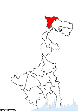
Location of Darjeeling district in West BengalState West Bengal,  India
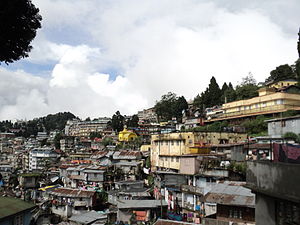
IndiaAdministrative division Jalpaiguri Headquarters Darjeeling Area 3,149 km2 (1,216 sq mi) Population 1,842,034 (2011) Population density 585 /km2 (1,520 /sq mi) Literacy 79.92% (excluding 0-6 population) Sex ratio 971 Lok Sabha Constituencies Darjeeling Assembly Seats Kalimpong, Darjeeling, Kurseong, Matigara-Naxalbari, Siliguri, Phansidewa Major highways NH 31, NH 55 Official website Darjeeling District (Bengali: দার্জিলিং জেলা; Nepali: दार्जीलिङ जिल्ला) is the northernmost district of the state of West Bengal in eastern India in the foothills of the Himalayas. The district is famous for its beautiful hill stations (and is often referred to as the Queen of the Hills) and Darjeeling tea. Darjeeling is the district headquarters. Kalimpong, Kurseong and Siliguri, three other major towns in the district, are the subdivisional headquarters of the district. Mirik, another town of the district, has been developed as a lake resort since the late 1970s.
Geographically, the district can be divided into two broad divisions, the hills and the plains. The entire hilly region of the district comes under the Darjeeling Gorkha Hill Council, a semi-autonomous administrative body under the state government of West Bengal. The council covers the three hill subdivisions of Darjeeling, Kurseong and Kalimpong. The foothills of Darjeeling Himalayas, which comes under the Siliguri subdivision, is known as the Terai. The Terai is bounded on the north by the mountains, on the south by Kishanganj district of Bihar state, on the east by Jalpaiguri district and on the west by Nepal. It has a length from north to south of 18 miles (29 km), and a breadth from east to west of 16 miles (26 km). As of 2011 it is the second least populous district of West Bengal (out of 19), after Dakshin Dinajpur.[1]
Contents
History
The name Darjeeling comes from the Tibetan words, Dorje (thunderbolt) and Ling (place or land), meaning the land of the thunderbolt. In 1835, Darjeeling was annexed by the East India Company from Sikkim. Prior to that, Darjeeling formed a part of Sikkim and for a brief period of Nepal.
Previously, Darjeeling formed a part of dominions of the Chogyal of Sikkim, who had been engaged in an unsuccessful warfare against the Gorkhas. From 1780, the Gorkhas made several attempts to capture the entire region of Darjeeling. By the beginning of 19th century, they had overrun Sikkim as far eastward as the Teesta River and had conquered and annexed the Terai.
In the meantime, the British were engaged in preventing the Gorkhas from overrunning the whole of the northern frontier. The Anglo-Gorkha war broke out in 1814, which resulted in the defeat of the Gorkhas and subsequently led to the signing of the Sugauli Treaty in 1815. According to the treaty, Nepal had to cede all those territories which the Gorkhas had annexed from the Chogyal of Sikkim to the British East India Company (i.e. the area between Mechi River and Teesta river).
Later in 1817, through the Treaty of Titalia, the British East India Company reinstated the Chogyal of Sikkim, restored all the tracts of land between the Mechi River and the Teesta river to the Chogyal of Sikkim and guaranteed his sovereignty.
The controversy did not end there. Later, in 1835, the hill of Darjeeling, including an enclave of 138 square miles (360 km2), was gifted to the British East India Company. In November 1864, the Treaty of Sinchula was executed in which the Bhutan Dooars with the passes leading into the hills and Kalimpong were ceded to the British by Bhutan. The Darjeeling district can be said to have assumed its present shape and size in 1866 with an area of 1234 sq. miles.
Gorkhaland Movement
 The GNLF flag.
During the 1980s, the Gorkha National Liberation Front led an intensive and often violent campaign for the creation of a separate Gorkhaland state within India, across the Nepali-speaking areas in northern West Bengal. The movement reached its peak around 1985-1986 but ended with the establishment of the Darjeeling Gorkha Hill Council in 1988.
Though Darjeeling is now peaceful, the issue of a separate state still lingers on, now supported by some political parties such as Gorkha Janmukti Morcha.[2]
The hill areas of Darjeeling enjoy some measure of autonomy under the Darjeeling Gorkha Hill Council. However, the aspirations of the people of Darjeeling and the surrounding areas were not fulfilled and the demand for full statehood within India has emerged once again, with the Gorkha Janmukti Morcha as its chief proponent.[3]
Geography
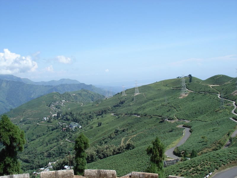
 A tea garden in Darjeeling.
The Darjeeling hill area is formed of comparatively recent rock structure that has a direct bearing on landslides. However, heavy monsoon precipitation is however a very common cause of the landslides. Soils of Darjeeling hill areas are extremely varied, depending on elevation, degree of slope, vegetative cover and geolithology. The Himalayas serve as the source of natural resources for the population residing in the hill
Divisions
Administrative subdivisions
The district comprises four subdivisions: Darjeeling Sadar, Kalimpong, Kurseong and Siliguri.[4] Darjeeling is the district headquarter. There are 17 police stations, 12 community development blocks, 4 municipalities, 1 municipal corporation and 134 gram panchayats in this district.[5]
Darjeeling and Kalimpong contain one municipality each and Kurseong has two. Siliguri has a municipal corporation instead. The community development blocks are divided into rural areas with gram panchayats.[6] and census towns.[7] In total there are 9 urban units: 4 municipalities, 1 municipal corporation and 4 census towns. Also, Darjeeling city and Pattabong Tea Garden are part of a urban agglomeration.
Darjeeling Sadar Subdivision
 Darjeeling Municipal Area
- Darjeeling municipality
- Darjeeling Pulbazar (Community development block) consists of rural areas with 23 gram panchayats and one census town: Pattabong Tea Garden.
- Rangli Rangliot (Community development block) consists of rural areas only with 11 gram panchayats.
- Jorebunglow Sukhiapokhri (Community development block) consists of rural areas only with 16 gram panchayats.
Kalimpong Subdivision
- Kalimpong municipality
- Kalimpong I (Community development block) consists of rural areas only with 18 gram panchayats.
- Kalimpong II (Community development block) consists of rural areas only with 13 gram panchayats.
- Gorubathan (Community development block) consists of rural areas only with 11 gram panchayats.
Kurseong Subdivision
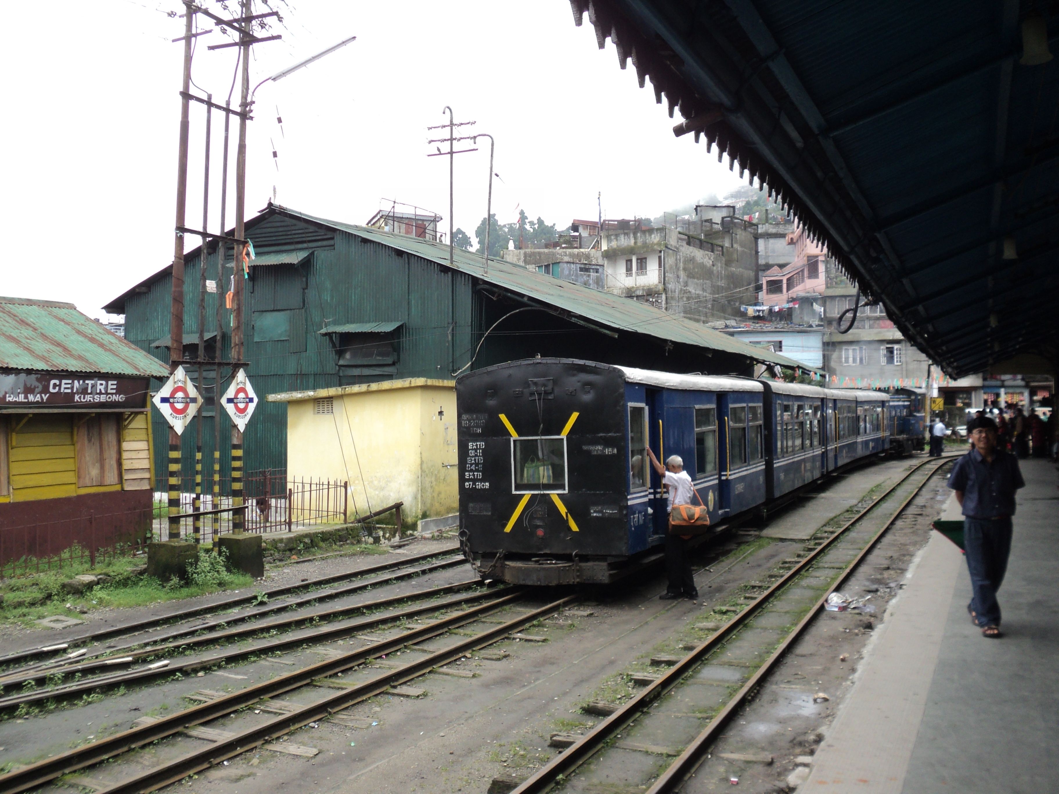
 Kurseong Station, Darjeeling Himalayan Railway
- Kurseong municipality
- Mirik municipality
- Mirik (Community development block) consists of rural areas only with 6 gram panchayats.
- Kurseong (Community development block) consists of rural areas with 14 gram panchayats and one census town: Cart Road.
Siliguri Subdivision
- Siliguri municipal corporation
- Matigara (Community development block) consists of rural areas with 5 gram panchayats and one census town: Bairatisal.
- Naxalbari (Community development block) consists of rural areas with 6 gram panchayats and one census town: Uttar Bagdogra.
- Phansidewa (Community development block) consists of rural areas only with 7 gram panchayats.
- Kharibari (Community development block) consists of rural areas only with 4 gram panchayats.
Assembly Constituencies
The district was previously divided into 5 assembly constituencies:[8]
- Kalimpong (assembly constituency no. 22),
- Darjeeling (assembly constituency no. 23),
- Kurseong (assembly constituency no. 24),
- Siliguri (assembly constituency no. 25) and
- Phansidewa (ST) (assembly constituency no. 26).
Phansidewa constituency was reserved for Scheduled Tribes (ST) candidates. Along with two assembly constituencies from North Dinajpur district, the five assembly constituencies of this district formed the Darjeeling Lok Sabha constituency.
Impact of Delimitation of Constituencies
As per order of the Delimitation Commission in respect of the delimitation of constituencies in West Bengal, the district will be divided into 6 assembly constituencies:[9]
- Kalimpong (assembly constituency no. 22),
- Darjeeling (assembly constituency no. 23),
- Kurseong (assembly constituency no. 24),
- Matigara-Naxalbari (SC) (assembly constituency no. 25),
- Siliguri (assembly constituency no. 26) and
- Phansidewa (ST) (assembly constituency no. 27).
Phansidewa constituency will continue to be reserved for Scheduled Tribes (ST) candidates. Matigara-Naxalbari constituency will be reserved for Scheduled Castes (SC) candidates. Along with one assembly constituency from North Dinajpur district, the six assembly constituencies of this district will form the Darjeeling Lok Sabha constituency.
Demographics
According to the 2011 census Darjeeling district has a population of 1,842,034,[1] roughly equal to the nation of Kosovo[10] or the US state of West Virginia.[11] This gives it a ranking of 257th in India (out of a total of 640).[1] The district has a population density of 585 inhabitants per square kilometre (1,520 /sq mi) .[1] Its population growth rate over the decade 2001-2011 was 14.47 %.[1] Darjiling has a sex ratio of 971 females for every 1000 males,[1] and a literacy rate of 79.92 %.[1][12]
In 2001, the total population of the district was 1,609,172. The total rural population was 1,088,740 and total urban population was 520,432. Total males were 830,644 and total females were 778,528. The density of population was 511 per km2. The decennial population growth rate (1991–2001) was 23.79%.[13]
The original inhabitants of the Darjeeling Hills were the Lepchas or Rongpa (the ravine folks) as they prefer themselves to be known as. They are decidedly Mongolian in physical features. The greater bulk of the people in the hills today are the Gorkhas. They are industrious and enterprising as a race and speak Nepali and various other dialects. Among the population are the Sherpas. They are well known for their contributions to mountaineering. Also much in evidence in the hills are the Bhutias. There is also a sizable population of Tibetans who arrived from Tibet since the 1950s. In the plains, one will find several communities like the Gorkhas, the adivasi people originally from Chotanagpur and Santhal Parganas, and a greater bulk of Bengali people.
Languages
Languages include Bijori, a Munda language distantly related to Khmer and Vietnamese, spoken by about 25 000.[14]
Flora and fauna
In 1986 Darjeeling district became home to Neora Valley National Park, which has an area of 88 km2 (34.0 sq mi).[15] It is also home to Singhalila National park, which was established in 1986 and has an area of 79 km2 (30.5 sq mi).[15]
The district also contains three wildlife sanctuaries: Jorepokhri, Mahananda, and Senchal.[15]
See also
References
- ^ a b c d e f g "District Census 2011". Census2011.co.in. 2011. http://www.census2011.co.in/district.php. Retrieved 2011-09-30.
- ^ "Constitution of Gorkha Janmukti Morcha". http://www.gorkhajanmuktimorcha.org/constitution.php. Retrieved 2009-05-18.
- ^ "Gorkhaland State a distinct possibility". The Hindu (Chennai, India). 2004-05-15. http://www.hindu.com/2004/05/15/stories/2004051502021400.htm.
- ^ "List of Districts/C.D.Blocks/ Police Stations with Code No., Number of G.Ps and Number of Mouzas". West Bengal. Directorate of census operations. http://web.cmc.net.in/wbcensus/DataTables/01/Table2_1.htm. Retrieved 2008-11-06.
- ^ "District Profile". Official website of the Darjeeling district. http://darjeeling.gov.in/dist-prof.html. Retrieved 2008-11-06.
- ^ "Directory of District, Sub division, Panchayat Samiti/ Block and Gram Panchayats in West Bengal, March 2008". West Bengal. National Informatics Centre, India. 2008-03-19. http://wbdemo5.nic.in/writereaddata/Directoryof_District_Block_GPs(RevisedMarch-2008).doc. Retrieved 2008-11-12.
- ^ "Population, Decadal Growth Rate, Density and General Sex Ratio by Residence and Sex, West Bengal/ District/ Sub District, 1991 and 2001". West Bengal. Directorate of census operations. http://web.cmc.net.in/wbcensus/DataTables/02/Table4_1.htm. Retrieved 2008-11-06.
- ^ "General election to the Legislative Assembly, 2001 – List of Parliamentary and Assembly Constituencies". West Bengal. Election Commission of India. http://archive.eci.gov.in/se2001/background/S25/WB_ACPC.pdf. Retrieved 2008-11-16.
- ^ "Press Note, Delimitation Commission". Assembly Constituencies in West Bengal. Delimitation Commission. http://www.wbgov.com/e-gov/English/DELIMITATION.pdf. Retrieved 2008-11-16.
- ^ US Directorate of Intelligence. "Country Comparison:Population". https://www.cia.gov/library/publications/the-world-factbook/rankorder/2119rank.html. Retrieved 2011-10-01. "Kosovo 1,825,632 July 2011 est."
- ^ "2010 Resident Population Data". U. S. Census Bureau. http://2010.census.gov/2010census/data/apportionment-pop-text.php. Retrieved 2011-09-30. " West Virginia 1,852,994"
- ^ http://censusindia.gov.in/2011-prov-results/prov_data_products_wb.html
- ^ http://www.darjeeling.gov.in/CENSUS-2001/index.htm
- ^ M. Paul Lewis, ed (2009). "Bijori: A language of India". Ethnologue: Languages of the World (16th edition ed.). Dallas, Texas: SIL International. http://www.ethnologue.com/show_language.asp?code=bix. Retrieved 2011-09-30.
- ^ a b c Indian Ministry of Forests and Environment. "Protected areas: Sikkim". http://oldwww.wii.gov.in/envis/envis_pa_network/index.htm. Retrieved September 25, 2011.
External links

West Sikkim district, Sikkim South Sikkim district, Sikkim East Sikkim district, Sikkim Nepal 
Jalpaiguri district  Darjeeling district

Kishanganj district, Bihar North Dinajpur district Bangladesh Cities and towns in Darjeeling District Darjeeling Sadar subdivision Bijanbari · Darjeeling · Ghum · Happy Valley Tea Estate · Pattabong Tea Garden · Sonada · Sukhiapokhri · Tukver Tea EstateKalimpong subdivision Kurseong subdivision Siliguri subdivision See also Darjeeling related topics · People from Darjeeling district · Bagdogra Airport · Villages in Darjeeling districtCities and towns
in other districtsBankura · Bardhaman · Birbhum · Cooch Behar · Dakshin Dinajpur · Hooghly · Howrah · Jalpaiguri · Malda · Murshidabad · Nadia · North 24 Parganas · Paschim Medinipur · Purba Medinipur · Purulia · South 24 Parganas · Uttar DinajpurCategories:


Wikimedia Foundation. 2010.