- Dakshin Dinajpur district
-
Dakshin Dinajpur district
দক্ষিণ দিনাজপুর জেলা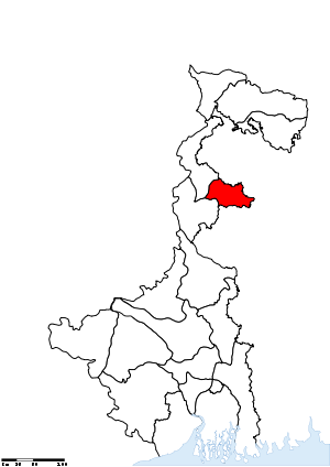
Location of Dakshin Dinajpur district in West BengalState West Bengal,  India
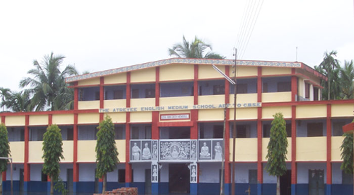
IndiaAdministrative division Jalpaiguri Headquarters Balurghat Area 2,219 km2 (857 sq mi) Population 16,70,931 (2011) Population density 753 /km2 (1,950 /sq mi) Literacy 73.86 per cent[1] Sex ratio 950 Lok Sabha Constituencies Balurghat Assembly Seats Kushmandi, Kumarganj, Balurghat, Tapan, Gangarampur, Harirampur Major highways NH 34 Official website  The Atreyee D. A. V. Public School in Balurghat
Dakshin Dinajpur or South Dinajpur (Bengali: দক্ষিণ দিনাজপুর জেলা) is a district of the Indian state of West Bengal. Created on 1 April 1992 by the division of the erstwhile West Dinajpur district, it comprises two subdivisions: Balurghat and Buniadpur. As of 2011 it is the least populous district of West Bengal (out of 19).[2]
Contents
History
The erstwhile Dinajpur District, at the time of the partition of India, was split up into West Dinajpur district and East Dinajpur. The East Dinajpur district, now called Dinajpur, became part of East Pakistan, now Bangladesh. The West Dinajpur district was enlarged in 1956, when States Reorganisation Act recommendations were implemented, with the addition of some areas of Bihar. The district was bifurcated into Uttar Dinajpur and Dakshin Dinajpur on April 1, 1992.[3][4]
Economy
Dakshin Dinajpur is predominantly an agricultural district with large area of land being under cultivation. The district is drained by a number of North-South flowing river like Atreyee, Purnabhaba, Tangon and Brahmani, to give rise to a sizeable but unorganized fishing community.
Dakshin Dinajpur is a "Non Industry" district having no large scale industry. The first industry in medium scale sector got off to a start in the district in November, 2003. Internet access is available from most of the cities, even though broadband connections are not available. As for transport, there is one State Highway with only 3 km of National Highway No. 34 falling within the district. A new railway line has been laid between Eklakhi and Balurghat, the district headquarter. Train services has been started on December 30, 2004.
In 2006 the Ministry of Panchayati Raj named Dakshin Dinajpur one of the country's 250 most backward districts (out of a total of 640).[5] It is one of the eleven districts in West Bengal currently receiving funds from the Backward Regions Grant Fund Programme (BRGF).[5]
Divisions
Administrative subdivisions
The district comprises two subdivisions: Balurghat and Buniadpur. Balurghat consists of Balurghat municipality and four community development blocks: Hili, Balurghat, Kumarganj and Tapan. Buniadpur subdivision consists of Gangarampur municipality and four community development blocks: Gangarampur, Banshihari, Harirampur and Kushmandi.[6] Balurghat is the district headquarters. There are 8 police stations,[7] 8 development blocks, 2 municipalities, 65 gram panchayats and 2317 villages in this district.[6][8]
Other than municipality area, each subdivision contains community development blocs which in turn are divided into rural areas and census towns.[9] In total there are 2 urban units, both of which are municipalities. Chak Bhrigu and Baidynathpara were two urban outgrowths noted in census 2001.
Balurghat subdivision
- Balurghat: municipality
- Hili (Community development block) consists of rural areas only with 5 gram panchayats.
- Balurghat (Community development block) consists of rural areas only with 11 gram panchayats.
- Kumarganj (Community development block) consists of rural areas only with 8 gram panchayats.
- Tapan (Community development block) consists of rural areas only with 11 gram panchayats.
Buniadpur subdivision
- Gangarampur: municipality
- Gangarampur (Community development block) consists of rural areas only with 11 gram panchayats.
- Bansihari (Community development block) consists of rural areas only with 5 gram panchayats.
- Harirampur (Community development block) consists of rural areas only with 6 gram panchayats.
- Kushmandi (Community development block) consists of rural areas only with 8 gram panchayats.
Assembly constituencies
The district is divided into 5 assembly constituencies:[10]
- Kushmandi (SC) (assembly constituency no. 33),
- Gangarampur (assembly constituency no. 35),
- Tapan (ST) (assembly constituency no. 36),
- Kumarganj (assembly constituency no. 37),
- Balurghat (assembly constituency no. 38) and
Tapan constituency is reserved for Scheduled Tribes (ST) candidates. Kushmandi constituency is reserved for Scheduled Castes (SC) candidates. Along with one assembly constituency from North Dinajpur district, the six assembly constituencies of this district form the Balurghat (Lok Sabha constituency), which is reserved for Scheduled Castes (SC) candidates.
Impact of delimitation of constituencies
As per order of the Delimitation Commission in respect of the delimitation of constituencies in the West Bengal, the district will be divided into 6 assembly constituencies:[11]
- Kushmandi (SC) (assembly constituency no. 37),
- Kumarganj (assembly constituency no. 38),
- Balurghat (assembly constituency no. 39),
- Tapan (ST) (assembly constituency no. 40),
- Gangarampur (SC) (assembly constituency no. 41) and
- Harirampur (assembly constituency no. 42).
Tapan constituency will be reserved for Scheduled Tribes (ST) candidates. Kushmandi and Gangarampur constituencies will be reserved for Scheduled Castes (SC) candidates. Along with one assembly constituency from North Dinajpur district, the six assembly constituencies of this district will form the Balurghat (Lok Sabha constituency).
Demographics
According to the 2011 census Dakshin Dinajpur district has a population of 1,670,931 ,[12] roughly equal to the nation of Guinea-Bissau[13] or the US state of Idaho.[14] This gives it a ranking of 295th in India (out of a total of 640).[12] The district has a population density of 753 inhabitants per square kilometre (1,950 /sq mi) .[12] Its population growth rate over the decade 2001-2011 was 11.16 %.[12] Dakshin Dinajpur has a sex ratio of 954 females for every 1000 males,[12] and a literacy rate of 73.86 %.[12]
Languages
Bengali is the principal language of the district. The principal communities are Hindus and Muslims, constituting the major portion of the population.
Education
There is one Engineering College but no Medical College. But it does have a few good schools including The Atreyee English Medium School, in Balurghat. Many other Government schools also exist throughout the district. Balurghat College is the most popular college in the district. A Government-funded girls' college also exists in Balurghat. Balurghat also has a law college and a B.Ed college.
References
- ^ "District-specific Literates and Literacy Rates, 2001". Registrar General, India, Ministry of Home Affairs. http://www.educationforallinindia.com/page157.html. Retrieved 2010-10-10.
- ^ "District Census 2011". Census2011.co.in. 2011. http://www.census2011.co.in/district.php. Retrieved 2011-09-30.
- ^ "Uttar Dinajpur Website". Government of India Portal. http://uttardinajpur.nic.in/UDWEB.html. Retrieved 2008-11-10.
- ^ "Historical Perspective". Official website of South Dinajpur district from Government of India Portal. http://ddinajpur.nic.in/Historical_Perspective/historical_perspective.html. Retrieved 2008-11-10.
- ^ a b Ministry of Panchayati Raj (September 8, 2009). "A Note on the Backward Regions Grant Fund Programme". National Institute of Rural Development. http://www.nird.org.in/brgf/doc/brgf_BackgroundNote.pdf. Retrieved September 27, 2011.
- ^ a b "Directory of District, Sub division, Panchayat Samiti/ Block and Gram Panchayats in West Bengal, March 2008". West Bengal. National Informatics Centre, India. 2008-03-19. http://wbdemo5.nic.in/writereaddata/Directoryof_District_Block_GPs(RevisedMarch-2008).doc. Retrieved 2008-11-08.
- ^ "Census of India 2001, Final Population Totals, West Bengal, Rural Frame". West Bengal. Directorate of census operations. http://web.cmc.net.in/wbcensus/DataTables/01/Table2_2.htm. Retrieved 2008-11-09.
- ^ "District Profile". Official website of the South Dinajpur district. http://ddinajpur.nic.in/District_Profile/district_profile.html. Retrieved 2008-11-09.
- ^ "Population, Decadal Growth Rate, Density and General Sex Ratio by Residence and Sex, West Bengal/ District/ Sub District, 1991 and 2001". West Bengal. Directorate of census operations. http://web.cmc.net.in/wbcensus/DataTables/02/Table4_5.htm. Retrieved 2008-11-09.
- ^ "General election to the Legislative Assembly, 2001 – List of Parliamentary and Assembly Constituencies". West Bengal. Election Commission of India. http://archive.eci.gov.in/se2001/background/S25/WB_ACPC.pdf. Retrieved 2008-11-18.
- ^ "Press Note, Delimitation Commission". Assembly Constituencies in West Bengal. Delimitation Commission. http://www.wbgov.com/e-gov/English/DELIMITATION.pdf. Retrieved 2008-11-18.
- ^ a b c d e f "District Census 2011". Census2011.co.in. 2011. http://www.census2011.co.in/district.php. Retrieved 2011-09-30.
- ^ US Directorate of Intelligence. "Country Comparison:Population". https://www.cia.gov/library/publications/the-world-factbook/rankorder/2119rank.html. Retrieved 2011-10-01. "Guinea-Bissau 1,596,677 July 2011 est."
- ^ "2010 Resident Population Data". U. S. Census Bureau. http://2010.census.gov/2010census/data/apportionment-pop-text.php. Retrieved 2011-09-30. "Idaho 1,567,582"
External links

North Dinajpur district Bangladesh 
 Dakshin Dinajpur district

Malda district Bangladesh Cities and towns in Dakshin Dinajpur district Balurghat subdivision Balurghat · HiliGangarampur subdivision Related topics Dakshin Dinajpur district · Dakshin Dinajpur topics · People from South Dinajpur district · Villages in Dakshin Dinajpur districtCities and towns
in other districtsBankura · Bardhaman · Birbhum · Cooch Behar · Darjeeling · Hooghly · Howrah · Jalpaiguri · Malda · Murshidabad · Nadia · North 24 Parganas · Paschim Medinipur · Purulia · South 24 Parganas · Uttar DinajpurDakshin Dinajpur district topics General Subdivisions Balurghat • GangarampurMunicipalities Community development blocks Balurghat subdivision Hili • Balurghat • Kumarganj • Tapan Gangarampur subdivision Bansihari • Gangarampur • Harirampur • KushmandiRivers Transport Lok Sabha constituencies Vidhan Sabha constituencies Kushmandi • Kumarganj • Balurghat • Tapan • Gangarampur • HarirampurSee also Cities and towns in Dakshin Dinajpur district • People from Dakshin Dinajpur district • Villages in Dakshin Dinajpur districtOther districts in West Bengal Bankura • Bardhaman • Birbhum • Cooch Behar • Darjeeling • Hooghly • Howrah • Jalpaiguri • Kolkata • Malda • Murshidabad • Nadia • North 24 Parganas • Paschim Medinipur • Purba Medinipur • Purulia • South 24 Parganas • Uttar DinajpurSurrounding areas outside West Bengal Divisions & Districts of West Bengal Burdwan division Bankura · Bardhaman · Birbhum · Hooghly · Paschim Medinipur · Purba Medinipur · Purulia
Jalpaiguri division Cooch Behar · Dakshin Dinajpur · Darjeeling · Jalpaiguri · Malda · Uttar Dinajpur
Presidency division Minority Concentrated Districts in India Andaman & Nicobar Islands Arunachal Pradesh Assam Barpeta · Bongaigaon · Cachar · Darrang · Dima Hasao · Dhubri · Goalpara · Hailakandi · Kamrup · Karimganj · Kokrajhar · Marigaon · Nagaon
Bihar Delhi Haryana Jammu & Kashmir Jharkhand Karnataka Kerala Madhya Pradesh Maharashtra Manipur Meghalaya Mizoram Orissa Uttar Pradesh Baghpat · Bahraich · Balrampur · Barabanki · Bareilly · Bijnor · Budaun · Bulandshahar · Ghaziabad · Jyotiba Phule Nagar · Kheri · Lucknow · Meerut · Moradabad · Muzaffarnagar · Pilibhit · Rampur · Saharanpur · Shahjahanpur · Shravasti · Siddharth NagarUttarakhand West Bengal Bardhaman · Birbhum · Cooch Behar · Dakshin Dinajpur · Howrah · Kolkata · Malda · Murshidabad · Nadia · North 24 Parganas · South 24 Parganas · Uttar DinajpurCategories:- Districts of West Bengal
- South Dinajpur district
- Minority Concentrated Districts in India

Wikimedia Foundation. 2010.