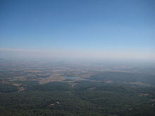
- Chikmagalur
-
This article is about the municipality in India. For its namesake district, see Chikmagalur district.
Chikkamagaluru — town — Coordinates 13°19′N 75°46′E / 13.32°N 75.77°ECoordinates: 13°19′N 75°46′E / 13.32°N 75.77°E Country India State Karnataka Population
• Density
101,021 (20[update])
• 27 /km2 (70 /sq mi)
Time zone IST (UTC+05:30) Area 3,742 square kilometres (1,445 sq mi) Codes-
• Pincode • 577101 - 577102 • Vehicle • KA- 18
Website www.chickamagalurcity.gov.in Chikmagalur (Kannada: ಚಿಕ್ಕ ಮಗಳೂರು, Cikka Magaḷūru) (also known as Chikkamagaluru) is a town located in Chikkamagaluru district in the Indian state of Karnataka. Located in the foothills of Mullayanagiri range chikmagalur is famous for the coffee, it is known as the coffee land of karnataka. it has international school called ambar valley and a star resort by name serai. chikmagalur is famous for its hill stations.
The nearest airport to this town is Bajpe international airport of Mangalore (160 km). The nearest railway station is Kadur (40 km).
Contents
History
Chickmagalur district was called Kadur district till 1947. It is situated roughly in the south-western part of Karnataka state. A large area of this district is 'malnad', i.e., a largely forested hilly region of heavy rainfall. The district takes its name from the headquarters town of Chickmagalur which literally means younger daughter's town - Chikka + Magala + Ooru (in Kannada). It is said to have been given as a dowry to the younger daughter of Rukmangada, the legendary chief of Sakrepatna. Another part of the town bestowed on the elder daughter is known as Hiremagalur. But some old inscriptions reveals that these two places were known as Kiriya-muguli and Piriya-muguli. Situated in a fertile valley south of the Baba-Budan hill range is the headquarters town of the district. A centre of education, trade and commerce. The town enjoys a salubrious climate and has venerated monuments of all religions- Kodandarama temple a synthesis of Hoysala and Dravidian styles of architecture, Jamia Mosque and the new St.Joseph's Cathedral with an attractive shell shaped portico. Hiremagalur which is now part of Chickmgalaur town has an Ishwara temple with a 1.22 metre high curious rotund figure of Jademuni. The temple also has a Yoopastambha supposed to be installed by King Janamejaya during his serpent sacrifice. There is also a Parashurama temple and a Kali shrine.
Location
The district is situated between 12° 54´ 42´´ and 13° 53´ 53´´ north latitude and between 75° 04´ 46´´ and 76° 21´ 50´´ east longitude. Its greatest length from east to west is about 138.4 kilometers and from north to south 88.5 kilometers. General boundaries are;
- East - Tumkur district
- South - Hassan district
- West - Western Ghats which separates it from Dakhina Kannada (South Kanara)
- North - East : Chitradurga district
- North - Shimoga district.
Geography
Chikmagalur is located at an elevation of 1037 meters (3,400 feet) and the hillstations around Chikmagalur are famous summer retreats since they remain cool even during summers. The temperature of the city however varies from 11-20 °C during winter to 25-32 °C during summer.
Demographics
As of 2001 India census,[1] Chikmagalur had a population of 101,021. Males constitute 51% of the population and females 49%. Chikmagalur has an average literacy rate of 77%, higher than the national average of 59.5%; with male literacy of 80% and female literacy of 73%. 11% of the population is under 6 years of age.
Divisions
- Chikmagalur
- Kadur
- Koppa
- Tarikere
- Narasimharajapura
- Mudigere
- Sringeri
Places Of Interest
Chikmagalur is a place for tourists.It is one of the major tourist spot.Ratnagiri bore, renamed as Mahatma Gandhi Park is a place of scenic beauties.The M.G road is also very preferable for shopping.The city has also many good educational institutes.It is famous for coffee.Chickmagalur district has all this and more. Every little village or town has some story behind it and some jatra or festival is on throughout the year ... it could be one of the fifty festivities celebrated during the year at Sri Jagad Guru Shankaracharya Dhakshinamnaya Mahasamsthanam Sri Sharada Peetha at Sringeri or Sri Renuka Jayanthi or Sri Veerabhadra Swamy Mahotsava at Rambha Puri Matha at Balehonnur. The Dassera Mahotsava of Mailaralingeswami of Birur where one can see the Dollu Kunitha and Veeragase, the thrilling and heroic folk dance of the area, the Urs at Baba-Budan Giri, the Girija Kalyana Mahotsava of Kalaseswaraswamy at Kalasa or the Veerabhadra Devara Rathotsava of Koppa. Or any of the annual festivals of local temples held in many of the villages and towns. Suggi habba or harvest festival is celebrated with great rejoicing in the rural parts and provides the rare opportunity of witnessing Kolata, Salu Kunitha, Suttu Kunitha, the Raja Kunitha and Fire walking too.
There is also a famous dargah of Dada Mir Hayat Qalandar , a Sufi saint who is on the hills of budhan baba. Its an Awesome spot and place to visit.
References
- ^ "Census of India 2001: Data from the 2001 Census, including cities, villages and towns (Provisional)". Census Commission of India. Archived from the original on 2004-06-16. http://web.archive.org/web/20040616075334/http://www.censusindia.net/results/town.php?stad=A&state5=999. Retrieved 2008-11-01.
External links
Categories:- Cities and towns in Chikmagalur district
-
Wikimedia Foundation. 2010.


