- Madikeri
-
This article is about the municipality in India. For its namesake district, see Kodagu district.
Madikeri — town — Coordinates 12°25′15″N 75°44′23″E / 12.4208°N 75.7397°ECoordinates: 12°25′15″N 75°44′23″E / 12.4208°N 75.7397°E Country India State Karnataka District(s) Kodagu Mayor Population 32,286 (2001[update]) Time zone IST (UTC+05:30) Area
• 1,525 metres (5,003 ft)
Madikeri (Kannada: ಮಡಿಕೇರಿ) is a hill station town in Karnataka state, India. Also known as Mercara, it is the headquarters of Kodagu district.
Contents
Etymology
Madikeri was formerly known as Muddu raja keri.[1] Muddurajakeri which means Mudduraja's town, was named after the prominent Haleri king, Mudduraja who ruled Kodagu from 1633-1687.
The form of the name often used in English, Mercara, is derived from Madikeri by a standard transformation of the retroflex 'd' to an 'r' consonant.
History
The history of Madikeri is related to the history of Kodagu. From the 2nd to 6th century AD, the northern part of Kodagu was ruled by Kadambas. The southern part of Kodagu was ruled by Gangas from 4th to 11th century. After defeating the Gangas in the 11th century, Cholas became the rulers of Kodagu. In the 12th century, Cholas lost Kodagu to the Hoysalas. Kodagu fell to the Vijayanagar kings in the 14th century. After their fall, the local chieftains (Palegars) started ruling their areas directly. These were defeated by the Haleri kings who ruled Kodagu from 1600-1834 A.D. Haleri kings made the place Haleri, near Madikeri as their capital. Mudduraja, the third king among the Haleri kings started leveling the land around Madikeri and built a fort in the year 1681. Madikeri fort was original built by mud and was replaced by "The Sword of Mysore", Tipu Sultan. Kodagu became the part of British India after 1834 A.D.[2]
Demographics
As of 2001[update] India census,[3] Madikeri had a population of 32,286. Males constitute 51% of the population and females 49%. Madikeri had an average literacy rate of 81%, higher than the national average of 59.5%: male literacy was 83%, and female literacy 79%. 11% of the population was under 6 years of age. This town is situated at an elevation of over 5000 ft above sea level.
The main language of Madikeri is Kodava Takk, Kannada, Byari. Also Are Bhashe/Gowda Kannada (language spoken by Gowdas of Coorg ) features prominently here. Before British rule, Kodagu was an independent country and stretched till Mangalore. Most of the Gowdas were staying near Amara Sullia and Bhagamandala.
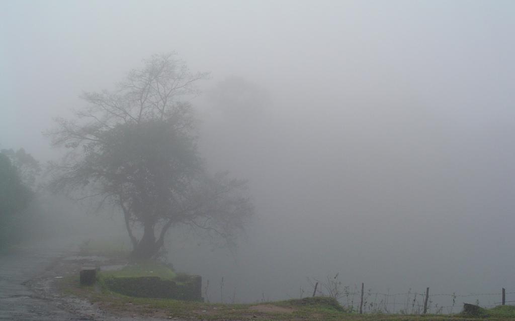
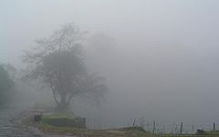 Madikeri on a misty morning
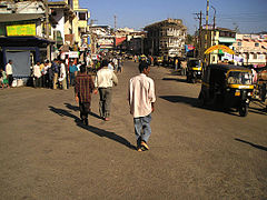 The streets of Madikeri
Geography
Madikeri is located at 12°25′N 75°44′E / 12.42°N 75.73°E.[4] It has an elevation of 1525 metres (5003 feet).
Madikeri lies in the Western Ghats and is a popular hill station. The nearest cities are Mangalore to the west, and Mysore to the east.
Temperature
The mean daily minimum temperature is lowest in January at about 11°C. The minimum temperature ever recorded was 8.9°C on 20 February 1936. Maximum temperature in summer is around 24°C to 27°C.[5] With the onset of the south-west monsoon, the temperature decreases in June and the weather becomes chilly.
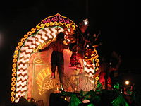 Mantapa from Kanchi Kamakshi Temple in Dasara procession
Feasts
In Madikeri the main festivals celebrated are Kailpodhu, Kaveri Sankramana, Puttari and Dasara. Karaga festival also starts during the time of Navaratri.
Getting there
By Road
Madikeri lies on the Karnataka State Highway 88 that runs from Mysore to Mangalore.[6] It is 120 km from Mysore and 136 km from Mangalore. From Bangalore, the state capital of Karnataka, one can take the State Highway 17 (Bangalore - Mysore Highway) and take a deviation just after the town of Srirangapatna to join State Highway 88 towards Madikeri. From Bangalore, Madikeri is at a distance of 252 km.[7] Nearby towns are Hassan (115 km) in Karnataka state and Kannur and Thalassery in Kerala state (each around 114 km away).
By Rail
Madikeri does not have a railway station. Nearest railheads are Hassan, Kasaragod, Kannur and Thalassery (each of which are almost equidistant 115 km away). Mysore and Mangalore have railway stations with better rail connectivity and are good alternatives to reach Madikeri.
Places to see
- Raja Seat: This is a small square mantapa in brick and mortar of four pillars bridged by arches, enhanced by beautiful surroundings. This spot was a favourite place of recreation for the Rajas and hence was permanently associated with them. It is built on a high level ground with a commanding view of the cliffs and valleys to the west.
- Madikeri Fort: This fort was first built by Mudduraja in the last quarter of the 17th century. He also built a palace inside the fort. It was eventually rebuilt in granite by Tipu Sultan who named the site as Jaffarabad. In 1790, Doddavira Rajendra took control of the fort. The British who added to the fort in 1834. The palace was renovated by Lingarajendra Wodeyar II in 1812-1814. In the north-east corner at the entrance are two life size masonry elephants and a church is present in the south-east corner. There is a famous Lord Ganesha temple known as "Kote ganapathi" just at the main entrance of the fort.
- Omkareshwara Temple: Located at the heart of the Town,Omkareshwara temple was built by king Lingarajendra in 1820. The temple has both Islamic and Gothic styles of architecture, built around a central pool. It is said Lingarajendra killed an honest and pious Brahmin to fulfill his political ambitions. That Brahmin became a "Brahmarakshasa" and started troubling the king. In order to purify himself for the killing of a Brahmin, he was advised to construct a temple to Lord Shiva. He brought a Shivalinga from Kashi, and the temple was built and named "Omkareshwara".
References
- ^ Coorg History
- ^ Jerry Dupont, The Common Law Abroad, Wm. S. Hein Publishing, 2001, ISBN 0837731259, from p 592
- ^ "Census of India 2001: Data from the 2001 Census, including cities, villages and towns (Provisional)". Census Commission of India. Archived from the original on 2004-06-16. http://web.archive.org/web/20040616075334/http://www.censusindia.net/results/town.php?stad=A&state5=999. Retrieved 2008-11-01.
- ^ Madikeri, FallingRain.com
- ^ Ground Water Information Booklet, Ministry of Water Resources, 2007. Retrieved 23 June 2011.
- ^ Mangalore to Madikeri route
- ^ Bangalore to Madikeri route map
External links
Kodagu (Coorg) topics Geography Society Towns Tourism Abbey Falls · Bhagamandala · Dubare · Honnamana Kere · Irupu Falls · Mallalli Falls · Nagarhole National Park · Nisargadhama · Pushpagiri Wildlife Sanctuary · Talakaveri · Harangi ReservoirPeople K.M. Cariappa · K.S. Thimayya · Rohan Bopanna · Arjun Halappa · Robin Uthappa · Gundu Rao · C.B. Muthamma · Prema Cariappa · M.P. Ganesh · B.P. Govinda · Ashwini Nachappa · Prema · Prasad Bidapa · Nikhil Chinnappa · N. Ponnappa · Biddu Appaiah · Joshna Chinappa · Len AiyappaCategories:- Kodava people
- Kodava Takk
- Cities and towns in Kodagu district
- Western Ghats
- Tourism in Karnataka
- Hill stations in India
- Hills of India
- Mountains of Karnataka


Wikimedia Foundation. 2010.