- Mundgod
-
Mundgod — city — Coordinates 14°58′N 75°02′E / 14.97°N 75.03°ECoordinates: 14°58′N 75°02′E / 14.97°N 75.03°E Country India State Karnataka District(s) Uttara Kannada Population 16,171 (2001[update]) Time zone IST (UTC+05:30) Area
• 567 metres (1,860 ft)
Mundgod (Kannada ಮುಂಡಗೋಡು) is a panchayat town in Uttara Kannada district in the Indian state of Karnataka. It lies en route to Hubli from Sirsi. It is a Main road town.
Contents
Tourist attractions of Mundgod region
- Tibetan colony Mundgod
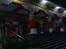 Tibetan colony Mundgod
Mundgod is the repository of Tibetan life and culture. It showcases the life style and ambitions of the Tibetan refugees and reflects the gradual transformation of a traditional society into modernity. It has rightfully earned the name Mini Tibet.
Reference : www.binoygupta.com/travel_india/travel-india-mundgod-mini-tibet-54/
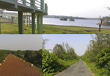
- Bachanaki Dam
 Bachanaki Dam between Mundagod and Attivery Bird sanctuary
It is about 6 km from Mundgod and 7 km from Attiveri Bird Sanctuary.
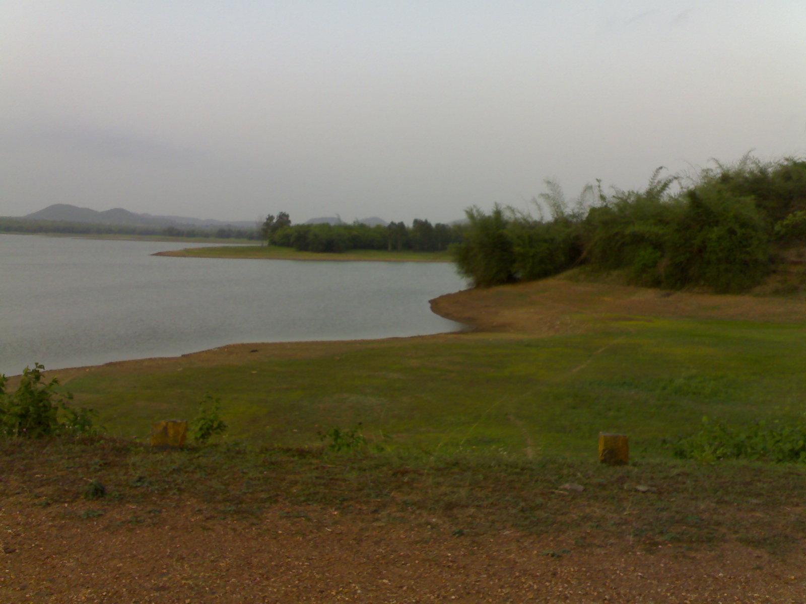
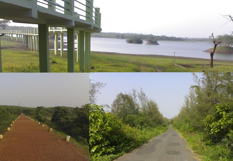
- Attiveri Bird Sanctuary
 Attivery Bird sanctuary
Attiveri Bird Sanctuary is around 15 km from Mundgod in Uttara Kannada District of Karnataka. from Hubli-Dharwad it is 43 km away.
Spread over an area of about 2.23 km2, the sanctuary is located in and around the Attiveri reservoir. The part of the sanctuary surrounding the reservoir has riverine and deciduous forests.
Birds that inhabit this area include Indian shag, cattle egret, little cormorant, spoonbill, pied kingfisher, white ibis, white-breasted kingfisher, Indian Grey Hornbill and common swallow. The agricultural fields surrounding the sanctuary attract a variety of aquatic creatures.
Best time to visit the sanctuary is between November and March.
Geography
Mundgod is located at 14°58′N 75°02′E / 14.97°N 75.03°E[1]. It has an average elevation of 567 metres (1860 feet).
Demographics
As of 2001[update] India census[2], Mundgod had a population of 16,171. Males constitute 51% of the population and females 49%. Mundgod has an average literacy rate of 67%, higher than the national average of 59.5%: male literacy is 73%, and female literacy is 62%. In Mundgod, 15% of the population is under 6 years of age.
With the help of the Government of India, the Tibetan administration, in the early 1960s, proposed to start a number of settlements for the Tibetan refugees. Tibetan settlement in Mundgod is one of them. Government of India in consultation with the state Government of Karnataka agreed to provide 4,000 acres (16 km²) of mostly forestland near Taluk village in North Kanara district 1900 feet (580 m) above sea level. The settlers were provided tents and bamboo huts for temporary shelter in the beginning. All the work in the settlement was done on co-operative basis and settlers were provided free dry ration. Doeguling Tibetan Settlement in Mundgod was established in 1966.
News and Media
Karwar eNews (http://www.karwarenews.com) is one of the major local newspaper in the region.
References
- ^ Falling Rain Genomics, Inc - Mundgod
- ^ "Census of India 2001: Data from the 2001 Census, including cities, villages and towns (Provisional)". Census Commission of India. Archived from the original on 2004-06-16. http://web.archive.org/web/20040616075334/http://www.censusindia.net/results/town.php?stad=A&state5=999. Retrieved 2008-11-01.
Uttara Kannada Taluks Tourist places Gokarna · Yana · Banavasi · Idagunji · Murudeshwar · Dandeli · Netrani Island
Jog Falls · Magod Falls · Sathodi Falls · Unchalli FallsSee also Project Seabird · Supa Dam · Kali River · Sharavathi River · Western Ghats · Konkani people
Categories:- Cities and towns in Uttara Kannada district


Wikimedia Foundation. 2010.