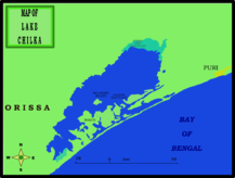
- Chilika Lake
-
Chilka Lake 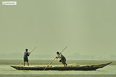
Fishermen pushing against the tide Coordinates 19°43′N 85°19′E / 19.717°N 85.317°ECoordinates: 19°43′N 85°19′E / 19.717°N 85.317°E Lake type Brackish Primary inflows 35 streams including the Bhargavi, Daya, Makra, Malaguni and Nuna rivers[1] Primary outflows old mouth at Arakhakuda, new mouth at Satapada to Bay of Bengal Catchment area 3,560 km2 (1,370 sq mi) Basin countries India Max. length 64.3 km (40.0 mi) Surface area min.: 740 km2 (286 sq mi)
max.: 1,165 km2 (450 sq mi)Max. depth 4.2 m (13.8 ft) Water volume 4 km3 (3,200,000 acre·ft) Surface elevation 0 – 2 m (6.6 ft) Islands 223 km2 (86 sq mi):
Badakuda, Honeymoon, Kalijai Hill, Kanthapantha, Krushnaprasadrah (Old Parikuda), Nalabana, Nuapara and Sanakuda.Settlements Puri and Satpara[2] References [1][2] 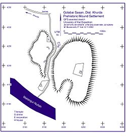 Golabai Sasan excavation site
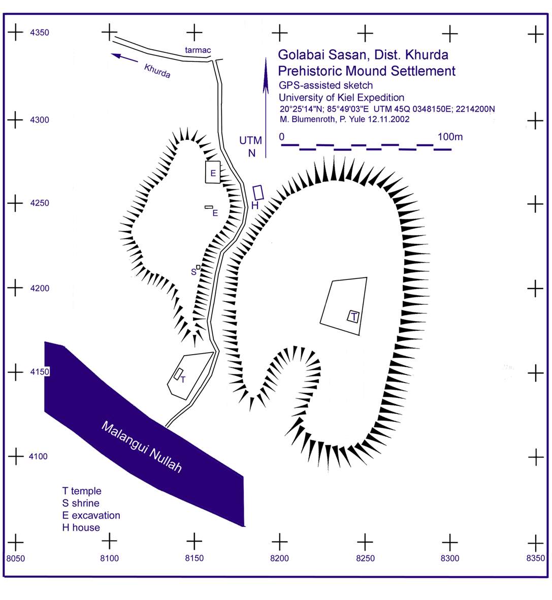
Chilka Lake (Chilika Lake) is a brackish water lagoon, spread over the Puri, Khurda and Ganjam districts of Orissa state on the east coast of India, at the mouth of the Daya River, flowing into the Bay of Bengal. It is the largest coastal lagoon in India and the second largest lagoon in the World.[3][4]
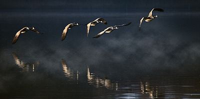
It is the largest wintering ground for migratory birds on the Indian sub-continent. The lake is home to a number of threatened species of plants and animals.[5][6] The lake is an ecosystem with large fishery resources. It sustains more than 150,000 fisher–folk living in 132 villages on the shore and islands.[7][8]
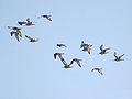
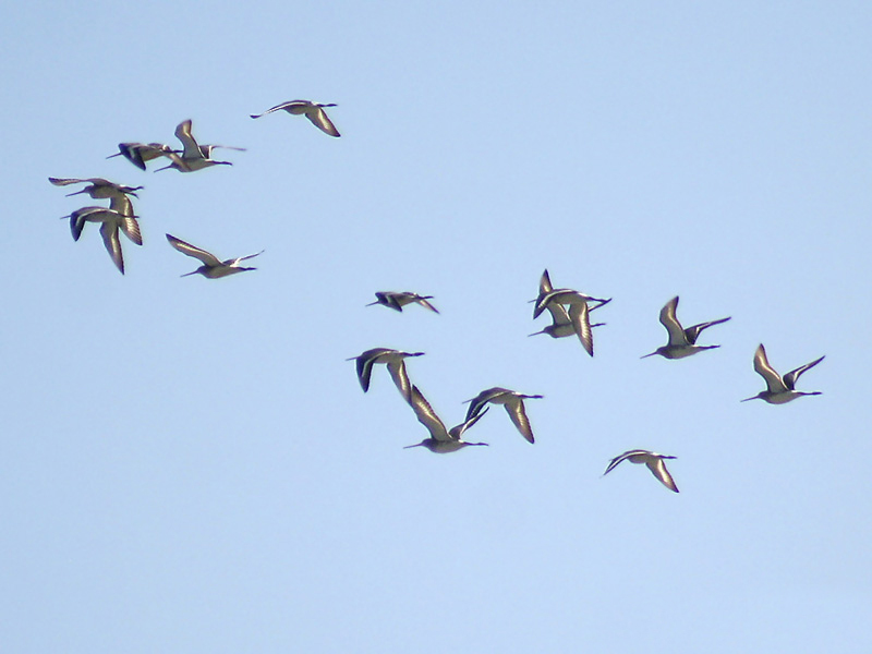
The lagoon hosts over 160 species of birds in the peak migratory season. Birds from as far as the Caspian Sea, Lake Baikal, Aral Sea and other remote parts of Russia, Kirghiz steppes of Mongolia, Central and southeast Asia, Ladakh and Himalayas come here. These birds travel great distances, but it must be stressed, that the migratory birds probably follow much longer routes than the straight lines, possibly up to 12,000 km, to reach Chilika River.
In 1981, Chilika Lake was designated the first Indian wetland of international importance under the Ramsar Convention.[9][10]
According to a survey, 45 percent of the birds are terrestrial in nature, 32 percent are waterfowl, and 23 percent are waders. The Lagoon is also home to 14 types of raptors.Around 135 rare and endangered Irrawaddy Dolphins have also been reported. Plus, the lagoon supports about 37 species of reptiles and amphibians.
The highly productive chilika lagoon eco-system with its rich fishery resources sustains the livelihood for many fisher men who live in and near the Lagoon. The water spread area of the Lagoon ranges between 1165 to 906 km2 during the monsoon and summer respectively. A 32 km long, narrow, outer channel connects the lagoon to the Bay of Bengal, near the village Motto, recently a new mouth was opened by CDA which has brought a new lease of life to the lagoon.
Microalgae, marine seaweeds, sea grasses, fishes and crabs also flourish in the brackish water of the Chilika Lagoon.
Contents
History
Geological evidence indicates that Chilika Lake was part of the Bay of Bengal during the later stages of the Pleistocene period (1.8 million to 10,000 years BP).
Excavations were conducted by the Archaeological Survey of India at Golabai Sasan (20°1′7″N 85°32′54″E / 20.01861°N 85.54833°E) just north of Chilka lake in Khurdha district.[11] Golabai provides evidence of a sequence of Chilka area culture in three phases: Neolithic (c. 1600 BCE), Chalcolithic (c. 1400 BCE to c. 900 BCE) and Iron Age (c. 900 BCE to c. 800 BCE). Radiocarbon dating traced the earliest level of Golbai to 2300 BCE. The site is located on the left bank of the Malaguni River, a tributary of the Daya River, which flows into Chilika Lake. This location, which gave access to the sea via Chilika Lake, gives strong evidence of the maritime activities of this region. The recovery of many woodworking adzes and other artifacts shows that Golabai was a boat-building centre. Significantly, Golabai is the only excavated site in Orissa where boat building has been revealed. This also indicates that Chilka lake was very close to Golabai and it facilitated the maritime trade of people in the area during the ancient period.[12]
Some ancient texts say the southern sector of Chilika was a major harbour for maritime commerce, when Kharavela (IAST: Khāravela, Devanagari: खारवेल) (c. 209 BCE–after 170 BCE), the King of Kalinga, was known as Lord of the Sea.[13]
Ptolemy (150 CE), the Greek geographer, referred to Palur as the port Paloura, located close to the point of departure situated outside of the southern tip of the lake at Kantiagarh, from where ships bound for different parts of Southeast Asia sailed. After 639, the Chinese Pilgrims Fa-Hien and Hiuen-Tsang mention a famous port "Che-li-ta-loChing" near the shore of the ocean which was a thoroughfare and resting place for sea-going traders and strangers from distant lands. This port was located at ‘Chhatragarh’ on the banks of Chilika Lake.[12]
A fourth century legend, often told to explain the birth of Chilika, states that the pirate king, Raktabahhu, planned to attack Puri with a huge fleet of ships. To avoid detection, he stealthily anchored out of sight, off the mouth to the sea. The deception was revealed by ships' refuse floating to the shore, thus warning the town’s people, who escaped with all their possessions. Raktabahu felt betrayed when he found an abandoned town and directed his fury towards the sea that had betrayed him. The sea parted to let the army march in, then surged back, drowned the army and formed the present lake.[2]
Archeological excavations discovered Seventh century ship anchors and stone memoirs dedicated to battle heroes at a village named Kanas, about 25 km (16 mi) north of Chilika on the banks of Nuna river, which flows into the lake. This gives evidence of an historic naval engagement off the coast.
A 10th century text, the Brahmanda Purana, mentions Chilika Lake as an important centre of trade and commerce, and a shelter for ships sailing to Java, Malaya, Singhala, China and other countries. This suggests that the lake was then deep enough for berthing sea-going ships and had a channel to the sea big enough for loaded trading ships embarking to Southeast Asia.[14][15][16] The villagers around Chilika Lake still observe an annual festival called "Bali Yatra" (Journey to Bali).
In 1803, the British entered the shores of the lake, reached Puri and occupied Orissa with the help of Fateh Muhammed. Fateh Muhammed in turn was rewarded by the British with freehold of the areas of Malud and Parikud, of the present day Garh Krishnaprasad revenue block.[13]
Over the years, Poets including Kabibar Radhanath Ray and Pandit Godavarish Mishra, Freedom fighters and Saints have extolled historicity of the lake as pertinent to its cultural, spiritual and religious aspects.[13][14]
“Gopabandhu Das, a famous Oriya poet, became impatient to see the beauty of the march of colorful sights and sounds of Chilika lagoon while going by train. He asked the speeding train to stop for a moment so that he could enjoy the beauty. It is because of the beauty that arrests him much”.[17]
Geology
The lake is of estuarine character in an ephemeral environment. Geological studies indicate that the coastline extended along the western shores of the lake in the Pleistocene era with its northeastern region lying under the sea. That the coastline has moved eastward over the ages is supported by the fact that the nearby Konarak Sun Temple, built originally on the seashore a few hundred years ago, is now about 3 km (2 mi), away from the coast.
The catchment area of Chilika lake has a rock, sand and mud substratum. It contains a wide range of sedimentary particles such as clay, silt, sand, gravel and shell banks but the major part of the catchment area is silt. Around 1.6 million metric tons per year of sediment is deposited in Chilika lake by rivers Daya and several streams.[17]
It is conjectured that a rise in worldwide sea levels over the last 6,000–8,000 years occurred with a pause in the rise of sea level about 7,000 years ago, which could have resulted in the formation of a sandy beach near the coast at the Southern sector. With rise in the sea level, the sand beach grew gradually, progressed seaward to the northeast and formed the spit of Chilika. A fossil unearthed from the southwestern edge of the spit indicates that the lake was formed about 3,500–4,000 years ago. The abrupt change in the direction of the coast north of the lake, strong winds shifting sand to the shore, long shore drift (littoral drift), the presence or absence of strong river and tidal currents in different areas are the reasons attributed for the growth of the spit.[13]
White bands of coral in the southern sector, at a height of 8 m (26 ft), above the present water level, shows that the area was once marine and that the water was much deeper than present.[13] The chronological development of the outer barrier spit of the lake has been dated by Optically stimulated luminescence studies of minerals. This was done on sixteen samples of the lake bed. The studies indicated doses of between 153 ± 3 mGy and 2.23 ± 0.07 Gy, corresponding to ages from 40 years at the top of the spit to 300 years at the bottom. The youngest ages are consistent with the age of the overlying vegetation. A clearly defined period of >2.5 miles (4.0 km) of barrier construction 40 years ago is identified. Prior to that the deposition rate was relatively constant for 300 years.'"[18]
Geography and topography
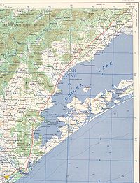
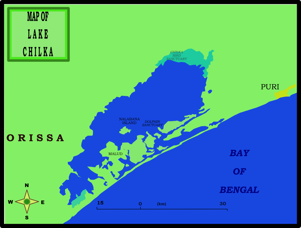
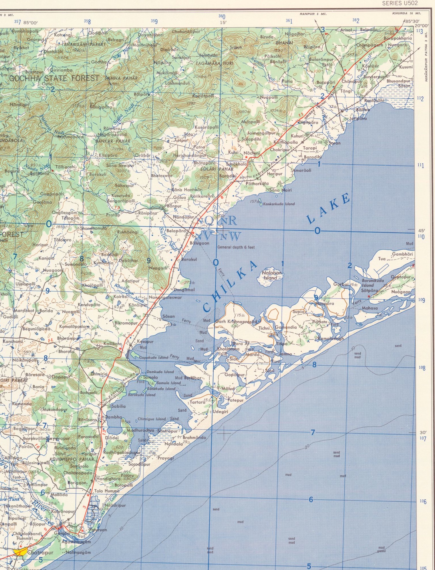
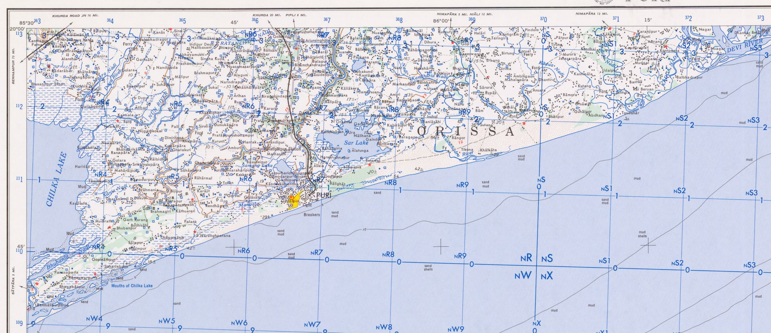
 Map of Chilka Lake showing Nalaban Island, Chilka Bird Sanctuary, Dolphin Sanctuary, Puri town and Malud peninsula.
Chilika Lake is a shallow bar-built estuary with large areas of mudflats. The western and southern margins of the lake are fringed by the Eastern Ghats hill range.[16]
Several inland rivers, which bring silt into the lake, control the northern end of the lake. A 60 km (37 mi) long barrier beach called Rejhansa,[19] formed by northerly currents in the Bay of Bengal, resulted in the formation of this shallow lake and forms its eastern side. As an ephemeral lake, it’s water surface area varies from 1,165 km2 (449.8 sq mi) in the summer monsoon season to 906 km2 (349.8 sq mi) in the winter dry season.
 Chilka Lake-central & west
1958 Topographic map, 1:250,000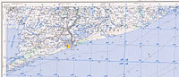 Chilka Lake-east end
The lake has numerous islands. The larger islands, separated by shallow channels, lie between the barrier and the main body of the lake. A total 42 km2 (16 sq mi) of channels connect the lake with Bay of Bengal.[14] The six major islands are Parikud, Phulbari, Berahpura, Nuapara, Nalbana, and Tampara. These islands, together with the Peninsula of Malud, constitute the Krishnaprasad Revenue Block of Puri District.[4][8]
The north shore of the lake is part of Khordha District and the western shore is part of Ganjam District. Due to siltation, the width of the barrier has fluctuated and the mouth to the sea has periodically been closed. The location of the mouth has also frequently shifted, generally towards the northeast. The mouth, which was 1.5 km (0.9 mi) wide in 1780, was only .75 km (0.5 mi) forty years later. The local fishermen, to maintain their livelihood, had to cut open the mouth regularly to gain access to the sea for fishing.[13]
Water depth of the lake varies from 0.9 ft (0.3 m) to 2.6 ft (0.8 m) in the dry season to 1.8 m (5.9 ft) to 4.2 m (13.8 ft) in the rainy season. The width of the old channel to the sea, now reported to be about 100 m (328.1 ft), is known as Magarmukha (Mouth of the Crocodile). The lake is divided into four separate zones namely, the southern, central, northern sectors and the outer channel area. A 32 km (19.9 mi) long outer channel connects the lake with the Bay of Bengal at Arakhuda village. The lake is vaguely pear shaped and has a maximum length of 64.3 km (40.0 mi) with a mean width of 20.1 km (12.5 mi).[4][20]
Hydrology
Three hydrological subsystems control the Hydrology of the lake. The land based system comprises distributaries of the Mahanadi River on the northern side, 52 river channels from the western side and the Bay of Bengal on the eastern side. Two of the three southern branches of the Mahanadi River that trifurcates at Cuttack, feed the lake. 61% (850 cubic metres per second (30,000 cu ft/s)) of the total fresh water inflow into the lake is contributed by these two branches.
The second drainage system which is non–perennial accounts for 39% (536 cubic metres per second (18,900 cu ft/s)). The important rivers of this drainage system are the Kansari, the Kusumi, the Janjira and the Tarimi rivers. The annual total surface freshwater input to the lake is estimated to 1.76 cubic kilometres (1,430,000 acre·ft) including direct precipitation over the lake contributing 0.87 cubic kilometres (710,000 acre·ft) All the inland river systems disgorge an annual flow of about 0.375 million cubic metres (304 acre·ft) of freshwater which is estimated to carry 13 million metric tons of silt into the lake. On the north east a channel connects the lake to the Bay of Bengal.
A tropical monsoon climate prevails over the drainage basin area of the lake. The lake experiences South–west and North-east monsoons during June to September and November to December respectively with average annual rainfall of 1,238.8 mm (48.77 in), with 72 rainy days. The maximum temperature of 39.9 °C (103.8 °F) and minimum temperature of 14 °C (57.2 °F) have been recorded. The wind speed varies from 5.3 to 16 metres (17 to 52 ft)/hour[dubious ] with southerly and southwesterly direction due to the influence of the South–west monsoon and from north and north easterly direction during the rest of the months.[5]
Water and sediment quality
The Chilika Development Authority (CDA) established an organized system of water quality measurements and limnological investigations indicating the following physico–chemical characteristics of the lake waters.[5]
- Lake water is alkaline – pH ranging from 7.1 – 9.6 with total alkalinity matching the salinity. The southern part of the lake near Rambha has recorded the highest alkalinity.
- Bathymetry survey indicates extreme shallow depths in the northern sector, with less than 1.5 m (5 ft) in a large area. The southern sector of the lake has recorded the maximum depth of 3.9 m (12.8 ft)
- High turbidity due to strong mixing of overlying water with sediments is confirmed by observed transparency values ranging between 9 and 155 cm (0.30 and 5.09 ft).
- Salinity levels in the lake show wide temporal and spatial variation due to a complex blend of freshwater discharge, evaporation, wind condition and tidal inflow of seawater. The brackish nature of the lake is depicted by the 0 parts per thousand near the Daya River mouth to hyper-saline level of 42 ppt in the outlet channel during the dry period.
- The dissolved oxygen values were between 3.3–18.9 mg/l.
- Phosphate phosphorus (0–0.4 ppm), nitrate nitrogen (10–60 ppm) and silicates (1–8 ppm) are high in the north and northwest part of the lake where most of the rivers discharge into the lake with large amounts of silt and nutrients.
- The lake is broadly divided into four zones on the basis of salinity values, namely the southern, central, northern and outer channel. Tidal influx of seawater during monsoon is arrested by the strong influx of a large amount of fresh water from the northern and central zones. Brackish water conditions in the southern zone, even during monsoon, prevail due to low water exchange. Salinity in the southern zone decreases during the post monsoon period and in winter as northern winds facilitate mixing of water with rest of the lake. During the summer, intrusion of salt water from the outer channel into the lake increases since water level of the lake is at its lowest level. A general increase in salinity of the central and northern zones occurs due to wind induced mixing by the predominantly southern winds and salinity in the southern zone does not rise appreciably.[5]
- Sedimentation
Adverse tidal exchange occurred due to the littoral drift along the coast line causing flow reduction and shifting of the lake mouth every year. Estimated sediment transport due to this is on the order of 100,000 metric tons. This adverse effect needed ameliorative actions.[20]
Sediment cores were collected from different locations of the lake. The result indicated spatial variation of sedimentation rate in three zones of the lake of 7.6 millimetres (0.30 in)/year (Northern Sector), 8.0 millimetres (0.31 in)/year (Central Sector) and 2.8 millimetres (0.11 in)/year (SouthernSector). The non–uniform sedimentation rate along with the porosity and water content of the sediment cores were also analysed which indicated the lake had different deposition zones, with comparatively higher sedimentation rate in Northern and Central Sector and a slow rate in the Southern Sector.[21]
Conservation — threats and management
In 1981, Chilika Lake was designated the first Indian wetland of international importance under the Ramsar Convention due to its rich biodiversity as shown by the facts that:
- Over a million migratory waterfowl and shorebirds winter here.
- Over 400 vertebrate species have been recorded.
- As an estuarine lagoon, it supports a unique assemblage of marine, brackish and freshwater species.
- Several rare and endangered species are found in the region.
- The lake supports fisheries that are the lifeline of the community.
- The lake is of great value in preserving genetic diversity.
- There is an Increase in weeds and aquaculture activities.[9][10]
- Threats
Over the years, the ecosystem of the lake encountered several problems and threats such as:
- Siltation due to littoral drift and sediments from the inland river systems
- Shrinkage of water surface area
- Choking of the inlet channel as well as shifting of the mouth connecting to the sea
- Decrease in salinity and fishery resources
- Proliferation of fresh water invasive species and
- An overall loss of biodiversity with decline in productivity adversely affecting the livelihood of the community that depended on it
- Fights between fishermen and non-fishermen communities about fishing rights in the lake and consequent court cases
The rapid expansion of commercial aquaculture of prawn has contributed significantly to the decline of the lakes fisheries and bird population.[22]
Concerted action was initiated by the Orissa State Government with support from the Government of India to adopt adaptive conservation and management actions.[6][20]
By 1993, the problems in Chilika were so severe that the lake was put under "The Montreux Record" as the lake was considered to have “undergone, to be undergoing, or to be likely to undergo change in its ecological character brought about by human action”. The purpose was to stimulate remedial measures for the lake's conservation, supplemented with adequate monitoring. It was expected that such an action would benefit from the advice from Ramsar Advisory Mission and other identified technical assistance programmes.
In summary, siltation from upstream led to shrinkage of the water surface area, decrease of salinity and prolific growth of invasive fresh water aquatic weed infestation, all of which had a serious negative impact on habitat of wildlife and fishery resources.[17]
- Chilika Development Authority (CDA)
In 1992, the Government of Orissa, concerned by the degradation of the lake's ecosystem and cognizant of significant numbers of people who were dependent upon the lake's resources, set up the Chilika Development Authority (CDA). The CDA was set up for restoration and overall development of the lake under the Indian Societies Registration Act as a parastatal body under the administrative jurisdiction of the Forest and Environment Department, with the following charter:
- To protect the Lake ecosystem with all its genetic diversity
- To formulate the management plan for Integrated Resource Management and wise use of the lake's resources by the community depending on it
- To execute multidimensional and multidisciplinary developmental activities either itself or through other agencies
- To collaborate with various national and international institutions for development of the lake[20]
The governing body of the Authority is headed by the Chief Minister of Orissa State and has people’s representatives (Members of Parliament and Legislative Assembly), representatives of the fisherfolk communities and secretaries of the key departments, experts and eminent scientists as its members.
In 1998, an executive committee constituted with financial authority, supplemented with financial support from the Tenth and Eleventh Finance Commissions of the Government of India, gave support to the management initiatives taken up by CDA. This facilitated a coordinated approach to plan and implement effective ameliorative management actions.
An Integrated Management Plan was implemented with financial support of Rs 570 million (US$12.7 million) out of “special problem grants” recommended by the Finance Commissions. Hydrobiological monitoring was supported under the Orissa Water Resources Consolidation Project of the World Bank, to the extent of Rs 10 million (US$220,000). A strong support network was created with 7 state government organizations, 33 NGOs, 3 national government ministries, 6 other organizations, 11 international organizations, 13 research institutions and 55 different categories of community groups.[20]
In 2003, collaboration of Indian and Japanese experts led to a friendly relationship between Chilika lake and Saroma Lake in Japan called Sister Wetlands.[17]
- Ameliorative actions
Considering the threats faced by the lake, the National Wetlands, Mangroves and Coral Reefs Committee of the Ministry of Environment & Forests, Government of India, also identified the lake as a priority site for conservation and management.[5] The ameliorative actions taken by the CDA to restore the ecosystem and to improve the socio-economic conditions of the communities living around the lake and on its islands involved the following.
 Chilika Sea mouth
- Opening the lake mouth
The most effective ameliorative action was the hydrological intervention of opening the new lake mouth and channel to the sea through the barrier beach at Satapura. This improved the spatial and temporal salinity gradients of the lake to maintain the unique characteristics of an estuarine eco-system. This intervention was undertaken after detailed scientific studies, including 3-dimensional mathematical modeling and hydraulics studies on a model prototype, were carried out by the Central Water and Power Research Station, Pune and National Institute of Oceanography, Goa. In September 2000, the desiltation of the channel connecting the lake to the sea and opening of a new mouth to restore the natural flows of water and salinity levels was carried out. These actions resulted in a notable increase in the lake's fish yield and a reduction of freshwater weeds. The new mouth reduced the length of the outflow channel by 18 kilometres (11 mi).[10][23] Opening of the new mouth provided a favorable increased salinity regime throughout the lake with less fluctuations and improved water clarity.[17] detailed results of this action can be seen in the references cited in External sources.
Other measures included:
- Catchments management in a “participatory micro watershed management in a whole ecosystem approach”
- Protection of bird habitat and of bird species
- Economic incentives to the local population to stop poaching of birds
- Measures to improve the socio–economic conditions, such as training programmes to develop eco-tourism,
- Provision of solar streetlight systems to island villages
- Development of a ferry service for isolated villages
- Construction of landing facilities for fisher folk, as well as education and environmental awareness activities.
In 2002, Chilika was taken out of the Montreux Record, in light of the improved conditions of the lake.[9][10] Chilika lake is the first Ramsar site in Asia to be removed from the Montreux record.[17]
- Awards
 2002 Award for outstanding achievements
- In November 2002, the Ramsar Wetland Conservation Award was presented to the Chilika Development Authority for "outstanding achievements in the field of restoration and wise use of wetlands and effective participation of local communities in these activities".[9][10]
- The Indira Gandhi Paryavaran Puruskar, constituted by the Ministry of Environment and Forests, Government of India awarded the prestigious Indira Gandhi Paryavaran Award–2002 to the Chilika Development Authority for the outstanding contribution of conservation and restoration of the Chilika lake eco-system.[24]
Flora and fauna
The ecological richness of the lake is of great value in preserving the genetic diversity because of the multiplicity of its habitat, flora and fauna. (Some are pictured in the photo gallery).[6] The Zoological Survey of India (ZSI) surveyed the lake between 1985 and 1988 and identified 800 species of fauna, including many rare, endangered, threatened and vulnerable species, but excluding terrestrial insects.
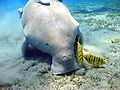
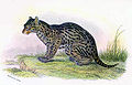
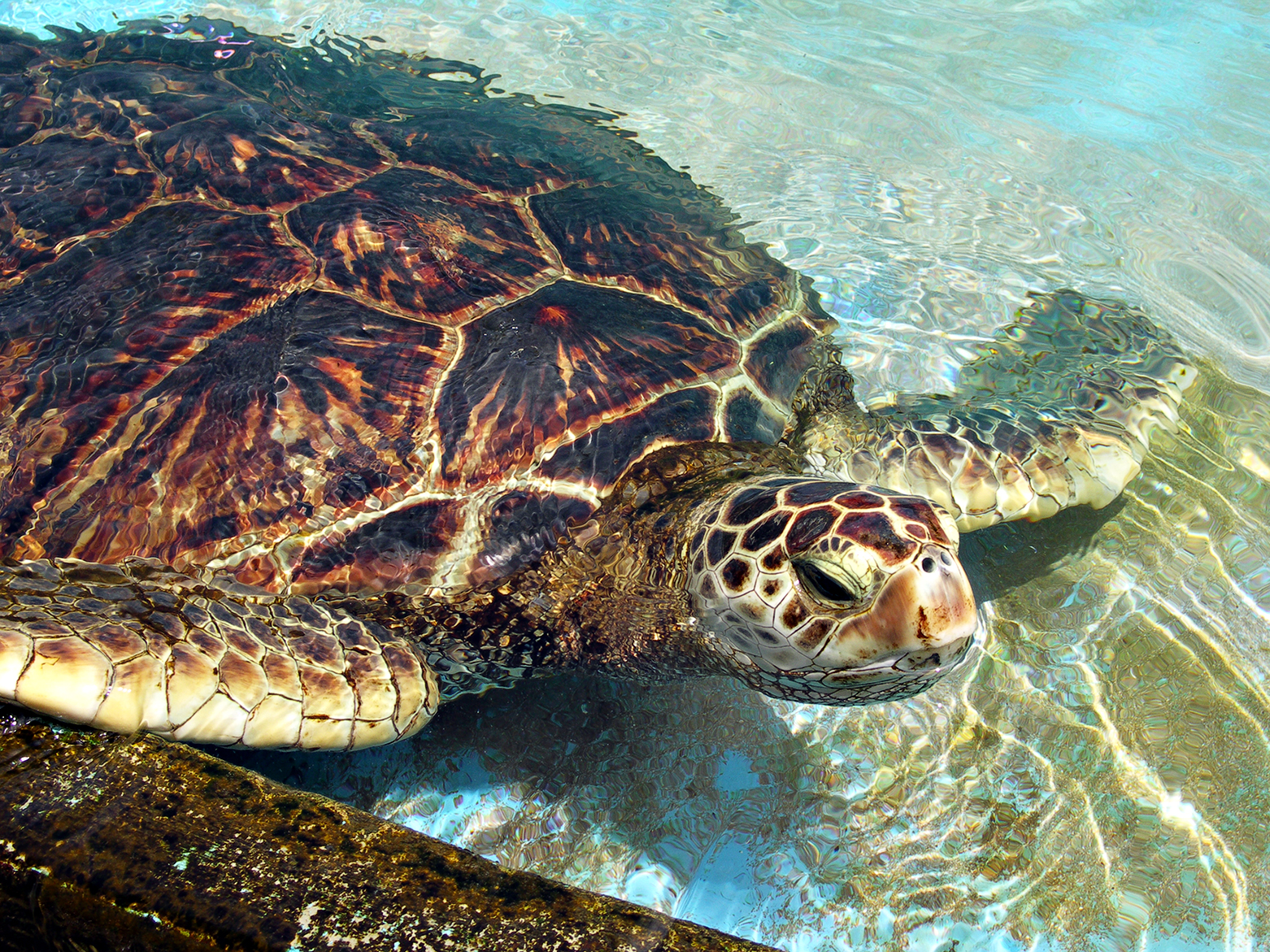
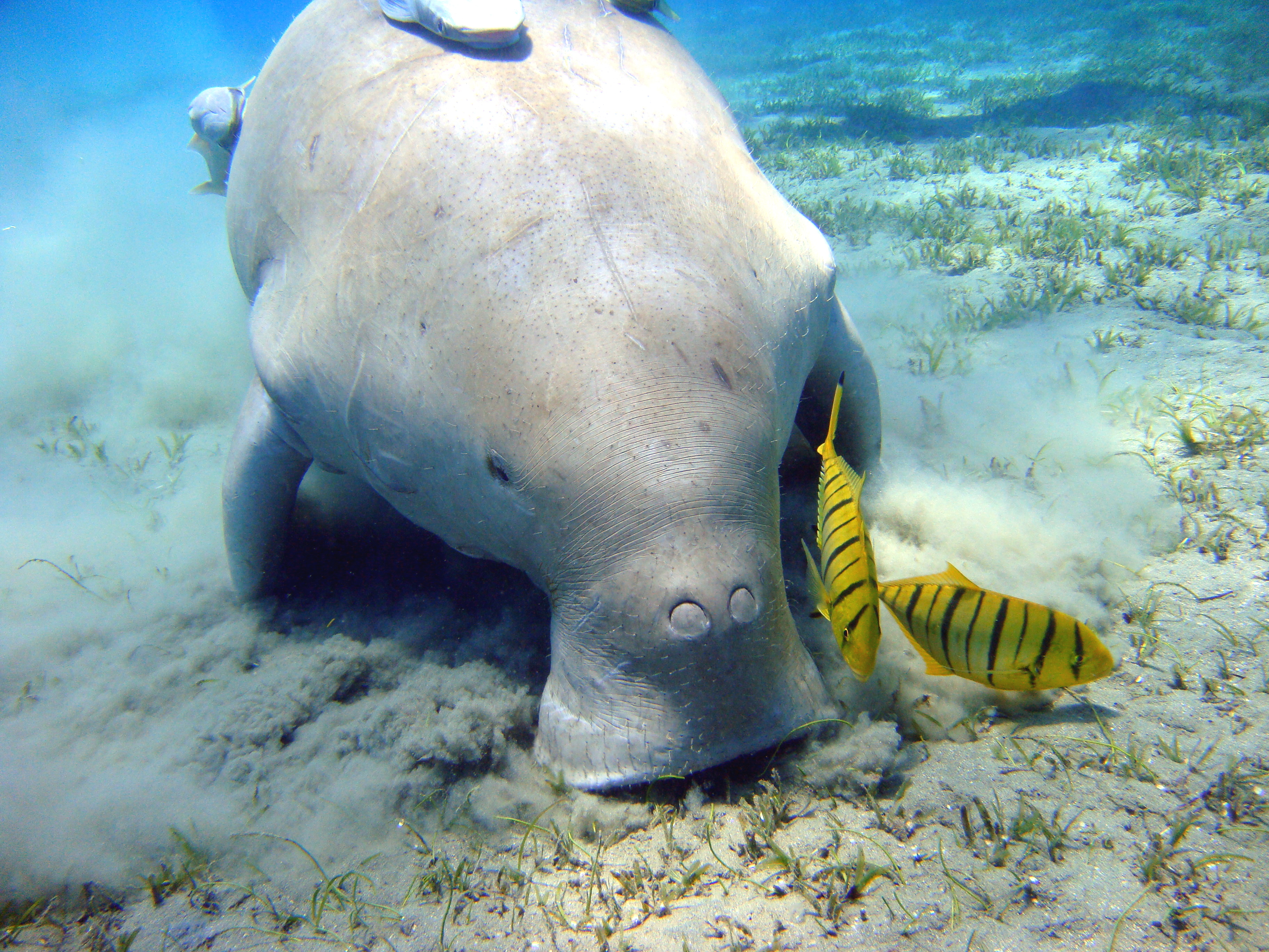
The rare and threatened animal species identified are green sea turtle (EN), dugong (VU), Irrawaddy dolphin (VU), blackbuck (NT), Spoon billed sandpiper (CR), limbless skink and fishing cat (EN). 24 mammalian species were reported. 37 species of reptiles and amphibians are also reported.[6][7]
Flora
Recent surveys revealed an overall 726 species of flowering plants belonging to 496 genera and 120 families. This represents about one –fourth of the vascular plant species of the Orissa state where some 2900 species altogether are found. Fabaceae is the most dominant plant family followed by Poaceae and Cyperaceae. Certain species were found to be characteristic of specific islands. The flora is predominantly of aquatic and sub-aquatic plants. Overall 726 species of flowering plants belonging to 496 genera and 120 families have been recorded. Fabaceae is the predominant plant family followed by Poaceae and Cyperaceae. The species reported are leguminosae, poaceae, and cyperaceae; endemic cassipourea ceylanica; five species of seagrass, and more. Important species identified are:.[6][20]
- Leguminosae, Poaceae, and Cyperaceae
- Endemic Cassipourea ceylanica
- Five species of seagrass
- Wild plants of horticultural importance and interesting plant groups such as insectivorous plants, epiphytes, parasites and lithophytes
- Mangrove associates, such as Aegiceras corniculatus, Excoecaria agalloch, Salvadora persica, Pongamia pinnata, Colubrina asiatica, Capparis roxburghii, Macrotyloma ciliatum and many others.
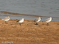
Avifauna
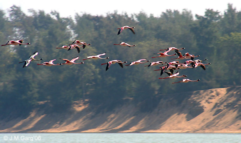
 A flock of Lesser Flamingos at Chilika Lake
Chilika Lake is the largest wintering ground for migratory birds, on the Indian sub-continent. It is one of the hotspots of biodiversity in the country. Some species listed in the IUCN Red List of threatened animals inhabit the lake for at least part of their life cycle.[25]
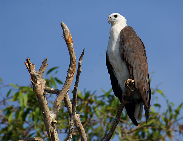
White bellied sea eagles, greylag geese, purple moorhen, jacana, herons and flamingos, Egrets, Gray and Purple Herons, Indian Roller, Storks and White Ibis, Spoonbills, Brahminy Ducks, Shovellers and Pintails, and more.
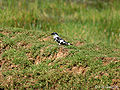
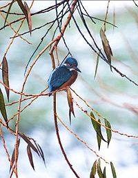 Kingfisher waiting for a fish to hunt
 White Ibis bird's during season of Winter in Chilika Lake
Migratory water fowl arrive here from as far as the Caspian Sea, Baikal Lake and remote parts of Russia, Mongolia, Lakah, Siberia, Iran, Iraq, Afghanistan and from the Himalayas.[14] A census conducted in the winter of 1997-98 recorded about 2 million birds in the lake.[26]
 Indian Roller bird's
In 2007, nearly 840,000 birds visited the lake, out of which 198,000 were spotted in Nalbana Island. On Jan 5, 2008, a bird census involving 85 wildlife officials counted 900,000 birds of which 450,000 were sighted in Nalabana. Removal of invasive species of freshwater aquatic plants, especially water hyacinth, due to restoration of salinity, is a contributing factor for the recent increasing attraction of birds to the lake.[14][27]
- Nalbana Bird Sanctuary
Nalbana Bird Sanctuary — nature reserve — Coordinates 19°41′39″N 85°18′24″E / 19.69417°N 85.30667°E Country India State Orissa Time zone IST (UTC+05:30) Area
15.53 square kilometres (6.00 sq mi)
• 2 metres (6.6 ft)
Coordinates 19°41′39″N 85°18′24″E / 19.69417°N 85.30667°E Website http://www.wildlifeorissa.in/chilika.html Nalbana Island is the core area of the Ramsar designated wetlands of Chilika Lake. Nalbana means a weed covered island In the Oriya language. It is a major island in the center of the lake and has an area of 15.53 km2 (6.00 sq mi)[dubious ]. The island gets completely submerged during the monsoon season. As the monsoon recedes in the winter, lake levels decrease and the island is gradually exposed, birds flock to the island in large numbers to feed on its extensive mudflats. Nalbana was notified in 1987 and declared a bird sanctuary in 1973 under the Wildlife Protection Act.[14][28]
Large flocks of Greater flamingos from Iran and the Rann of Kutch in Gujarat, feed in the shallow waters of the lake. Other-long legged waders seen around Nalbana Island are the Lesser Flamingos, Goliath Heron, Grey herons, and Purple herons, Egrets, Spoonbills, Storks and Black-headed Ibis.
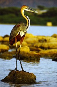 Goliath Heron
Rare birds reported in the lake are Asiatic Dowitchers (NT), Dalmatian Pelican (VU), Pallas's Fish-eagles (VU), the very rare migrant Spoon-billed Sandpiper (CR) and Spot-billed pelican (NT).[28][29]
The White-bellied Sea Eagle, Pariah Kite, Brahminy Kites, Kestrel, Marsh harriers, and the world's most widespread bird of prey, peregrine falcon, are among the raptors seen here.[28]
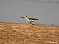
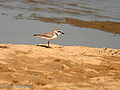
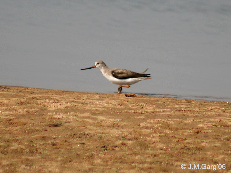
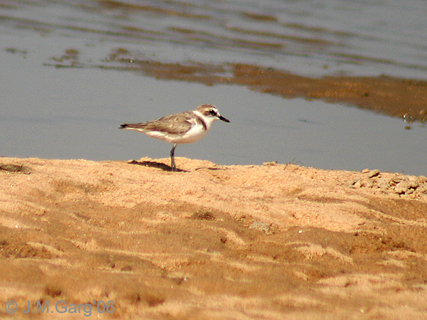
Many short-legged shorebirds are seen in a narrow band along the shifting shores of the lake and islands. These include Plovers, the Collared Pratincole, Ruff, Dunlin, Snipes and Sandpipers. Larks, Wagtails and Lapwings are also found on the mudflats. Feeding in deeper water are the longer-legged Avocets, Stilts and Godwits.
The higher vegetated areas of the lake support Moorhens, Coots and Jacanas. Pond Herons and Night Herons can be seen along the shores with Kingfishers and Rollers. Little Cormorants are seen on perches around the lake, Compact flocks of Brahminy Ducks, as well as Shovellers, Pintails, Gadwall, Teals, Pochards, Geese and Coots, are also seen.[30]
Nesting colonies of Gull-billed terns and River terns are seen on the Nalabana Island. In 2002, The Bombay Natural History Society survey recorded 540 nests of the Indian River Tern at the island, the largest nesting colony in the southeast Asia.[28]
Aqua fauna
As per the Chilika Development Authority’s (CDA) updated data (2002), 323 aquatic species, which includes 261 fish species, 28 prawns and 34 crabs are reported out of which sixty five species breed in the lake. 27 species are freshwater fishes and two genera of prawns. The remaining species migrate to the sea to breed. 21 species of herrings and sardines of the family Clupeidae are reported.
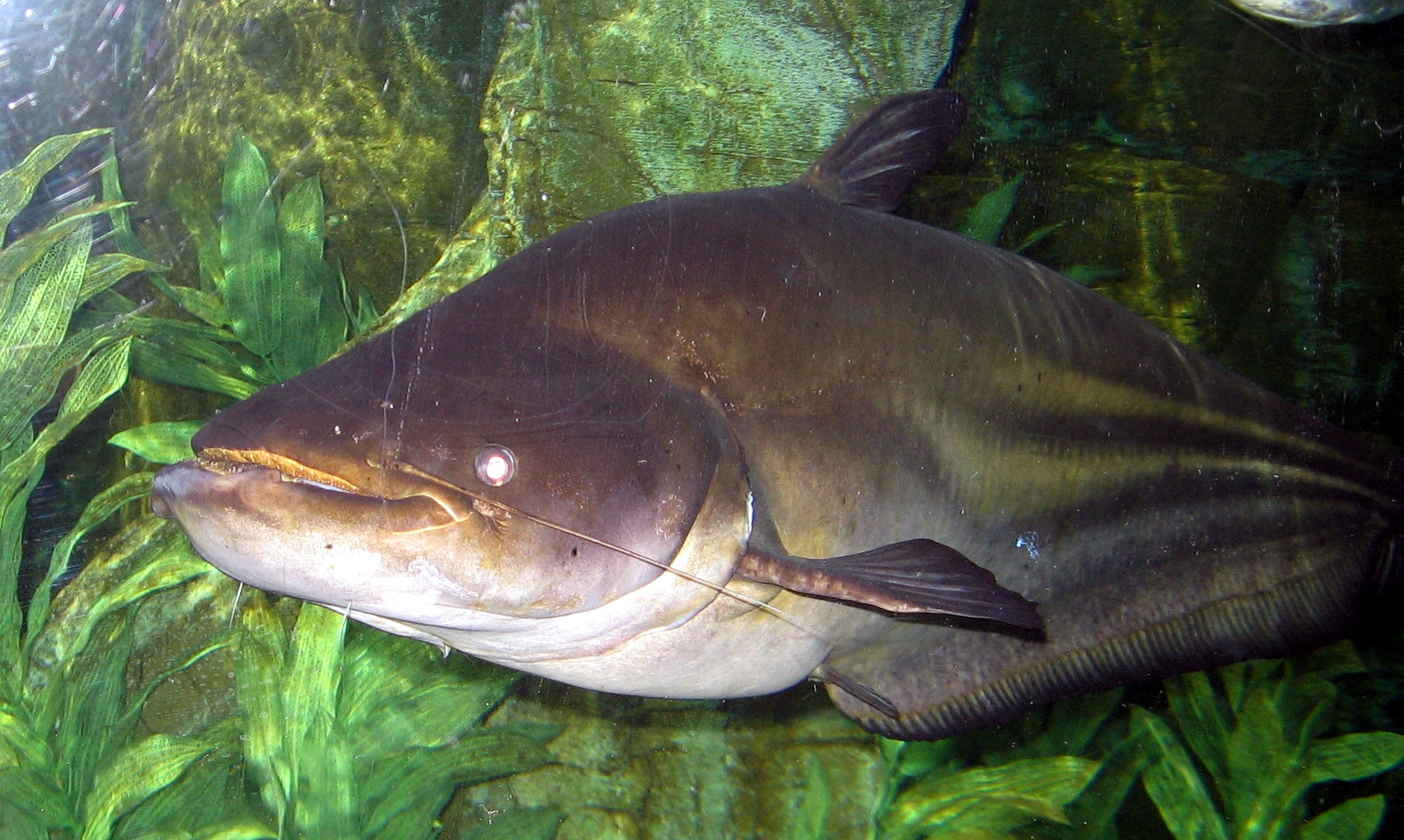
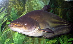 Wallago attu – A common type of fish in the lake
Between 1998–2002, 40 fish species were recorded here for the first time and following the reopening of the lake mouth in 2000, six threatened species have reappeared, including:
- Milk fish (Seba khainga),
- Indo-Pacific tarpon (Panialehio),
- Ten pounder (Nahama),
- Bream (Kala khuranti),
- Hilsa (Tenuealosa) ilisha (ilishi) and
- Mullet R. corsula (Kekenda)[6][7]
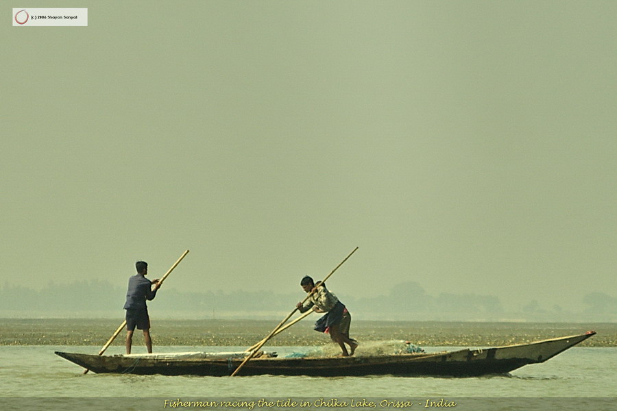
- Commercial fisheries
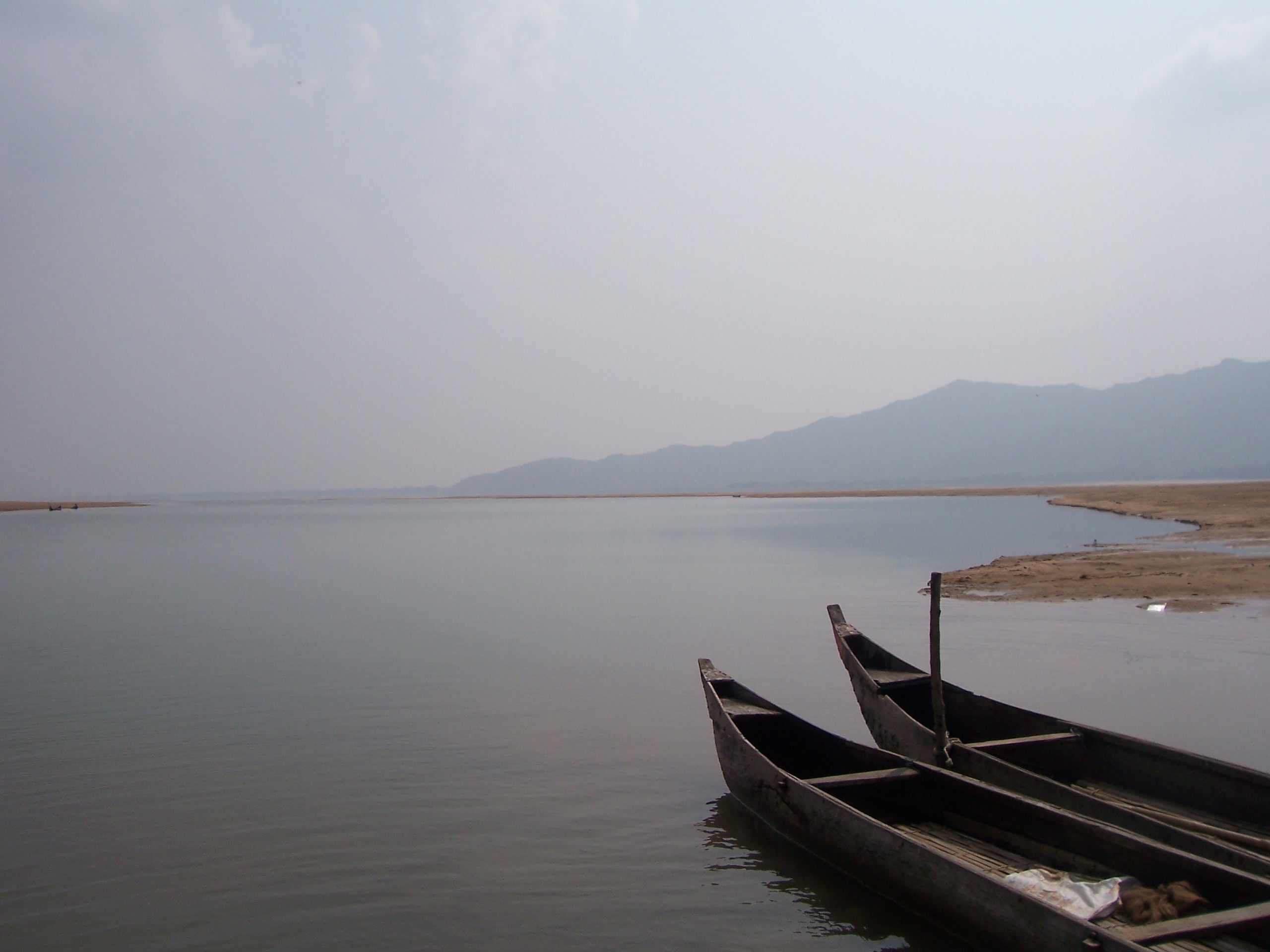
For centuries fisher folk evolved exclusive rights of fishing through a complex system of partitioning the fisheries of the lake, harvested the lake in a relatively sustainable fashion and developed a large range of fishing techniques, nets and gear.[13]
During the British rule, in 1897–98, fishermen community enjoyed exclusive fisheries rights in the lake. The fisheries of the lake were part of the Zamindari estates of Khallikote, Parikud, Suna Bibi, Mirza Taher Baig and the Chaudhary families of Bhungarpur and the Khas mahal areas of Khurda, lying within the kingdoms of the Rajas of Parikud and Khallikote. The zamindars (Landlords) leased out the fisheries exclusively to the local fisherfolk.[13]
With the abolition of zamindari (land lordship) system in 1953, traditional fishing areas continued to be leased out to cooperatives of local fishermen. Fishing, particularly, prawn fishing, became increasingly remunerative with outside interest playing an important role. But in 1991, when the government of Orissa proposed a leasing policy that would have resulted in the auction of leases to the highest bidder, the Fishermen’s cooperatives challenged the order in court. The High Court of Orissa ordered the Government to enact changes that would protect the interests of traditional fishermen and since then no new leases have been reported. This has resulted in a chaotic regime in which powerful vested interests from outside dominate, and the local people have been subordinated.[13]
Butter catfish and Wallago attu are the most common type of fish found in the lake. 11 species of fish, 5 species of prawn and 2 crab species are commercially important. The commercially important prawn are Giant tiger prawn, Penaeus indicus (Indian white shrimp), Metapenaeus monoceros (Speckled shrimp), Metapenaeus affinis (Pink prawn) and Metapenaeus dobson (Kadal shrimp). Mangrove crab is the most important commercial crab.[22] Fish landings in the lake, which fluctuated in the past, have recorded a remarkable recovery after the opening of the new mouth and dredging of silt –choked old mouth Magarmukh in 2000–2001, resulted in a better intermixing of the tidal influx from the sea and freshwater inflow from rivers. Against an all time lowest landing of fish and prawn of 1,269 t (1,399 short tons) in 1995–96, the all time high is reported to be 11,878 t (13,093 short tons) during 2001–2002 resulting in an estimated per capita income for the fisher folk of Rs 19,575 (about US$392) during the year.[7] Recently, the Government of Orissa have issued a notification banning the lease of Chilika Lake for Culture Fishery.[13]
- Dolphins
The Irrawaddy Dolphin (Orcaella brevirostris) is the flagship species of Chilika lake. Chilka is home to the only known population of Irrawaddy dolphins in India[31] and one of only two lagoons in the world that are home to this species.[29] It is classified as Critically Endangered, in five of the six other places it is known to live.[32]
A small population of Bottlenose dolphins, also migrate into the lagoon from the sea.[3] Chilika fishermen say that when Irrawaddy Dolphins and Bottlenose Dolphins meet in the outer channel, the former get frightened and are forced to return toward the lake.[33]
Some Irrawaddy dolphins used to be sighted only along the inlet channel and in a limited portion of the central sector of the lake. After the opening of the new mouth at Satapada in 2000, they are now well distributed in the central and the southern sector of the lake.[29] The number of dolphins sighted has varied from 50 to 170. A 2006 census counted 131 dolphins and the 2007 census revealed 138 Dolphins. Out of the 138 dolphins, 115 were adults, 17 adolescents and six calves. 60 adults were spotted in the outer channel followed by 32 in the central sector and 23 in the southern sector.[34]
Dolphin tourism provides an important alternative source of income for many local residents. There are four tourist associations in Satapada employing three hundred and sixty 9-HP long-tail motor boats taking tourists to a 25 km2 (9.7 sq mi) area of the lake for dolphin watching. About 500 fishing families are involved in this business.[31] The Orissa Tourism Department and the Dolphin Motorboat Association, an NGO at Satpada, report about 40,000 tourists visit Chilika every year for dolphin Watching. October–January and May–June are the peak season for tourists at Chilika, with a maximum 600-700 per day during December–January. The Dolphin Motorboat Association has 75 8-passenger motorboats for dolphin watching. Tourists pay Rs. 250 for 60–90 minutes per trip. According to the Association, most tourists see dolphins. Only 5% return disappointed. Besides the Association, the Orissa Tourism Department organises "dolphin-watch" for tourists. Even during monsoon, about 100 tourists/day visit the lake.[11]
Boat based dolphin watching tours impact dolphin behavior and cause several accidental dolphin deaths each year.[35] CDA conducts an annual census of dolphin deaths. They report 15 deaths in 2003-04, 11 in 2004-05, 8 in 2005-06 and 5 in 2006-07. 40% of the 2006-07 deaths were by mechanised boats.[34]
Since 2004, the Whale and Dolphin Conservation Society has been conducting a science based community education project to conserve the Irrawaddy dolphins and Chilika Lake. They have determined the primary cause of mortality for this population of dolphins is floating gill nets and hook line fisheries and the secondary cause is boat strikes from increasing unmanaged tourism activities.[31]
The Irrawaddy dolphins have a seemingly mutualistic relationship of co-operative fishing with the traditional fishermen. Fishermen recall when they would call out to the dolphins, to drive fish into their nets.[35] Castnet fishing with the help of Irrawaddy dolphins in upper reaches of the Ayeyawady River has been well documented.[36]
Major Attractions
Nalaban Island: The 15 km2 Nalaban Island is within the Lagoon and is the core area of the Ramsar designated wetlands. It was declared a bird sanctuary under the Wildlife Protection Act in 1973. It’s the heart of the park where one can seen thousands of birds descending during the migratory season. The island disappears during monsoon season due to inundation, and post-monsoon, the island emerges again.
The vast lake harbours 225 species of fish, a wide variety of phytoplankton, algae and aquatic plants, and also supports over 350 species of non-aquatic plants. The other areas where high concentrations of birds are recorded are Gerasara, Parikud Island, and the western shores of the Northern sector.
Chilka Lake is one of the best bird watching spots in India, and is also popular for fishing and angling.
Other attractions
Puri: This holy city is famous for the late 11th century built Jagannath temple. The other major attraction here is the beach, from where you can witness the glorious sunrise and equally mesmerising sunset. It’s said that a visit to Puri is incomplete without visiting Chilika Lagoon.
The Nirmaljhar Waterfall: This is an ideal place for pitching your picnic tent. The beautiful waterfall is located nearly 12 km from Chilika Lagoon.
Satpada: This place is located at a distance of around 55 km (34 mi) from Puri, on the eastern side of the Chilika Lake. This place is surrounded by lagoons from the three sides, which makes this place an amazing tourist spot for nature lover.
Eco-tourism
The open air and scenic natural flora and fauna of the lake are an attraction for eco-tourism. This is expected to provide a degree of alternate employment to the local community and generate environmental awareness, among local residents as well as visitors, about the conservation and wise use of the lake’s natural resources. The locations within the lake identified for such activity are:
- Ramba Bay at the southern end of the lake with the group of islands including:
- The Becon Island, with an architectural conical pillar (to put a light on the top) built by Mr. Snodgrass, the then collector of Ganjam of the East India Company, on a mass of rock in the Rambha Bay near Ghantasila hill. It has scenic water spread surrounded by the Eastern Ghat.
- The Breakfast Island, pear shaped, known as "Sankuda island", with remnants of a dilapidated bungalow constructed by the King of Kalikote, has rare plants and is full of greenery with appealing flora.
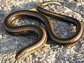
- Honeymoon Island, 5 km (3 mi) from Rambha Jetty, known as Barkuda Island, with clear waters has abundant red and green macro algae in the bed is also known for the limbless lizard, an endemic species found here.
- Somolo and Dumkudi islands, located in the Central and Southern sectors of the lake, in the backdrop of scenic Khalikote hill range, are inundated remnants of the Eastern Ghats with rich flora and fauna and also known for sighting of Irrawaddy Dolphins.
- Birds' island, located in the southern sector of the lake has huge exposed hanging rocks, are painted white due to folic acid of the droppings of the birds and is known for rich algal communities and few mangrove species and also migratory birds in winter.
- Parikud is a group of composite islands in the Garh Krishnaprasad Block for nature lovers and provides an avian spectacle during winter season
- Kalijai Temple located on an island is considered to be the abode of the Goddess Kalijai.This temple is located at a hill which is surrounded by the blue water bears. Local people of Chilika refer to goddess as the reigning deity of the lagoon
- Satapada village, at the new mouth of the lake, provides a beautiful view of the Lake and also views of the Dolphins. Hundreds of boats here provide tours of the lake for tourists.
- Barunkuda, a small island situated near Magarmukh, mouth of the lake, has a temple of Lord Varuna.
- Nabagraha is an ancient deity located along the outer channel.
- Chourbar Shiva Temple is located near Alupatna village, along the outer channel.
- Manikpatna, located on the outer channel has historical evidence of a port which was used for trade with Far East and also has the Bhabakundeswar temple of Lord Shiva, an old Mosque whose entrance door is made of the jaws of the whale.
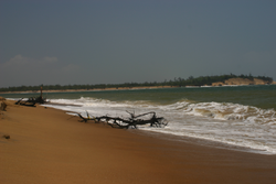
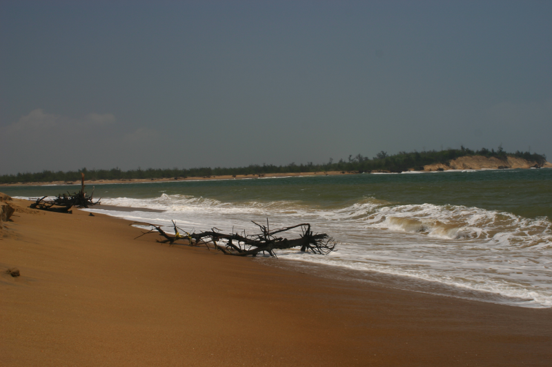
- Sand-Bar and Mouth of the Lake is a striking and un-explored stretch of 30 km (20 mi) of empty beach across the sand bar which separates the Lake from the Sea.[37]
Access
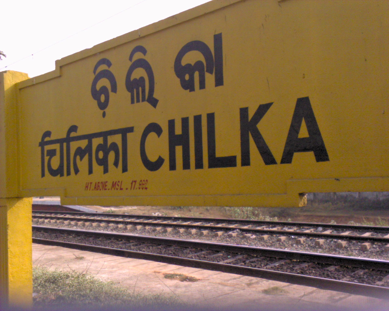
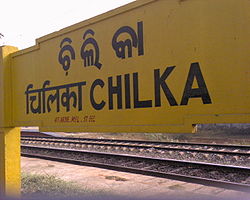 Chilika raiilway station
The lake is well connected by road to Chennai and Kolkata through National Highway No 5. Satpara town on the eastern bank of the lake is about 50 km (30 mi) by road southwest of the city of Puri and at a distance of 100 km (60 mi) from Bhubaneswar, the capital of Orissa, which is also the nearest airport.
A broad gauge railway line of the South Eastern Railway from Kolkata skirts along the western bank of the lake passing through Balugaon, Chilika and Rambha stations.[5]
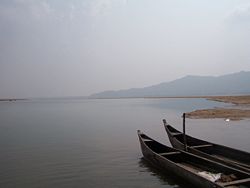
Within the lake precincts, Orissa Transport Development Corporation Ltd (OTDC) and the Revenue Department of the state government offer boat cruises. Private operators also provide country boats on hire to various islands in the lake.[38]
There are OTDC Guest houses at Barkul, Rambha, Satapada & several hotels at Balugaon. Before entering into the Nalbana Bird Sanctuary one has to obtain an entry permit. The entry permit has to be produced at entry/exit points, at check gates as and whenever requested by officials.
Gallery
-
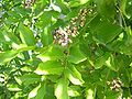
Pongamia pinnata (panigrahi)- A flowering shoot
-
Sanderling Calidris alba
-
Terek Sandpiper Xenus cinereus
-
Kentish Plover (Charadrius alexandrinus)
-
Black-tailed Goodwit Limosa limosa
-
Pied Kingfisher (Ceryle rudis)
-
Dugong
-
Limbless Lizard
-
Fishing Cat
References
- ^ a b Tripati, Sila; A. P. Patnaik (2008-02-10). "Stone anchors along the coast of Chilika Lake: New light on the maritime activities of Orissa, India". CURRENT SCIENCE (Bangalore: Indian Academy of Sciences) 94 (3): 386–390. http://www.ias.ac.in/currsci/feb102008/386.pdf.
- ^ a b c Mohanty, Prof. Prafulla Kumar; Dr. Sanjaya Narayan Otta (2008-6). "Dolphins of Chilika". Orissa Review (Govt. of Orissa): 21–26. http://orissagov.nic.in/e-magazine/Orissareview/2008/June-2008/engpdf/Pages21-26.pdf.
- ^ a b Forest and Environment Department. "Chilika". Wildlife Conservation in Orissa. Govt of Orissa. http://wildlifeorissa.in/chilika.html. Retrieved 2008-12-21.
- ^ a b c "Inventory of wetlands". Govt. of India. pp. 314–318. http://envfor.nic.in/divisions/csurv/Wetland%20Inventory.pdf. Retrieved 2008-12-09.
- ^ a b c d e f Chilika Development Authority (2008). "About Chilika". http://www.chilika.com/about.htm. Retrieved 2008-12-16.[dead link]
- ^ a b c d e f WWF India (2008). "Chilika Lake". http://www.wwfindia.org/about_wwf/what_we_do/freshwater_wetlands/our_work/ramsar_sites/chilika_lake_.cfm. Retrieved 2008-12-16.[dead link]
- ^ a b c d Chilika Development Authority (2008). "Fish Yield Status". Archived from the original on 2008-06-30. http://web.archive.org/web/20080630081317/http://www.chilika.com/reappear.htm. Retrieved 2008-12-11.
- ^ a b Chilika Development Authority (2008). "Welcome to Chilika Lagoon". http://www.chilika.com/home.htm. Retrieved 2008-12-16.[dead link]
- ^ a b c d The Ramsar Convention (26 November 2008). "The Montreux Record". Archived from the original on 2008-08-01. http://web.archive.org/web/20080801115705/http://www.ramsar.org/key_montreux_record.htm. Retrieved 2008-12-18.
- ^ a b c d e Chilika Development Authority (2008). "Ramsar Award". http://www.chilika.com/ramsar.htm. Retrieved 2008-12-16.[dead link]
- ^ a b Sinha, B.K. (2000). "13. B.K. Sinha, Golabai :". In Kishor K. Basa and Pradeep Mohanty. A Protohistoric Site on the Coast of Orissa. vol. I (in: Archaeology of Orissa ed.). Delhi: Pratibha Prakashan. pp. 322–355. ISBN 81-7702-011-0.
- ^ a b Patra, Sushanta Ku.; Dr. Benudhar Patra (1992-93,). "ARCHAEOLOGY AND THE MARITIME HISTORY OF ANCIENT ORISSA". OHRJ (Bhubaneswar: Govt. of Orissa) XLVII, (2): 107–118. http://orissagov.nic.in/e-magazine/Journal/Journal2/pdf/ohrj-014.pdf.
- ^ a b c d e f g h i j "History of Chilika". Chilika Lake Development Authority, Orissa. http://www.chilika.com/history.htm. Retrieved 2008-12-16.
- ^ a b c d e f Choudhury, Dr. Janmejay (2007-11). "Nature Queen Chilika and Eco-Tourism". Orissa Review (Govt. of Orissa): 17–19. http://orissagov.nic.in/e-magazine/Orissareview/nov-2007/engpdf/Pages17-19.pdf.
- ^ "New clues to historic naval war in Chilika". Nature India Journal Published online 3 June 2008, Subhra Priyadarshini. http://www.nature.com/nindia/2008/080603/full/nindia.2008.215.html. Retrieved 2008-12-16.
- ^ a b Tripathy, Dr. Balaram (2007-11). "Maritime Heritage of Orissa". Orissa Review (Govt. of Orissa): 27–41. http://orissagov.nic.in/e-magazine/Orissareview/nov-2007/engpdf/Pages27-41.pdf.
- ^ a b c d e f Iwasaki, Shimpei (1998-12-14). "Sustainable Regional DevelopmentIn the Catchment of Chilika Lagoon, Orissa State, India". In Chilika Development Authority and Department of Water Resources (Orissa). Proceedings of the International Workshop in Sustainable Development of Chilika Lagoon.. Tokyo, Japan.: Global Environment Information Centre. pp. 27. http://geic.hq.unu.edu/ENV/Files/2007/2007_iwasaki_intern.pdf.
- ^ "Luminescence dating of the barrier spit at Chilika lake, Orissa, India". Oxford Journals, Radiation Protection Dosimetry, Volume 119, Number 1-4 , pp. 442-445, A. S. Murray and M. Mohanti. http://rpd.oxfordjournals.org/cgi/content/abstract/119/1-4/442. Retrieved 2008-12-16.
- ^ Singh, Sarina; Joe Bindloss, Paul Clammer, Janine Eberle (2005). India. Lonely Planet. pp. 576. ISBN 1740596943, 9781740596947. http://books.google.com/books?id=Fk8FQa2ZSFQC&pg=PA571&vq=chilika&source=gbs_search_r&cad=0_1#PPA576,M1.
- ^ a b c d e f International Lake Environment Committee (ILEC) (2005). "Chilika Lagoon-Experience and Lessons Learned Brief, Asish K.Ghosh, CED & Ajit K.Patnaik, CDA, pp. 116-129". http://www.iwlearn.net/publications/ll/chilikalagoon_2005.pdf. Retrieved 2008-12-16.
- ^ "Estimation of Sedimentation Rate in Chilka Lake, Orissa Using Environmental 210pb Isotope Systematics,P 267". Centre for Water Resources Development and Management. http://www.bsip.res.in/pdf/XXI%20ICMS%20abstract.pdf. Retrieved 2008-12-16.
- ^ a b Wood, Alexander; Pamela Stedman-Edwards, Johanna Mang, World Wildlife Fund (U.S.) (2000). "Ch. 10". The Root Causes of Biodiversity Loss. Earthscan. pp. 213–230. ISBN 1853836990, 9781853836992. http://books.google.com/books?id=haIGoPpqTRgC&pg=PA214&dq=chilka+endangered+birds+chilka+chilika&lr=&num=100&as_brr=3&ei=kuRPSY2aM4HwMuuk0dcG&client=safari#PPA223,M1.
- ^ Chilika Development Authority. "Restoration". Archived from the original on 2008-08-03. http://web.archive.org/web/20080803061914/http://www.chilika.com/restore.htm. Retrieved 2008-12-15.
- ^ Chilika Development Authority. "News". http://www.chilika.com/news.htm. Retrieved 2008-12-16.
- ^ "Chilika Lake". http://www.trekearth.com/gallery/Asia/India/photo364192.htm.. Retrieved 2008-12-16.
- ^ staff (1998-10-15). "Birds Crowd Orissa Sanctuary". Times of India (Times of India). http://wii.gov.in/envis/paupdates/jpamfebruary1999.htm#or. Retrieved 2008-12-21.[dead link]
- ^ "900,000, Birds Visit Chilika Lake". srijanfoundation. http://srijanfoundation.org/2008/01/09/900000-birds-visit-chilika-lake/. Retrieved 2008-12-09.
- ^ a b c d Chilika Development Authority (2008). "Avi fauna". http://www.chilika.com/avifauna.htm. Retrieved 2008-12-16.[dead link]
- ^ a b c Ghosh, Asish K.; Ajit K. Pattnaik. "fig.1 Chilika Lagoon Basin". Chilika Lagoon Experience and Lessons learned Brief. UNEP International Waters Learning Exchange and Resource Network. pp. 115. http://www.iwlearn.net/publications/ll/chilikalagoon_2005.pdf. Retrieved 2008-12-23.
- ^ "Chilika Lagoon". Birds and birding in India.. birding.in. 2008. http://www.birding.in/birdingsites/chilika_lagoon.htm. Retrieved 2008-12-22.
- ^ a b c Sutaria, Dipani (2007). "Irrawaddy dolphin - India". Whale and Dolphin Conservation Society. http://www.wdcs.org/submissions_bin/consprojectirr.pdf. Retrieved 2008-12-25.
- ^ Cetacean Specialist Group (1996). Orcaella brevirostris. 2006. IUCN Red List of Threatened Species. IUCN 2006. www.iucnredlist.org. Retrieved on 10 March 2007.
- ^ Sinha, R.K. (May-Aug 2004). "The Irrawaddy Dolphins Orcaella of Chilika Lagoon, India". Journal of the Bombay Natural History Society (Mumbai, India: online edition: Environmental Information System (ENVIS), Annamalai University, Centre of Advanced Study in Marine Biology, Parangipettai - 608 502, Tamil Nadu, India) 101 ((2)): 244–251. http://google.com/search?q=cache:0d5_f2dmIdkJ:www.casmbenvis.nic.in/sdnp/lagoon%2520pdf/L10.pdf+pía+loma&hl=en&ct=clnk&cd=4&gl=us&client=safari.
- ^ a b Das, Subrat (2008-02-28). "Dolphins better off in Chilika - Survey reveals dip in death toll of Irrawaddy School". The Telegraph (Calcutta): pp. Front page. http://www.telegraphindia.com/1080228/jsp/frontpage/story_8956267.jsp. Retrieved 2008-12-25.
- ^ a b D’Lima, Coralie (2008). "Dolphin-human interactions, Chilika". Project summary. Whale and Dolphin Conservation Society. http://www.wdcs.org/submissions_bin/dolphin-human_interactions_chilika.pdf. Retrieved 2008-12-21.
- ^ Tun, Tint (2008). "Castnet Fishing with the Help of Irrawaddy Dolphins". Irrawaddy Dolphin. Yangon, Myanmar. http://tinttun.mm.googlepages.com/irrawaddydolphin. Retrieved 2008-12-25.
- ^ Chilika Development Authority. "Eco Tourism". http://www.chilika.com/eco.htm. Retrieved 2008-12-16.[dead link]
- ^ Chilika Development Authority (2008). "How to reach". Archived from the original on 2008-06-28. http://web.archive.org/web/20080628181814/http://www.chilika.com/reach.htm. Retrieved 2008-12-16.
External links
- Irrawaddy dolphin — India
- Tourist information on Chilka Lake Travel
- Opening of new mouth and IRS 1D LISS III Image of Chilika Lagoon
- Figure 1 Chilika Lagoon Basin
- Tourist locations in the lagoon
- Birds of Chilika
- The journey from Puri to Chilika lake brings alive the rustic life of Orissa
Hydrology of South Asia Inland Indus · Ganges · Yamuna · Chenab · Jhelum · Bhagirathi River · Brahmaputra · Godavari · Narmada · Tapti · Ravi · Beas · Sutlej · Padma · Sarasvati · Sharda · Krishna · Kaveri · Kali River · Meghna · Gandaki River · Mahanadi · Mahaweli · Son · Ghaghara · Betwa · Chambal · Kosi · Sankosh · Ganges Basin · Ganges Delta · Indus Delta · Dal Lake · Pookode Lake · Skeleton Lake · Chilka Lake · Lake Powai · Borith Lake · Saiful Muluk · Gosaikunda · Nizam Sagar · Red Hills Lake · Malampuzha · Kerala Backwaters · Damodar · LuniCoastal Categories Lakes of India / Nepal / Pakistan · Reservoirs and dams in India · Rivers of Bangladesh / Bhutan / India / Nepal / PakistanHydrology of Orissa Rivers Bhargavi • Baitarani • Brahmani • Budhabalanga • Daya • Devi • Kadua • Kharkai • Koina • Kushabhadra • Mahanadi • Malguni • Nagavali • Ong • Rushikulya • Sankh • South Karo • South Koel • Subarnarekha • Surubalijora • Tel • Telen • VamsadharaLakes Anshupa • ChilkaWaterfalls Hot springs Beaches Dams Bridges Second Mahanadi Rail BridgeHarbours/Ports/Proposed Ports Hydrology of surrounding areas Andhra Pradesh • Chhattisgarh • Jharkhand • BengalCategories:- Lakes of Orissa
- Estuaries of India
- Ramsar sites in India
- Bird sanctuaries of India
- Wetlands of India


Wikimedia Foundation. 2010.