- Malaguni River
-
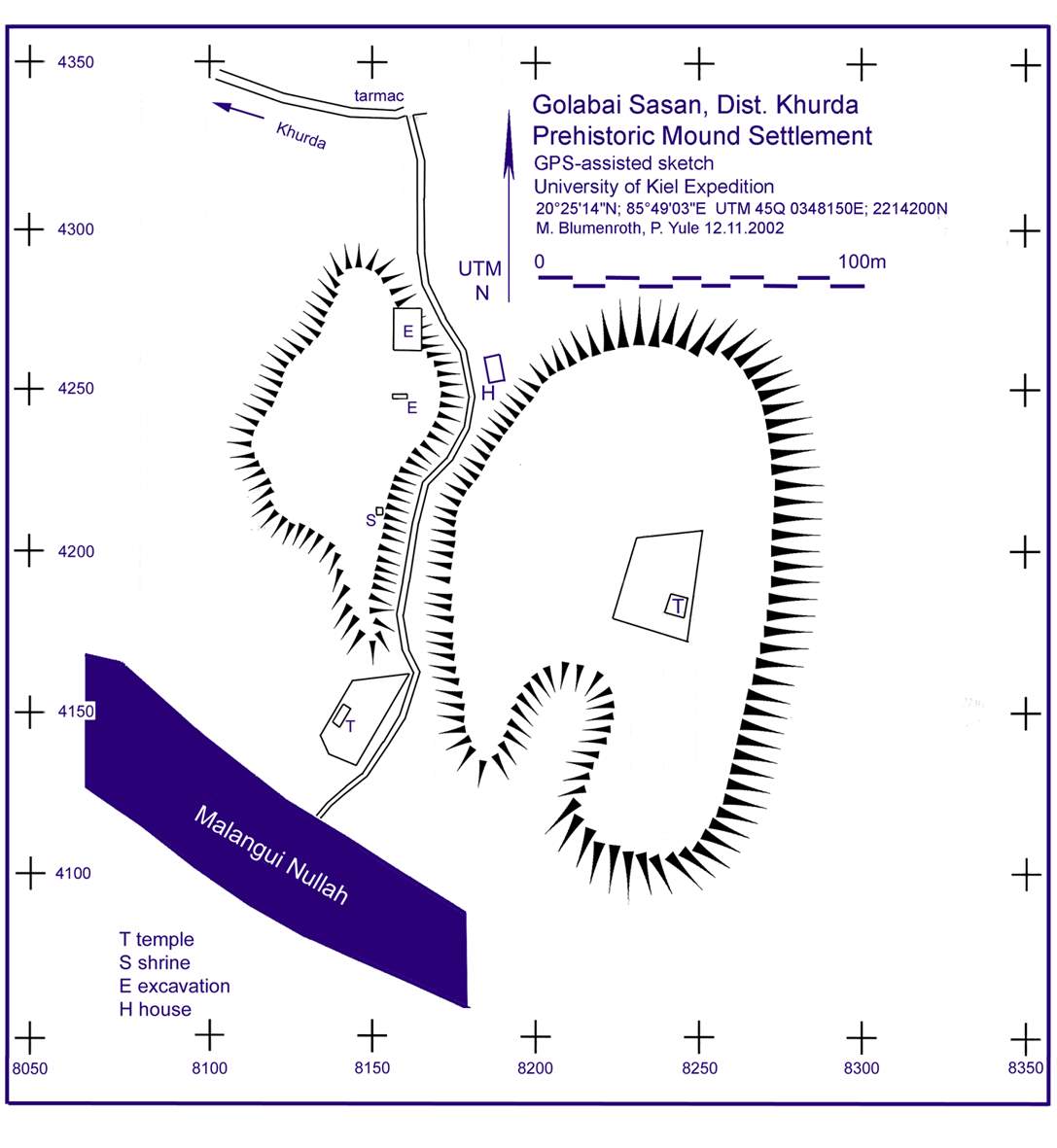
 Malangui Nullah at Golabai
The Malaguni River (Mallaguni, Malangui) is a Nullah or hill stream in Khurda District, Orissa state of India. It originates on the border of Ganjam District and Khurda District. It flows northeast, east and southeast through Khurda Tahasil, passes historic Golabai Sassan and joins the Daya River at 20°0′1″N 85°37′30″E / 20.00028°N 85.625°E, 1 km (0.62 mi) north of Balabhadrapur village in Puri District. The Daya then flows southwest into Chilika Lake, which then flows to the Bay of Bengal.[1]
There is a Minor Irrigation project constructed on it near Rameswar village. When it floods, some portions of Khurda, Chilika and Tangi blocks are badly affected.[2]
References
- ^ Ghosh, Asish K.; Ajit K. Pattnaik. "fig.1 Chilika Lagoon Basin". Chilika Lagoon Experience and Lessons learned Brief. UNEP International Waters Learning Exchange and Resource Network. pp. p.115. http://www.iwlearn.net/publications/ll/chilikalagoon_2005.pdf. Retrieved 2008-12-23.
- ^ Collector & D.M.; District Informatics Officer. "Khorda Topogaphy - RIVER SYSTEMS OF THE DISTRICT". Khordha District website. http://khordha.nic.in/topography.htm. Retrieved 2008-12-24.
Hydrology of Orissa Rivers Bhargavi • Baitarani • Brahmani • Budhabalanga • Daya • Devi • Kadua • Kharkai • Koina • Kushabhadra • Mahanadi • Malguni • Nagavali • Ong • Rushikulya • Sankh • South Karo • South Koel • Subarnarekha • Surubalijora • Tel • Telen • VamsadharaLakes Anshupa • ChilkaWaterfalls Hot springs Beaches Dams Bridges Second Mahanadi Rail BridgeHarbours/Ports/Proposed Ports Hydrology of surrounding areas Andhra Pradesh • Chhattisgarh • Jharkhand • BengalCategories:- Rivers of Orissa
Wikimedia Foundation. 2010.