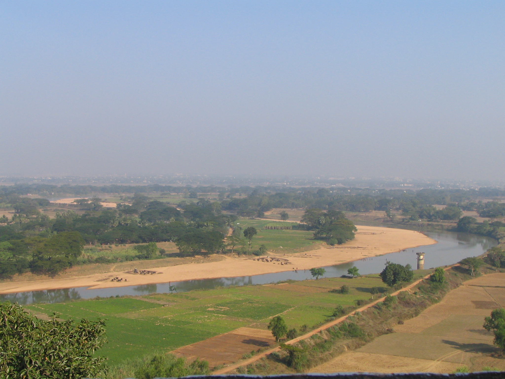
- Daya River
-

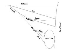 An illustration of Mahanadi Koyakhai distributray system in Orissa, India draining into Bay of Bengal and Chilka lake. Picture not drawn to scale
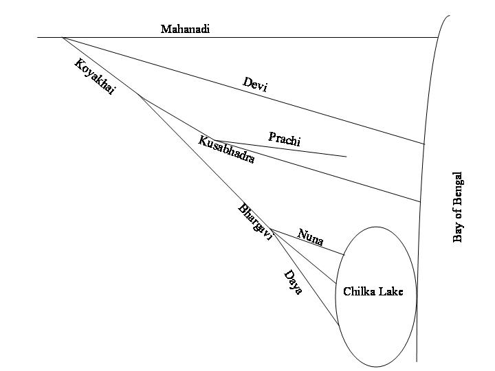
The Daya River starts as a branch of the Kuakhai River at Saradeipur (near Badahati) in Orissa state in India. It is joined by the Malaguni River below Golabai and flows through Khordha and Puri districts before emptying into the north-eastern corner of Chilika Lake, 37 km (23 mi) km from its origin.[1]
The historically important Dhauli hills are located on the banks of the Daya River, 8 km (5.0 mi) south of Bhubaneswar. It is a hill with vast open space adjoining it, and has major Edicts of Ashoka engraved on a mass of rock, by the side of the road leading to the summit of the hill. Dhauli hill is presumed to be the area where Kalinga War was fought.
References
- ^ "Daya River". India. Online Highways LLC.. 2005. http://www.india9.com/i9show/Daya-River-36455.htm. Retrieved 2008-12-23.
Hydrology of Orissa Rivers Bhargavi • Baitarani • Brahmani • Budhabalanga • Daya • Devi • Kadua • Kharkai • Koina • Kushabhadra • Mahanadi • Malguni • Nagavali • Ong • Rushikulya • Sankh • South Karo • South Koel • Subarnarekha • Surubalijora • Tel • Telen • VamsadharaLakes Anshupa • ChilkaWaterfalls Hot springs Beaches Dams Bridges Second Mahanadi Rail BridgeHarbours/Ports/Proposed Ports Hydrology of surrounding areas Andhra Pradesh • Chhattisgarh • Jharkhand • BengalMahanadi-Brahmani-Baitarani Basin Rivers Dams, barrages Geographical features Dandakaranya • Dakshina Kosala Kingdom • Chota Nagpur Plateau • Western Orissa • Mahanadi River Delta • Bhitarkanika MangrovesRiparian districts Chhattisgarh Dhamtari • Kanker • Raipur • Janjgir-Champa • Raigarh • Jashpur • Korba • Koriya • Surguja Madhya Pradesh Anuppur Jharkhand Gumla • Khunti • Ranchi • West Singhbhum Orissa Jharsuguda • Kendujhar • Mayurbhanj • Sundergarh • Boudh • Angul • Jajpur • Cuttack • Kendrapara • Khordha • Jagatsinghpur • PuriLanguages/ people Coalfields Industries Korba Super Thermal Power PlantTransport Related topics Hydrology of Chhattisgarh • Hydrology of Jharkhand • Hydrology of Orissa
Coordinates: 19°53′N 85°35′E / 19.883°N 85.583°ECategories:- Rivers of Orissa
- Tributaries of the Mahanadi River
- Orissa geography stubs
Wikimedia Foundation. 2010.