- Dhamtari district
-
This article is about the district. For its eponymous headquarters, see Dhamtari.
Dhamtari district
धमतरी जिला
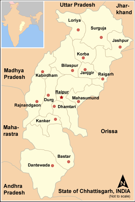
Location of Dhamtari district in ChhattisgarhState Chhattisgarh,  India
IndiaHeadquarters Dhamtari Area 2,029 km2 (783 sq mi) Population 703,569 (2001) Literacy 75.16 Official website Dhamtari is a district in the Indian state of Chhattisgarh. It was officially formed on July 6, 1998, from an amalgamation of Dhamma and Tarai (hence the name). The district headquarter is Dhamtari. It is situated between 20042' N Latitude and 81o33' Longtitude. The total area of the district is 2029 km² and it is 305 meters above the sea level. In the east, Satpura range is located. It is popularly known as Sihawa pahad.
Contents
Geography
Mahanadi River is the principal river of this district and till this area it is named as Kankannadi, Chitrotpala, Neelotpala, Mandvahini, Jairath etc. Its tributaries are Sendur, Pairy, Sondur, Joan, Kharun and Shivnath. The fertility of lands of Dhamtari district can be attributed to the presence of these rivers. The chief crop of this region is paddy. Mahanadi one of the major river in central India originates in the hills of Sihawa flows in an easterly direction into the Bay of Bengal.
The national highway No. 43 Raipur – Vijaynagaram (Andhra Pradesh) passes through Dhamtari. Raipur is 78 km from Dhamtari. thankyou
Economics
Dhamtari has over 106 rice mills.[1]
Ravishankar Sagar dam that irrigates almost 570 square kilometres of land and also acts as a main supply unit of safe drinking water resource for state capital Raipur as well as supply to Bhilai Steel Plant lies almost 11 km from the district capital. Work of 10 MW hydro-electric power plant is progressing and is likely to be completed very soon.
Asia's first ever Syphen dam was built in the year 1914 at Madamsilli. Besides Madamsilli, Sondhur dam, Dudhawa dam are the major projects.
Approximately 52 percent of the geographic area is covered by forests. The district has a tropical climate.[2]
Demographics
According to the 2011 census Dhamtari district has a population of 799,199,[3] roughly equal to the nation of Comoros[4] or the US state of South Dakota.[5] This gives it a ranking of 485th in India (out of a total of 640).[3] The district has a population density of 236 inhabitants per square kilometre (610 /sq mi) .[3] Its population growth rate over the decade 2001-2011 was 13.11 %.[3] Dhamtari has a sex ratio of 1012 females for every 1000 males,[3] and a literacy rate of 78.95 %.[3]
This District is situated between 20°42' N latitude and 81°33' longitude. Dhamtari district was officially formed on 6 July 1998 dividing the Raipur district currently the capital of Chhattisgarh along with Mahasamund. Raipur district was broken up into the districts of Raipur, Mahasamund and Dhamtari. Dhamtari, Kurud and Nagari are included in Dhamtari district as tehsils, and blocks.
The total area of the district is 2029 km², and its altitude is 305 m above sea level. The district is surrounded by Raipur District to the north and south, and part of Orissa state to the east and west.
Dhamtari district falls between two Lok Sabha constituencies (Kanker and Mahasamund) and three Assembly constituencies: Dhamtari, Kurud, and Sihawa.
References
- ^ "Dhamtari Government Website". http://dhamtari.gov.in/prof.htm. Retrieved 2006-09-22.
- ^ "Dhamtari District NCCR". http://cgwbraipur.gov.in/NCCR/Dhamtari.htm. Retrieved 2006-09-22.
- ^ a b c d e f "District Census 2011". Census2011.co.in. 2011. http://www.census2011.co.in/district.php. Retrieved 2011-09-30.
- ^ US Directorate of Intelligence. "Country Comparison:Population". https://www.cia.gov/library/publications/the-world-factbook/rankorder/2119rank.html. Retrieved 2011-10-01. "Comoros 794,683 July 2011 est."
- ^ "2010 Resident Population Data". U. S. Census Bureau. http://2010.census.gov/2010census/data/apportionment-pop-text.php. Retrieved 2011-09-30. "South Dakota 814,180"
External links

Durg district Kanker district 
Raipur district  Dhamtari district

Bastar district Nabarangapur district, Orissa Cities and towns in Dhamtari district Dhamtari Cities and towns
in other districtsBastar · Bilaspur · Dantewada · Durg · Jangir-Champa · Jashpur · Kabirdham · Kanker · Korba · Koriya · Mahasamund · Raigarh · Raipur · Rajnandgaon · Surguja
Districts of Chhattisgarh Bastar · Bijapur · Bilaspur · Dantewada · Dhamtari · Durg · Janjgir Champa · Jashpur · Kabirdham · Kanker · Korba · Koriya · Mahasamund · Narayanpur · Raigarh · Raipur · Rajnandgaon · Surguja
Capital: RaipurMahanadi-Brahmani-Baitarani Basin Rivers Dams, barrages Geographical features Dandakaranya • Dakshina Kosala Kingdom • Chota Nagpur Plateau • Western Orissa • Mahanadi River Delta • Bhitarkanika MangrovesRiparian districts Chhattisgarh Dhamtari • Kanker • Raipur • Janjgir-Champa • Raigarh • Jashpur • Korba • Koriya • Surguja Madhya Pradesh Anuppur Jharkhand Gumla • Khunti • Ranchi • West Singhbhum Orissa Jharsuguda • Kendujhar • Mayurbhanj • Sundergarh • Boudh • Angul • Jajpur • Cuttack • Kendrapara • Khordha • Jagatsinghpur • PuriLanguages/ people Coalfields Industries Korba Super Thermal Power PlantTransport Related topics Hydrology of Chhattisgarh • Hydrology of Jharkhand • Hydrology of Orissa
Categories:
Wikimedia Foundation. 2010.