- Durg district
-
Durg district
दुर्ग जिला
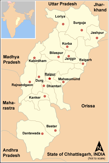
Location of Durg district in ChhatisgarhState Chhatisgarh,  India
IndiaHeadquarters Durg Area 8,537 km2 (3,296 sq mi) Population 2,810,436 (2001) Literacy 75.62 per cent Sex ratio 982 Official website Durg District is situated in Chattisgarh state of India. Until 2000 it formed part of Madhya Pradesh. District headquarters is Durg. The district covers an area of 8,537 km². The population in 1991 was 2, 397,134 of which 12.4% were members of scheduled tribes. As of 2011 it is the second most populous district of Chhattisgarh (out of 18), after Raipur.[1]
The district is home to two important religious sites. The principal Hindu temple, the Ganga Maiyaat Jhalmala, Jain shrine of Uwasaggaharam Parshwa Teerth at Nagpura (near Durg), attract pilgrims from all over India.
The town of Bhilai is home to the Bhilai Steel Plant.
Contents
Geography
Cities and Town in Durg
- Durg
- Bhilai
- Balod
- Gunderdehi
- Dalli Rajhara
- Jamul
- Kumhari
Nagar Panchayat
Demographics
According to the 2011 census Durg district has a population of 3,343,079,[1] roughly equal to the nation of Uruguay[2] or the US state of Connecticut.[3] This gives it a ranking of 100th in India (out of a total of 640).[1] The district has a population density of 391 inhabitants per square kilometre (1,010 /sq mi) .[1] Its population growth rate over the decade 2001-2011 was 18.95 %.[1] Durg has a sex ratio of 988 females for every 1000 males,[1] and a literacy rate of 79.69 %.[1]
Languages
Vernaculars spoken include Bharia, a Dravidian language spoken by at least 200 000 members of the Bharia tribe and written in the Devanagari script.[4]
References
- ^ a b c d e f g "District Census 2011". Census2011.co.in. 2011. http://www.census2011.co.in/district.php. Retrieved 2011-09-30.
- ^ US Directorate of Intelligence. "Country Comparison:Population". https://www.cia.gov/library/publications/the-world-factbook/rankorder/2119rank.html. Retrieved 2011-10-01. "Uruguay 3,308,535 July 2011 est."
- ^ "2010 Resident Population Data". U. S. Census Bureau. http://2010.census.gov/2010census/data/apportionment-pop-text.php. Retrieved 2011-09-30. "Connecticut 3,574,097"
- ^ M. Paul Lewis, ed (2009). "Bharia: A language of India". Ethnologue: Languages of the World (16th edition ed.). Dallas, Texas: SIL International. http://www.ethnologue.com/show_language.asp?code=bha. Retrieved 2011-09-28.
External links

Kabirdham district Bilaspur district Raipur district 
 Durg district

Rajnandgaon district Kanker district Dhamtari district Cities and towns in Durg district Durg Cities and towns
in other districtsBastar · Bilaspur · Dantewada · Dhamtari · Jangir-Champa · Jashpur · Kabirdham · Kanker · Korba · Koriya · Mahasamund · Raigarh · Raipur · Rajnandgaon · Surguja
Districts of Chhattisgarh Bastar · Bijapur · Bilaspur · Dantewada · Dhamtari · Durg · Janjgir Champa · Jashpur · Kabirdham · Kanker · Korba · Koriya · Mahasamund · Narayanpur · Raigarh · Raipur · Rajnandgaon · Surguja
Categories:- Districts of Chhattisgarh
- Durg district
- Chhattisgarh geography stubs
Wikimedia Foundation. 2010.