- Missouri City, Texas
-
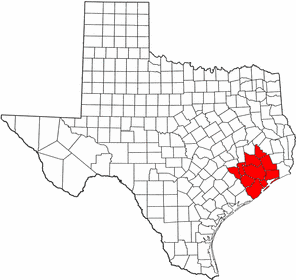
City of Missouri City — City — Location in Fort Bend and Harris Counties in the state of Texas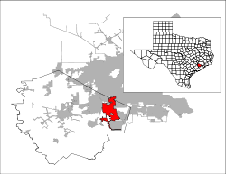
Coordinates: 29°34′58″N 95°32′22″W / 29.58278°N 95.53944°WCoordinates: 29°34′58″N 95°32′22″W / 29.58278°N 95.53944°W Country  United States
State  Texas
TexasCounties Fort Bend, Harris Government – Type Council-Manager – City Council Mayor Allen Owen
Jerry Wyatt
Danny Nguyen
Bobby Marshall
Don Smith
Robin Elackatt
Brett Kolaja– City Manager Frank Simpson Area – Total 30.4 sq mi (78.8 km2) – Land 29.7 sq mi (76.9 km2) – Water 0.7 sq mi (1.9 km2) Elevation 79 ft (24 m) Population (2005) – Total 63,910 – Density 2,099.2/sq mi (810.5/km2) Time zone Central (CST) (UTC-6) – Summer (DST) CDT (UTC-5) ZIP codes 77459, 77489 Area code(s) 281 FIPS code 48-48804[1] GNIS feature ID 1374972[2] Website MissouriCityTX.gov  Missouri City
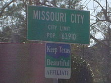 Missouri City City Limit sign
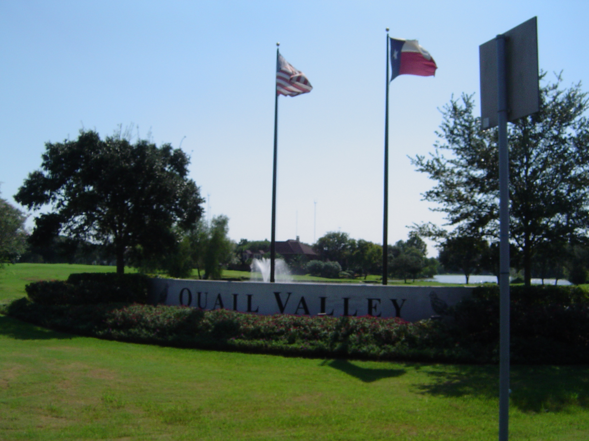
 Quail Valley is a golf course community in Missouri City
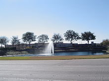 Riverstone is an upscale master planned community in Missouri City's extra territorial jurisdiction
Missouri City is a city located in the U.S. state of Texas within the Houston–Sugar Land–Baytown metropolitan area. The city is mostly in Fort Bend County with a small portion within Harris County. As of the 2000 U.S. Census, the city had a total population of 52,913 (though a 2005 estimate placed the population at 63,910).
Contents
History
The area in which Missouri City is now located holds a significant part in the history of Texas that dates back to its early days as part of the United States. In August 1853, the Buffalo Bayou, Brazos, and Colorado Railway (BBB&C), began operating its first twenty miles (32 km) of rail line that stretched from Harrisburg (now Houston) to Stafford's Point (now Stafford). It was the first railroad to begin operating in Texas, and the first standard gauge railroad west of the Mississippi River.
The railway continued its extension westward until, in 1883, it linked with its eastward counterpart, completing the Sunset Route from Los Angeles to New Orleans. Today, the route of the BBB&C (now owned by the Union Pacific Railroad) is still an important and heavily operated railroad line.
In 1890, two real estate investors from Houston (R.M. Cash and L.E. Luckle) purchased four square miles of land directly on the route of the BBB&C, only a mile and a half from its first stop at Stafford's Point. They advertised the property as "a land of genial sunshine and eternal summer" in St. Louis, Missouri, and its surrounding areas. Three years later, W.R. McElroy purchased 80 acres (320,000 m2) in the same vicinity, and in effort to promote the area jointly with Cash and Luckle in St. Louis, he named it "Missouri City". Its first actual settlers were from Arlington, Texas, near Dallas and Fort Worth.
The settlement was officially registered in Texas in 1894, and began to take shape as a railroad town along present-day US 90A at Texas Parkway, then known as Main Street and Blue Ridge Road. Its growth took an unexpected turn when, on February 14, 1895, shortly after the first group of settlers had arrived, the town was hit with a blizzard. This discouraged some of the newcomers who gave up and moved elsewhere. Those unwaivered stayed and found success in farming and ranching.
Among its first businesses were a blacksmith shop, a depot, and a general store, which also housed the first post office. The first Catholic church was built in 1913, but was destroyed by a hurricane in 1915. The new church built to replace it stood until 1990.
Oil was discovered in nearby Blue Ridge in 1919; soon after, a salt mine opened there. Missouri City became the railroad shipping point for these two resources. In 1925, at the same location, natural gas was discovered. After a pipeline had been constructed the following year, Missouri City became the first town in Fort Bend County to make use of natural gas.
With the benefit of a railroad, Missouri City had already been home to commuters who, by train, commuted to adjacent towns like Stafford's Point and Sugar Land to work. With the increase of automobiles and improvement of roads and highways in the early part of the 20th century, the developing community gradually attracted a wealth of newcomers. This gave birth to a new generation of commuters replacing railroad commuters that eventually became obsolete. By the 1950s, the town began to take shape as a notable "bedroom community" suburb of Houston.
After fear and rumor spread of possible annexation of the unincorporated town by Houston, town leaders scrambled to piece together a city government. On March 13, 1956, the community that began as a small settlement more than 55 years earlier was incorporated.
Missouri City has since seen tremendous economic growth, moving eastward, southward, and then westward. The city was first made over by Fondren Park (in Harris County), near US 90A, in the early 1960s, followed by Quail Valley, along Cartwright Road between Texas Parkway and Murphy Road, in the late 1960s. It should be noted that, unlike neighboring Houston, Missouri City has been a zoned city since 1981. Multifamily complexes (e.g. apartments and condominiums) are a rare find because of the current zoning ordinance.
In the 1970s, an influx of middle-class African Americans - most of them first-time homeowners - were attracted to developing communities south and west of Houston. Many of them made the subdivisions of Missouri City home. This influx occurred after an economic downturn caused property values and interest rates to drop. Teal Run and other unincorporated areas east of Highway 6 became ethnically diverse before neighborhoods farther west. Movement by black families has been characterized by neighborhood hopping, whereby families who can afford to move go to majority white neighborhoods, ostensibly to escape possible negative influences to their children. As a result of the influx, some white families moved to different communities and neighborhoods in a response known as 'white flight'. (White Flight usually further decreases property values, whereby a neighborhood is no longer seen as desirable to a significant segment of the population, and therefore worth less. Low income families tend to fill the void left by whites, and the process starts over again when minority members of the community once again seek a better neighborhood to live in.) Many of the newcomers were employees within nearby Houston work centers (e.g., Texas Medical Center, Greenway Plaza). A lot of Middle Class African Americans call Missouri City home. In 2000, it was named a model city for Middle-class African Americans by Black Entertainment Television (BET).
The Missouri City area's recent upscale, master-planned residential developments include Lake Olympia, south of Quail Valley, and portions of Riverstone, south of State Highway 6. The nearby unincorporated area of Sienna Plantation, also located south of State Highway 6, is situated on and around land once occupied by plantations where, among other things, sugarcane and cotton were harvested.
Transportation
Missouri City is served by US 90A, Beltway 8 (Sam Houston Tollway), Fort Bend Toll Road, State Highway 6, FM 1092 (Murphy Road), FM 2234 (Texas Parkway), and FM 3345 (Cartwright Road). Other nearby highways are US 59, and Interstate 610 (Loop 610).
Although Missouri City does not have public transportation within the city limits itself, it is part of the service area of METRO. METRO operates the Missouri City Park and Ride located on Beltway 8 and Fondren Road, which is the terminus of express bus Route 163 Fondren to Sharpstown and Downtown Houston and Route 170 Missouri City Express to the Texas Medical Center (terminating at the Texas Medical Center Transit Center METRORail station there).
Discussions continue on commuter service along US 90A from METRORail's Fannin South station, initially to terminate at the Ft Bend County line near Beltway 8.[3] Expansion westward awaits, among other things, formation of a transportation district or other funding means for communities that are not now in the METRO service area.
Geography
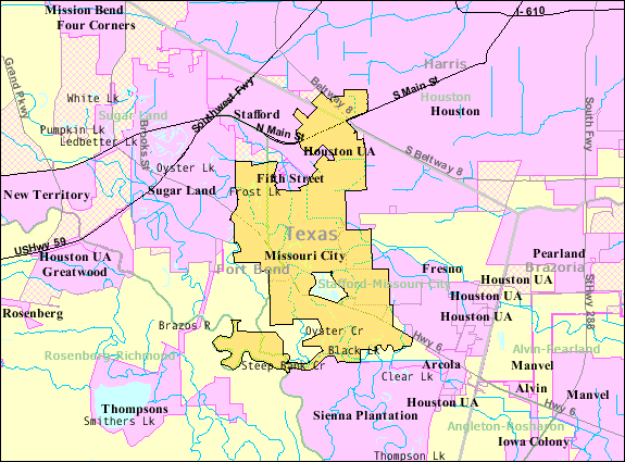
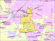 Map of Missouri City
Missouri City is located at 29°34′58″N 95°32′22″W / 29.58278°N 95.53944°W (29.582799, -95.539423)[4].
According to the United States Census Bureau, the city has a total area of 30.4 square miles (78.8 km²), of which, 29.7 square miles (76.9 km²) of it is land and 0.7 square miles (1.9 km²) of it (2.37%) is water.

Stafford Houston Houston Sugar Land 
Dewalt radio towers
Fresno Missouri City

Brazos River Juliff Arcola Demographics
As of the census[1] of 2000, there were 52,913 people, 17,069 households, and 14,645 families residing in the city. The population density was 1,781.7 people per square mile (687.9/km²). There were 17,481 housing units at an average density of 588.6 per square mile (227.3/km²). The racial makeup of the city was 44.29% White, 38.35% African American, 0.20% Native American, 10.60% Asian, 0.04% Pacific Islander, 4.46% from other races, and 2.06% from two or more races. Hispanic or Latino of any race were 10.88% of the population.
There were 17,069 households out of which 48.6% had children under the age of 18 living with them, 70.2% were married couples living together, 12.5% had a female householder with no husband present, and 14.2% were non-families. 11.9% of all households were made up of individuals and 2.4% had someone living alone who was 65 years of age or older. The average household size was 3.09 and the average family size was 3.36.
In the city the population was spread out with 30.8% under the age of 18, 7.0% from 18 to 24, 31.0% from 25 to 44, 25.7% from 45 to 64, and 5.4% who were 65 years of age or older. The median age was 36 years. For every 100 females there were 94.0 males. For every 100 females age 18 and over, there were 89.9 males.
According to a 2007 estimate, the median income for a household in the city was $79,471, and the median income for a family was $84,636.[1] Males had a median income of $51,013 versus $36,786 for females. The per capita income for the city was $27,210. About 12.4% of families and 13.3% of the population were below the poverty line, including 3.5% of those under age 18 and 4.2% of those age 65 or over.
Communities
Points of interest
Missouri City is home to much of the Houston area's "antennae farm" for radio and television outlets. These include:
- Senior Road Tower (which operates most of the Houston area's radio stations)
- KRIV-TV Tower
- KHOU-TV Tower
- KTRK-TV Tower
- Houston Tower Joint Venture Tower (which operates KPRC-TV and KIAH-TV)
- American Towers Tower Missouri City
- Richland Towers Tower Missouri City
- Blue Ridge Tower Missouri City
Blue Ridge Landfill (Expanding to near 20 stories tall)
It has the headquarters of the Diocese of South-West America of the Malankara Orthodox Syrian Church.[5]
Government and infrastructure
On Friday October 1, 2010, the City of Missouri City's anti-smoking law, which bans smoking in most public places, will go into effect.[6]
The United States Postal Service operates the Missouri City Post Office and the Missouri City Post Office Annex.[7][8]
Education
Primary and secondary schools
Public schools
The Fort Bend County portion of Missouri City is served by Fort Bend Independent School District, while the Harris County portion is served by Houston Independent School District. The Harris County portion is within Trustee District IX, represented by Lawrence Marshall as of 2008.[9]
Fort Bend Independent School District
FBISD operates the following schools within the Missouri City limits:
- Elementary Schools
- E. A. Jones Elementary School
- Glover Elementary School
- Hunters Glen Elementary School
- Lantern Lane Elementary School
- Palmer Elementary School
- Quail Valley Elementary School
- Middle Schools
- Lake Olympia Middle School
- Missouri City Middle School
- Quail Valley Middle School
- Baines Middle School
In addition to these schools, a small portion of Missouri City is also served by Dulles Middle School, First Colony Middle School, Clements High School and Dulles High School, all in Sugar Land. Some areas of Missouri City are served by other schools.
Houston Independent School District
The Harris County portion of Missouri City is zoned to HISD schools located in the city limits of Houston:
- Kate Bell Elementary School (places south of Beltway 8)[10]
- Jenard M. Gross Elementary School (places north of Beltway 8)[11]
- Louie Welch Middle School[12]
- Westbury High School[13]
Colleges and universities
The entire city is served by the Houston Community College System.
Public libraries
Missouri City is served by the Missouri City Branch of the Fort Bend County Libraries system. The library, across the street from the City Hall complex and the Missouri City Civic Center, opened in June 1992. The 18,642 square feet (1,731.9 m2) branch, designed by Hall/Merriman Architects, was the first of four branches built with 1989 bond funds.[14]
Notable people
- Crystle Stewart - Miss Texas USA 2008, Miss USA 2008[15][16]
- Houston rap artist Z-Ro, a native of Missouri City, sometimes refers to it as "MO City" or "Misery City". Joseph McVey, a.k.a. Z-Ro, sometimes refers to himself as the "MO City Don". The nickname MO City derives the postal abbreviation for Missouri (MO).
- Houston Astros pitcher Doug Brocail resides in Missouri City during the off-season with his wife and five daughters.[citation needed]
- Paul Begala, a political commentator, born in New Jersey, was raised in Missouri City.
- Bruce Matthews, NFL Hall of Famer, who formerly played with the Houston Oilers and the Tennessee Titans, now assistant coach with the Houston Texans, resides in Missouri City with his family.
- Numerous current and former professional athletes live in Missouri City, most notably in Sienna Plantation, including Houston Texans Dunta Robinson, NY Giant QB (and former Texan) David Carr, and former Houston Oilers Sean Jones, Alonzo Highsmith, and Webster Slaughter.
- Former Houston Oiler and NFL hall of fame QB Warren Moon lived in the area from 1984 to 2004.
- Frank Beard of the rock band ZZ Top lived in the Quail Valley subdivision for many years.
- Errol "E-POPPI" McCalla Jr. Grammy Award winning music producer
References
- ^ a b "American FactFinder". United States Census Bureau. http://factfinder.census.gov. Retrieved 2008-01-31.
- ^ "US Board on Geographic Names". United States Geological Survey. 2007-10-25. http://geonames.usgs.gov. Retrieved 2008-01-31.
- ^ Maxey, Elsa (2010-04-07). "Commuter rail for Fort Bend cities...closer to a reality?". Fort Bend/Southwest Star. http://www.fortbendstar.com/040710/n_commuter.htm. Retrieved 2010-05-25.
- ^ "US Gazetteer files: 2010, 2000, and 1990". United States Census Bureau. 2011-02-12. http://www.census.gov/geo/www/gazetteer/gazette.html. Retrieved 2011-04-23.
- ^ "Home." Diocese of South-West America. Retrieved on October 27, 2011. "3703 Chesterdale Dr. Missouri City, TX 77459"
- ^ Ciamacco, Joey. "Missouri City smoking ban to soon take effect." Ultimate Fort Bend, Houston Chronicle. September 27, 2010. Retrieved on September 27, 2010.
- ^ "Post Office Location - MISSOURI CITY." United States Postal Service. Retrieved on December 6, 2008.
- ^ "Post Office Location - MISSOURI CITY ANNEX." United States Postal Service. Retrieved on December 6, 2008.
- ^ "Trustee Districts Map." Houston Independent School District. Retrieved on November 11, 2008.
- ^ "Bell Elementary Attendance Zone." Houston Independent School District. Retrieved on September 27, 2010.
- ^ "Gross Elementary Attendance Zone." Houston Independent School District. Retrieved on September 27, 2010.
- ^ "Welch Middle Attendance Zone." Houston Independent School District. Retrieved on September 27, 2010.
- ^ "Westbury High School Attendance Zone." Houston Independent School District. Retrieved on September 27, 2010.
- ^ "Missouri City Branch Library." Fort Bend County Libraries. Retrieved on May 14, 2010.
- ^ Associated Press (2007-07-01). "Miss Fort Bend County takes Miss Texas title". Houston Chronicle.
- ^ "Miss Fort Bend County wins Miss Texas USA". Houston Chronicle. 2007-07-02.
External links
- City of Missouri City
- Missouri City, Texas from the Handbook of Texas Online
 Houston–Sugar Land–Baytown
Counties Austin • Brazoria • Chambers • Fort Bend • Galveston • Harris • Liberty • Montgomery • San Jacinto • Waller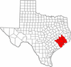
"Principal" cities Other cities Alvin • Angleton • Bellaire • Clute • Deer Park • Dickinson • Freeport • Friendswood • Galena Park • Humble • Jacinto City • Katy • Lake Jackson • La Marque • La Porte • League City • Missouri City • Pasadena • Pearland • Richmond • Rosenberg • South Houston • Stafford • Texas City • West University Place
- For a complete listing, see list of cities and towns in Houston–Sugar Land–Baytown MSA
Unincorporated
areasAtascocita • Channelview • Cloverleaf • Crosby • Cypress • Fresno • Hockley • Klein • Port Bolivar • Spring • The WoodlandsBodies of water Buffalo Bayou • Galveston Bay • Gulf Intracoastal Waterway • Houston Ship Channel • San Jacinto River • Trinity River • Lake Houston • Lake ConroeMunicipalities and communities of Fort Bend County, Texas Cities 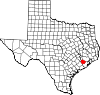
Town Villages CDPs Cinco Ranch‡ | Cumings | Fifth Street | Four Corners | Fresno | Greatwood | Mission Bend‡ | New Territory | Pecan Grove | Sienna Plantation
Unincorporated
communitiesBooth | Crabb | Clodine | Foster | Guy | Juliff | Long Point | Pittsville | Powell Point | Tavener
Footnotes ‡This populated place also has portions in an adjacent county or counties
 State of Texas
Topics Architecture · Climate · Geography · Government · History · Languages · Literature · Sports · Texans · Transportation · Symbols · Visitor Attractions
Society Regions Ark‑La‑Tex · Big Bend · Blackland Prairies · Brazos Valley · Central Texas · Coastal Bend · Cross Timbers · Deep East Texas · East Texas · Edwards Plateau · Golden Triangle · Hill Country · Llano Estacado · Northeast Texas · North Texas · Osage Plains · Panhandle · Permian Basin · Piney Woods · Rio Grande Valley · Southeast Texas · South Plains · South Texas · Trans-Pecos · West Texas
Metropolitan
areasAbilene · Amarillo · Austin–Round Rock–San Marcos · Beaumont–Port Arthur · Brownsville–Harlingen · College Station–Bryan · Corpus Christi · Dallas–Fort Worth–Arlington · El Paso · Houston–Sugar Land–Baytown · Killeen–Temple–Fort Hood · Laredo · Longview · Lubbock · McAllen–Edinburg–Mission · Midland · Odessa · San Angelo · San Antonio–New Braunfels · Sherman–Denison · Texarkana · Tyler · Victoria · Waco · Wichita Falls
Counties See: Table of Texas counties or List
Categories:- Cities in Texas
- Populated places in Fort Bend County, Texas
- Greater Houston
- Missouri City, Texas
- Populated places in Harris County, Texas


Wikimedia Foundation. 2010.