- Mission Bend, Texas
-
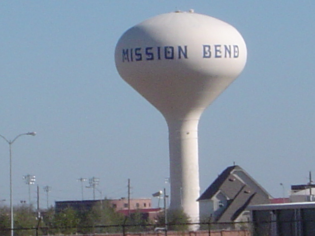
Mission Bend, Texas — CDP — A Mission Bend water tower
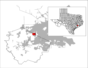
Coordinates: 29°41′37″N 95°39′42″W / 29.69361°N 95.66167°WCoordinates: 29°41′37″N 95°39′42″W / 29.69361°N 95.66167°W Country United States State Texas Counties Fort Bend, Harris Area – Total 5.3 sq mi (13.6 km2) – Land 5.2 sq mi (13.5 km2) – Water 0.0 sq mi (0.1 km2) Elevation 95 ft (29 m) Population (2000) – Total 30,831 – Density 5,900.1/sq mi (2,278.0/km2) Time zone Central (CST) (UTC-6) – Summer (DST) CDT (UTC-5) FIPS code 48-48772[1] GNIS feature ID 1867556[2] Mission Bend is a census-designated place (CDP) around Texas State Highway 6 within the extraterritorial jurisdiction of Houston in Fort Bend and Harris Counties in the U.S. state of Texas; Mission Bend is four miles northwest of the city hall of Sugar Land and twenty miles southwest of Downtown Houston.[3] The population was 30,831 at the 2000 census.
Contents
History
Mission Bend began in the early 1980s.[3] The area gained population between 1980 and 1990.[4] In 1990 the community had 24,945 residents. By 2000 many of the area's residents commuted to Houston.[3]
Geography
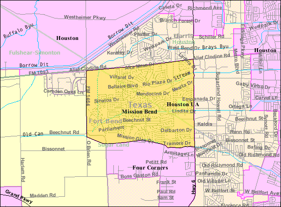
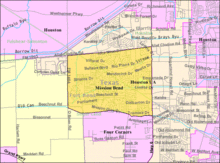 Map of the Mission Bend CDP
Mission Bend is located at 29°41′37″N 95°39′42″W / 29.69361°N 95.66167°W (29.693667, -95.661721)[5].
According to the United States Census Bureau, the CDP has a total area of 5.3 square miles (13.6 km²), of which, 5.2 square miles (13.5 km²) of it is land and 0.04 square miles (0.1 km²) of it (0.57%) is water.
Demographics
Historical populations Census Pop. %± 1990 24,945 — 2000 30,831 23.6% source: [6] As of the census[1] of 2000, there were 30,831 people, 8,978 households, and 7,864 families residing in the CDP. The population density was 5,900.1 people per square mile (2,276.1/km²). There were 9,202 housing units at an average density of 1,761.0/sq mi (679.3/km²). The racial makeup of the CDP was 46.32% White, 21.50% African American, 0.31% Native American, 16.96% Asian, 0.08% Pacific Islander, 10.63% from other races, and 4.20% from two or more races. Hispanic or Latino of any race were 27.06% of the population.
There were 8,978 households out of which 55.7% had children under the age of 18 living with them, 70.5% were married couples living together, 12.5% had a female householder with no husband present, and 12.4% were non-families. 9.5% of all households were made up of individuals and 1.1% had someone living alone who was 65 years of age or older. The average household size was 3.43 and the average family size was 3.67.
In the CDP the population was spread out with 33.7% under the age of 18, 8.1% from 18 to 24, 32.9% from 25 to 44, 21.4% from 45 to 64, and 3.9% who were 65 years of age or older. The median age was 32 years. For every 100 females there were 97.2 males. For every 100 females age 18 and over, there were 92.2 males.
The median income for a household in the CDP was $60,222, and the median income for a family was $60,999. Males had a median income of $39,323 versus $31,119 for females. The per capita income for the CDP was $20,029. About 4.5% of families and 5.7% of the population were below the poverty line, including 7.5% of those under age 18 and 8.9% of those age 65 or over.
Government and infrastructure
The Harris County Sheriff's Office serves the Harris County side. It operates the Mission Bend Storefront in an unincorporated area in the International District adjacent to the CDP.[7][8]
Transportation
Metropolitan Transit Authority of Harris County, Texas (METRO) operates public bus services in the area. The agency operates the Mission Bend Park and Ride in an unincorporated area of Harris County, near Mission Bend.[9]
Education
Primary and secondary schools
Public schools
Mission Bend CDP residents in Fort Bend County are zoned to schools in the Fort Bend Independent School District. Mission Bend CDP residents in Harris County are zoned to schools in the Alief Independent School District. The Fort Bend County section is within the West Division, controlling school board slots 1 through 3.[10] As of 2008 the board members in the slots are Susan Hohnbaum, Sonal Buchar, and Bob Broxson, respectively.[11]
Elementary schools serving the FBISD section of the Mission Bend CDP and within the Mission Bend CDP include Mission Bend, Mission Glen, and Mission West. Arizona Fleming, located in the Four Corners CDP, serves a section of the Mission Bend CDP.[12] Hodges Bend Middle School, located in the Four Corners CDP, serves almost all of the FBISD portion of the CDP, while Crockett Middle School, outside of the Mission Bend CDP, serves a small portion.[13] George Bush High School, located in the Mission Bend CDP, serves the FBISD section of the Mission Bend CDP.[14]
Alief schools that serve Harris County areas in the Mission Bend CDP include Petrosky Elementary School (in the CDP), Miller Intermediate School (outside of the CDP), and Albright Middle School (inside the CDP).[15][16] Elementary school bilingual students are zoned to Rees Elementary School.[17] Alief ISD students are randomly assigned to either Elsik, Hastings, or Taylor high schools. None of the high schools are within the Mission Bend CDP.
Private schools
Mission Bend Christian Academy is located north of the CDP.[18]
Parks and recreation
Fort Bend County owns and operates the Mission West Park in Mission Bend. The park includes a baseball blacktop, a play area, tables, a walking track, and a volleyball court.[19]
References
- ^ a b "American FactFinder". United States Census Bureau. http://factfinder.census.gov. Retrieved 2008-01-31.
- ^ "US Board on Geographic Names". United States Geological Survey. 2007-10-25. http://geonames.usgs.gov. Retrieved 2008-01-31.
- ^ a b c Mission Bend, Texas from the Handbook of Texas Online
- ^ Rodriguez, Lori. "Census tracks rapid growth of suburbia." Houston Chronicle. Sunday March 10, 1991. Section A, Page 1.
- ^ "US Gazetteer files: 2010, 2000, and 1990". United States Census Bureau. 2011-02-12. http://www.census.gov/geo/www/gazetteer/gazette.html. Retrieved 2011-04-23.
- ^ "CENSUS OF POPULATION AND HOUSING (1790-2000)". U.S. Census Bureau. http://www.census.gov/prod/www/abs/decennial/index.html. Retrieved 2010-07-17.
- ^ "International District Boundaries." International Management District. Retrieved on May 2, 2010.
- ^ "Contact Information." Harris County Sheriff's Office. Retrieved on May 28, 2010.
- ^ "Mission Bend Park and Ride." Metropolitan Transit Authority of Harris County, Texas. Retrieved on January 24, 2010.
- ^ "2007-2008 Operating Procedures." Fort Bend Independent School District. Retrieved on December 8, 2008.
- ^ "Contacting Your School Board Members." Fort Bend Independent School District. Retrieved on December 8, 2008.
- ^ 2009-2010 Elementary School Boundary. Fort Bend Independent School District. Retrieved on August 30, 2009.
- ^ 2009-2010 Middle School Boundary. Fort Bend Independent School District. Retrieved on August 30, 2009.
- ^ 2008-2009 High School Boundary. Fort Bend Independent School District. Retrieved on August 30, 2009.
- ^ "2007-2008 Elementary/Intermediate School Boundaries." Alief Independent School District. Retrieved on December 3, 2008.
- ^ "2007-2008 Middle/Intermediate School Boundaries." Alief Independent School District. Retrieved on December 3, 2008.
- ^ "2007-2008 Elementary Bilingual School Boundaries." Alief Independent School District. Retrieved on December 3, 2008.
- ^ Home Page. Mission Bend Christian Academy. Retrieved on September 5, 2009.
- ^ "County Owned Parks." Fort Bend County. Retrieved on October 11, 2009.
External links
- Mission Bend Civic Association
- Mission Bend, Texas from the Handbook of Texas Online
Municipalities and communities of Fort Bend County, Texas Cities Arcola | Beasley | Fulshear | Houston‡ | Katy‡ | Kendleton | Meadows Place | Missouri City‡ | Needville | Orchard | Pearland‡ | Richmond | Rosenberg | Simonton | Stafford‡ | Sugar Land | Weston Lakes
Town Villages CDPs Cinco Ranch‡ | Cumings | Fifth Street | Four Corners | Fresno | Greatwood | Mission Bend‡ | New Territory | Pecan Grove | Sienna Plantation
Unincorporated
communitiesBooth | Crabb | Clodine | Foster | Guy | Juliff | Long Point | Pittsville | Powell Point | Tavener
Footnotes ‡This populated place also has portions in an adjacent county or counties
Categories:- Populated places in Fort Bend County, Texas
- Populated places in Harris County, Texas
- Census-designated places in Texas
- Greater Houston


Wikimedia Foundation. 2010.