- Fulshear, Texas
Infobox Settlement
official_name = Fulshear, Texas
settlement_type =City
nickname =
motto =
imagesize =
image_caption =
image_
mapsize = 250px
map_caption = Location of Fulshear, Texas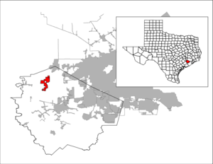
mapsize1 = 250px
map_caption1 =subdivision_type = Country
subdivision_name =United States
subdivision_type1 = State
subdivision_name1 =Texas
subdivision_type2 = County
subdivision_name2 = Fort Bendgovernment_footnotes =
government_type =
leader_title =
leader_name =
leader_title1 =
leader_name1 =
established_title =
established_date =unit_pref = Imperial
area_footnotes =
area_magnitude =
area_total_km2 = 21.2
area_land_km2 = 21.1
area_water_km2 = 0.0
area_total_sq_mi = 8.2
area_land_sq_mi = 8.2
area_water_sq_mi = 0.0population_as_of = 2000
population_footnotes =
population_total = 716
population_density_km2 = 33.9
population_density_sq_mi = 87.7timezone = Central (CST)
utc_offset = -6
timezone_DST = CDT
utc_offset_DST = -5
elevation_footnotes =
elevation_m = 40
elevation_ft = 131
latd = 29 |latm = 41 |lats = 27 |latNS = N
longd = 95 |longm = 53 |longs = 26 |longEW = Wpostal_code_type =
ZIP code
postal_code = 77441
area_code = 281
blank_name = FIPS code
blank_info = 48-27876GR|2
blank1_name = GNIS feature ID
blank1_info = 1336299GR|3
website =
footnotes =Fulshear is a city in Fort Bend County,
Texas ,United States . The population was 716 at the 2000 census. Fulshear is part of theHouston Metropolitan Area .Growth in Fulshear exploded in the 2000s due to its proximity to Houston. [http://www.khou.com/video/news-index.html?nvid=134022]
Geography
Fulshear is located at coor dms|29|41|27|N|95|53|26|W|city (29.690824, -95.890531).GR|1
According to the
United States Census Bureau , the city has a total area of 8.2square mile s (21.2km² ), all of it land.Demographics
As of the
census GR|2 of 2000, there were 716 people, 251 households, and 192 families residing in the city. Thepopulation density was 87.7 people per square mile (33.9/km²). There were 260 housing units at an average density of 31.8/sq mi (12.3/km²). The racial makeup of the city was 59.92% White, 24.02% African American, 0.42% Native American, 0.70% Asian, 13.41% from other races, and 1.54% from two or more races. Hispanic or Latino of any race were 22.49% of the population.There were 251 households out of which 39.0% had children under the age of 18 living with them, 62.9% were married couples living together, 11.6% had a female householder with no husband present, and 23.5% were non-families. 20.7% of all households were made up of individuals and 6.0% had someone living alone who was 65 years of age or older. The average household size was 2.85 and the average family size was 3.33.
In the city the population was spread out with 32.1% under the age of 18, 6.7% from 18 to 24, 27.4% from 25 to 44, 25.3% from 45 to 64, and 8.5% who were 65 years of age or older. The median age was 36 years. For every 100 females there were 98.9 males. For every 100 females age 18 and over, there were 96.8 males.
The median income for a household in the city was $44,375, and the median income for a family was $54,444. Males had a median income of $40,893 versus $36,563 for females. The
per capita income for the city was $19,489. About 15.6% of families and 22.8% of the population were below thepoverty line , including 24.8% of those under age 18 and 27.6% of those age 65 or over.Education
Almost all of Fulshear is zoned to schools in the
Lamar Consolidated Independent School District .That portion is served by: [" [http://www.lcisd.org/DistrictbrInformation/MapofLCISD/ Map of LCISD] ." "
Lamar Consolidated Independent School District ".]
* Huggins Elementary School (Fulshear)
* Briscoe Junior High School (Unincorporated Fort Bend County)
* Foster High School (Unincorporated Fort Bend County)A small portion is within the
Katy Independent School District .Fulshear's Bob Lutts Fulshear/Simonton Branch Library is a part of the
Fort Bend County Libraries system.Postal service
The
United States Postal Service operates the Fulshear Post Office at 8059 F. M. 359 Road South, 77441-6336.Transportation
Airports near Fulshear, located in unincorporated Fort Bend County, include
Westheimer Air Park ,Cardiff Brothers Airport , and Dewberry Heliport.Area airports with commercial airline service include
George Bush Intercontinental Airport andWilliam P. Hobby Airport , both of which are in Houston.References
External links
*Handbook of Texas|id=FF/hlf34|name=Fulshear, Texas

Wikimedia Foundation. 2010.