- Clodine, Texas
-
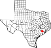
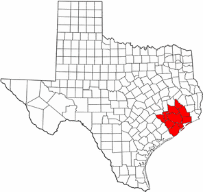
Clodine, Texas — Village — Location of Clodine, Texas
Coordinates: 29°42′27″N 95°41′17″W / 29.7075°N 95.68806°WCoordinates: 29°42′27″N 95°41′17″W / 29.7075°N 95.68806°W Country United States State Texas County Fort Bend Elevation 95 ft (29 m) Time zone Central (CST) (UTC-6) - Summer (DST) CDT (UTC-5) ZIP code 77407 Area code(s) 281 Clodine is an unincorporated community in Fort Bend County, Texas, United States, between the Alief section of Houston and the city of Fulshear.
Contents
History
Clodine was first established in the 1880s as a station on the San Antonio and Aransas Pass Railway. Clodine had acquired a Post Office by 1893. In 1896 the town had a general store, a Baptist church, and a population of fifty. Clodine acquired a Community School in the year 1897. By 1914 Clodine had telephone and telegraph connections, and a population of twenty-five. The Texas and New Orleans Railroad bought the San Antonio and Aransas Pass line in 1934 and removed the depot and section houses. In 1936 the town had gained a factory and several businesses. In 1947 Clodine had a population of fifty and was a shipping point for surrounding farms and a local oil field. In 1990 Clodine had around 31 residents.[1] In 2001 George Bush High School opened. In the early 2003 the rail road was taken up to make way for the Westpark Tollway. In 2005 the Westpark Tollway was constructed on the former railroad right of way. A shopping center was built near the tollway on FM 1093. In April of 2008 the Clodine General Store was moved to make room for the expansion of Farm to Market Road 1464.[2]
Education
Clodine is within the Fort Bend Independent School District. It is served primarily by George Bush High School, Hodges Bend Middle School, Barbra Jordan Elementary School, and Mission West Elementary School.
References
- ^ Clodine, Texas from the Handbook of Texas Online
- ^ "Clodine landmark escapes destruction." Fort Bend Herald. April 4, 2008. Retrieved on May 12, 2009.
External links
- Clodine, Texas from the Handbook of Texas Online
- U.S. Geological Survey Geographic Names Information System: Clodine, Texas
 Houston–Sugar Land–Baytown
Counties Austin • Brazoria • Chambers • Fort Bend • Galveston • Harris • Liberty • Montgomery • San Jacinto • Waller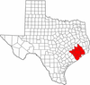
"Principal" cities Other cities Alvin • Angleton • Bellaire • Clute • Deer Park • Dickinson • Freeport • Friendswood • Galena Park • Humble • Jacinto City • Katy • Lake Jackson • La Marque • La Porte • League City • Missouri City • Pasadena • Pearland • Richmond • Rosenberg • South Houston • Stafford • Texas City • West University Place
- For a complete listing, see list of cities and towns in Houston–Sugar Land–Baytown MSA
Unincorporated
areasAtascocita • Channelview • Cloverleaf • Crosby • Cypress • Fresno • Hockley • Klein • Port Bolivar • Spring • The WoodlandsBodies of water Buffalo Bayou • Galveston Bay • Gulf Intracoastal Waterway • Houston Ship Channel • San Jacinto River • Trinity River • Lake Houston • Lake ConroeMunicipalities and communities of Fort Bend County, Texas County seat: Richmond Cities Arcola | Beasley | Fulshear | Houston‡ | Katy‡ | Kendleton | Meadows Place | Missouri City‡ | Needville | Orchard | Pearland‡ | Richmond | Rosenberg | Simonton | Stafford‡ | Sugar Land | Weston Lakes
Town Villages CDPs Cinco Ranch‡ | Cumings | Fifth Street | Four Corners | Fresno | Greatwood | Mission Bend‡ | New Territory | Pecan Grove | Sienna Plantation
Unincorporated
communitiesBooth | Crabb | Clodine | Foster | Guy | Juliff | Long Point | Pittsville | Powell Point | Tavener
Footnotes ‡This populated place also has portions in an adjacent county or counties
Categories:- Unincorporated communities in Texas
- Populated places in Fort Bend County, Texas
- Greater Houston
- East Texas geography stubs


Wikimedia Foundation. 2010.