- Orchard, Texas
-
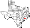
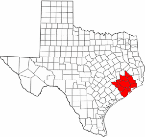
City of Orchard — City — Location of Orchard, Texas
Coordinates: 29°36′7″N 95°58′8″W / 29.60194°N 95.96889°WCoordinates: 29°36′7″N 95°58′8″W / 29.60194°N 95.96889°W Country United States State Texas County Fort Bend Area – Total 0.4 sq mi (1.0 km2) – Land 0.4 sq mi (1.0 km2) – Water 0.0 sq mi (0.0 km2) Elevation 125 ft (38 m) Population (2000) – Total 408 – Density 1,078.9/sq mi (416.6/km2) Time zone Central (CST) (UTC-6) – Summer (DST) CDT (UTC-5) ZIP code 77464 Area code(s) 979 FIPS code 48-54192[1] GNIS feature ID 1343307[2] Orchard is a city in Fort Bend County, Texas within the Houston–Sugar Land–Baytown metropolitan area. The population was 408 at the 2000 census.
Contents
Geography
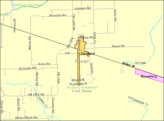
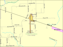 Map of Orchard
Orchard is located at 29°36′7″N 95°58′8″W / 29.60194°N 95.96889°W (29.602015, -95.968821)[3].
According to the United States Census Bureau, the city has a total area of 0.4 square miles (1.0 km2), all of it land.
Demographics
As of the census[1] of 2000, there were 408 people, 147 households, and 110 families residing in the city. The population density was 1,078.9 people per square mile (414.6/km²). There were 156 housing units at an average density of 412.5/sq mi (158.5/km²). The racial makeup of the city was 76.47% White, 8.09% African American, 1.47% Native American, 12.50% from other races, and 1.47% from two or more races. Hispanic or Latino of any national origin were 22.55% of the population.
There were 147 households out of which 39.5% had children under the age of 18 living with them, 61.2% were married couples living together, 8.2% had a female householder with no husband present, and 24.5% were non-families. 21.1% of all households were made up of individuals and 8.8% had someone living alone who was 65 years of age or older. The average household size was 2.78 and the average family size was 3.26.
In the city the population was spread out with 28.4% under the age of 18, 11.5% from 18 to 24, 31.1% from 25 to 44, 20.1% from 45 to 64, and 8.8% who were 65 years of age or older. The median age was 33 years. For every 100 females there were 103.0 males. For every 100 females age 18 and over, there were 102.8 males.
The median income for a household in the city was $47,000, and the median income for a family was $59,063. Males had a median income of $40,089 versus $27,396 for females. The per capita income for the city was $21,329. About 7.3% of families and 8.9% of the population were below the poverty line, including 9.8% of those under age 18 and 17.1% of those age 65 or over.
Government and infrastructure
The United States Postal Service operates the Orchard Post Office at 218 Missouri Street.[4]
Education
Orchard is served by the Brazos Independent School District.
References
- ^ a b "American FactFinder". United States Census Bureau. http://factfinder.census.gov. Retrieved 2008-01-31.
- ^ "US Board on Geographic Names". United States Geological Survey. 2007-10-25. http://geonames.usgs.gov. Retrieved 2008-01-31.
- ^ "US Gazetteer files: 2010, 2000, and 1990". United States Census Bureau. 2011-02-12. http://www.census.gov/geo/www/gazetteer/gazette.html. Retrieved 2011-04-23.
- ^ "Post Office Location - ORCHARD." United States Postal Service. Retrieved on December 4, 2008.
External links
- Orchard, Texas from the Handbook of Texas Online
 Houston–Sugar Land–Baytown
Counties Austin • Brazoria • Chambers • Fort Bend • Galveston • Harris • Liberty • Montgomery • San Jacinto • Waller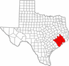
"Principal" cities Other cities Alvin • Angleton • Bellaire • Clute • Deer Park • Dickinson • Freeport • Friendswood • Galena Park • Humble • Jacinto City • Katy • Lake Jackson • La Marque • La Porte • League City • Missouri City • Pasadena • Pearland • Richmond • Rosenberg • South Houston • Stafford • Texas City • West University Place
- For a complete listing, see list of cities and towns in Houston–Sugar Land–Baytown MSA
Unincorporated
areasAtascocita • Channelview • Cloverleaf • Crosby • Cypress • Fresno • Hockley • Klein • Port Bolivar • Spring • The WoodlandsBodies of water Buffalo Bayou • Galveston Bay • Gulf Intracoastal Waterway • Houston Ship Channel • San Jacinto River • Trinity River • Lake Houston • Lake ConroeMunicipalities and communities of Fort Bend County, Texas Cities Arcola | Beasley | Fulshear | Houston‡ | Katy‡ | Kendleton | Meadows Place | Missouri City‡ | Needville | Orchard | Pearland‡ | Richmond | Rosenberg | Simonton | Stafford‡ | Sugar Land | Weston Lakes
Town Villages CDPs Cinco Ranch‡ | Cumings | Fifth Street | Four Corners | Fresno | Greatwood | Mission Bend‡ | New Territory | Pecan Grove | Sienna Plantation
Unincorporated
communitiesBooth | Crabb | Clodine | Foster | Guy | Juliff | Long Point | Pittsville | Powell Point | Tavener
Footnotes ‡This populated place also has portions in an adjacent county or counties
Categories:- Cities in Texas
- Populated places in Fort Bend County, Texas
- Greater Houston


Wikimedia Foundation. 2010.